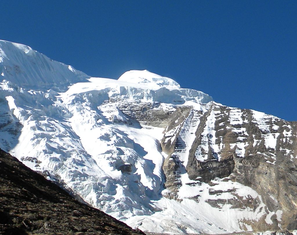
Mount Kuchela Dhura is a mountain located in Pithoragarh, Uttarakhand, India. It is located at the near true right bank of Lwa Glacier or true left bank of Shalang glacier, surrounded by Mount Nandakot, 6861 metres and 0.6041 metres to its south-west and north-east respectively. This peak offers a 3 km (approx.) long rutted ridge leading to Nanda Kot’s north face.
An unknown attempt was made in the late 1980s, and no information of route and team. IMF sent an 8 members team to the peak via west ridge during pre-monsoon season in the year 2012. Team left behind from the summit by almost around 500 horizontal & 88 vertical metres.
The Indian Mountaineering Foundation (IMF) sent an expedition in the month of August–September 2013 to Mt Kuchela Dhura. The core Indian team had total 10 members from different states of the country Dhruv Joshi from Almora(leader), Wallambok Lyngdoh from Shillong (Dy. Leader), Dr Anand Vaidya from Gujarat (Medical Officer), Ram Prasad Lodha (Rajasthan), Zoram sanga(Mizoram), Vineet Saini(U.P), Vijay Rautela(Uttarakhand), Banshngainlang Nongkynrih(Meghalaya), Karan Kumar Shandilya (Assam) and Chitramohan Singh (Uttarakhand). Four members Dhruv joshi, Wallambok Lyngdoh, Chitramohan & Vijay Rautela successfully scaled the mountain on 6 September 2013 at 0820 hrs and made the first international and national ascent of the peak.
The expedition was flagged off by Col(Rtd) J P Bhagatjee on 15 August 2013, Director IMF and flagged in by Mick Fowler (Legendary Mountaineer and President of Alpine Club) on 20 September 2013. This expedition was sponsored by the Indian Mountaineering Foundation, Ministry of Youth Affairs & sports.
We use GPS information embedded into the photo when it is available.
3D mountains overlay
Adjust mountain panorama to perfectly match your photos because recorded by camera photo position might be imprecise.
Move tool
Rotate tool
Zoom
More customization
Choose which peak labels should make into the final photo and what photo title should be.
Next
Photo Location
Satellitte
Flat map
Relief map
Latitude
Longitude
Altitude
OR
Latitude
°'''
Longitude
°'''
Apply
Register Peak
Peak Name
Latitude
Longitude
Altitude
Register
Teleport
PeakVisor
This 3D model of Sagarmatha National Park in Nepal was made using the PeakVisor app topographic data. The mobile app features higher precision models worldwide, more topographic details, and works offline. Download PeakVisor maps today.
Download OBJ model
PeakVisor
The download should start shortly. If you find it useful please consider supporting the PeakVisor app.
PeakVisor for iOS and Android
Be a superhero of outdoor navigation with state-of-the-art 3D maps and mountain identification in the palm of your hand!