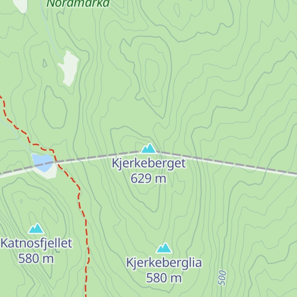
Kjerkeberget is a mountain in Nordmarka, Oslo, Norway.
It is the highest point, as well as the northernmost point in the county and municipality of Oslo. It lies on the border of Oslo and the municipality Lunner in Akershus, between the lakes Sandungen in the southeast and Katnosa in the northwest.
The first element is kjerke f 'church', the last element is the finite form of berg n 'rocky mountain'. (Several mountains in Norway are called 'the church', because of some likeness in shape with a church). The word kjerke is the form in the dialect of the area - in Bokmål kirke, and in Nynorsk kyrkje.
During World War II, Milorg used this hill as a site for parachute drops. On 4 October 1942, Milorg's District 13 received its first paradrop here. In the paradrop were four people: Tor Helliesen, Jan Allan, Ruben Larsen and Johannes S. Andersen.
We use GPS information embedded into the photo when it is available.
3D mountains overlay
Adjust mountain panorama to perfectly match your photos because recorded by camera photo position might be imprecise.
Move tool
Rotate tool
Zoom
More customization
Choose which peak labels should make into the final photo and what photo title should be.
Next
Photo Location
Satellitte
Flat map
Relief map
Latitude
Longitude
Altitude
OR
Latitude
°'''
Longitude
°'''
Apply
Register Peak
Peak Name
Latitude
Longitude
Altitude
Register
Teleport
PeakVisor
This 3D model of Sagarmatha National Park in Nepal was made using the PeakVisor app topographic data. The mobile app features higher precision models worldwide, more topographic details, and works offline. Download PeakVisor maps today.
Download OBJ model
PeakVisor
The download should start shortly. If you find it useful please consider supporting the PeakVisor app.
PeakVisor for iOS and Android
Be a superhero of outdoor navigation with state-of-the-art 3D maps and mountain identification in the palm of your hand!