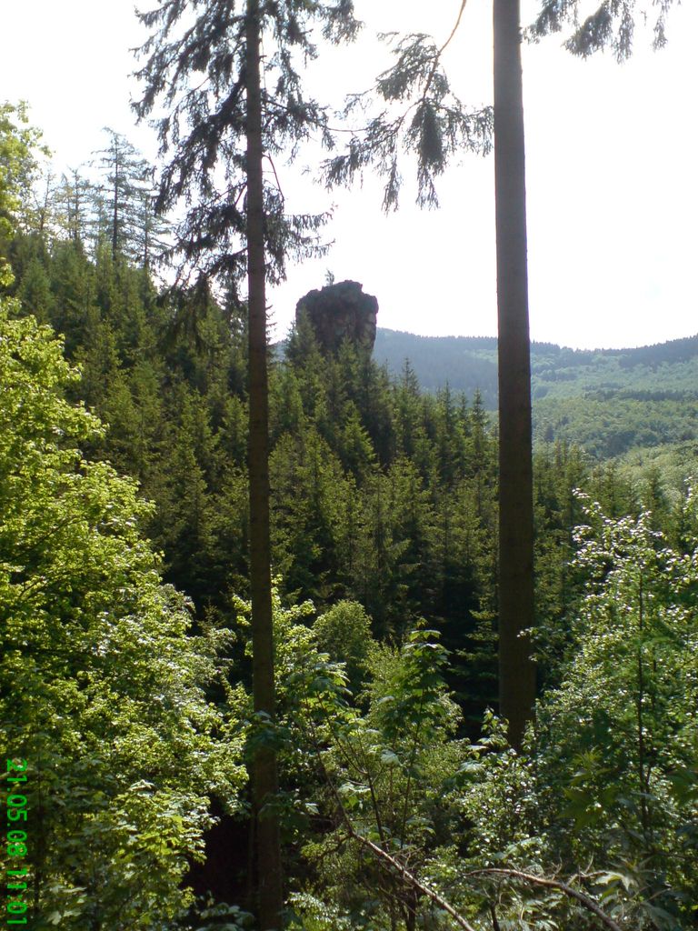
The Kilianstein is a free-standing rock tower on the Hopfenberg hill in the eastern part of the Sembach valley in central Germany. It stands about 800 m east of the (upper) village of Winterstein on the northern slopes of the Thuringian Forest in Germany.
The pinnacle is about 15 metres high and some 500 m above sea level (NN). It consists of a relatively crumbly quartz porphyry and is visited, albeit rarely, by sports climbers. Several trails are signposted from here, climbing routes have been established on the rock and on the top is a summit register.
According to one Winterstein legend, this rock was formed when the devil rammed his walking stick into the ground in anger at the success of the missionary St. Kilian in converting the local pagans, and the tip of his stick remained embedded.
The nearest mountain hut is Jagthütte Sembachtal located 829m/2 721ft S of the summit.
We use GPS information embedded into the photo when it is available.
3D mountains overlay
Adjust mountain panorama to perfectly match your photos because recorded by camera photo position might be imprecise.
Move tool
Rotate tool
Zoom
More customization
Choose which peak labels should make into the final photo and what photo title should be.
Next
Photo Location
Satellitte
Flat map
Relief map
Latitude
Longitude
Altitude
OR
Latitude
°'''
Longitude
°'''
Apply
Register Peak
Peak Name
Latitude
Longitude
Altitude
Register
Teleport
PeakVisor
This 3D model of Sagarmatha National Park in Nepal was made using the PeakVisor app topographic data. The mobile app features higher precision models worldwide, more topographic details, and works offline. Download PeakVisor maps today.
Download OBJ model
PeakVisor
The download should start shortly. If you find it useful please consider supporting the PeakVisor app.
PeakVisor for iOS and Android
Be a superhero of outdoor navigation with state-of-the-art 3D maps and mountain identification in the palm of your hand!