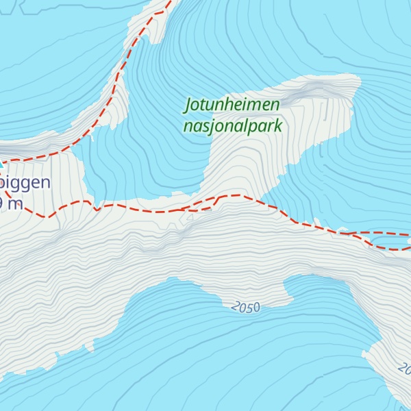
Keilhaus topp is a mountain in Lom Municipality in Innlandet county, Norway. It is one of Norway's highest mountains, but is not always included in rankings due to its topographic prominence of only 20 metres (66 ft). The 2,355-metre (7,726 ft) tall mountain is located in the Jotunheimen mountains within Jotunheimen National Park. The mountain sits about 25 kilometres (16 mi) southwest of the village of Fossbergom and about 45 kilometres (28 mi) northeast of the village of Øvre Årdal. The mountain is surrounded by several other notable mountains including Galdhøpiggen (Norway's tallest mountain) to the west, Veslpiggen to the northwest, Galdhøi and Juvvasshøi to the north, Store Styggehøe to the southeast, Midtre Tverråtinden to the south, and Svellnosbreahesten and Store Tverråtinden to the southwest.
We use GPS information embedded into the photo when it is available.
3D mountains overlay
Adjust mountain panorama to perfectly match your photos because recorded by camera photo position might be imprecise.
Move tool
Rotate tool
Zoom
More customization
Choose which peak labels should make into the final photo and what photo title should be.
Next
Photo Location
Satellitte
Flat map
Relief map
Latitude
Longitude
Altitude
OR
Latitude
°'''
Longitude
°'''
Apply
Register Peak
Peak Name
Latitude
Longitude
Altitude
Register
Teleport
PeakVisor
This 3D model of Sagarmatha National Park in Nepal was made using the PeakVisor app topographic data. The mobile app features higher precision models worldwide, more topographic details, and works offline. Download PeakVisor maps today.
Download OBJ model
PeakVisor
The download should start shortly. If you find it useful please consider supporting the PeakVisor app.
PeakVisor for iOS and Android
Be a superhero of outdoor navigation with state-of-the-art 3D maps and mountain identification in the palm of your hand!