Kamena Gora (Serbian Cyrillic: Камена гора, pronounced [kâmenaː ɡǒra]) is a mountain on the border of Serbia and Montenegro, near the town of Prijepolje. It belongs to the Dinaric mountain range. Its highest peaks are Crni vrh on the Montenegrin side, and Ravna gora on the Serbian side, with an elevation of 1496 m each.
Tourist access and facilities are centered on village of Kamena Gora on the slopes of the mountain.
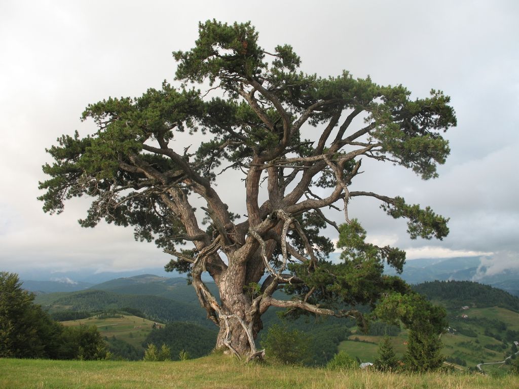
As of 2013, an area of 78.07 hectares on the mountain is proposed for status of nature park in the national register of protected resources. The famous "Holy pine", estimated to be 500 years old, is also proposed for protection as a "botanic natural monument".
By elevation Kamena Gora is
# 66 out of 1393 in Zlatibor Administrative District
We use GPS information embedded into the photo when it is available.
3D mountains overlay
Adjust mountain panorama to perfectly match your photos because recorded by camera photo position might be imprecise.
Move tool
Rotate tool
Zoom
More customization
Choose which peak labels should make into the final photo and what photo title should be.
Next
Photo Location
Satellitte
Flat map
Relief map
Latitude
Longitude
Altitude
OR
Latitude
°'''
Longitude
°'''
Apply
Register Peak
Peak Name
Latitude
Longitude
Altitude
Register
Teleport
PeakVisor
This 3D model of Sagarmatha National Park in Nepal was made using the PeakVisor app topographic data. The mobile app features higher precision models worldwide, more topographic details, and works offline. Download PeakVisor maps today.
Download OBJ model
PeakVisor
The download should start shortly. If you find it useful please consider supporting the PeakVisor app.
PeakVisor for iOS and Android
Be a superhero of outdoor navigation with state-of-the-art 3D maps and mountain identification in the palm of your hand!