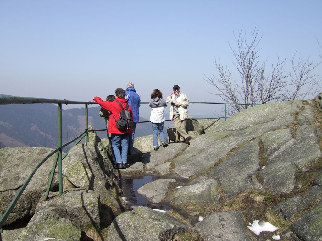
The Kästeklippen, often shortened to Käste, is a rocky tor above the Oker valley in the Upper Harz mountains of central Germany. It lies at a height of 602 m above NN.
Near the Käste are other similar granite rock formations such as the Hexenküche ("Witch's Kitchen"), Mausefalle ("Mousetrap"), Feigenbaumklippe and the Treppenstein. Next to the observation platform is a protruding rock which resembles the face of an old man and is called Der Alte vom Berge ("Old Man of the Mountain"). The rocks consist of granite "wool sacks", typical of the Harz region.
The Kästeklippen (Klippen = crags) are a popular destination in the Harz. From here, there are views to the Sudmerberg hill in the borough of Goslar. Numerous paths lead from the Oker Reservoir, Romkerhall, Oker, Göttingerode and Bad Harzburg up to the Käste. The most important access route is the Kästestraße. It runs from Bad Harzburg up to the Schlackenplatz on the Morlberg and then continues at a height of just under 600 m over the Alte Schlewecke and the crags of the Stiefmutterklippen to the Käste. From there it goes downhill again, past the Hinterer Ziegenrücken and Vorderen Ziegenrücken to Oker. The Kästestraße was once tarmacked all the way from Bad Harzburg to the Käste. Remnants of the asphalt surface can still be seen today. From the beginning of April to the end of October a bus service runs from Bad Harzburg to the Käste. The Kästehaus restaurant was demolished in 2019.
The Kästehaus is checkpoint no. 118 in the Harzer Wandernadel hiking trail network.
There's a trail leading to the summit.
The nearest mountain hut is Schutzhütte Ziegenrücken located 1 033m/3 389ft undefined of the summit.
We use GPS information embedded into the photo when it is available.
3D mountains overlay
Adjust mountain panorama to perfectly match your photos because recorded by camera photo position might be imprecise.
Move tool
Rotate tool
Zoom
More customization
Choose which peak labels should make into the final photo and what photo title should be.
Next
Photo Location
Satellitte
Flat map
Relief map
Latitude
Longitude
Altitude
OR
Latitude
°'''
Longitude
°'''
Apply
Register Peak
Peak Name
Latitude
Longitude
Altitude
Register
Teleport
PeakVisor
This 3D model of Sagarmatha National Park in Nepal was made using the PeakVisor app topographic data. The mobile app features higher precision models worldwide, more topographic details, and works offline. Download PeakVisor maps today.
Download OBJ model
PeakVisor
The download should start shortly. If you find it useful please consider supporting the PeakVisor app.
PeakVisor for iOS and Android
Be a superhero of outdoor navigation with state-of-the-art 3D maps and mountain identification in the palm of your hand!