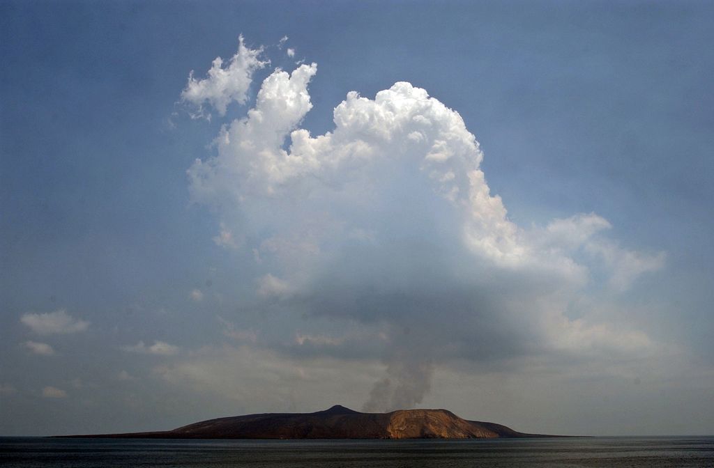
Jabal al-Tair Island (or Jebel Teir, Jabal al-Tayr, Tair Island, Al-Tair Island, Jazirat at-Tair) (Arabic: جزيرة جبل الطير Jazīrat Jabal aṭ-Ṭayr, 'Bird Mountain Island') is a roughly oval volcanic island in Yemen, northwest of the constricted Bab al-Mandab passage at the mouth of the Red Sea, about halfway between mainland Yemen and Eritrea. From 1996 until an eruption in 2007, Yemen maintained two watchtowers and a small military base on the island.
After 124 years of dormancy, the volcano that created the island erupted on 30 September 2007.
By elevation Jabal al-Tair is
# 96 out of 124 in Al Hudaydah Governorate # 1 out of 6 in Alluheyah District
By prominence Jabal al-Tair is
# 16 out of 124 in Al Hudaydah Governorate # 1 out of 6 in Alluheyah District
We use GPS information embedded into the photo when it is available.
3D mountains overlay
Adjust mountain panorama to perfectly match your photos because recorded by camera photo position might be imprecise.
Move tool
Rotate tool
Zoom
More customization
Choose which peak labels should make into the final photo and what photo title should be.
Next
Photo Location
Satellitte
Flat map
Relief map
Latitude
Longitude
Altitude
OR
Latitude
°'''
Longitude
°'''
Apply
Register Peak
Peak Name
Latitude
Longitude
Altitude
Register
Teleport
PeakVisor
This 3D model of Sagarmatha National Park in Nepal was made using the PeakVisor app topographic data. The mobile app features higher precision models worldwide, more topographic details, and works offline. Download PeakVisor maps today.
Download OBJ model
PeakVisor
The download should start shortly. If you find it useful please consider supporting the PeakVisor app.
PeakVisor for iOS and Android
Be a superhero of outdoor navigation with state-of-the-art 3D maps and mountain identification in the palm of your hand!