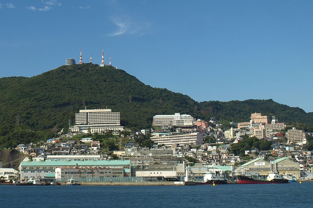
Mount Inasa (稲佐山, Inasa-yama) is a hill to the west of Nagasaki which rises to a height of 333 metres (1,093 ft). The Nagasaki Ropeway allows visitors to travel to the top from Nagasaki. A short walk from the cable car station are several buildings that house transmitters for TV and radio stations that serve Nagasaki and the surrounding area.
There is an observation platform that is popular with tourists as it provides extensive views of Nagasaki's "10 Million Dollar Night View" (1000万ドルの夜景, Issenmandoru no yakei).
We use GPS information embedded into the photo when it is available.
3D mountains overlay
Adjust mountain panorama to perfectly match your photos because recorded by camera photo position might be imprecise.
Move tool
Rotate tool
Zoom
More customization
Choose which peak labels should make into the final photo and what photo title should be.
Next
Photo Location
Satellitte
Flat map
Relief map
Latitude
Longitude
Altitude
OR
Latitude
°'''
Longitude
°'''
Apply
Register Peak
Peak Name
Latitude
Longitude
Altitude
Register
Teleport
PeakVisor
This 3D model of Sagarmatha National Park in Nepal was made using the PeakVisor app topographic data. The mobile app features higher precision models worldwide, more topographic details, and works offline. Download PeakVisor maps today.
Download OBJ model
PeakVisor
The download should start shortly. If you find it useful please consider supporting the PeakVisor app.
PeakVisor for iOS and Android
Be a superhero of outdoor navigation with state-of-the-art 3D maps and mountain identification in the palm of your hand!