Hohentwiel is a mountain of volcanic origin in the Hegau region of Baden-Württemberg in southern Germany. It is the Hausberg of the industrial city of Singen, located west of it and ca 10 km (6.2 mi) west of Zeller See (Lake Constance). The ruins of the medieval Hohentwiel Castle rest on top of it.
Hohentwiel was an active volcano about 7–8 million years ago during the Miocene epoch, along with several other volcanoes in the Hegau region. It mostly consists of phonolite, which represents the former volcanic pipe. The surrounding softer rocks have been eroded over time by ice age glaciers during the Riss glaciation, creating an inverted relief and giving the mountain its present-day shape.
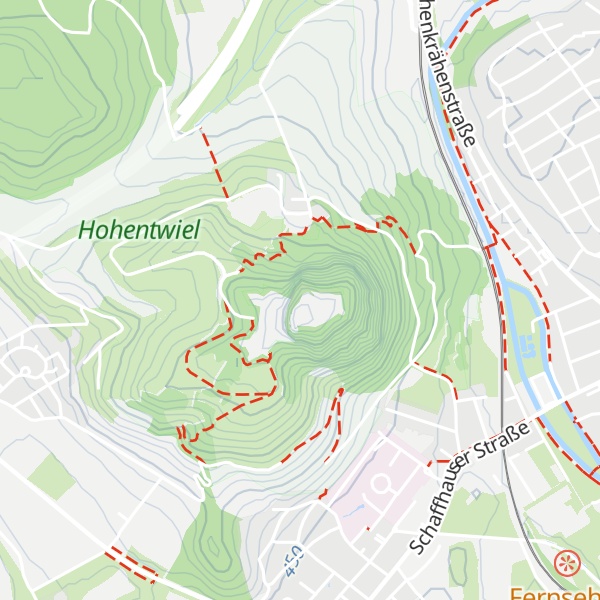
There's a trail leading to the summit.
By elevation Hohentwiel is
# 12 out of 75 in Landkreis Konstanz
By prominence Hohentwiel is
# 7 out of 75 in Landkreis Konstanz # 83 out of 3504 in Baden-Württemberg
We use GPS information embedded into the photo when it is available.
3D mountains overlay
Adjust mountain panorama to perfectly match your photos because recorded by camera photo position might be imprecise.
Move tool
Rotate tool
Zoom
More customization
Choose which peak labels should make into the final photo and what photo title should be.
Next
Photo Location
Satellitte
Flat map
Relief map
Latitude
Longitude
Altitude
OR
Latitude
°'''
Longitude
°'''
Apply
Register Peak
Peak Name
Latitude
Longitude
Altitude
Register
Teleport
PeakVisor
This 3D model of Sagarmatha National Park in Nepal was made using the PeakVisor app topographic data. The mobile app features higher precision models worldwide, more topographic details, and works offline. Download PeakVisor maps today.
Download OBJ model
PeakVisor
The download should start shortly. If you find it useful please consider supporting the PeakVisor app.
PeakVisor for iOS and Android
Be a superhero of outdoor navigation with state-of-the-art 3D maps and mountain identification in the palm of your hand!


.jpg)