The Hinterwaldkopf is a mountain, 1,198.2 m above sea level (NHN), in the Southern Black Forest in Germany. It lies in the southeastern part of the catchment area of the Dreisam east of Freiburg im Breisgau between Kirchzarten and Hinterzarten. To the north it is bounded by the
Höllental valley, to the south by the Zastler valley. Nearby settlements include Kirchzarten, Oberried (Breisgau), Falkensteig (part of Buchenbach) and Hinterzarten.
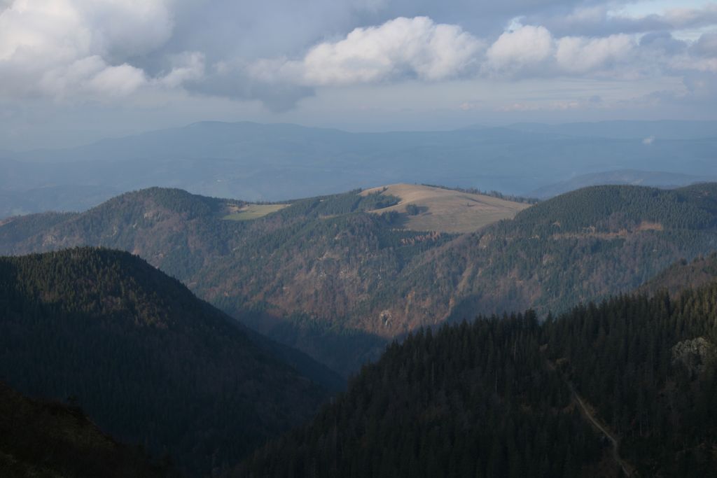
The characteristic outline of the Hinterwaldkopf is a symbol of the Dreisam valley. Its open summit region offers views over the valley to the Kandel. A trail managed by the Black Forest Club runs over the mountain.
There's a hiking trail (T1) leading to the summit.
The nearest mountain hut is Hinterwaldkopfhütte located 435m/1 428ft SE of the summit.
By elevation Hinterwaldkopf is
# 38 out of 217 in Landkreis Breisgau-Hochschwarzwald # 60 out of 3504 in Baden-Württemberg # 60 out of 21663 in the German Highlands
By prominence Hinterwaldkopf is
# 46 out of 217 in Landkreis Breisgau-Hochschwarzwald
We use GPS information embedded into the photo when it is available.
3D mountains overlay
Adjust mountain panorama to perfectly match your photos because recorded by camera photo position might be imprecise.
Move tool
Rotate tool
Zoom
More customization
Choose which peak labels should make into the final photo and what photo title should be.
Next
Photo Location
Satellitte
Flat map
Relief map
Latitude
Longitude
Altitude
OR
Latitude
°'''
Longitude
°'''
Apply
Register Peak
Peak Name
Latitude
Longitude
Altitude
Register
Teleport
PeakVisor
This 3D model of Sagarmatha National Park in Nepal was made using the PeakVisor app topographic data. The mobile app features higher precision models worldwide, more topographic details, and works offline. Download PeakVisor maps today.
Download OBJ model
PeakVisor
The download should start shortly. If you find it useful please consider supporting the PeakVisor app.
PeakVisor for iOS and Android
Be a superhero of outdoor navigation with state-of-the-art 3D maps and mountain identification in the palm of your hand!