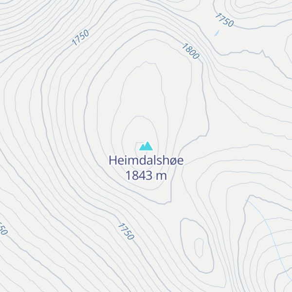
Heimdalshøe is a mountain on the border of Nord-Fron Municipality and Vågå Municipality in Innlandet county, Norway. The 1,843-metre (6,047 ft) tall mountain is located in the Jotunheimen mountains and in the upper Sikkilsdalen valley. The mountain sits about 47 kilometres (29 mi) south of the village of Vågåmo and about 24 kilometres (15 mi) north of the village of Beitostølen. The mountain is surrounded by several other notable mountains including Styggehøe, Gravdalsknappen, and Ingulssjøhøi to the northeast; and Besshø and Besseggen to the northwest. At a height of 1,843 metres (6,047 ft) above sea level, it is the highest mountain in the Nord-Fron municipality. The mountain's topographic prominence of 670 metres (2,200 ft) is among Scandinavia's 200 highest.
We use GPS information embedded into the photo when it is available.
3D mountains overlay
Adjust mountain panorama to perfectly match your photos because recorded by camera photo position might be imprecise.
Move tool
Rotate tool
Zoom
More customization
Choose which peak labels should make into the final photo and what photo title should be.
Next
Photo Location
Satellitte
Flat map
Relief map
Latitude
Longitude
Altitude
OR
Latitude
°'''
Longitude
°'''
Apply
Register Peak
Peak Name
Latitude
Longitude
Altitude
Register
Teleport
PeakVisor
This 3D model of Sagarmatha National Park in Nepal was made using the PeakVisor app topographic data. The mobile app features higher precision models worldwide, more topographic details, and works offline. Download PeakVisor maps today.
Download OBJ model
PeakVisor
The download should start shortly. If you find it useful please consider supporting the PeakVisor app.
PeakVisor for iOS and Android
Be a superhero of outdoor navigation with state-of-the-art 3D maps and mountain identification in the palm of your hand!