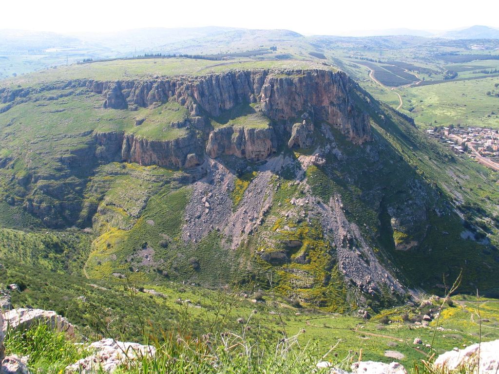
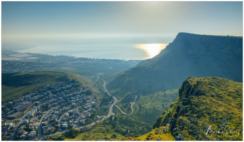
Mount Nitai (Hebrew: הר נתאי, Har Nitai), sometimes spelled Nitay, is a mountain in Israel situated west of the Sea of Galilee and north of the city of Tiberias. Har Nitai is named after Nittai of Arbela. The cliffs of Nitai and Arbel are visible when looking southwest from Capernaum on the shore of the Sea of Galillee.In 2018, Severino Caruso, a young French man accompanying groups of pilgrims in Israel, identified Mount Nittai of Arbela as the plausible place where Christ spent a week in retreat with his apostles, far from the tumult of the world, in order to introduce them to specific teaching with a view to their future mission in the Church. His research is based on the descriptions of a Mystic work entitled: “The Gospel as it was revealed to me” by Maria Valtorta, a Catholic mystic, who, through vision and supernatural immersion, would have witnessed all the biblical events in the public life of Jesus of Nazareth, from 1943 to 1947. The descriptions of the work allowed the engineer and researcher Jean-François Lavère to authenticate many of the original places that saw Jesus pass during his public life. Severino Caruso then perceived the historical significance of this discovery, which he made in the Arbel Valley, which confirms that the visions of Maria Valtorta seem to be authentic. He published a testimonial french book on the subject in 2021 entitled: “The Arbel Valley and the election of the twelve apostles” Centro Valtortiano edition.
We use GPS information embedded into the photo when it is available.
3D mountains overlay
Adjust mountain panorama to perfectly match your photos because recorded by camera photo position might be imprecise.
Move tool
Rotate tool
Zoom
More customization
Choose which peak labels should make into the final photo and what photo title should be.
Next
Photo Location
Satellitte
Flat map
Relief map
Latitude
Longitude
Altitude
OR
Latitude
°'''
Longitude
°'''
Apply
Register Peak
Peak Name
Latitude
Longitude
Altitude
Register
Teleport
PeakVisor
This 3D model of Sagarmatha National Park in Nepal was made using the PeakVisor app topographic data. The mobile app features higher precision models worldwide, more topographic details, and works offline. Download PeakVisor maps today.
Download OBJ model
PeakVisor
The download should start shortly. If you find it useful please consider supporting the PeakVisor app.
PeakVisor for iOS and Android
Be a superhero of outdoor navigation with state-of-the-art 3D maps and mountain identification in the palm of your hand!