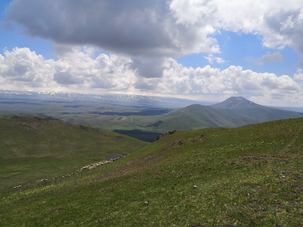
Gutanasar or Gut'anasar (Armenian: Գութանասար) is a mountain in the Kotayk Province near Fantan in Armenia. It is a 7,543 ft (2,299 m) high. A small Surb Astvatsatsin Church is located below it. It is a volcano which last erupted 200,000 BP, judging from Ar39/Ar40 dating of lava flows, and one of the common sources of obsidian in archeological sites of Armenia. Neighbouring communities include Fontan and Alapars. The volcano is part of the Geghama mountains volcanic area. and appear to share a common feeding conduit.
By elevation Gutanasar is
# 76 out of 152 in Kotayk Province
By prominence Gutanasar is
# 71 out of 2607 in Armenia # 6 out of 152 in Kotayk Province
We use GPS information embedded into the photo when it is available.
3D mountains overlay
Adjust mountain panorama to perfectly match your photos because recorded by camera photo position might be imprecise.
Move tool
Rotate tool
Zoom
More customization
Choose which peak labels should make into the final photo and what photo title should be.
Next
Photo Location
Satellitte
Flat map
Relief map
Latitude
Longitude
Altitude
OR
Latitude
°'''
Longitude
°'''
Apply
Register Peak
Peak Name
Latitude
Longitude
Altitude
Register
Teleport
PeakVisor
This 3D model of Sagarmatha National Park in Nepal was made using the PeakVisor app topographic data. The mobile app features higher precision models worldwide, more topographic details, and works offline. Download PeakVisor maps today.
Download OBJ model
PeakVisor
The download should start shortly. If you find it useful please consider supporting the PeakVisor app.
PeakVisor for iOS and Android
Be a superhero of outdoor navigation with state-of-the-art 3D maps and mountain identification in the palm of your hand!