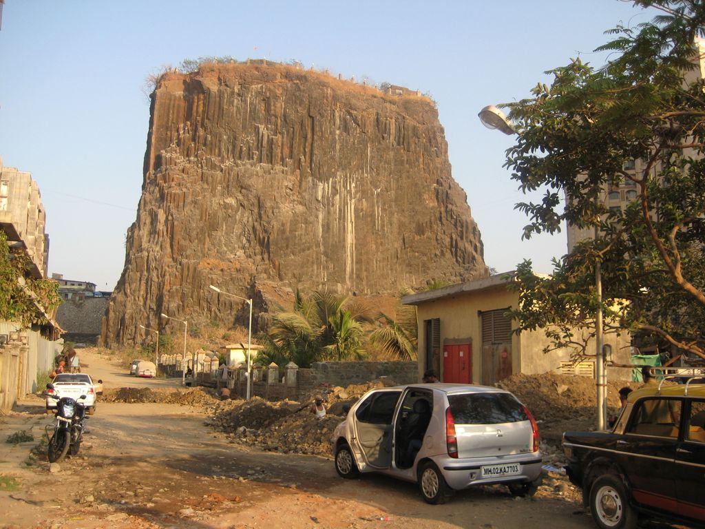
Gilbert Hill is a 200 ft (61 m) monolith column of black basalt rock at Andheri, in Mumbai, India. The rock has a sheer vertical face and was formed when molten lava was squeezed out of the Earth's clefts during the Mesozoic Era about 66 million years ago. During that era, molten lava had spread around most of the Indian states of Maharashtra, Gujarat and Madhya Pradesh, covering an area of 50,000 square kilometres (19,000 sq mi). The volcanic eruptions were also responsible for the destruction of plant and animal life during that era.
According to experts, this rare geological phenomenon was the remnant of a ridge and had clusters of vertical columns in nearby Jogeshwari which were quarried off two decades ago. These vertical columns are similar to the Devils Tower National Monument in Wyoming, and the Devils Postpile National Monument in eastern California, USA. Gilbert Hill was declared a National Park in 1952 by the Central Government under the Forest Act. In 2007, after years of lobbying by geologists, the hill was declared a Grade II heritage structure by the Municipal Corporation of Greater Mumbai (MCGM), and all quarrying and other activities around the monument were prohibited. Over the period of time, Gilbert Hill has faced severe erosion problems too.
Atop the rock column, two Hindu temples, the Gaodevi and Durgamata temples, set in a small garden, are accessed by a steep staircase carved into the rock. The hill offers a panoramic view of suburban Mumbai.
Efforts are being made to convert Gilbert Hill into a tourist attraction and include it as a stop on a tour of Mumbai by Maharashtra Tourism Development Corporation.
We use GPS information embedded into the photo when it is available.
3D mountains overlay
Adjust mountain panorama to perfectly match your photos because recorded by camera photo position might be imprecise.
Move tool
Rotate tool
Zoom
More customization
Choose which peak labels should make into the final photo and what photo title should be.
Next
Photo Location
Satellitte
Flat map
Relief map
Latitude
Longitude
Altitude
OR
Latitude
°'''
Longitude
°'''
Apply
Register Peak
Peak Name
Latitude
Longitude
Altitude
Register
Teleport
PeakVisor
This 3D model of Sagarmatha National Park in Nepal was made using the PeakVisor app topographic data. The mobile app features higher precision models worldwide, more topographic details, and works offline. Download PeakVisor maps today.
Download OBJ model
PeakVisor
The download should start shortly. If you find it useful please consider supporting the PeakVisor app.
PeakVisor for iOS and Android
Be a superhero of outdoor navigation with state-of-the-art 3D maps and mountain identification in the palm of your hand!