Geishöhe (German for goat height) is a 521 meter tall hill of Bavaria, Germany in the Mittelgebirge Spessart.
Oberwinterbach, a hamlet which ist part of the municipality Dammbach, lies on the plateau at the top of the hill. It is the permanently inhabited location with the highest elevation in the Spessart.
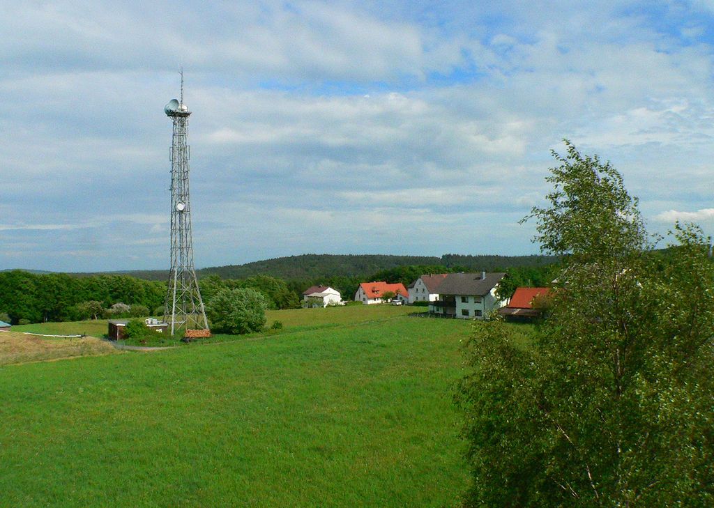
At the highest point of Geishöhe stands the Ludwig-Keller-Tower, a lookout tower build by the Spessartbund (the local rambling and naturalist organization) in 1936/37.
60 steps lead to a viewing platform with panoramic view of Spessart, Odenwald, Taunus and Rhön. It is named after the former chairman of the Spessartbund Ludwig Keller (1873 to 1932). Four marked hiking trails meet at the tower.
The lookout tower is used by amateur radio operators due to its exposed location.
100 meters east of the lookout tower rises a 35 meter high steel lattice mast with the antennas for the Geishöhe transmit and receive system.
There's a trail leading to the summit. Geißhöhe is one of the 1 peaks along the Josef-Braun-Weg.
By elevation Geißhöhe is
# 48 out of 470 in Naturpark Spessart # 17 out of 235 in Landkreis Aschaffenburg
By prominence Geißhöhe is
# 26 out of 470 in Naturpark Spessart # 11 out of 235 in Landkreis Aschaffenburg
We use GPS information embedded into the photo when it is available.
3D mountains overlay
Adjust mountain panorama to perfectly match your photos because recorded by camera photo position might be imprecise.
Move tool
Rotate tool
Zoom
More customization
Choose which peak labels should make into the final photo and what photo title should be.
Next
Photo Location
Satellitte
Flat map
Relief map
Latitude
Longitude
Altitude
OR
Latitude
°'''
Longitude
°'''
Apply
Register Peak
Peak Name
Latitude
Longitude
Altitude
Register
Teleport
PeakVisor
This 3D model of Sagarmatha National Park in Nepal was made using the PeakVisor app topographic data. The mobile app features higher precision models worldwide, more topographic details, and works offline. Download PeakVisor maps today.
Download OBJ model
PeakVisor
The download should start shortly. If you find it useful please consider supporting the PeakVisor app.
PeakVisor for iOS and Android
Be a superhero of outdoor navigation with state-of-the-art 3D maps and mountain identification in the palm of your hand!