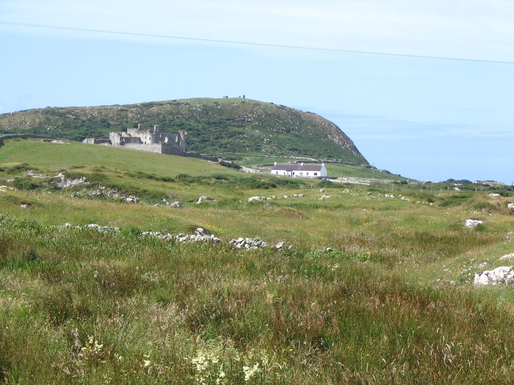
Doon Hill (Irish: Cnoc an Dúin, meaning 'hill of the fort') is a volcanic plug in the townland of Bunowen More, in the barony of Ballynahinch, near Ballyconneely in County Galway, Ireland. The hill, which is 67 m high, is a prominent landscape feature on the Errismore peninsula. Fishermen use Doon Hill as a landmark to guide them into Bunowen Pier at Aillebrack. The Irish name for the hill, dún, means "fortress", possibly indicating an earlier fort on top of the hill.
At the top of Doon Hill are the ruins of a Napoleonic era signal tower (dating to c. 1806) and a concrete watch post dating from the period of The Emergency (WWII).
Nearby Bunowen Castle was built in the mid 1700s. Built on lands originally associated the O'Flaherty family, following the Cromwellian conquest of Ireland, the lands at Bunowen were "transplanted" to Art Geoghegan, a landowner from County Westmeath. The Geoghegan family rebuilt and extended the original O'Flaherty castle, and remained in the castle until the mid-19th century. The castle was purchased by the Blake family in 1852, for use as a summer home. The castle, now in ruin, is owned by the McDonagh family. Near the castle are the ruins of a medieval church, a cemetery and a garden.
We use GPS information embedded into the photo when it is available.
3D mountains overlay
Adjust mountain panorama to perfectly match your photos because recorded by camera photo position might be imprecise.
Move tool
Rotate tool
Zoom
More customization
Choose which peak labels should make into the final photo and what photo title should be.
Next
Photo Location
Satellitte
Flat map
Relief map
Latitude
Longitude
Altitude
OR
Latitude
°'''
Longitude
°'''
Apply
Register Peak
Peak Name
Latitude
Longitude
Altitude
Register
Teleport
PeakVisor
This 3D model of Sagarmatha National Park in Nepal was made using the PeakVisor app topographic data. The mobile app features higher precision models worldwide, more topographic details, and works offline. Download PeakVisor maps today.
Download OBJ model
PeakVisor
The download should start shortly. If you find it useful please consider supporting the PeakVisor app.
PeakVisor for iOS and Android
Be a superhero of outdoor navigation with state-of-the-art 3D maps and mountain identification in the palm of your hand!