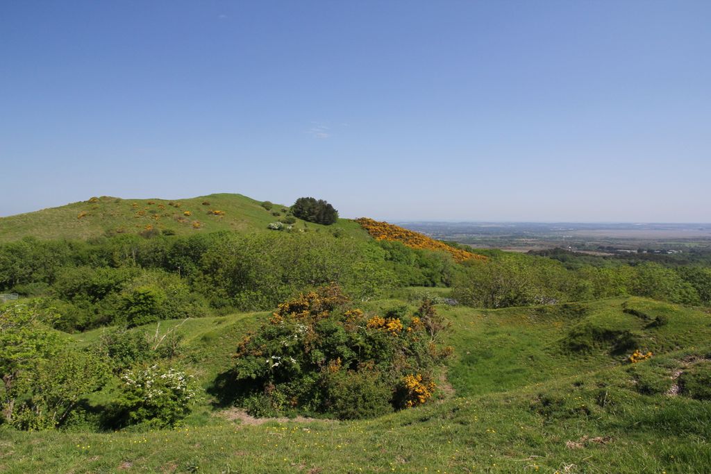
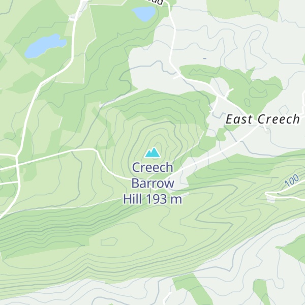
Creech Barrow Hill is a steep, conical hill, 193 metres (633 ft) (one source 637 feet) high, near the coast of Dorset, England, and the highest point of the Dorset Heaths. It has been described as "one of Dorset's most distinctive landmarks." Geologically, it is also the highest Cenozoic hill in England.
There is a single, round barrow at the summit that gives Creech Barrow Hill its name and, from some angles, the appearance of a double summit. To the southeast is Stone Hill Down long barrow. There is also a trig point on the summit.
The name of the hill means "hill" three times. "Creech" is derived from the Celtic crich = hill and "barrow" from the Saxon for "mound".
The hill is a classic viewpoint that was once the site of King John's hunting lodge.
We use GPS information embedded into the photo when it is available.
3D mountains overlay
Adjust mountain panorama to perfectly match your photos because recorded by camera photo position might be imprecise.
Move tool
Rotate tool
Zoom
More customization
Choose which peak labels should make into the final photo and what photo title should be.
Next
Photo Location
Satellitte
Flat map
Relief map
Latitude
Longitude
Altitude
OR
Latitude
°'''
Longitude
°'''
Apply
Register Peak
Peak Name
Latitude
Longitude
Altitude
Register
Teleport
PeakVisor
This 3D model of Sagarmatha National Park in Nepal was made using the PeakVisor app topographic data. The mobile app features higher precision models worldwide, more topographic details, and works offline. Download PeakVisor maps today.
Download OBJ model
PeakVisor
The download should start shortly. If you find it useful please consider supporting the PeakVisor app.
PeakVisor for iOS and Android
Be a superhero of outdoor navigation with state-of-the-art 3D maps and mountain identification in the palm of your hand!