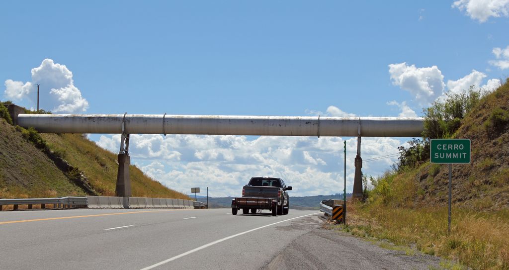
Cerro Summit (elevation 8,042 feet (2,451 m)) is a mountain pass in the State of Colorado, located about 14 miles east of Montrose, Colorado. It divides the watershed of the Cimmaron River to the east and the Uncompahgre River to the west, both of which eventually flow into the Gunnison River.
The summit is traversed by U.S. Route 50. Until 1949, Cerro Summit was part of the Denver and Rio Grande Western Railroad's Black Canyon line which ran between Gunnison and Montrose. When constructed in 1882, the route was originally part of the D&RGW's transcontinental line to Salt Lake City and remained so until more direct routes were built in the early 20th century.
Although grades on U.S. 50 are gentle, the former rail line over Cerro Summit had a ruling gradient of 4% or 1 in 25 and it was not uncommon for most freight trains to require a banker.
Since 2015, Cerro Summit has been home to the Cerro Summit Recreation Area, an open space managed by the City of Montrose which features a network of hiking trails.
We use GPS information embedded into the photo when it is available.
3D mountains overlay
Adjust mountain panorama to perfectly match your photos because recorded by camera photo position might be imprecise.
Move tool
Rotate tool
Zoom
More customization
Choose which peak labels should make into the final photo and what photo title should be.
Next
Photo Location
Satellitte
Flat map
Relief map
Latitude
Longitude
Altitude
OR
Latitude
°'''
Longitude
°'''
Apply
Register Peak
Peak Name
Latitude
Longitude
Altitude
Register
Teleport
PeakVisor
This 3D model of Sagarmatha National Park in Nepal was made using the PeakVisor app topographic data. The mobile app features higher precision models worldwide, more topographic details, and works offline. Download PeakVisor maps today.
Download OBJ model
PeakVisor
The download should start shortly. If you find it useful please consider supporting the PeakVisor app.
PeakVisor for iOS and Android
Be a superhero of outdoor navigation with state-of-the-art 3D maps and mountain identification in the palm of your hand!