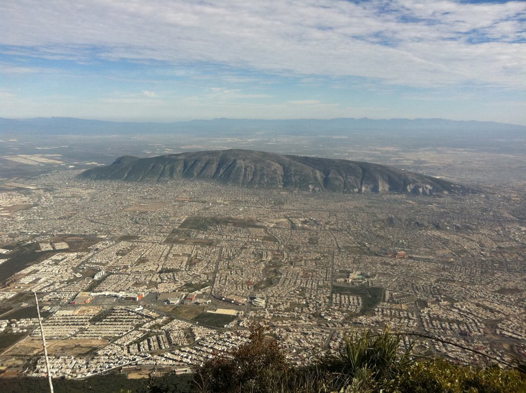
The Cerro del Topo Chico (Spanish, 'Small Mole Hill', from the Latin talpa 'mole') is a mountain and a protected area in the Escobedo, San Nicolás and Monterrey municipalities; state of Nuevo León, Mexico. The summit reaches 1,178 meters above sea level, and it has 618 meters of prominence (Parent: Cerro de las Mitras). The mountain is about 7.5 km long, is a symbol of Escobedo and San Nicolás, and is completely surrounded by Monterrey metropolitan area. It is known for being the source of the Topo Chico mineral water.
By elevation Cerro del Topo Chico is
# 2 out of 2 in General Escobedo # 13 out of 18 in Monterrey
By prominence Cerro del Topo Chico is
# 49 out of 1499 in Nuevo León # 2 out of 2 in General Escobedo # 3 out of 18 in Monterrey # 95 out of 5323 in the Sierra Madre Oriental
We use GPS information embedded into the photo when it is available.
3D mountains overlay
Adjust mountain panorama to perfectly match your photos because recorded by camera photo position might be imprecise.
Move tool
Rotate tool
Zoom
More customization
Choose which peak labels should make into the final photo and what photo title should be.
Next
Photo Location
Satellitte
Flat map
Relief map
Latitude
Longitude
Altitude
OR
Latitude
°'''
Longitude
°'''
Apply
Register Peak
Peak Name
Latitude
Longitude
Altitude
Register
Teleport
PeakVisor
This 3D model of Sagarmatha National Park in Nepal was made using the PeakVisor app topographic data. The mobile app features higher precision models worldwide, more topographic details, and works offline. Download PeakVisor maps today.
Download OBJ model
PeakVisor
The download should start shortly. If you find it useful please consider supporting the PeakVisor app.
PeakVisor for iOS and Android
Be a superhero of outdoor navigation with state-of-the-art 3D maps and mountain identification in the palm of your hand!