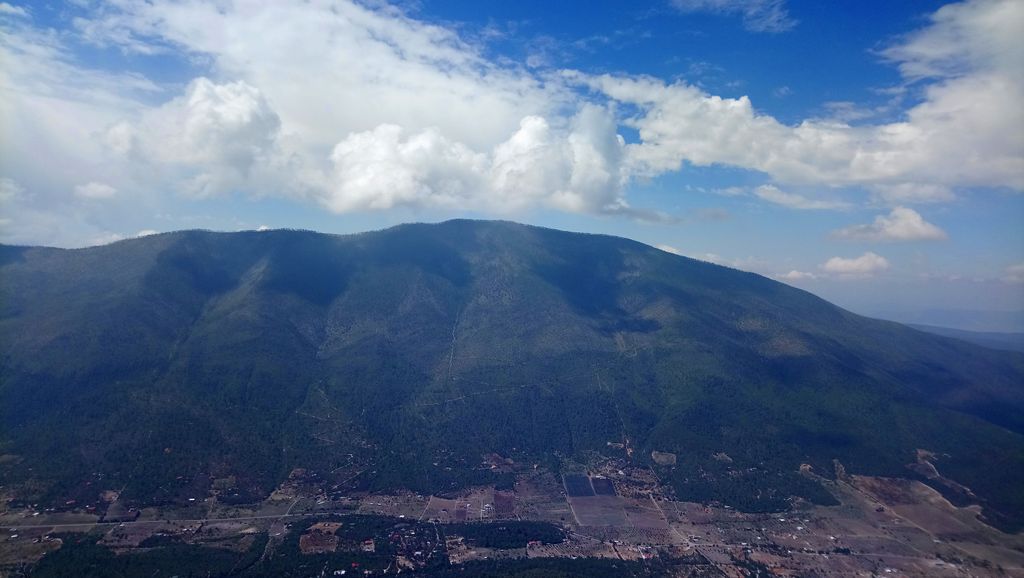
The Cerro de la Viga is a mountain located in the municipalities of Arteaga, Coahuila and Santiago, Nuevo León in northeastern Mexico. Its peak named Cerro San Rafael culminates at 3,712 m above the sea level and has a prominence of 1,395 m. It is the highest point in Coahuila and the second highest point in the Sierra Madre Oriental and in northern Mexico. The mountain is surrounded by the Cerro Rancho Nuevo, Sierra El Álamo, Sierra San Isidro, Sierra Mauricio, Sierra El Muerto (Santiago), El Coahuilón, Sierra Las Alazanas and Cerro La Mina.
Its 40-km-long ridge is the border between Coahuila and Nuevo León over 22 km.
In June 2011, a fire affected the southern side of the mountain.
By elevation Cerro de la Viga is
# 38 out of 1946 in Coahuila # 21 out of 57 in Arteaga
We use GPS information embedded into the photo when it is available.
3D mountains overlay
Adjust mountain panorama to perfectly match your photos because recorded by camera photo position might be imprecise.
Move tool
Rotate tool
Zoom
More customization
Choose which peak labels should make into the final photo and what photo title should be.
Next
Photo Location
Satellitte
Flat map
Relief map
Latitude
Longitude
Altitude
OR
Latitude
°'''
Longitude
°'''
Apply
Register Peak
Peak Name
Latitude
Longitude
Altitude
Register
Teleport
PeakVisor
This 3D model of Sagarmatha National Park in Nepal was made using the PeakVisor app topographic data. The mobile app features higher precision models worldwide, more topographic details, and works offline. Download PeakVisor maps today.
Download OBJ model
PeakVisor
The download should start shortly. If you find it useful please consider supporting the PeakVisor app.
PeakVisor for iOS and Android
Be a superhero of outdoor navigation with state-of-the-art 3D maps and mountain identification in the palm of your hand!