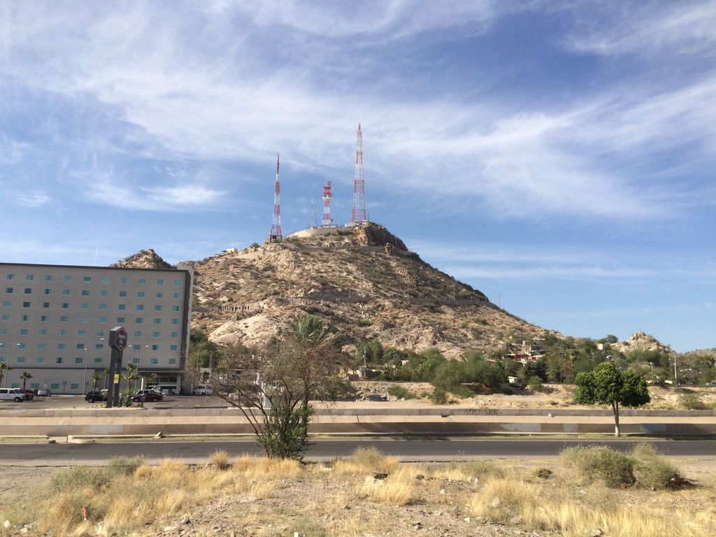
Cerro de la Campana (Bell Hill) is a rocky landform and a symbol of the city of Hermosillo, Sonora, in Mexico. This place is an excellent viewpoint for tourists, because from the rocky hilltop you can see an almost complete panoramic view of the City of the Sun (Ciudad del Sol). It was inaugurated in 1909 as the viewpoint of the city. Its name comes from its shape, which is similar to a bell as seen from the west, even though other theories prompt that its name comes from the sound similar to a bell as rocks crash on the hill.
We use GPS information embedded into the photo when it is available.
3D mountains overlay
Adjust mountain panorama to perfectly match your photos because recorded by camera photo position might be imprecise.
Move tool
Rotate tool
Zoom
More customization
Choose which peak labels should make into the final photo and what photo title should be.
Next
Photo Location
Satellitte
Flat map
Relief map
Latitude
Longitude
Altitude
OR
Latitude
°'''
Longitude
°'''
Apply
Register Peak
Peak Name
Latitude
Longitude
Altitude
Register
Teleport
PeakVisor
This 3D model of Sagarmatha National Park in Nepal was made using the PeakVisor app topographic data. The mobile app features higher precision models worldwide, more topographic details, and works offline. Download PeakVisor maps today.
Download OBJ model
PeakVisor
The download should start shortly. If you find it useful please consider supporting the PeakVisor app.
PeakVisor for iOS and Android
Be a superhero of outdoor navigation with state-of-the-art 3D maps and mountain identification in the palm of your hand!