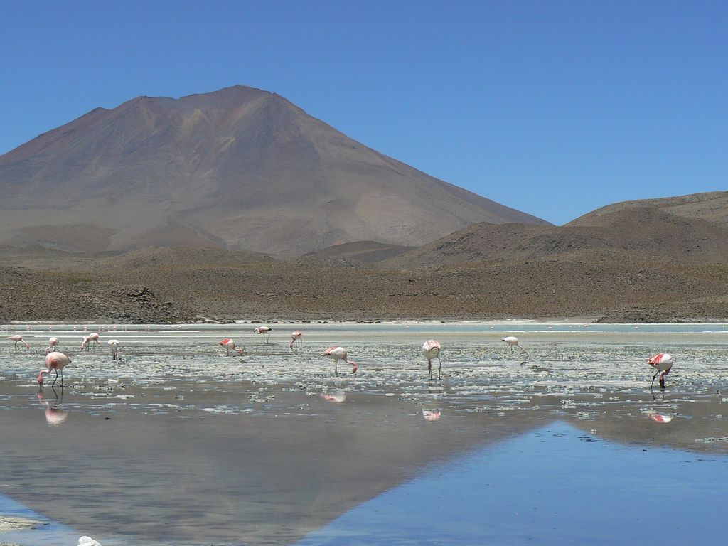
Cerro Araral is an extinct volcano located in the Andes on the border between Chile and Bolivia in the Potosí Department and in the Antofagasta Region. It has a height of 5647 metres, rising over a base of 3900 metres and covers an area of 109.4 square kilometres (42.2 sq mi). The edifice has a volume of 43.4 cubic kilometres (10.4 cu mi), down from 47.2 cubic kilometres (11.3 cu mi) due to erosion. Based on the erosion rate, the volcano is 1.9-2.75 and forms an alignment with Cerro Ascotan. Its formation may be linked to the Altiplano-Puna Magma Body, which appear to have contributed to part of Araral's magmas. The modern snowline on the mountain lies at more than 5,700 metres (18,700 ft) altitude. There are archeological sites at its base and on its flanks. The volcanism is at first andesitic and later becomes intermediary between andesite and basalt, with olivine, plagioclase and pyroxene.
By elevation Cerro Araral is
# 39 out of 410 in Provincia de El Loa # 42 out of 973 in Región de Antofagasta # 68 out of 3781 in Bolivia # 9 out of 232 in Provincia Nor Lípez # 31 out of 1235 in Potosí
By prominence Cerro Araral is
# 18 out of 410 in Provincia de El Loa # 20 out of 973 in Región de Antofagasta # 37 out of 3781 in Bolivia # 11 out of 232 in Provincia Nor Lípez # 23 out of 1235 in Potosí
We use GPS information embedded into the photo when it is available.
3D mountains overlay
Adjust mountain panorama to perfectly match your photos because recorded by camera photo position might be imprecise.
Move tool
Rotate tool
Zoom
More customization
Choose which peak labels should make into the final photo and what photo title should be.
Next
Photo Location
Satellitte
Flat map
Relief map
Latitude
Longitude
Altitude
OR
Latitude
°'''
Longitude
°'''
Apply
Register Peak
Peak Name
Latitude
Longitude
Altitude
Register
Teleport
PeakVisor
This 3D model of Sagarmatha National Park in Nepal was made using the PeakVisor app topographic data. The mobile app features higher precision models worldwide, more topographic details, and works offline. Download PeakVisor maps today.
Download OBJ model
PeakVisor
The download should start shortly. If you find it useful please consider supporting the PeakVisor app.
PeakVisor for iOS and Android
Be a superhero of outdoor navigation with state-of-the-art 3D maps and mountain identification in the palm of your hand!