The Büchelstein is a mountain, 832 m above sea level (NN) high, in the southern Bavarian Forest near the higher peak of the Brotjacklriegel.
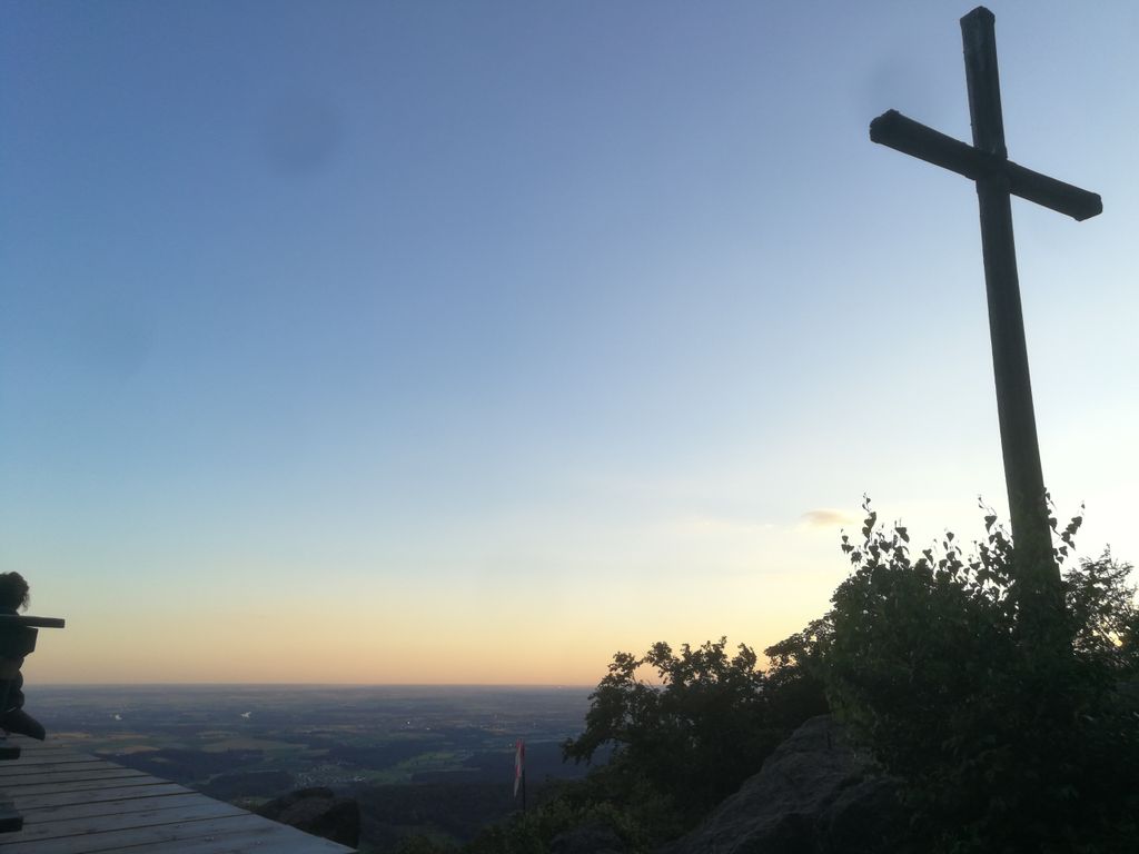
Its forested slopes rise above the bowl of the Lallinger Winkel in the east and the village of Grattersdorf to the north. Just below the highest point is a lookout rock with a large summit cross and wide panoramas over parts of Lower Bavaria. In föhn conditions in autumn even the northern chain of the Alps may be seen from the Dachstein to the Zugspitze. In addition there is a starting point here for hang gliders, that take off in suitable right thermal conditions. Several very short paths lead to the Büchelstein from Grattersdorf, Kerschbaum or Langfurth and the E8 European long distance path passes close to the lookout rocks.
The Büchelstein may have given its name to the local dish known as Pichelsteiner Eintopf. On 17 June 1839, on the initiative of the Grafenau Landrichter, Jakob Strelin, the first Büchelstein Festival (Büchelsteiner Fest) was celebrated. It later moved to Grattersdorf.
We use GPS information embedded into the photo when it is available.
3D mountains overlay
Adjust mountain panorama to perfectly match your photos because recorded by camera photo position might be imprecise.
Move tool
Rotate tool
Zoom
More customization
Choose which peak labels should make into the final photo and what photo title should be.
Next
Photo Location
Satellitte
Flat map
Relief map
Latitude
Longitude
Altitude
OR
Latitude
°'''
Longitude
°'''
Apply
Register Peak
Peak Name
Latitude
Longitude
Altitude
Register
Teleport
PeakVisor
This 3D model of Sagarmatha National Park in Nepal was made using the PeakVisor app topographic data. The mobile app features higher precision models worldwide, more topographic details, and works offline. Download PeakVisor maps today.
Download OBJ model
PeakVisor
The download should start shortly. If you find it useful please consider supporting the PeakVisor app.
PeakVisor for iOS and Android
Be a superhero of outdoor navigation with state-of-the-art 3D maps and mountain identification in the palm of your hand!