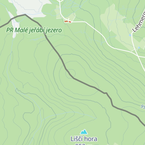
The Buchschachtelberg (Czech: Bučina) is a forested mountain south of Henneberg in the western Saxon Ore Mountains, which is 973 metres high. The border between Germany and the Czech Republic runs over its summit.
Northwest of the Buchschachtelberg lies the Kleiner Kranichsee.
In winter a cross-country skiing trail runs past the Buchschachtelberg and via the Scheffelsberg from Henneberg towards the border. In clear visibility there is a good view from the Buchschachtelberg of the Saxon-Bohemian upper Ore Mountains.
West of the mountain runs the Buchschachtelgraben stream, on Czech territory.
There's a trail leading to the summit.
By elevation Buchschachtelberg is
# 37 out of 3044 in Northwest # 29 out of 547 in Karlovarský kraj # 14 out of 381 in Erzgebirgskreis # 14 out of 4164 in Saxony
We use GPS information embedded into the photo when it is available.
3D mountains overlay
Adjust mountain panorama to perfectly match your photos because recorded by camera photo position might be imprecise.
Move tool
Rotate tool
Zoom
More customization
Choose which peak labels should make into the final photo and what photo title should be.
Next
Photo Location
Satellitte
Flat map
Relief map
Latitude
Longitude
Altitude
OR
Latitude
°'''
Longitude
°'''
Apply
Register Peak
Peak Name
Latitude
Longitude
Altitude
Register
Teleport
PeakVisor
This 3D model of Sagarmatha National Park in Nepal was made using the PeakVisor app topographic data. The mobile app features higher precision models worldwide, more topographic details, and works offline. Download PeakVisor maps today.
Download OBJ model
PeakVisor
The download should start shortly. If you find it useful please consider supporting the PeakVisor app.
PeakVisor for iOS and Android
Be a superhero of outdoor navigation with state-of-the-art 3D maps and mountain identification in the palm of your hand!