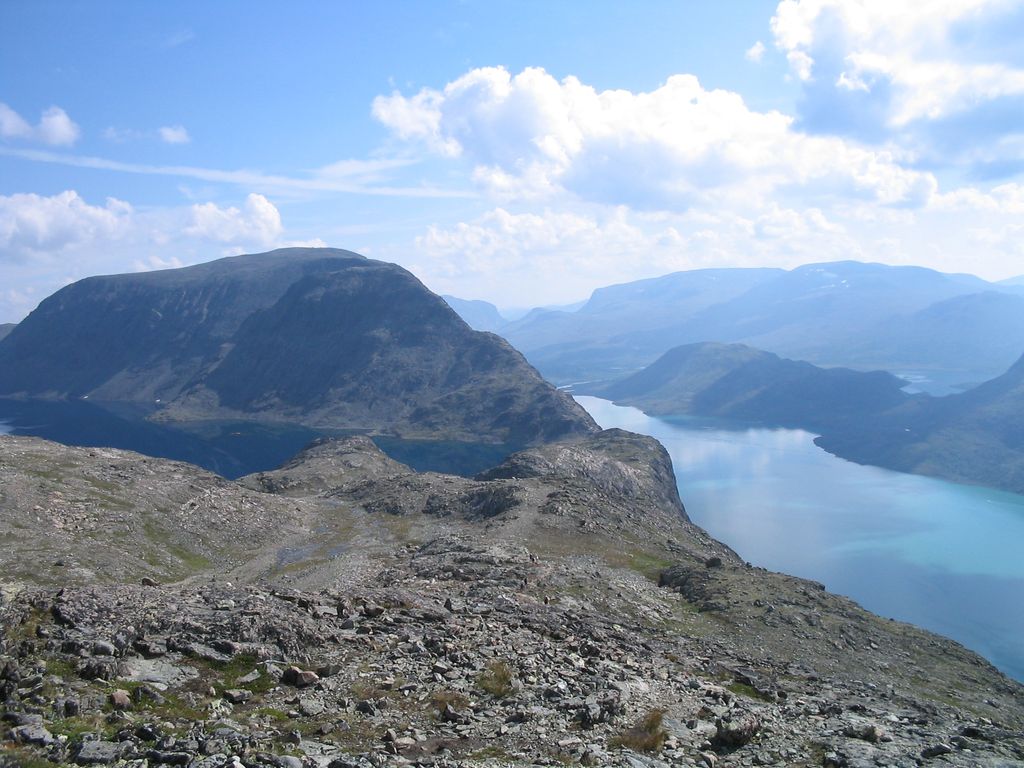
Besseggen or Besseggi is a mountain ridge in Vågå Municipality in Innlandet county, Norway. The 1,634-metre (5,361 ft) tall mountain ridge is located in the Jotunheimen mountains within Jotunheimen National Park. The mountain sits about 46 kilometres (29 mi) southwest of the village of Vågåmo and about 30 kilometres (19 mi) northwest of the village of Beitostølen. The mountain ridge is surrounded by several other notable mountains including Veslfjellet to the east and Besshø to the northwest. The ridge runs between the lakes Gjende and Bessvatnet.
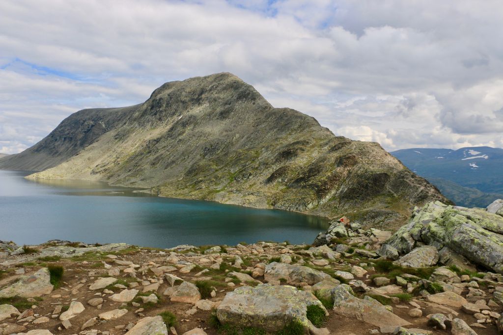
The walk over Besseggen is one of the most popular mountain hikes in Norway. About 30,000 people walk this trip each year. The route over Besseggen starts at Gjendesheim, up to the trails highest point, Veslfjellet (at 1,743 metres (5,719 ft)), down Besseggen, further over the relatively flat area Bandet (at the foot of Besshø), and ends at Memurubu, where one may take the regularly scheduled ferry route back to Gjendesheim. Many choose to do the hike in the other direction by starting at Memurubu after first taking the ferry there from Gjendesheim. The trip is estimated to take about 5–7 hours to walk without rest stops.
From Besseggen there is a great view over the lakes Gjende and Bessvatnet. One of the unique aspects of the view is that Gjende lies almost 400 metres (1,300 ft) lower than Bessvatnet, and while Bessvatnet has a blue color typical of other lakes, Gjende has a distinct green color. The green color is the result from glacier runoff containing clay (rock flour). Looking down towards Memurubu one can see the nearby river Muru coloring the water with a light colored runoff.
We use GPS information embedded into the photo when it is available.
3D mountains overlay
Adjust mountain panorama to perfectly match your photos because recorded by camera photo position might be imprecise.
Move tool
Rotate tool
Zoom
More customization
Choose which peak labels should make into the final photo and what photo title should be.
Next
Photo Location
Satellitte
Flat map
Relief map
Latitude
Longitude
Altitude
OR
Latitude
°'''
Longitude
°'''
Apply
Register Peak
Peak Name
Latitude
Longitude
Altitude
Register
Teleport
PeakVisor
This 3D model of Sagarmatha National Park in Nepal was made using the PeakVisor app topographic data. The mobile app features higher precision models worldwide, more topographic details, and works offline. Download PeakVisor maps today.
Download OBJ model
PeakVisor
The download should start shortly. If you find it useful please consider supporting the PeakVisor app.
PeakVisor for iOS and Android
Be a superhero of outdoor navigation with state-of-the-art 3D maps and mountain identification in the palm of your hand!