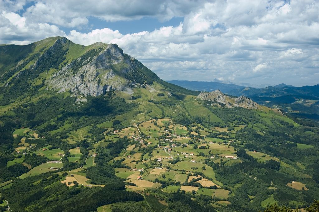
Balerdi (1,195 m), also called Mallozarra, is a mountain of the Aralar massif closing the mountain range at its northern end as well as standing last in the imposing ridge-line called the Malloak (a term used by locals to refer to them, translating roughly as 'jagged ridge') looming over the valley Araitz. It lies on the border between Gipuzkoa and Navarre as most of Aralar forms the border between both Spanish provinces. Despite its descending shape from the higher mount Artubi, the summit is popular with locals and hikers for its characteristic outline of limestone walls and the tricky access to the summit at the end of a narrow rocky stretch with cliffs on either side. As a result, there have been many fatal accidents.
The main access points are in the villages at the foot of the mountain, i.e. Gaintza (388 m) and Azkarate (460 m) on the Navarrese side. The trail rises west in a zigzag to the pass of Astunalde (1,203 m), the ascent being steep. It takes no more than to 2 hours on foot. Another approach starts in the Gipuzkoan town of Amezketa and leads through the highland valley of the quarries (Minak). It takes 2½ hours to reach the top of Balerdi from there and the paths are signposted clearly all along.
There's a trail leading to the summit.
By elevation Balerdi is
# 49 out of 102 in Aralar parke naturala/Parque Natural de Aralar # 96 out of 977 in Gipuzkoa
By prominence Balerdi is
# 94 out of 102 in Aralar parke naturala/Parque Natural de Aralar
We use GPS information embedded into the photo when it is available.
3D mountains overlay
Adjust mountain panorama to perfectly match your photos because recorded by camera photo position might be imprecise.
Move tool
Rotate tool
Zoom
More customization
Choose which peak labels should make into the final photo and what photo title should be.
Next
Photo Location
Satellitte
Flat map
Relief map
Latitude
Longitude
Altitude
OR
Latitude
°'''
Longitude
°'''
Apply
Register Peak
Peak Name
Latitude
Longitude
Altitude
Register
Teleport
PeakVisor
This 3D model of Sagarmatha National Park in Nepal was made using the PeakVisor app topographic data. The mobile app features higher precision models worldwide, more topographic details, and works offline. Download PeakVisor maps today.
Download OBJ model
PeakVisor
The download should start shortly. If you find it useful please consider supporting the PeakVisor app.
PeakVisor for iOS and Android
Be a superhero of outdoor navigation with state-of-the-art 3D maps and mountain identification in the palm of your hand!