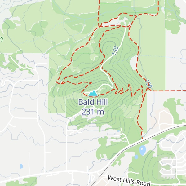
Bald Hill is a hill in the Willamette Valley west of Corvallis, Oregon. With an elevation of 755 feet (230 m) and a top clear of tree cover, Bald Hill is a popular local hiking destination and lookout, with Corvallis, Mary's Peak, the Coastal Range, and the Cascade Range foothills all visible from atop the hill.
Bald Hill is part of the Bald Hill Natural Area, a 284-acre (115 ha) park that contains 10 miles (16 km) of trails through oak savanna remnants and denser forest which are managed to provide habitat for endemic plant species and wildlife.
There's a trail called Summit Road leading to the summit.
By elevation Bald Hill is
# 1 out of 1 in Bald Hill Natural Area # 38 out of 55 in Benton County
By prominence Bald Hill is
# 1 out of 1 in Bald Hill Natural Area # 25 out of 55 in Benton County
We use GPS information embedded into the photo when it is available.
3D mountains overlay
Adjust mountain panorama to perfectly match your photos because recorded by camera photo position might be imprecise.
Move tool
Rotate tool
Zoom
More customization
Choose which peak labels should make into the final photo and what photo title should be.
Next
Photo Location
Satellitte
Flat map
Relief map
Latitude
Longitude
Altitude
OR
Latitude
°'''
Longitude
°'''
Apply
Register Peak
Peak Name
Latitude
Longitude
Altitude
Register
Teleport
PeakVisor
This 3D model of Sagarmatha National Park in Nepal was made using the PeakVisor app topographic data. The mobile app features higher precision models worldwide, more topographic details, and works offline. Download PeakVisor maps today.
Download OBJ model
PeakVisor
The download should start shortly. If you find it useful please consider supporting the PeakVisor app.
PeakVisor for iOS and Android
Be a superhero of outdoor navigation with state-of-the-art 3D maps and mountain identification in the palm of your hand!