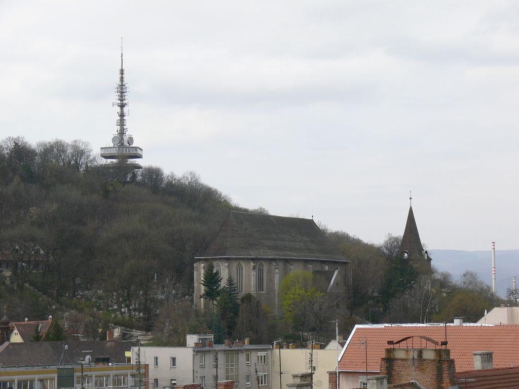
The Avas is a hill of volcanic origin in Miskolc, Hungary. Its top (234 m above sea level, 104 m above the city) is the highest point of Miskolc proper (although other parts, annexed to the city later, lie higher up in the Bükk mountains). On the top stands a TV tower with observation deck which is a former symbol of the city and provides a nice panorama.
The name of the hill is an archaic Hungarian word meaning "forbidden". It was named that at a time it was forbidden for shepherds to graze their herds there because the old wine cellars threatened with caving in.
In the early 20th century several prehistoric artefacts were found in the Avas, proving that a people belonging to the Neolithic Szeleta culture lived here. (The culture itself was named after Szeleta Cave, in Lillafüred, where many important archaeological finds were found.)
The limestone caves of Avas, that were once used by prehistoric men, are now used as wine cellars; the narrow, winding streets give a Mediterranean atmosphere to this part of Avas Hill.
On the northern part of the hill, close to downtown Erzsébet Square, stands the Gothic Protestant Church of Avas, the oldest building of Miskolc proper (the other oldest building is the Castle of Diósgyőr) and its belfry (16th century). There are also several wine cellars dug in sandstone nearby, in the so-called Kis-Avas ("Little Avas") district.
The TV tower is 72 meters high and was built in 1963. The previous tower was made of wood and was designed by Bálint Szeghalmi, who also designed the Wooden Church; it was destroyed by Soviet soldiers during the revolution in 1956.
The southern part of Avas, also called Avas-South, is where the largest housing estate of the city stands, with 10-storey Socialist-style concrete blocks of flats providing homes for about one-third of the city's population. The district has five primary and four secondary schools, two post offices and a police station.
We use GPS information embedded into the photo when it is available.
3D mountains overlay
Adjust mountain panorama to perfectly match your photos because recorded by camera photo position might be imprecise.
Move tool
Rotate tool
Zoom
More customization
Choose which peak labels should make into the final photo and what photo title should be.
Next
Photo Location
Satellitte
Flat map
Relief map
Latitude
Longitude
Altitude
OR
Latitude
°'''
Longitude
°'''
Apply
Register Peak
Peak Name
Latitude
Longitude
Altitude
Register
Teleport
PeakVisor
This 3D model of Sagarmatha National Park in Nepal was made using the PeakVisor app topographic data. The mobile app features higher precision models worldwide, more topographic details, and works offline. Download PeakVisor maps today.
Download OBJ model
PeakVisor
The download should start shortly. If you find it useful please consider supporting the PeakVisor app.
PeakVisor for iOS and Android
Be a superhero of outdoor navigation with state-of-the-art 3D maps and mountain identification in the palm of your hand!