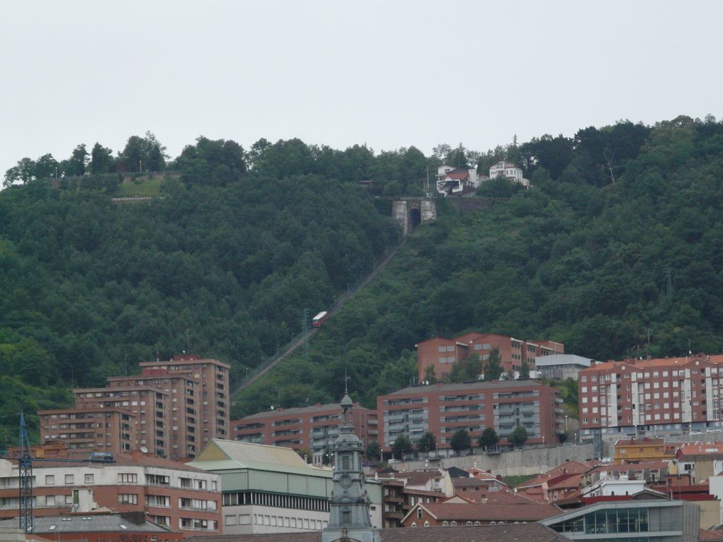
Mount Artxanda (Basque: Artxanda mendia; Spanish: Monte Archanda) is one of the two small mountain ranges that delimit the municipality of Bilbao, the other one being Pagasarri. Of the two, it is the lower one (at no more than 300 m.), the closer one to the center of the city, and the one that has suffered from more intense urbanization. The pass of Santo Domingo separates the main part of Artxanda from Monte Avril, 400m high.
The Artxanda Funicular links downtown Bilbao with a recreational area at the top of the mountain, which has a park, several restaurants, a hotel, and a sports complex. The area is quite popular among the city's inhabitants and offers panoramic views of the city to the tourists.
There's a trail called Artxandamendi bidea leading to the summit.
The nearest mountain hut is Baita located 1 285m/4 216ft WSW of the summit.
We use GPS information embedded into the photo when it is available.
3D mountains overlay
Adjust mountain panorama to perfectly match your photos because recorded by camera photo position might be imprecise.
Move tool
Rotate tool
Zoom
More customization
Choose which peak labels should make into the final photo and what photo title should be.
Next
Photo Location
Satellitte
Flat map
Relief map
Latitude
Longitude
Altitude
OR
Latitude
°'''
Longitude
°'''
Apply
Register Peak
Peak Name
Latitude
Longitude
Altitude
Register
Teleport
PeakVisor
This 3D model of Sagarmatha National Park in Nepal was made using the PeakVisor app topographic data. The mobile app features higher precision models worldwide, more topographic details, and works offline. Download PeakVisor maps today.
Download OBJ model
PeakVisor
The download should start shortly. If you find it useful please consider supporting the PeakVisor app.
PeakVisor for iOS and Android
Be a superhero of outdoor navigation with state-of-the-art 3D maps and mountain identification in the palm of your hand!