Scan the QR code and open PeakVisor on your phone
Wilsons Promontory National Park is a protected park area in Victoria, Australia. Located on a peninsula southeast of Melbourne, it’s the southernmost tip of mainland Australia. The park is home to 36 named mountains, the highest and most prominent of which is Mount Latrobe (754 m / 2474 ft).
Wilsons Promontory National Park covers an area of around 50,500 hectares (124,788 acres) in southeastern Victoria. Located in the South Gippsland region of the state, it is Victoria’s largest coastal wilderness area. Wilsons Promontory National Park is also the southernmost tip of mainland Australia, jutting out into the Bass Strait.
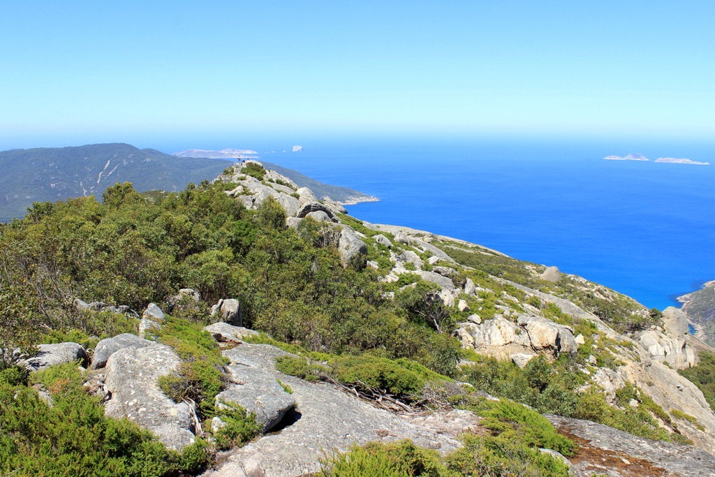
Most of the peninsula and surrounding waters are protected by Wilsons Promontory National Park and Wilsons Promontory Marine National Park. This covers much of the ancient mountain range that once linked Victoria to Tasmania millions of years ago. The remains of this mountain range can be seen across Wilsons Promontory, with various rocky peaks rising up to the highest point at Mount Latrobe (754 m / 2474 ft).
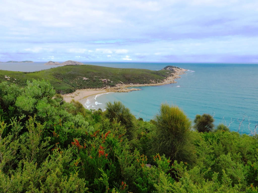
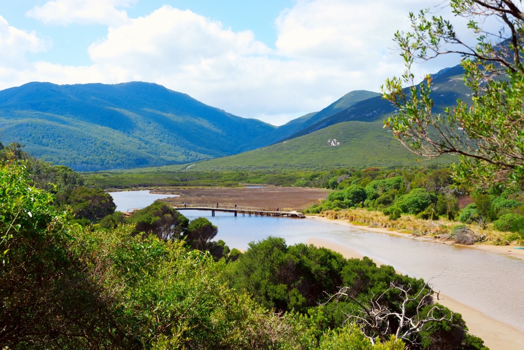
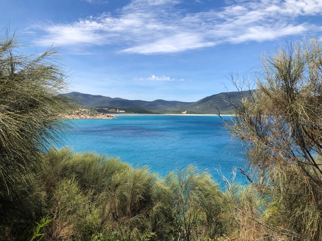
Between its mountain peaks, the landscape of Wilsons Promontory National Park features extensive intertidal mudflats, sandy beaches in sheltered coves, prominent rocky headlands, and coastal dunes.
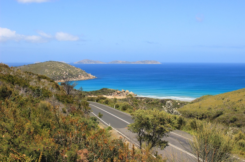
Wilsons Promontory Marine National Park protects more than 13 islands surrounding the peninsula. It is one of the richest marine ecosystems off Australia’s coast.
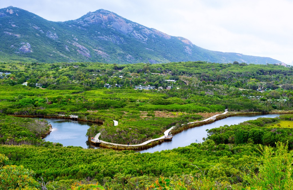
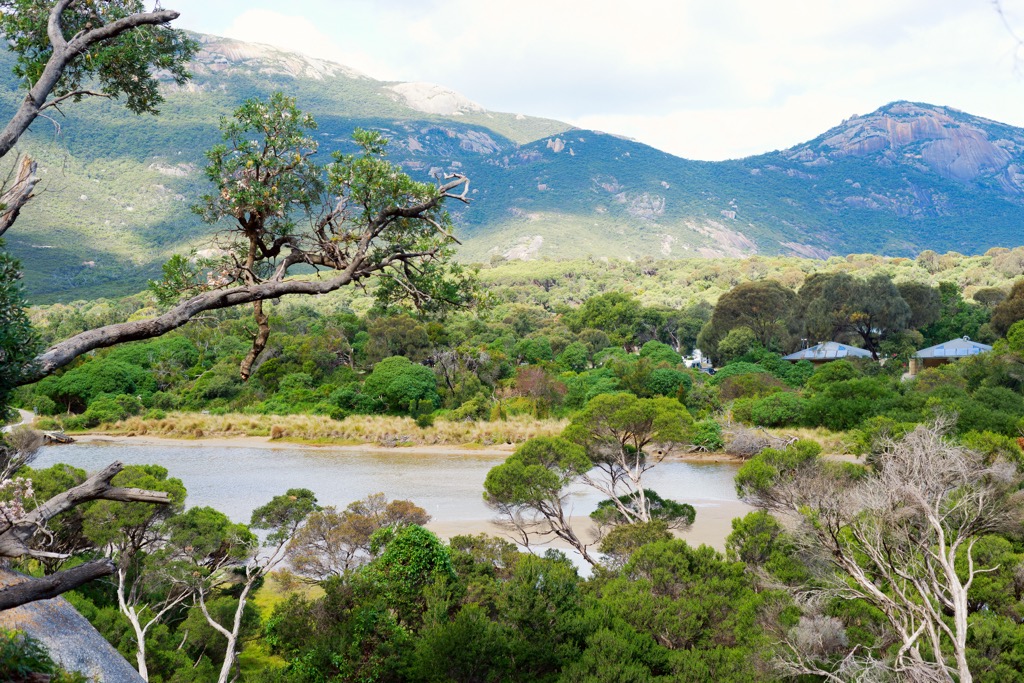
Tidal River is the main river in Wilsons Promontory. The river runs into Norman Bay where the main settlement on the peninsula is located, also called Tidal River.
While it’s a remote coastal park, there are other national parks in the Gippsland area not too far away, including Tarra Bulga National Park, Bunurong Marine National Park, and Morwell National Park. Wilsons Promontory is one of the most popular national parks in Victoria, and is bustling with visitors throughout the year.
Wilsons Promontory National Park covers most of the peninsula southeast of Melbourne. It is dominated by granitic batholith from the lower Devonian, which was pushed up through the earth’s crust to form a series of mountains and valleys about 350 million years ago.
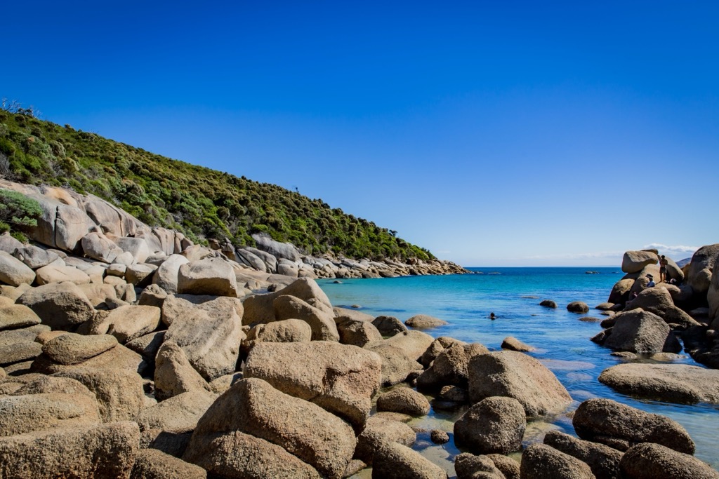
The granite mass was so large that it originally extended all the way down to Tasmania. Around 10,000 years ago, the climate warmed and sea levels rose, submerging the Bass Strait and cutting Tasmania off from the mainland. This also led to the creation of granite islands off the coast of Wilsons Promontory National Park, as well as the granite boulders scattered on the beaches and mountain peaks across the peninsula.
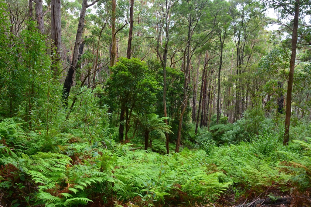
Wilsons Promontory National Park features a diverse range of ecosystems, including rainforest, tall open forest, woodland, heathland, swamps, and coastal coves. The flora and fauna of the peninsula has had to adapt to harsh conditions, including wind speeds of up to 170 kilometers per hour (105 miles per hour) and temperatures varying from 0 degrees (32 F) to 42 degrees celsius (107 F).
Most slopes of the higher peaks are covered in hardy heathland and dry forest. Although, in the low lying valleys, you’ll find bogs and swamps. Sections of the coast are backed by dramatic sand dunes, most prominent at The Big Drift in the northern part of the national park.
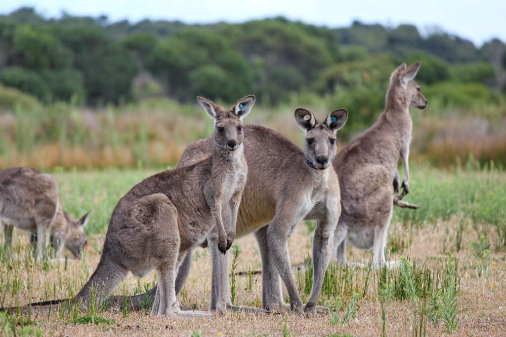
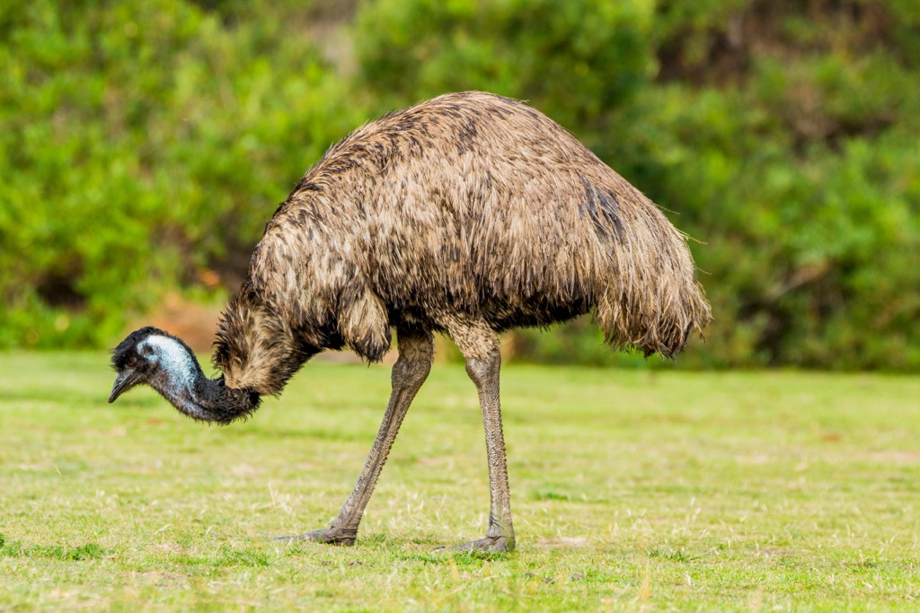
Wilsons Promontory National Park is also home to a variety of fauna. One of the most prominent marsupials is the common wombat, which can be found across the peninsula. However, the park is also home to kangaroos, snakes, wallabies, long-nosed potoroos, white-footed dunnarts, broad-toothed rats, echidnas, and feather-tailed gliders.
Some of the common birds found on the promontory include crimson rosellas, yellow-tailed black cockatoos and fairy wrens. The small granite islands around the peninsula also form part of the Wilsons Promontory Islands Important Bird Area, because of their importance for breeding seabirds.
The Wilsons Promontory Marine National Park is also home to a variety of marine life and coral reefs. Southern right whales seasonally arrive in the area to rest and calve in the sheltered bays along with Humpback whales. Dolphins, seals, sea lions, and penguins can also be spotted off the coast of the peninsula.
Wilsons Promontory National Park sits on the Gunaikurnai, Bunurong and Boonwurrung People’s custodial land. The park is vital to the Aboriginal cultural landscape and dreaming stories and is known as the home of their spiritual ancestor, Loo-errn.
The first European to spot the area was George Bass in 1798. After consultation with Matthew Flinders, the name Wilsons Promontory was recommended after Thomas Wilson, a merchant engaged in trade with Australia.
Seal hunting and whaling activities began on the promontory in the early 1800s. It wasn’t until the 1880s that a public campaign asked to declare the area a national park. It was temporarily reserved in 1898, and then officially declared a national park in 1905, making it one of the oldest in Victoria, along with Mount Buffalo National Park.
The peninsula was originally accessible only by boat, until a road was completed in the 1930s. Since then, walking tracks, bridges and boardwalks have been constructed to provide public access to pristine beaches and vast areas of wilderness.
Tidal River is the main settlement within the national park. However, it is not home to permanent residents, only park rangers and campers throughout the year. There is a visitor center open daily, a general store which serves basic supermarket and emergency items, and a cafe.
Wilsons Promontory National Park is home to many walking trails open all year round. The park is popular for those looking for stunning coastal scenery, with a variety of options from accessible short trails to longer overnight hikes.
Here are some of the best hikes in Wilsons Promontory National Park to check out on your next visit:
A family-friendly walk in Wilsons Promontory National Park, the Lilly Pilly Gully Nature Walk is a 5.5 km (3.4 mi) walk through heathland and tall eucalypt trees. It begins with a boardwalk through the trees, allowing you to pay attention to the birds and animals you might spot along the way.
The track is predominantly on a compact and flat track, making it perfect for families and those with limited mobility. It also passes by the track leading up to Mount Bishop (319 m / 1,046 ft) for those with more energy to climb to the nearby summit.
By far the most popular walk in the national park, Mount Oberon (558 m / 1,830 ft) is one of the tallest peaks in the region. Starting from Telegraph Saddle car park, the walk first follows a management track that winds its way up to the top. The final steps on the rocky outcrop require a stair climb with a helpful barrier for those uneasy on their feet.
The reward at the top is a stunning 360-degree panoramic view of the entire peninsula. The walk is 6.8 km (4.2 mi) return, but is graded moderate-hard for its steep ascent.
Another rocky peak that offers an incredible view is Mount Bishop (319 m / 1,046 ft). Beginning from Lilly Pilly Gully Carpark, the 6.6 km (4.1 mi) return hike climbs up from Lilly Pilly Gully and onto the rugged outcrop.
You’ll pass through dry forest as the vegetation thins out towards the top. The peak is covered with a cluster of boulders, be careful of exposed cliff edges and only explore where you feel safe. The view stretches across the western coastline of the peninsula.
For a longer day hike, you can walk from Tidal River to Oberon Bay and back. Technically a section of the Southern Circuit Hike, it’s possible to complete this 14 km (8.7 mi) walk in a day. From Tidal River, follow a sandy track through the coastal shrubs to Norman Point. Then, continue around the headland towards Little Oberon Bay.
This is a beautiful small cove with a sandy beach, popular on a hot summer day for a dip. Otherwise, you can continue on the trail a further 2 km (1.2 mi) to Oberon Bay. This is a vast long beach that stretches along the west coast of the peninsula. There is a bush camp there, but this is reserved for overnight hikers. Return to Tidal River the same way.
From Tidal River, it’s possible to take in three bays on the west coast of the peninsula in one day hike. After crossing the footbridge near the campground, head off on the trail to Pillar Point. Then, turn right and head north towards Squeaky Beach, the first bay on this walk.
At the other end of the beach, you can pick up the trail again and continue onto Picnic Bay. From there, you can also hike up and over the headland to Whiskey Bay. You’ll need to return the same way again, making it a 12 km (7.4 mi) hike back to Tidal River. Don’t forget to pack your swimsuit though, because there’s plenty of opportunities to swim.
This underrated hike in WIlsons Promontory National Park is a must for beach lovers. Starting from Darby River Carpark, 11.5 km (7.1 mi) before Tidal River, head off on the Tongue Point Track. It first climbs over Darby Hill, an ancient sand dune, before snaking around the headland offering views back over Darby River and Beach.
Along the way you can make the short 500 m (0.3 mi) detour down to Fairy Cove, one of the most beautiful places on the whole peninsula. The rocky cove has calm water that is perfect for swimming.
Then, continue to Tongue Point at the end of the windswept headland. This offers stunning views over the western coastline of the peninsula. Return the same way for a 9 km (5.6 mi) return hike. Otherwise, there is the option of continuing on Tongue Point Track to Sparkes Lookout and ending at Darby Saddle Carpark for a one way hike.
Wilsons Promontory National Park also has an extended multi-day hike taking in its southern coastline. The Southern Circuit is a three or five-day hike starting and finishing at Telegraph Saddle Carpark. The three day circuit includes camping at both Sealers Cove and Waterloo Bay, or you can opt for the longer five day circuit which also includes Wilsons Prom Lighthouse and South Point.
Campsites must be booked in advance through Parks Victoria website, as numbers are limited. In summer, there are shuttle buses running from Tidal River to Telegraph Saddle Carpark for hikers. There is a hiker carpark at Tidal River next to the Visitor Center.
If you want to stay within Wilsons Promontory National Park, then camping and booking accommodation at Tidal River is the best option. This is the only settlement within the park boundary and is located at the very end of Wilsons Promontory Road.
Tidal River features a huge campground with nearly 500 camping and caravan sites. Close to Norman Beach, there are both unpowered and powered sites available. There are toilets and showers for campers, as well as access to the Tidal River General Store.
For those looking for something more comfortable, there are also a range of cabins and lodges available near the campground, which can cater for larger groups.
During peak season, the campground and cabins are booked well in advance. You can book all accommodation online on the Parks Victoria website.
There are also a handful of wild camping areas for those completing overnight hikes. There is a popular three or five-day circuit around the southern coastline of the promontory, which includes basic bush camps for hikers. Bookings for these campsites must also be made online on the Parks Victoria website.
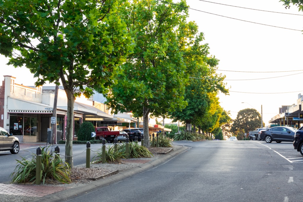
Wilsons Promontory National Park is accessible from many nearby small towns of the South Gippsland region in Victoria. If you’re looking for places to pick up supplies on your trip, here are the closest towns to the national park:
Wilsons Promontory National Park is located southeast of Melbourne in Victoria. It’s one of the most visited national parks from the city, so it’s easy to head off for a day trip or weekend to Wilsons Promontory.
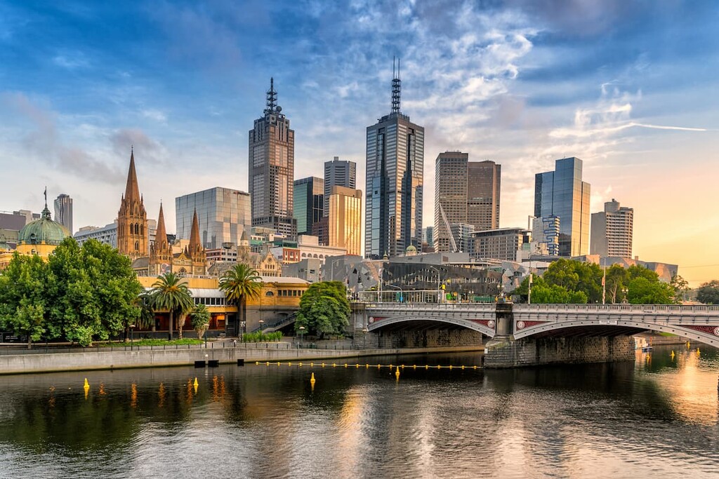
The closest capital city to Wilsons Promontory National Park is Melbourne, located 230 km (143 mi) northwest of the park. It’s a relatively easy drive via the M1 from the city, before taking the South Gippsland Highway through many towns on the way.
Melbourne is the central transport hub of Victoria, so you’ll find a domestic and international airport and train and bus stations. As the capital city of Victoria, it’s well known for its lively nightlife, coffee culture, shopping scene, and variety of architecture. There are plenty of things to do, with iconic attractions including the Melbourne Arts Precinct, Federation Square, Bourke Street Mall, and Southbank area.