Scan the QR code and open PeakVisor on your phone
The Udege Legend National Park was established in 2007 and is located in the Krasnoarmeysky District of the Primorsky Territory of the Russian Federation in the foothills of the western Sikhote Alin Range. It includes some part of the Big Ussurka River basin in its middle reaches and the lower part of the Armu River as well as the lower part of the Perevalnaya River valley.
There are 28 registered archaeological sites belonging to different historical epochs from the Stone Age to Medieval times. The park’s territory is geographically located between two regional centres – Vladivostok and Khabarovsk, 520 and 440 kilometres respectively, which are connected by a good quality highway.
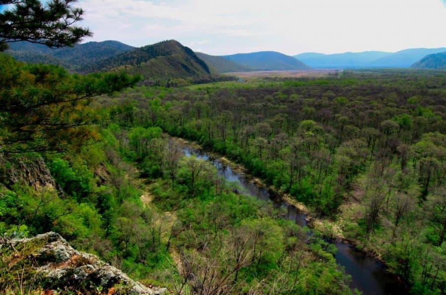
The relief is dominated by medium-altitude mountains; the highest point is Mount Armu (1,330 m). Yet, these modest stats are well compensated by many deposits of gems. You can find various types of amethyst, jasper, chalcedony, agate here. The most interesting pieces are exhibited in the Mineralogical Museum located in the village Roshchino. Plenty of souvenirs are made from those gems.
The valley of the Big Ussurka River (the Iman) has been inhabited since the Stone Age. That is why the area is scattered with remnants of ancient settlements belonging to different cultures and peoples.
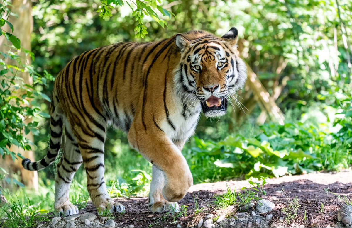
This territory is home to the Udege, one of the indigenous peoples of the Far East. Before the arrival of the Russians, the Udege did not know writing but had their own language, the main religion was shamanism and animism manifested in the belief in the relationship of people with the bear and the Amur tiger. Old believers who preserved traditions and way of life of their ancestors still live here.
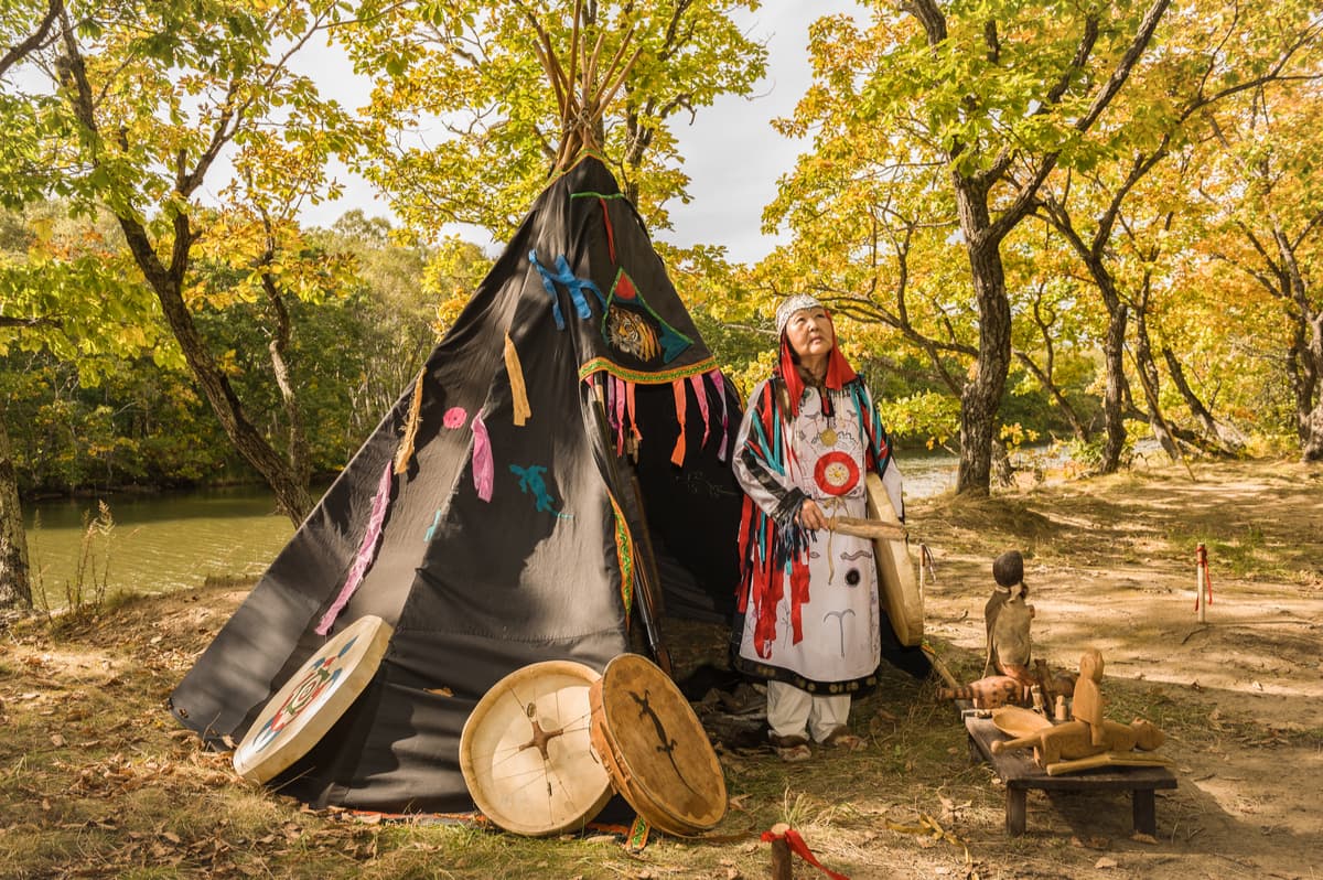
Up to this date, there have been discovered 41 historical and archaeological monuments and 5 ethnological sites used by the Udege for carrying out religious ceremonies and rituals. The local Udege have their own sacred places bequeathed to them by their ancestors, it is strongly believed this legacy can influence the fate of the taiga.
Due to errors in the registration of the territory, as well as litigations with indigenous communities and various organizations, the exact boundaries of the park have not yet been definitely identified.
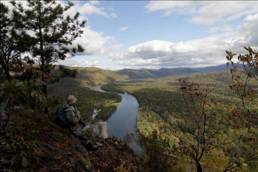
The richness of fauna and flora, beautiful landscapes, archaeological, historical and cultural monuments of indigenous people determine the attractiveness of the area for tourism. The nature of the park has remained practically unspoilt by human touch.
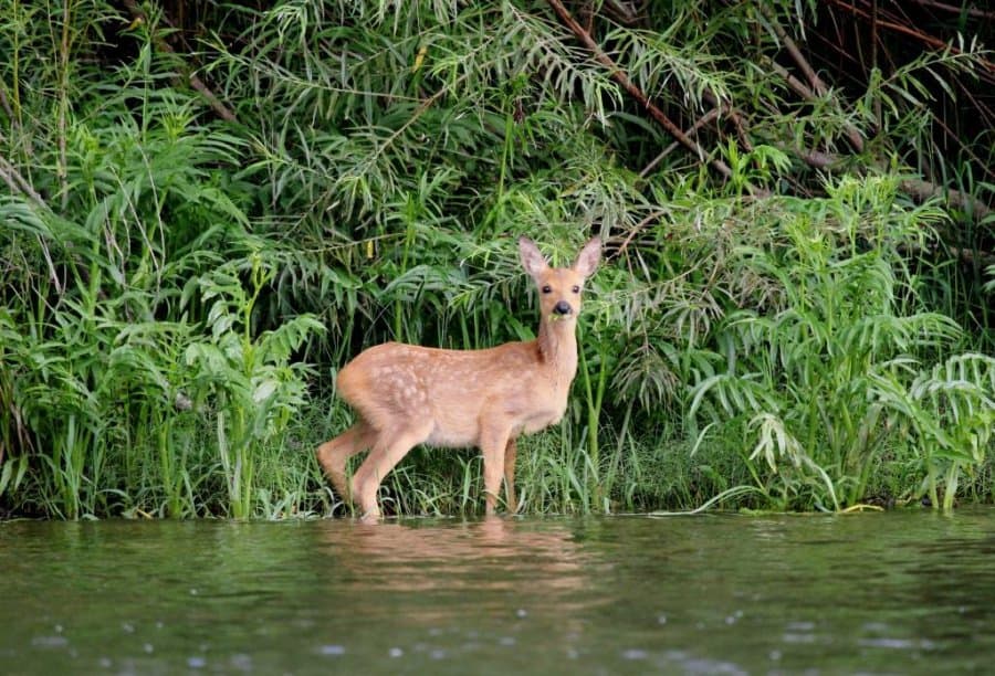
Here, in the impassable and mysterious taiga, one can easily feel oneself a true discoverer, walk a forest or a mountain route, see the tiger's footprints and Manchurian elk drinking from the river, catch a silver grayling and wash one’s face with the ice-cold dew easily filling your handful with water.
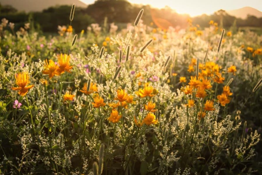
The park has several range boundaries of many species of flora and fauna of the Ussuri taiga. Biodiversity is astounding here, take a good camera to capture mossy loose rocks, bushes and shrubs on mountain peaks, spruce-fir mountain slopes, cedar-broadleaved forests lying at the foothills, cedar trees, and swamps and meadows of river floodplains. The colour patchwork is the feast for the eye.
There are 30 rare vascular plants in need of protection as well as 12 species of lichens which are listed in the Red Book. There are about 70 nesting bird species including 9 rare and endangered species. Protected mammal species feature the Amur tiger, the Himalayan bear, and the red wolf. The park has 28 species of insects listed in the Red Book of Russia as well.
The Kovalevskaya Yew Grove is a real gem of the park. It is located on a beautiful, sunny cape separating two tributaries of the Kovalevsky Spring. Here grows a common yew of berry, a very rare species of coniferous plant despite the name ‘common’. According to careful estimates, the oldest living tree here is about 2000 years old! Tourists call it the wish tree. It is believed that if you make a wish and try to hug the trunk of this giant, you wish will certainly come true. If you visit the grove in September, you can enjoy the scarlet-red yew berries. But in any case, whenever you come, sitting under the branches and breathing this pure air, you will touch the past, become cleaner and wiser.
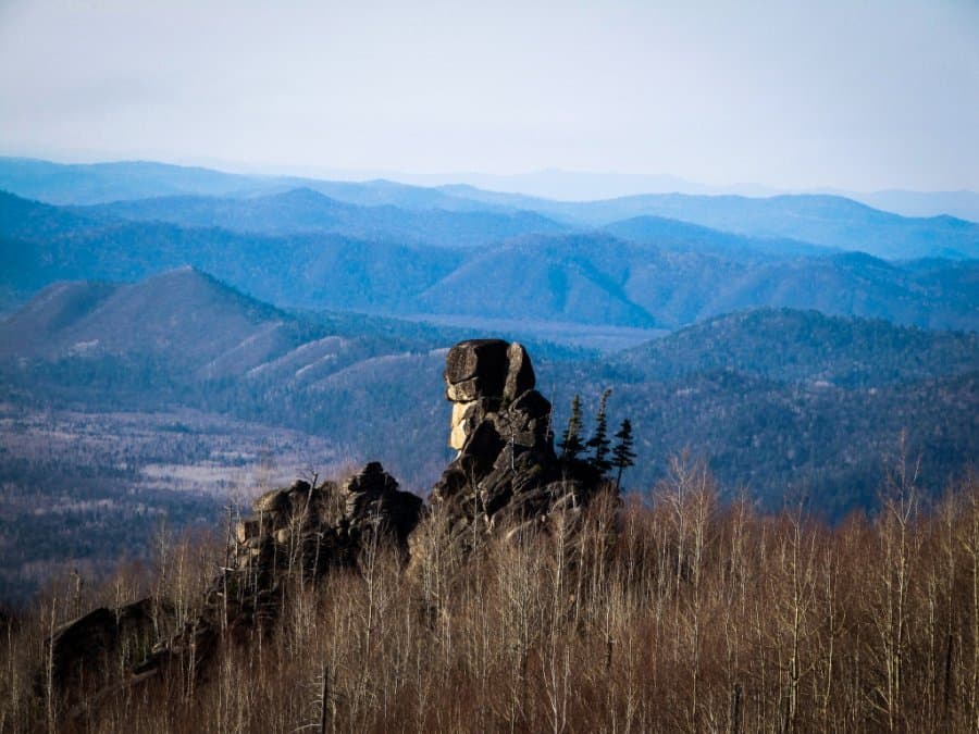
Samadi Bya (Shaman's Stay) is of the most attractive and inaccessible places for tourists; it is located on the slope of Mount Zamanikha (aka Devil’s Club). The trail runs along the floodplain and the terrace of the Thunder Spring. Here you can see the baths of wild boars, footprints of Manchurian elks, roes, and bears. The place itself is located closer to the head of the spring and is basically a group of stone idols. The height of the rocks is from 20 to 110 m, each of them has a fantastic shape. It was believed that the area around used to be inhabited by good spirits, and a shaman who can climb to the top of the rock will get enormous powers.
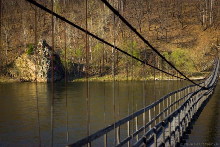
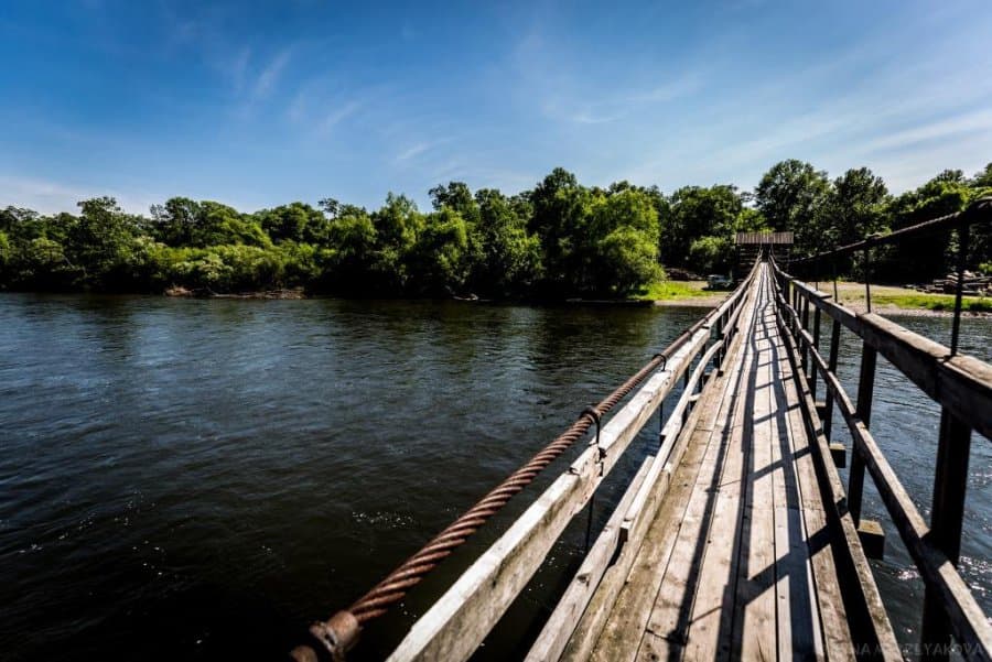
Rock outcrops called Bokho are revered by the Udege. They are on the Big Ussurka River close to the suspension bridge at the entrance to the park. The site was used for religious rituals and ceremonies. According to the legend, there had been no rocks in this place before one family came to settle here. Parents were very fond of their only son. One day, the son went fishing and got drowned. When they found out, the parents were petrified by grief and turned into rocks. The Udege call these rocks "Old Man" and "Old Woman". In spring, the Daursky rhododendron blooms on them.
Gugya Rock is a 40-meter tall canine-shaped rocky pillar in the middle reaches of the Ostrovnaya River. It is another place of ritual rites. Modern Udege of Ostrovnoe village believe that this sacred rock used to be a Chinese shaman. Once upon a time, he came from China. He had a long narrow beard, a long hanging moustache and a Chinese smoking pipe. The shaman passed the taiga and sat down in a cave to rest. The Udege brought him food, but he didn't eat it, just smoked a pipe. After a while, this shaman said: "This is my place," and he turned into stone. After that petrification, the Udege went to this rock for a long time, brought it food, prayed and asked for happy living.
Ostrovnoe village (Sanchikheza) is a Udege settlement. In the recent past, this area was a place of traditional residence and trade of a small indigenous people – the Imanian Udege.
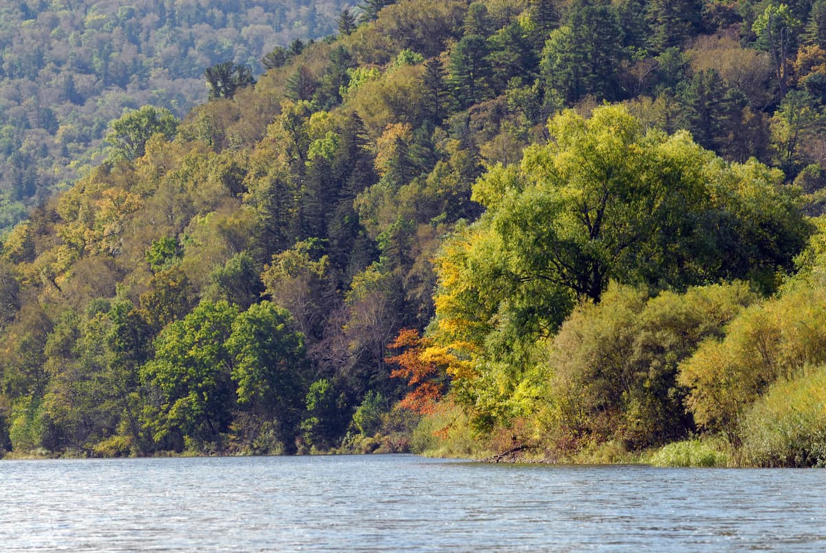
The Suspension Bridge ushers tourists into the realm of morning milky white mists that smell a bit of the fresh river water and a little of pine nuts. It is a gateway to the land filled with riddles and leisurely taiga wisdom. And when the morning magic fades away, you can fully behold the man-made creation hanging like a giant necklace between the banks of the Big Ussurka River.
The Dubravushka Falls is 50 meters away from the suspension bridge over the Big Ussurka River. It is more than 100 meters long and is a cute landmark itself, visitors often take cool pictures near it. Crystal clear water is falling into a stone bowl. Here you can quench your thirst and replenish the water supplies. Climbing up the slope, you can get into an amazing oak grove, as well as walk on the rocks to admire the view of the suspension bridge and the river.
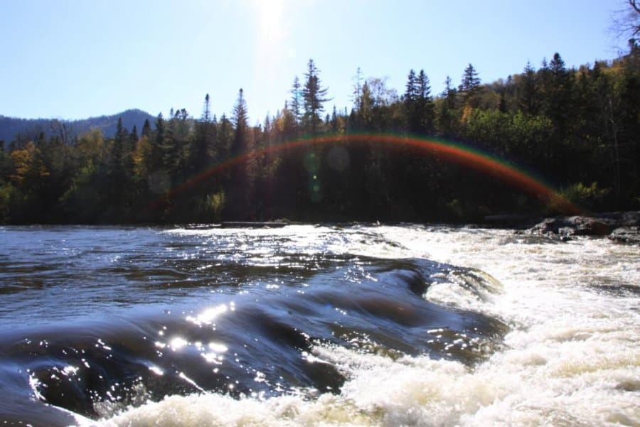
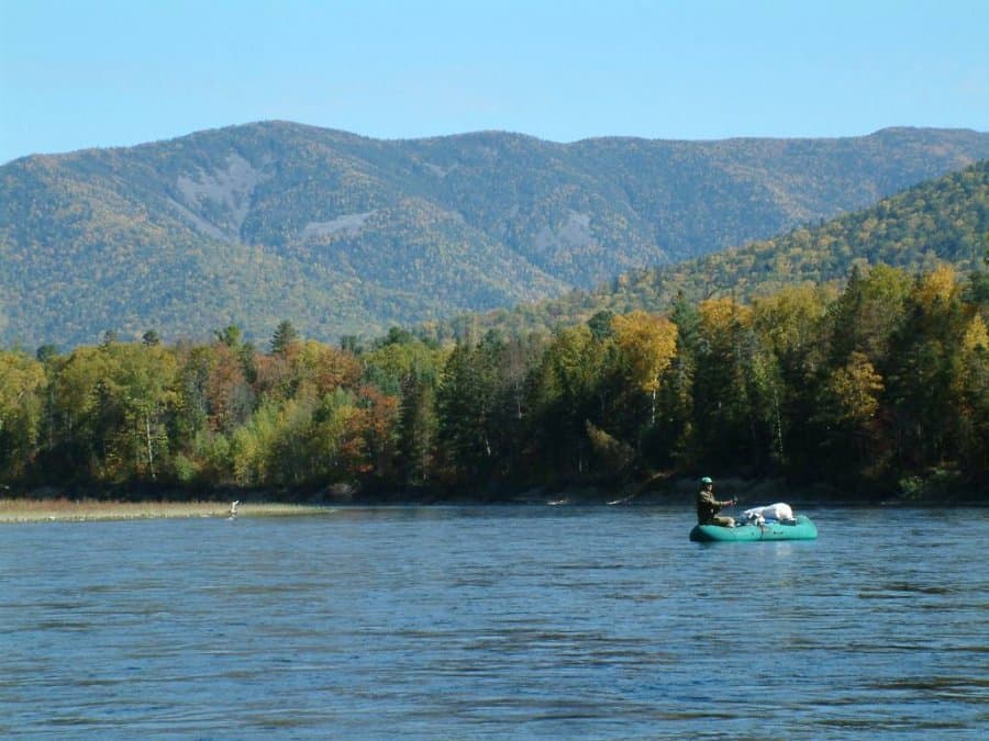
The Armu River routes are quite old ones, as compared to the rest of the park. As far back as the 1930s, hiking fans were offered a pedestrian-water route along the Far East, among which was the so-called Arminsky Route. The abundance of fish and the absence of complicated water obstacles with all the charms of high-speed rafting on the mountain river annually attracts hundreds of tourists. Something mysterious and fascinating can be heard in the name of this mountain river. It is as if you are touching the mysteries of the Ussuri taiga, hear the rustle of rambling cedars, the noise of river rolling over its rapids and the roar of the taiga lord – the tiger.
The Three Sisters are three rocky islands in the Armu River bed. The place is famous for its excellent fishing.
The Village of Dersu (Laulu) is a settlement of Old Believers. Amazing people live here, they have been preaching their faith for many years, they preserved the way of life and traditions of their ancestors.
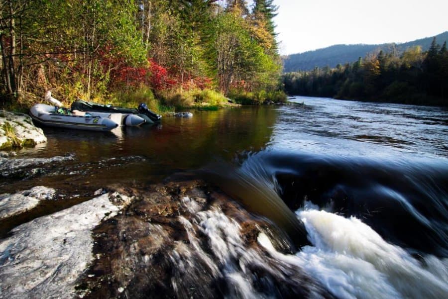
Ust-Armu Camping is located near the confluence of the Armu River into the Big Ussurka. Tourist routes in the territory of the national park start from here.
The Bokhai period settlement is an archaeological monument on the bank of the Big Ussurka. The exposition of dwellings and household items of ancient man will be interesting not only for specialists but also for all those who are keen on the history of the Far East.
The Orochon God is a rock sticking out directly from the transparent waters of a mountain river. One of the mysteries of the Orochon God is that it is constantly changing its shape. Sometimes it resembles a head with characteristic Asian features, sometimes it looks into the sky like a nomad, then suddenly it looks like a bear or a dog. Each time it appears to you in a new image. "No one should know the true face of our God," say the Udege. The Udege go to this rock to pray for protection and recuperation from illnesses.
The Zabytoye aka the Forgotten Place is at the southern border of the park in the area of the Zabytoye mine. On the hillside, you can see topazes and aquamarines, clusters of quartz and morion (dark smoky quartz).
The park has Ust-Armu, Shevkinskaya and Tennikovskaya camping sites.
A weekend route lasts 1-2 days. It is meant for several days with accommodation in tourist camps on the Korean hill. It offers fascinating rafting on the Armu and Big Ussurka. You can visit the main attractions of the park, i.e. the Laulinsky Clamp, Kovalevskaya Yew Grove and the Orochon God, the Udegey Rock that sticks out directly from the mountain river. During the rafting, you can enjoy some fishing, make stops for rest, photo and video shoots. The water is crystal clear, the scenery is amazing, and the forest sauna at the tourist camp will wash away all the fatigue of the long day hike.
Clean Waters of the Iman Route lasts 2-3 days and is designed for adults and children older than 12. The beginning of the route is the village Roshchino, take a road to the Lovlyagin Spring. Here the water part of the trip on inflatable boats or rafts will start. The main landmarks along this route are the loose rock fields in the area of the Rattle Spring (Gremuchiy), Dark Lakes, the Zabytoye. It is of utmost importance to stick to safety rules when rafting on this route. The life jackets and the ability to swim are mandatory. Still, a boat ride is pretty unhurried, with occasional moorings to the shore and amateur fishing. The journey ends at the suspension bridge.
Kovalevskaya Yew Grove Trail winds in a yew grove which is a perfect place to enjoy a coniferous forest, make a wish and taste some yew berries. The total length of the route is 1.5 km, duration - 2.5-3 hours.
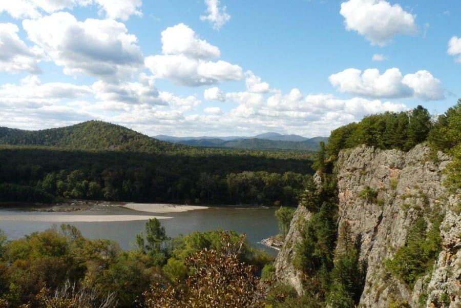
The Laulinsky Clamp is located on the right bank of the Big Ussurka River and is an eighty-meter rocky terrace that breaks off into the river. This cliff is a granite rock rising above the river and is one of the most visited places. There are archaeological excavations of a paramilitary settlement dating back to the Neolithic period of the Early Iron Age. The viewing platforms at the highest points offer stunning views of the river valley and the lilac hills. The total length of the hiking route is about 1 km. The duration is 1.5-2 hours.
Visit the official site of the park to pay for the visit and obtain the permit.
The address of the park Primorsky Krai, Krasnoarmeysky district, Roshchino village, Leninskaya str., 50. Tel.: 7 423 592 3898. udlegenda@mail.ru, b.i.litvinov@mail.ru
The nearest airport is in Vladivostok (650 km) and Khabarovsk (550 km), the кailway station is 150 km away in Dalnerechensk.
The federal roads on the way to the park are in good condition, so most tourists use a private car to get to the national park the Udege Legend.