
Scan the QR code and open PeakVisor on your phone
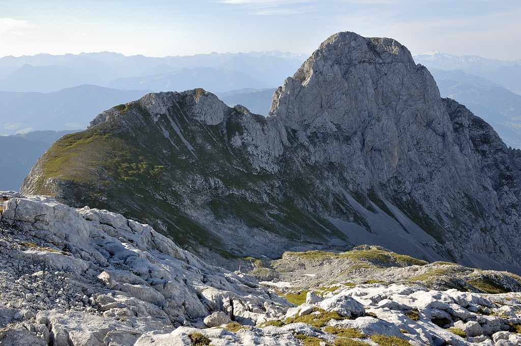
Established in 1982, the Tennengebirge Nature Reserve protects around 85 sq km (32 sq mi) of the Tennengebirge in the Northern Limestone Alps in Salzburg, Austria. This compact, karst mountain range affords near-endless adventure opportunities for hikers, climbers, and skiers. There are 63 named mountains in the Tennengebirge Nature Reserve. The highest and the most prominent mountain is Raucheck (2,430 m / 7,972 ft).
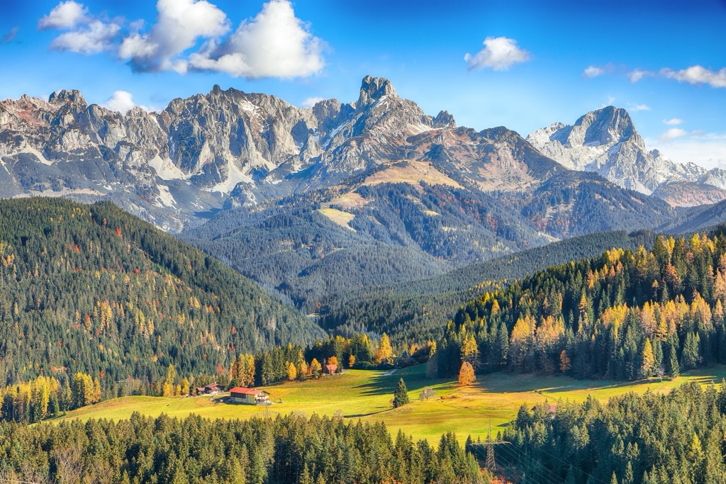
The Tennengebirge is a 280 sq km (108 sq mi) mountain range split between Salzburg’s St. Johann im Pongau and Hallein districts. Sheer mountainous sides flank the 45 sq km (17 sq mi) Tennen Plateau and fall into surrounding valleys.
The range extends for around 18 km (11 mi) from the Lammertal in the east to the Salzach River in the west and for 17 km (10.5 mi) from Pass Lueg (552 m / 1,814 ft) in the north to the Salzburg Slate Alps in the south. To the east of the Tennengebirge are the Dachstein Mountains, and to the west are the Berchtesgaden Alps.
The Tennengebirge Nature Reserve covers the entire Tennen Plateau from Raucheck to the east and Bleikogel (2,411 m / 7,910 ft) to the west, including 37 sq km (14.2 sq mi) of the Tennen Plateau above 2,000 m (6,561 ft) in elevation. The reserve doesn't include some of the Tennengebirge's most popular summits in the south and east, like the Frommerkogel (1 883 m / 6,178 ft) and the Fritzerkogel (2,360 m / 7,740 ft).
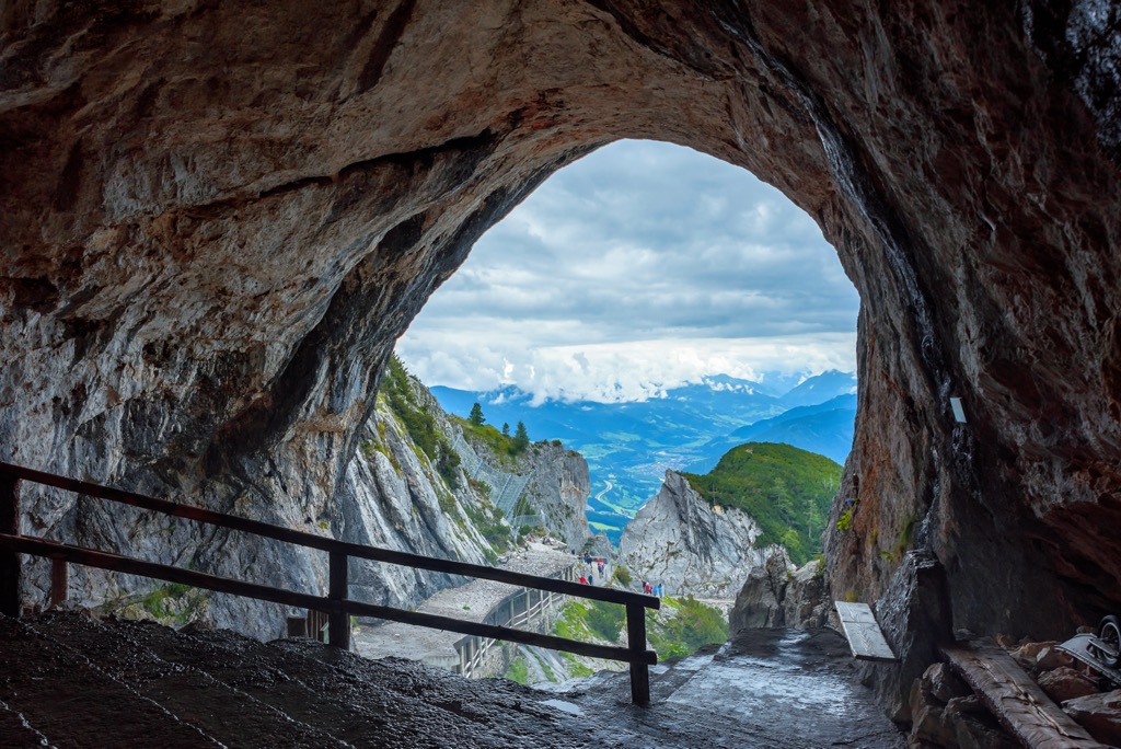
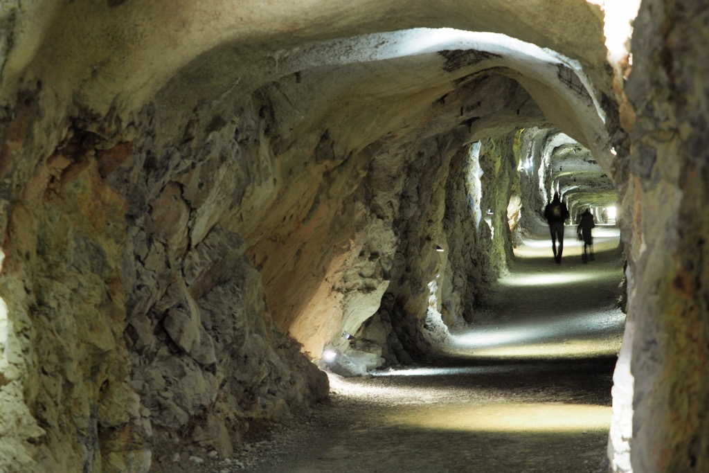
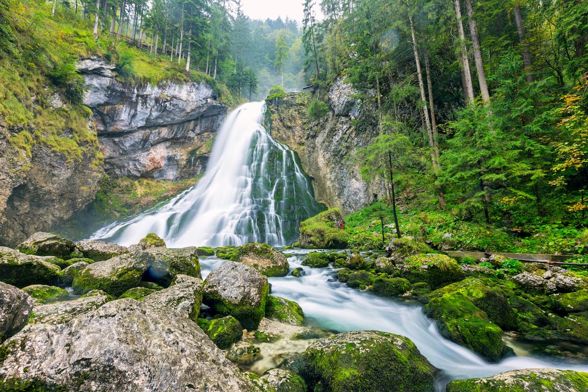
Countless complex cave systems lay below the Tennengebirge's rugged karst landscape. The most famous of these caves is Eisriesenwelt near Werfen. Eisriesenwelt is a limestone cave that's over 42 km (26 mi) long and can be visited from May through October, attracting over 150,000 visitors annually.
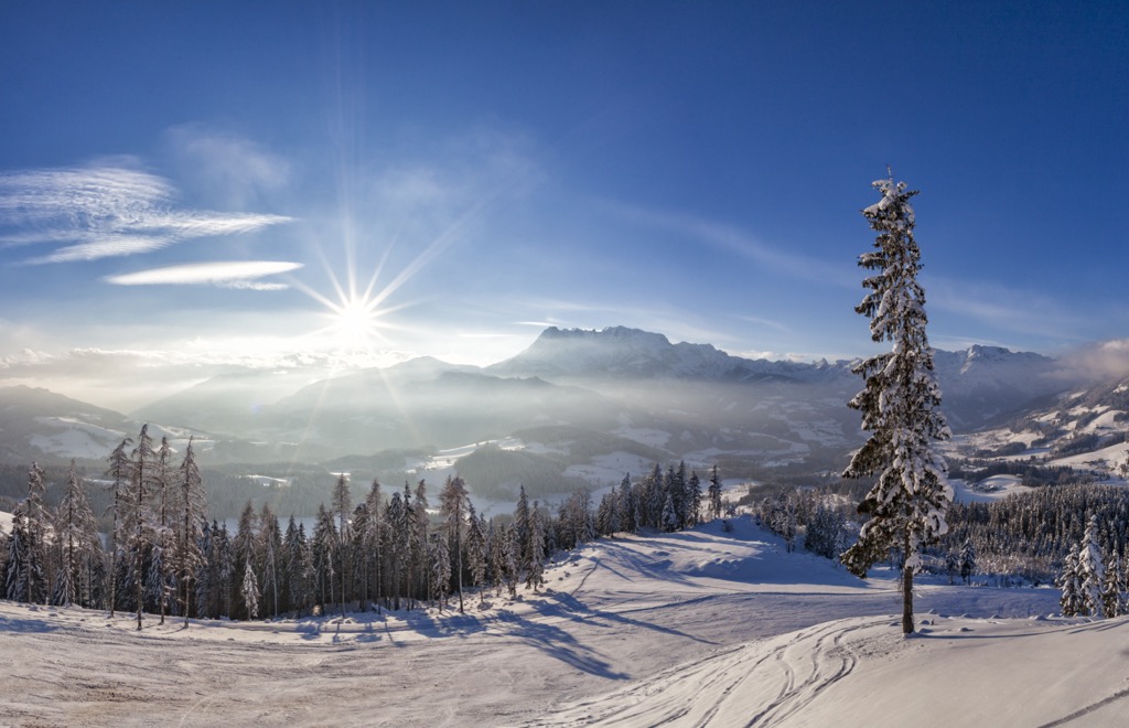
Water drains almost immediately from the Tennengebirge due to its karst features. As a result, large areas of the Tennen Mountains are barren during the summer, with exposed rocky slopes scattered with sparse coniferous woodlands and grasslands. The Tennengebirge receives heavy snowfall in winter and is excellent for skiing.
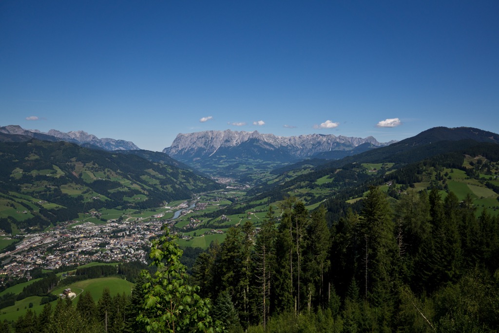
While a few ski resorts snake around its fringes, the Tennengebirge is generally untouched by tourism. There are no settlements within the range's interior. Settlements around the edge of the Tennengebirge include Kuchl, Golling an der Salzach, Bischofshofen, Werfen, and St. Martin am Tennengebirge. Salzburg, Austria's fourth-largest city, is 40 km (25 mi) north of the Tennengebirge Nature Reserve.
The Tennengebirge consists primarily of Dachstein limestone, which sits atop a bed of Ramsau dolomite. This Dachstein limestone formed over 200 million years ago during the Late Triassic period.
During the Late Triassic, the Tennengebirge lay on the edge of a large shallow bay. Sediment from sea creatures, algae, and coral compressed onto the seafloor formed into Dachstein limestone. As a result, Dachstein limestone is rich with preserved fossils, including numerous invertebrate and reptile species.
The Tennengebirge were moved into their current position by a mountain-building event called the Alpine Orogeny. This event commenced over 60 million years ago when the African, Arabian, and Indian tectonic plates to the south collided with the Eurasian Plate to the north.
Convergent movements between these plates folded the Alps into their current shape. The last glacial period heavily eroded the Northern Limestone Alps, carving out jagged summits and sweeping valleys.
Dachstein limestone is especially karstic and home to thousands of caves across its formation. Within the Tennengebirge, geologists have identified over 700 caves, with more discovered every year.
Established to protect its unique landscape and unspoiled nature, the Tennengebirge Nature Reserve is home to some nationally significant plant and animal populations.
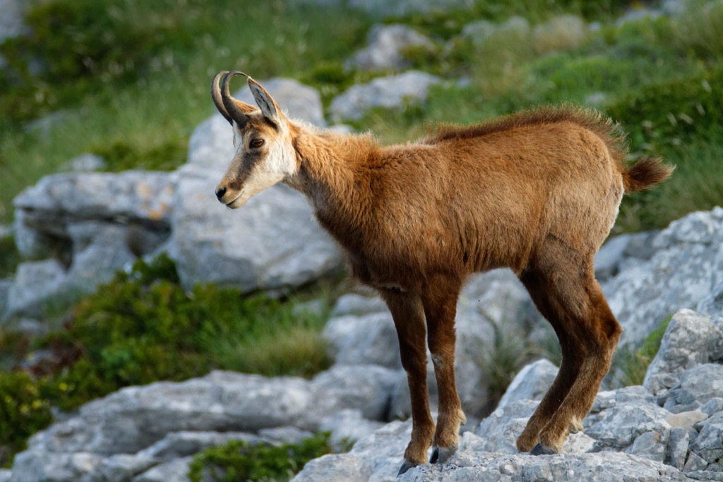
Some of the "Big Five" alpine animal species can be spotted within the Tennengebirge. Chamois rear their young on seemingly insurmountable slopes while the whistle of marmots echoes through alpine pastureland.
Other common mammals in the Tennengebirge include mountain hares, red foxes, red deer, wild boar, and red squirrels. Several bat species inhabit the Tennengebirge's caves, including Alpine long-eared bats and common pipistrelles.
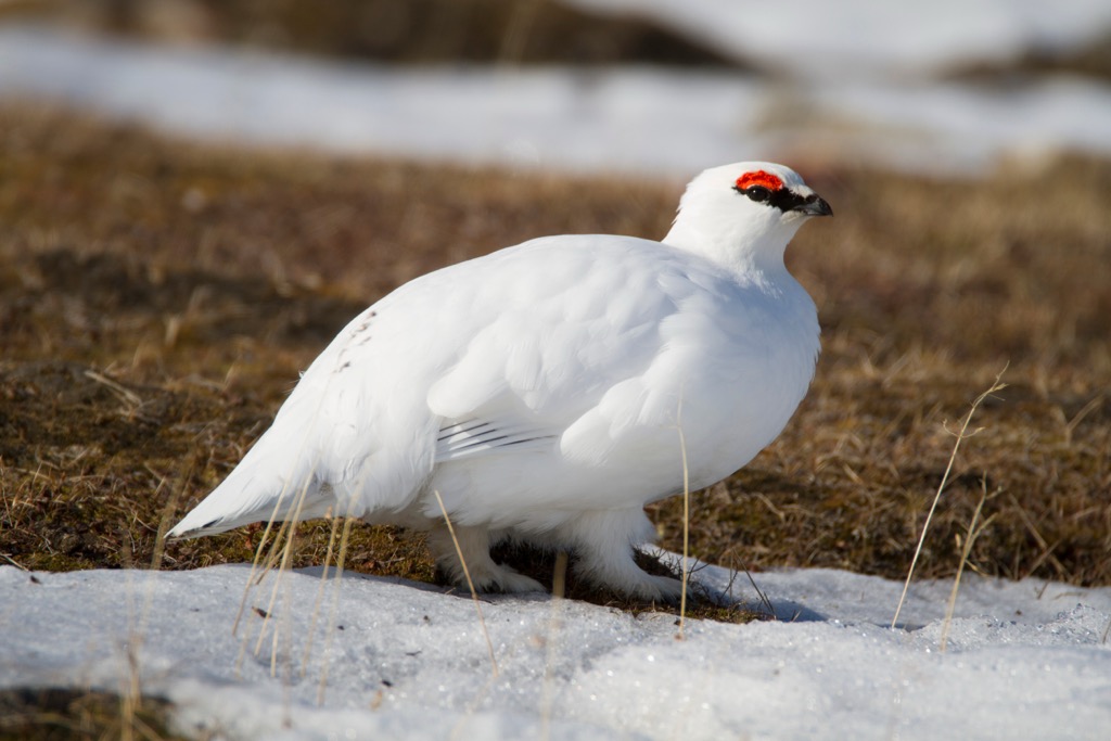
A wide variety of bird species nest and breed within the Tennengebirge, like Alpine choughs, the highest nesting bird globally, nesting at elevations of up to 6,500 m (21,300 ft). Other notable bird species spotted in the Tennengebirge Nature Reserve include golden eagles, peregrine falcons, rock ptarmigans, and alpine accentors.
Adders, also known as common European vipers, are the only venomous snakes in Salzburg — they can usually be found hiding in bushes and under rocks at elevations up to 3,000 m (9,800 ft). Their bite is medically significant but rarely life-threatening.
One of the rarest animals inhabiting the Tennengebirge is Koenenia austriaca, an ancient species of cave-dwelling microwhip scorpion.
The Tennengebirge's primary environments are grasslands, wetlands, and coniferous forests. Its forests primarily comprise spruces, firs, beeches, and mountain pines.
The Lammertal Virgin Forest on the Tennengebirge's eastern fringes is famous for being home to Austria's tallest tree, the Lammertal Watchmen, a 48 m (157 ft) tall pine thought to be over 300 years old.

Flowering plants commonly seen within the Tennengebirge Nature Reserve include skullcaps, common spotted orchids, bellflowers, twayblade saxifrage, gentians, spring snowflakes, Turk's cap lilies, alpine snowbells, and alpine roses.
The Tennengebirge, along with the rest of the Alps, became increasingly popular for recreational hiking around the turn of the 20th century. At this time, the old German and Austrian Alpine Club (DuÖAV) built infrastructure high in the mountains, making ranges like the Tennengebirge more accessible to casual hikers.
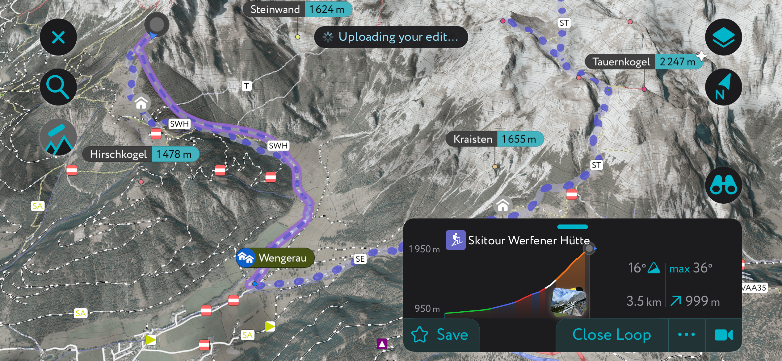
The Söldenhütte (1,531 m / 5,023 ft), formerly called the Dr.-Heinrich-Hackel-Hütte, was bought as a ruin by the DuÖAV and reopened in 1913. The hut has afforded hikers easy access to popular mountains like Tauernkogel (2,247 m / 7,372 ft) and Eiskogel (2,321 m / 7,615 ft).
Between 1925 and 1926, the DuÖAV constructed the Laufener Hütte (1,726 m / 5,663 ft), one of the main mountain huts in the Tennengebirge, providing access to peaks in the east of the range, like Bleikogel, Fritzerkogel (2,360 m / 7,740 ft), and Hochkarfelderkopf (2,219 m / 7,280 ft).
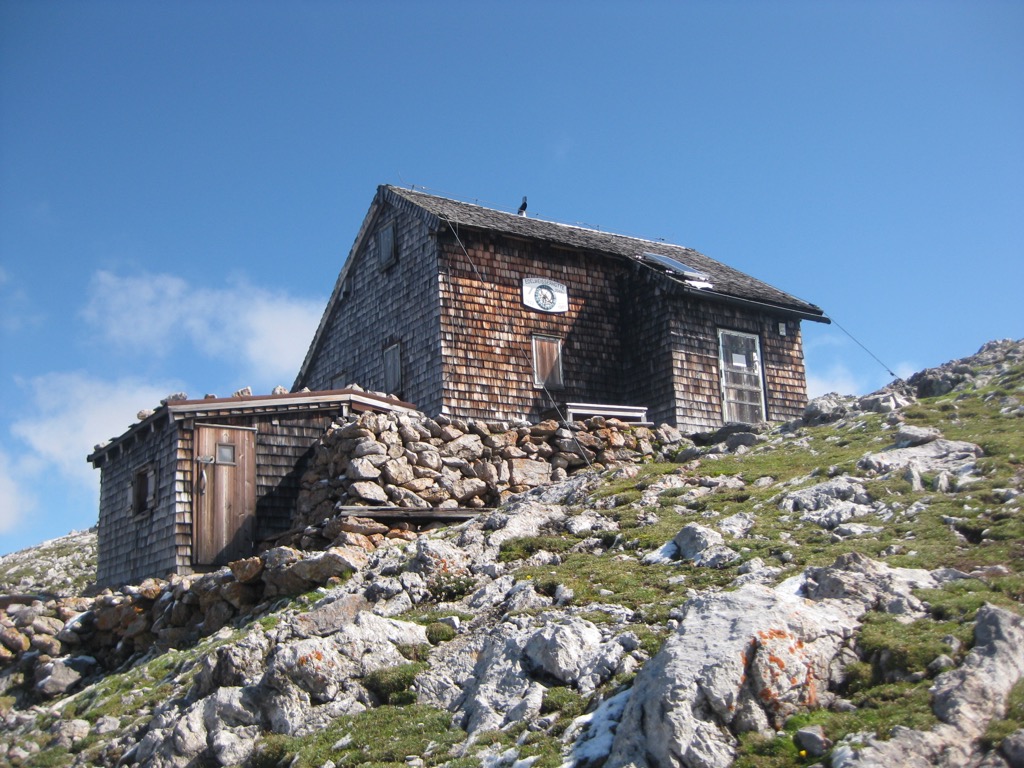
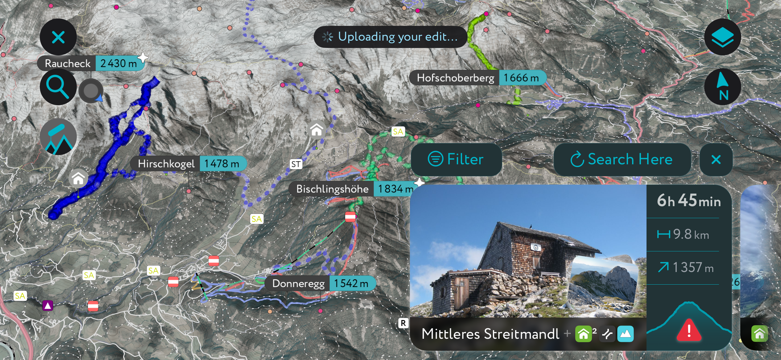
The small Edelweißerhütte (2,349 m / 7,707 ft) is the highest hut in the Tennengebirge and was built by the Edelweiss family in 1921. It was an impressive accomplishment at the time, as there was no road to the hut's location just below the summit of Mittleres Streitmandl (2,360 m / 7,743 ft). Construction involved the family carrying wooden beams up 1,200 m (3,937 ft) from Mahdegg. The second-highest hut in the Tennengebirge is Werfener Hütte (1,969 m / 6,460 ft), which is significantly larger, with over 40 beds.
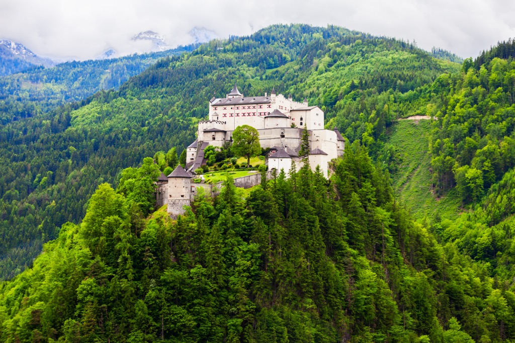
One of the Tennengebirge's most famous landmarks is Hohenwerfen Castle (Festung Hohenwerfen), an 11th-century medieval castle overlooking the town of Werfen. It's the main setting of the 1968 film Where Eagles Dare and features briefly in The Sound of Music. The castle once belonged to the House of Habsburg.
The State of Salzburg established the Tennengebirge Nature Reserve in 1982 to protect the range's karst landscape and diverse fauna and flora.
Many mountains in the Tennengebirge are relatively easy to summit, and no rock climbing is necessary. Most trails in the Tennengebirge Nature Reserve are well-marked. That said, the range does pose some dangers. There’s a lack of freshwater and rivers in the range, and sudden fog and mist can cause hikers to get lost.
A head for heights and sure footing is needed when hiking in the Tennengebirge Nature Reserve. Map out your route carefully, bring plenty of water, and inform others of your itinerary.
Learn about and explore the finest hiking trails in the Austrian Alps and beyond with the PeakVisor App.
We've gathered information on publicly maintained walking paths and ski resorts worldwide, creating 3D maps to help you plan the perfect outing. Additionally, we’ve compiled details on ski tours, in case you want to venture off the beaten path.
PeakVisor started simply as a summit identification tool but has evolved into so much more — it's now one of the market's top portable 3D hiking map apps. Track your hikes, post pictures, and map out your favorite routes for others to attempt.
We've recently added several helpful features to the PeakVisor App, like local weather reports, including snow depths. Plus, you'll find details on thousands of mountain huts, with information on overnight accommodation, opening hours, and dining options. You can even use our Hiking Map on your desktop to make .gpx files for routes to follow on the app.
Raucheck (2,430 m / 7,972 ft) is the highest summit in the Tennengebirge. It's one of the range's most westerly summits, located less than 5 km (3 mi) northeast of Werfen. The nearest hut is Edelweißerhütte, less than 1.5 km (1 mi) to the east.
Raucheck is a relatively straightforward hike, with no climbing needed. However, it's pretty physically demanding. There are several routes to Raucheck, starting from the Dr. Oedl Haus (1,574 m / 5,167 ft) or the Wengerau. The classic and quickest route to Raucheck begins just south of Mahdegg-Alm (1,209 m / 3,967 ft).
This hike from Mahdegg to Raucheck is short but steep. After parking at the Unterholzbauern, the trail leads past Mahdegg-Alm and between Hochthron (2 363m/7 753ft) and Kleines Fieberhorn (2,152 m / 7,060 ft) to reach the Griesscharte (2,270 m / 7,448 ft) saddle. You can take a short detour to the Werfener Hütte before reaching the Griesscharte if you want to spend a night in the mountains.
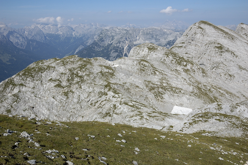
The route continues north, passing near the summit of Vorderes Streitmandl (2,354 m / 7,723 ft) and continuing west along the plateau's edge, skirting the north flank of the Hiefler (2,378 m / 7,802 ft) to reach Raucheck from the north. Raucheck's summit views are spectacular and dizzying, with 1,000 m (3,280 ft) high rock faces plummeting into the Salzach Valley on the mountain's south side.
Descend the way you came. This hike from Mahdegg-Alm to Raucheck is approximately a 10.5 km (6.6 mi) round-trip.
Eiskogel (2,321 m / 7,615 ft) is one of the most famous summits in the Tennengebirge Nature Reserve. It's a double-peaked mountain located on the Tennen Plateau's southern edge, around 2 km (1.2 mi) northeast of the Söldenhütte (Dr.-Heinrich-Hackel-Hütte) (1,531 m / 5,023 ft) in Werfenweng.
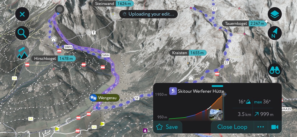
Like Raucheck, Eiskogel has steep southern sides with 1,000 m (3,280 ft) high sheer rock faces, while its northern and eastern flanks gently ascend from the plateau. The normal route to Eiskogel starts from the Wengerau. This walk is strenuous, and a head for heights is needed. Eiskogel's normal route is also a very popular winter ski tour.
From the Wengerau Parkplatz, head right across an alpine pasture and into the forest. Take the left-hand path past Söldenhütte (Dr.-Heinrich-Hackel-Hütte), and continue along the trail past Tauernkogel (2,247 m / 7,372 ft) via the Tauernscharte (2,103 m / 6,900 ft). Here, you'll find the Stieglloch, a UIAA I-rated exposed, secured passage that leads to Eiskogel's summit.
Descend the way you came. This Eiskogel hike is approximately a 12 km (7.5 mi) round-trip.
The Tiroler Kogel (2,322 m / 7,618 ft) is a mountain on the western edge of the Tennen Plateau on the border between the Hallein and Pongau districts. The nearest mountain hut to the Tiroler Kogel is the Leopold-Happisch-Haus (1925 m / 6,316 ft), roughly 1 km (0.6 mi) east of the summit.
The Tiroler Kogel is a striking mountain with 1,800 m (5,905 ft) high scree flanks overlooking the Salzach Valley. The summit views are impressive, too, with panoramas of the Hochkönig and the Hagengebirge groups in the Berchtesgaden Alps.
Despite its beauty, the Tiroler Kogel isn't often climbed — it's hard to reach and one of the most challenging mountains in the Tennengebirge. If you fancy summiting this tricky two-thousander, you can pick up the trail from the Dr. Oedl Haus near Eisriesenwelt.
This trail is the shortest route to Tiroler Kogel. An alternative is the normal route from Stegenwald, which is several kilometers longer and more challenging. From the Dr. Oedl Haus, pass over the Hochkogelsteig and past the Leopold-Happisch-Haus. Then there's a final exposed, secured section that's UIAA grade II to reach the Tiroler Kogel’s summit. Descend the way you came. This hike from Eisriesenwelt to the Tioler Kogel is approximately a 12.5 km (7.8 mi) round-trip.
Hochthron (2,363 m / 7,753 ft), or Werfener Hochthron, is one of the most remarkable mountains in the Tennengebirge. With its fan-like summit flanked by rugged rock faces, it's among the range's most popular rock-climbing destinations. It's the third-highest mountain in the Tennengebirge, located around 500 m (1,640 ft) north of the Werfener Hütte.
Hochthron is demanding yet rewarding — its summit affords commanding views of the entire Pongau district. The normal route up Hochthron involves a UIAA III-graded climb, meaning you should only tackle this mountain if you're an experienced rock climber.
From the Wengerau, follow the trail past Wengerau Alm (987 m / 3,238 ft) and Gamsblickalm (1,019 m / 3,343 ft) before following a steep path to Elmaualm (1,533 m / 5,030 ft) and the Werfener Hütte. After the Werfener Hütte, Hochthron's UIAA III-graded climb begins. We highly recommend you wear a helmet while climbing Hochthron — falling rocks are a real danger!
After reaching the summit, you'll descend via the 20 m (65 ft) Thronleiter ladder back to the Werfener Hütte. This Hochthron hike is approximately a 12 km (7.5 mi) round-trip.
Deep, powdery snow undisturbed by crowds of skiers means the Tennengebirge is excellent for peaceful ski tours. Here's a brief look at a couple of the best ski tours in the Tennengebirge Nature Reserve.
The Tennengebirge's second-highest peak, Bleikogel (2,411 m / 7,910 ft), is not particularly popular with hikers due to its long approach and is more frequently visited by skiers. This isolated summit sits on the eastern boundary of the Tennengebirge Nature Reserve, around 2.5 km (1.5 mi) west of the Laufener Hütte.
Bleikogel is long and challenging — it goes without saying this lonely ski tour isn't suitable for beginners. However, you'll be rewarded once you reach the slopes of Bleikogel with panoramas of the Dachstein Mountains to the east.
You can pick up this Bleikogel ski tour from the Karalm (1,003 m / 3,291 ft) car park in Abtenau. The tour begins by following the summer trail steeply uphill through forests before following the winter trail towards the Laufener Hütte. After the hut, the trail heads for Fritzerkogel (2,360 m / 7,740 ft) before detouring near Tennkessel (1,945 m / 6,381 ft) to Bleikogel.
An alternative, longer route is to circle north around Großer Breitstein (2,161 m / 7,090 ft) and over Langwand (2,256 m / 7,402 ft) to reach Belikogel. This Bleikogel ski tour is between 15 km (9.3 mi) and 18 km (11 mi) long, depending on your route.
A more accessible but still quite demanding ski tour in the Tennengebirge Nature Reserve is from the Wengerau to the Werfener Hütte. The Werfener Hütte is the range's second-highest hut, offering sublime views south of the Salzburg Slate Alps.
From the Wengerau Parkplatz, you'll pass Wengerau Alm and then Gamsblickalm. After the hiking trail ends, keep to the left, away from Hochthron's flanks, which are prone to avalanches after heavy snow. After passing through a forested area to Elmaualm, you'll soon reach the Werfener Hütte. This Werfener Hütte ski tour is roughly an 11 km (6.8 mi) round-trip.
You'll find one major ski resort on the southern edge of the Tennengebirge Nature Reserve: Skigebiet Werfenweng (29 km [18 mi] of slopes / 9 lifts). Two other minor ski resorts, Karkogel – Abtenau (9 km [5.5 mi] of slopes / 5 lifts) and St. Martin (3 km [1.8 mi] of slopes / 2 lifts), are located on the Tennengebirge's eastern boundary away from the reserve.
There's no shortage of peaceful places to stay near the Tennengebirge, with several traditional market towns and alpine villages surrounding the range.
Salzburg is Austria's fourth-largest city, with a population of over 156,000. Situated around 40 km (25 mi) north of the Tennengebirge Nature Reserve, Salzburg is one of the most convenient places to stay nearby. Salzburg Airport is Austria's second-largest international airport, providing regular flights to London, Paris, Madrid, Copenhagen, Dubai, and more.

Salzburg is also well-positioned for exploring other nearby mountain ranges, with the Salzkammergut Mountains just east of the city. The city itself is home to several world-class attractions worth checking out, like Mozart's Birthplace, the 17th-century Salzburg Cathedral, and the 11th-century Fortress Hohensalzburg.
St. Johann im Pongau is a city and the administrative center of St. Johann im Pongau District. It's positioned roughly 20 km (12 mi) south of the Tennengebirge Nature Reserve. It has a population of just under 11,000.
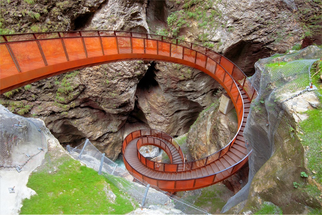
Tucked away in the Salzach Valley, St. Johann im Pongau offers easy access to many popular Salzburg mountain ranges — the Salzburg Slate Alps, the Radstadt Tauern, and the Ankogel Group surround the city. The Liechtensteinklamm, a 4 km (2.5 mi) long narrow gorge with wooden walkways, is located less than 5 km (3 mi) south of St. Johann.
St. Johann im Pongau Train Station connects the city to Salzburg, Vienna, Munich, and Zell am See.
Located less than 5 km (3 mi) southwest of the Werfener Hütte within the Salzach Valley, Werfen is one of the best places to stay if you want to be within touching distance of the Tennengebirge Nature Reserve. The town has a population of just over 3,000 people.
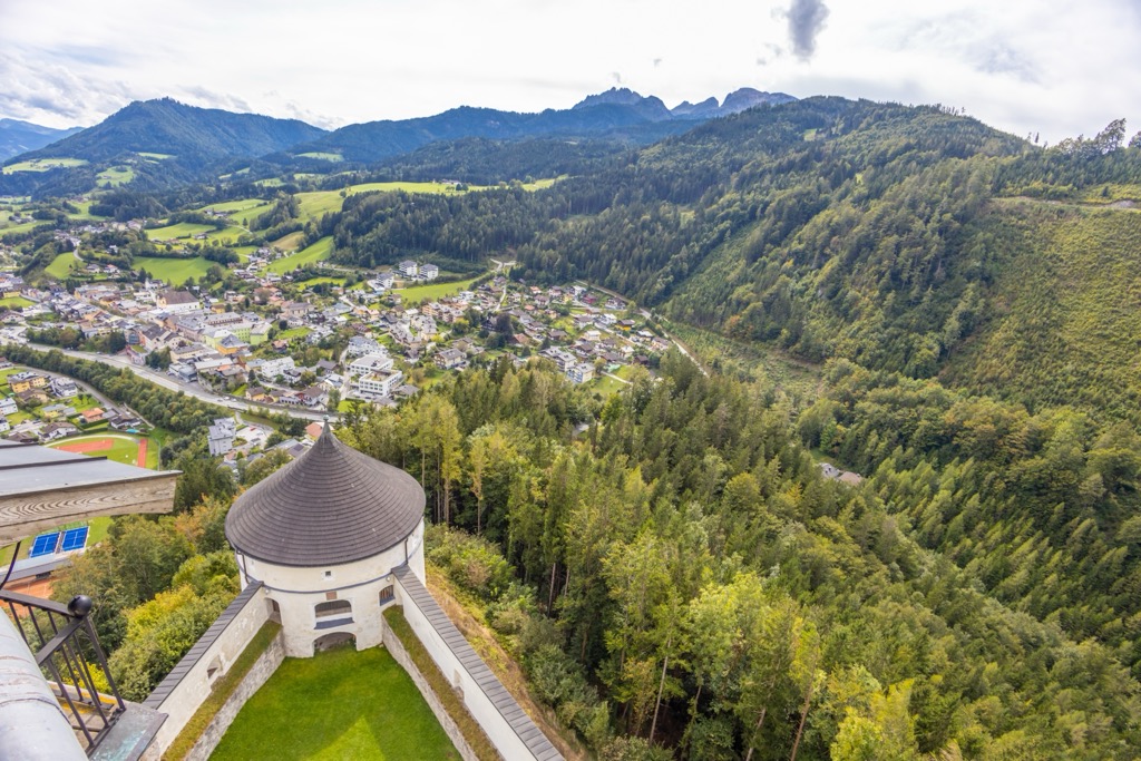
Despite its modest size, Werfen boasts some of the finest attractions in the region, with the Eisriesenwelt ice cave and the iconic Hohenwerfen Castle less than 3 km (1.8 mi) from the town center. The Sound of Music Trail is a leisurely walk worth undertaking in Werfen.
Werfen Train Station is on the Salzburg-Tyrol Railway, connecting to Salzburg, Wörgl, and Bischofshofen.


