Scan the QR code and open PeakVisor on your phone
Tankwa Karoo National Park is in the Northern Cape province of South Africa, forming part of the larger Karoo, a semi-desert region known for its unique landscapes. There are 26 named mountains in Tankwa-Karoo National Park. Kromberg is the highest point at 1,506 meters (4,941 ft). The most prominent mountain is Leeuberg, with 729 meters of prominence (2,392 ft).
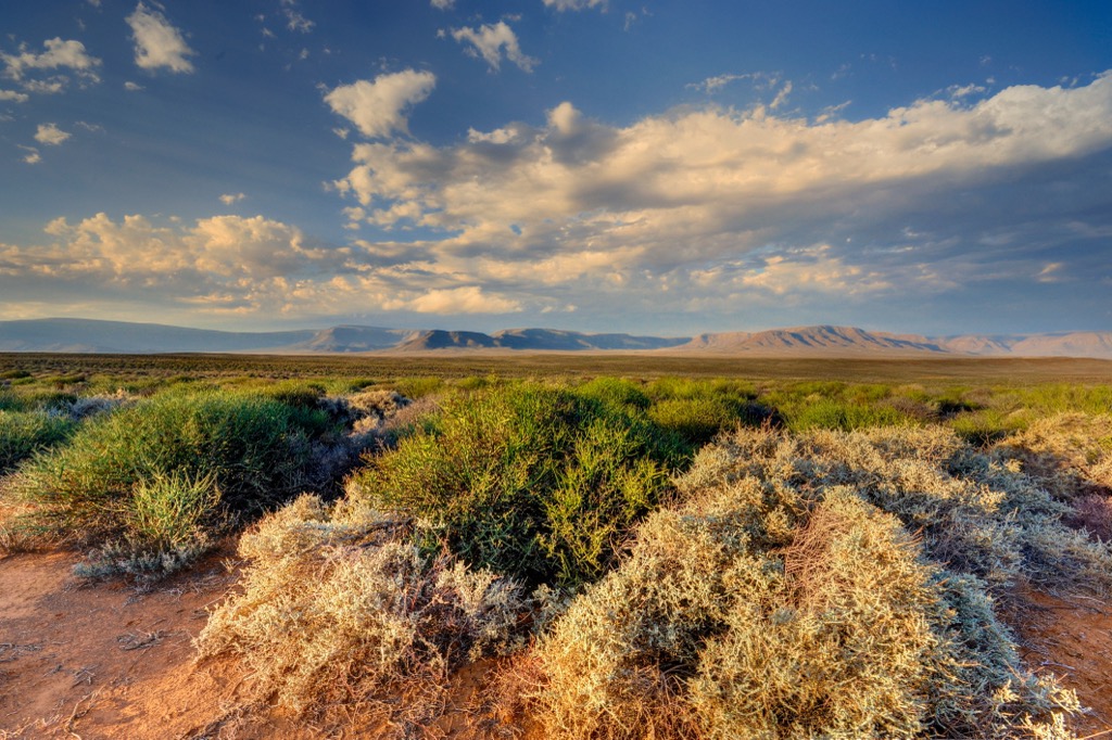
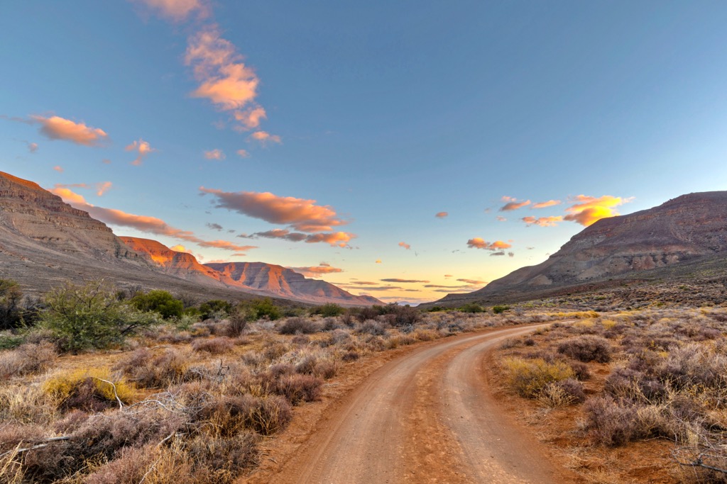
Tankwa Karoo National Park covers an area of about 144,000 ha (355,832 ac) in the Great Karoo region. It’s one of the country's most arid regions, with some areas receiving less than 100 mm (4 in) of average annual rainfall. The park lies about 70 km (43 mi) west of Sutherland, near the border of the Northern and Western Cape provinces.
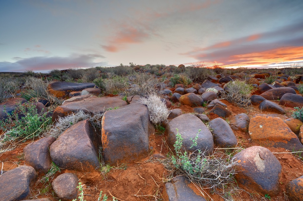
The park is a vital component of the Succulent Karoo biome, renowned globally as a crucial biodiversity hotspot. The park has a diverse terrain, ranging from mountains to desert plains to impressive rock formations.
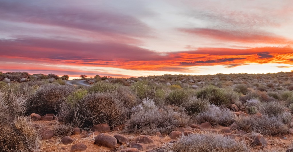
Climate-wise, the park is typically arid, with hot summers of 36°C to 40°C (97°F to 104°F) and cold winters averaging 5°C (41°F). The Tankwa River, although often dry, runs through the park.
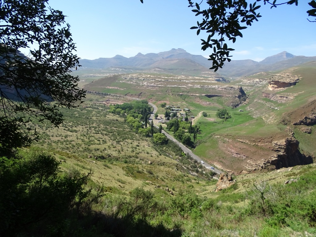
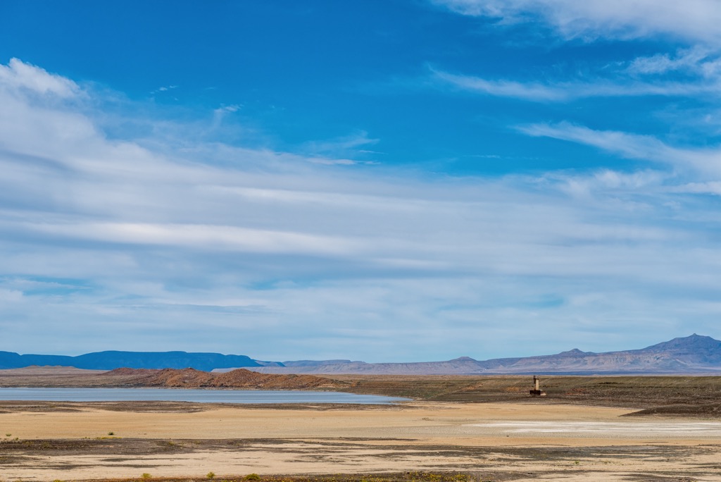
The Roggeveld Mountains bound the park to the east, the Cederberg to the west, the Kouebokkeveld Mountains to the north, and the Tankwa River to the south. The park also contains the Oudebaaskraal Dam, a popular spot for birdwatching and game viewing.
One of the park's standout features is its distinction as a prime destination for stargazing. A dearth of light pollution allows visitors to experience the brilliance of the southern hemisphere's constellations. Sutherland, a nearby town, is renowned for its observatories.
Beyond its natural wonders, the park carries a rich history of human occupation dating back to the Stone Age. The San, or Bush people, left behind artifacts and rock paintings. More recently, the park bears traces of the settler farmers who arrived in the mid-18th century and used the land for sheep farming.
The geology of the Tankwa Karoo National Park’s hills is mainly composed of fine-grained sedimentary rocks, such as sandstone and shale. Sediments were first deposited in the Karoo Basin, once a deep inland sea, about 258 million years ago. Incredibly, the sediments originate from the ancient Andes Mountains, located about 700 km (435 mi) away from the basin at that time. Tectonic plate movement eventually put the Southern Atlantic Ocean between the two regions.
Rivers transported the sediments from the mountains to the basin, forming layers of different thickness and composition. These layers have eroded and exist as distinct sandstone and shale units in the park.
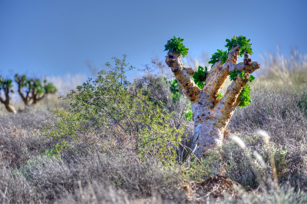
The Tankwa Karoo National Park vegetation is adapted to arid conditions, with species like hardy succulents, shrubs, and grasses. The park is part of the Succulent Karoo Biome, one of the world’s biodiversity hotspots containing many unique succulent plants, including various aloe species and euphorbia.
The park’s wildlife includes more than 30 mammal species, some of which have been reintroduced to their historical range, such as gemsbok, springbok, red hartebeest, and Cape mountain zebra. The park is also home to 188 bird species, such as the black-headed canary, Ludwig’s bustard, and the black-eared sparrow-lark. The park’s best game viewing areas are around the Oudebaaskraal Dam and the Abrahamsknie and Perdekop waterholes.
Tankwa Karoo National Park has a rich human history, dating back to the Stone Age. The area's first inhabitants were the San people, who left behind traces of their culture in the form of stone tools and rock paintings. The San were hunter-gatherers who adapted to the harsh environment of the Karoo, using plants and animals for food, medicine, and shelter.
The Khoi pastoralists later joined the San, who brought cattle and sheep. The Khoi were also skilled at using the natural resources of the Karoo, such as water sources, salt pans, and grasslands. They traded with other groups, such as the Nama, and sometimes clashed over grazing rights and water access. The Khoi also interacted with the European settlers who arrived in the mid-18th century. Initially, they exchanged goods and services but eventually suffered from disease, dispossession, and discrimination.
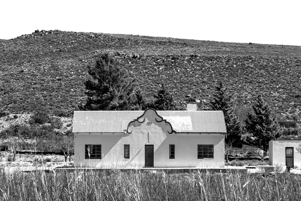
The European settlers were mainly farmers from the South African Cape, looking for new lands to cultivate and graze. They established farms and homesteads in the Karoo and introduced new crops, such as wheat and grapes. They also built roads, dams, windmills, and churches and developed a distinctive culture and identity. The settlers faced many challenges, such as droughts, floods, pests, diseases, and conflicts with the indigenous people and the British authorities. They also contributed to the degradation of the environment through overgrazing, erosion, and deforestation.
Tankwa Karoo National Park was proclaimed in 1986 to conserve the region's unique vegetation and wildlife, as well as the cultural heritage of its people. The park has since been expanded, and the restoration to its natural state continues. The park has reintroduced several animal species that used to inhabit the area, such as gemsbok, springbok, red hartebeest, and Cape mountain zebra.
The Tankwa Camino is a modern-day ‘Great Trek’ that takes participants through one of South Africa’s most remote regions. It is a 256 km (159 mi), 10-day, slack-packing endurance hike that is considered as much a spiritual pilgrimage as a test of physical and mental strength. The terrain is rugged, and the weather can be extreme, ranging from freezing cold to scorching hot.
The route follows South Africa's longest gravel road, the R355, from Calvinia in the Northern Cape and ends in Ceres, a town in the Western Cape province. The terrain varies from plains to hills, valleys, riverbeds, and mountains. Hikers encounter diverse flora and fauna en route, including succulents, wildflowers, springbok, and Cape mountain zebra.
The Leeuberg Trail is an 11 km (7 mi) out-and-back route mainly used for 4x4 driving but can also be hiked. It starts at the Elandsberg Wilderness Camp and follows a dirt road that climbs to the Leeuberg, offering scenic views of the Tankwa Karoo and the surrounding hills of Elandsberg, Gemsbokberg, and Pramberg.
This moderate to hard hiking trail is also suitable for most high-clearance 4x4 vehicles. Hikers traversing the path will encounter different vegetation types, such as acacia trees, grasses, and shrubs, and may also spot some of the park’s mammals.
The Elandsberg Trail is a 7.4 km (4.6 mi) hiking and running trail with an elevation gain of 201 meters (659 ft). The trail starts at the Elandsberg Wilderness Camp, where hikers ascend Elandsberg, which forms part of the Roggeveld escarpment.
Along the way, hikers can enjoy the scenery of the Tankwa Karoo’s semi-desert region, home to a rich diversity of succulent plants and wildlife. From the summit, hikers can view the hills of Leeuberg, Ouberg, and Kromberg.
The Buitekring MTB constitutes a 50 km (31 mi) circular trail primarily designated for mountain biking, although it is also suitable for hiking. It starts and ends at the Oudebaaskraal Dam. The route is graded as hard; on foot, it can take up to three days to complete, passing across diverse landscapes of desert plains, hills, and valleys.
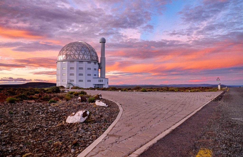
Sutherland is a small town located in the Karoo region of the Northern Cape province, about 350 km (217 mi) north of Cape Town. Its high altitude and remote location contribute to its excellent conditions for astronomical observations.
The Southern African Large Telescope (SALT) houses the largest optical telescope in the southern hemisphere. Visitors can take a guided observatory tour and learn about the various scientific discoveries made there. In addition, visitors can book a night tour and observe the stars and planets through the telescope.
Another astronomical place of interest is the Sutherland Planetarium, a dome-shaped theatre that shows educational and entertaining documentaries about the universe.
About 45 km (28 mi) from Sutherland in Uitkyk, visitors can learn about the history and culture of the Khoisan people at the Khoisan Rock Art Site. This heritage site features ancient rock paintings and engravings of animals, humans, and geometric shapes.
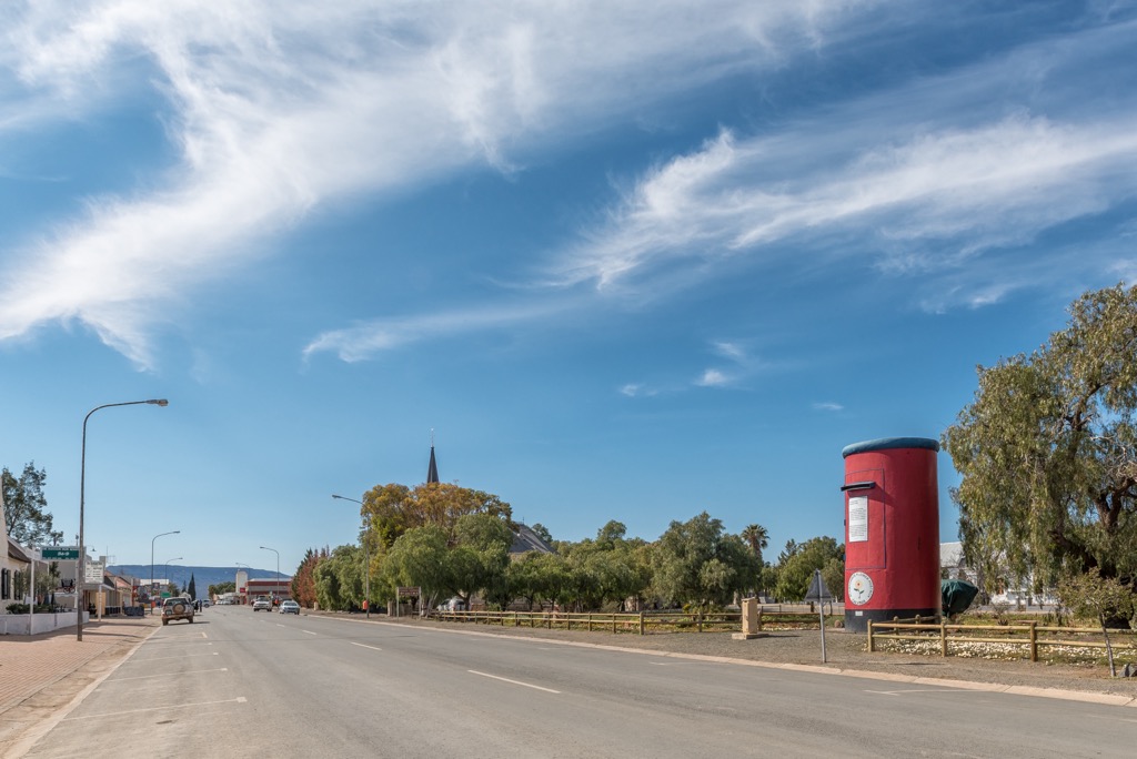
Calvinia is a small town in the Hantam region of the Northern Cape province, located 380 km (236 mi) north of Cape Town. The town is part of the Great Karoo region, known for its arid landscapes, diverse flora and fauna, and rich cultural heritage.
The Akkerendam Nature Reserve is located on the outskirts of Calvinia and offers scenic views of the Hantam mountains and the Karoo plains. Visitors can hike, bike, bird watch, and spot some endemic plants and animals, such as the Hantam tortoise, the Namaqua rock mouse, and the Akkerendam daisy.
The Calvinia post box is one of the most unique attractions in the town. It’s made from an old water tank used to store water for steam locomotives. The post box is painted blue with a sign that says ‘Die Blou Nartjie,’ which means ‘The Blue Orange’ in Afrikaans.
Finally, visitors can admire the unique architecture in Calvinia and surrounding towns, such as the corbelled houses and other sandstone structures. Corbelled houses are dome-shaped buildings made from flat stones stacked without any mortar. They were built by the early settlers of the Karoo as a way of coping with the harsh climate and scarce resources.