
Scan the QR code and open PeakVisor on your phone
South Ural State Nature Reserve has 90 named peaks. The highest is Mount Yamantau at 1,640 m. Other notable peaks include Small Yamantau, Gora Bol’shoy Shelom and Uglovoi Mashak.
The South Urals Nature Reserve covers the major part of the Southern Urals, hence the name. The Reserve is assigned to two administrative districts the Republic of Bashkortostan and Chelyabinsk Region with the 90% of the territory located in Bashkiria (a household name of Bashkortostan). The rest of the Reserve is located in Katav-Ivanovsky District of Chelyabinsk Region. The total area is 252.8 thousand hectares. It is the largest nature reserve of the Southern Urals.
According to the official website information, it was founded in 1978 and intended to preserve mountain spruce-fir forests, plant communities, and wildlife of the area. Previously, there were operating factories on its territory, and the forest farms which were ferociously cutting down the forests, therefore when deforestation had grown to an alarming extent, the authorities made a decision to save what was left of the natural landscape, flora and fauna of the area.
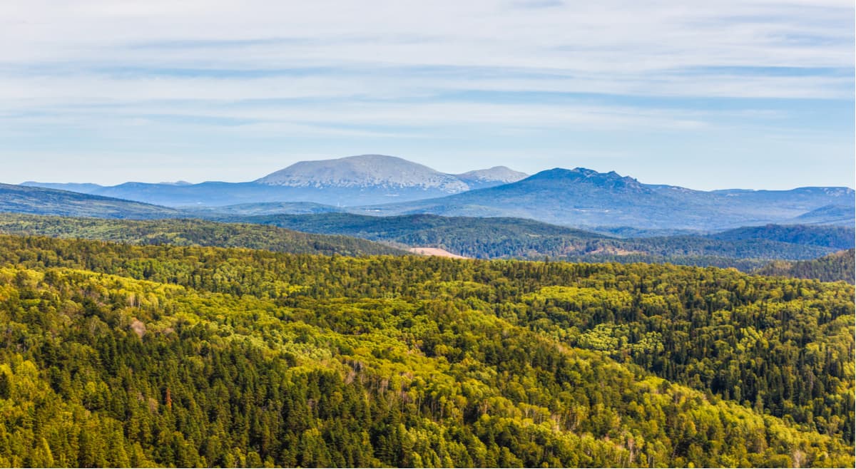
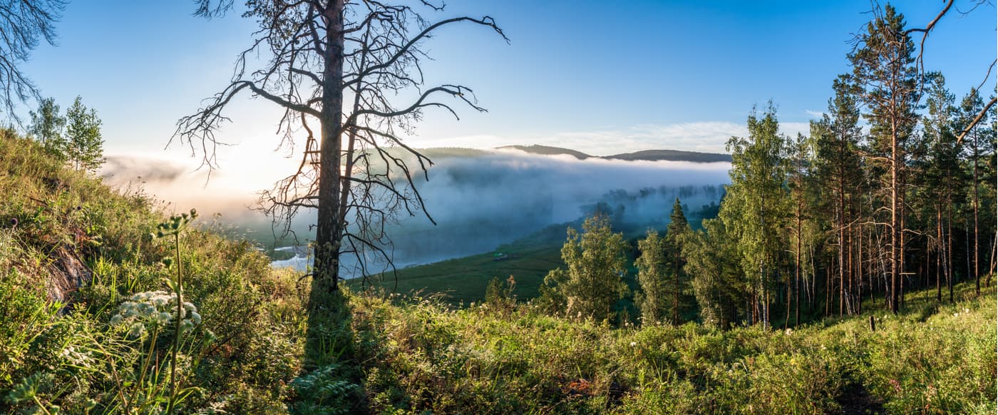
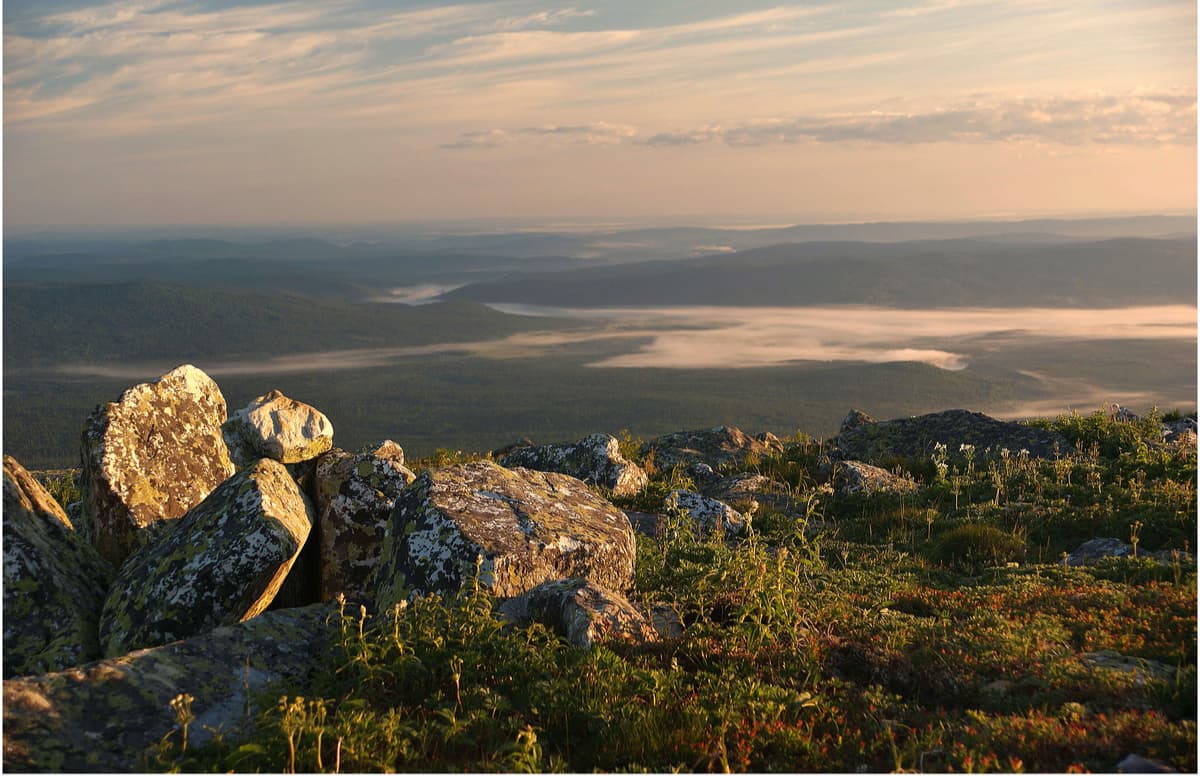
The Reserve is located in the central, highest part of the Southern Urals. Several ridges - the Mashak, the Zigalga, the Nary, the Kumardak and a mountain massif of the Yamantau - form here the highest mountain junction of all Southern Ural Mountains with the highest point of 1,640 m above sea level. The ridges in the reserve form several parallel mountain chains, which are separated by wide intermountain depressions.
The particular discontinuity of mountain chains creates the lattice structure of the relief typical for the whole Southern Urals. The northern part of the western mountain range in the Reserve is formed with the help of the so-called "Dry Mountains" – Veselaya, Salya, Rossypnaya, Kruglaya and others. Then come the Bairamgul, Karyada and the Belyagush ridges. The second mountain range is formed by the ridges with bald peaks – the Nary Range, the Little Yamantau Range and the Zigalga Range (within the reserve there is the southern part of the ridge with the highest peak Big Shelom), Then comes the most complex mountain chain which is formed in its northern part by the Mashak Range and the Yamantau mountain massif, and in the southern part of the mountain chain there are the Naratash, Belyatur, Yusha, Kapkalka and Eraktash ridges. The northeast part of the South Urals Reserve the mountain chain is formed by the ridges Kumardak and Bakty (within the reserve there are southern ends of these ridges). Finally, the southeast part of the reserve on the left bank of the Big Inzer River lies the mountain chain formed by short ridges – the Mayardak, Aursyak and Karagas.
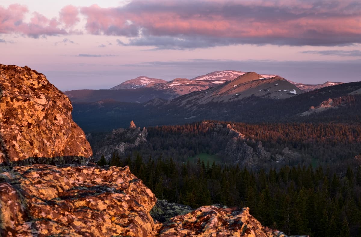
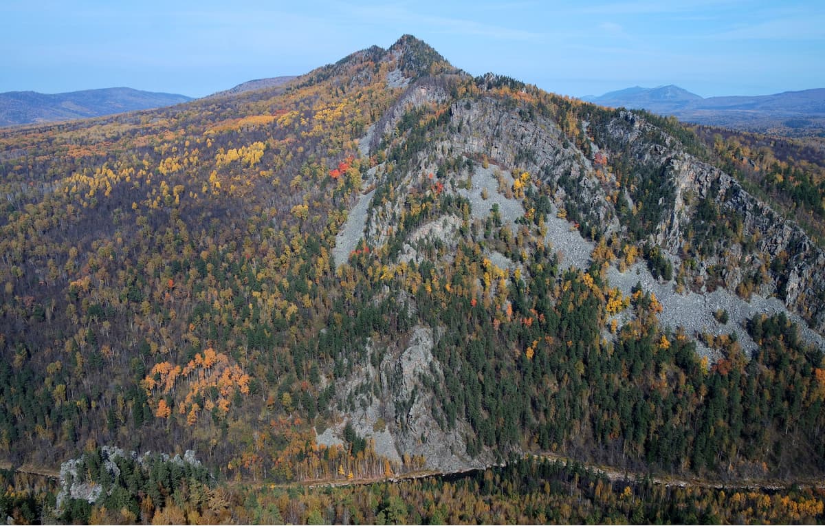
The peaks of the highest ridges are characterized by bald balustrade steps and terraces. They are especially well developed on the Zigalga Ridge. The mountain stairs are wide platforms that fringe the slopes for several meters, but in some cases, their length can be up to 1 km. Their surface is covered with large boulders, among which rise rocky idols. On the outer part of such fringes, there is herbaceous vegetation. The lines of these steps can be found at the top of Mount Big Shelom at an altitude from 850m to about 1050m. Mountain terraces are narrower in comparison with the mountain steps; they are horizontal sites found mainly within the ‘sub-naked-peak’ belt between 1100 and 1200m a.s.l. Their width varies from 5-10m to 100m. The surface of terraces is deprived of any soil and plant cover, they are laid out with quartzite blocks.
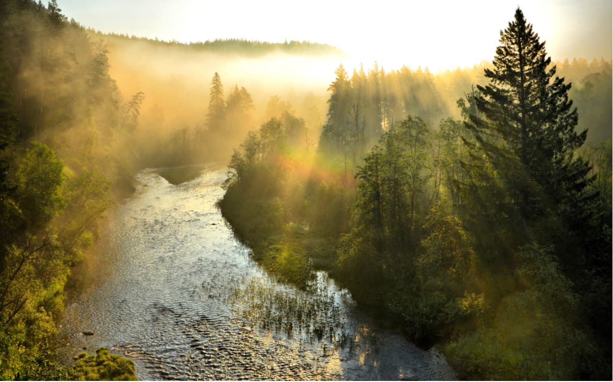
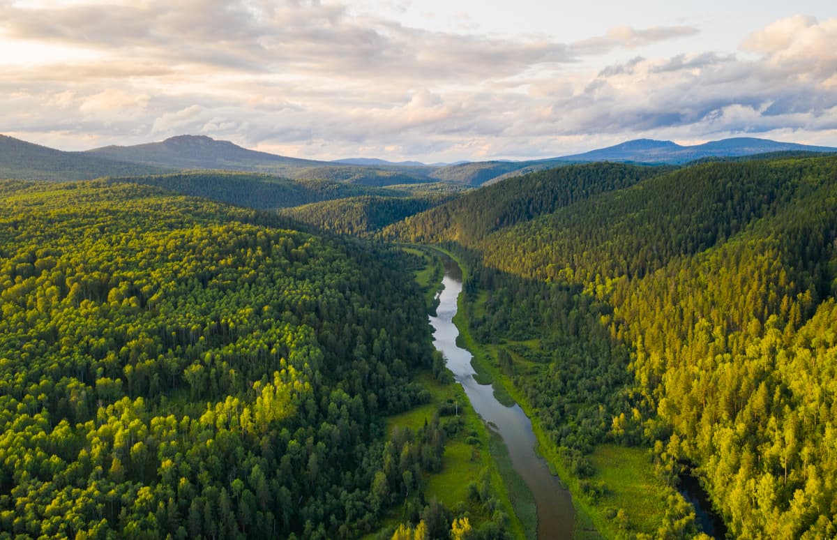
The Big Inzer and the Little Inzer, the Tyulma, the Yuryuzan, the Revet, the Tyulmen, the Katav, the Nura and other rivers flow through the territory of the reserve. All rivers are classified as small rivers. The longest of them is the Maly Inzer, it is merely 96 km in length. This river is the central artery of the South Urals Reserve. The rivers of the Reserve are typically mountainous with prevailing fast currents, rapids, and rocky channels. The waterlogged area of the Reserve is considered to be rather low due to large inclines of the slopes of the mountainous terrain. There are 12 swamp batches with a total area of 128 ha.
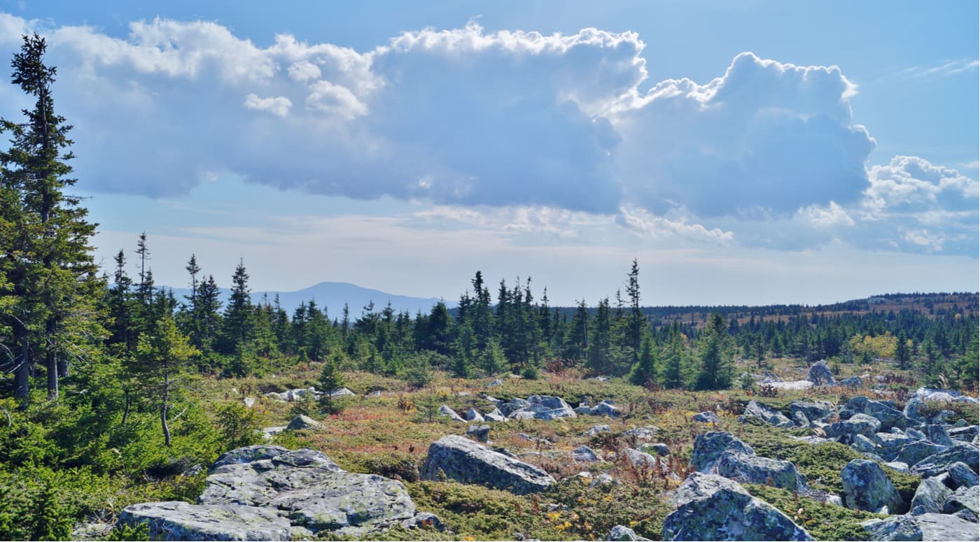
Forests cover most of the reserve (about 89% of the total area), among the trees dominant species are spruce, fir, aspen, pine, and birch. The flora of the South Ural Reserve is rich. There are 698 species of higher plants, 226 species of mosses, 169 species of lichens, 177 species of soil algae, and 121 species of mushrooms. There are 20 endemic species of the Urals which do not occur anywhere else. Of the revealed vascular plants, 8 species are included in the Red Book of the Russian Federation, 62 species are in the Red Book of the Republic of Bashkortostan.
There are 260 species of vertebrates, including 50 mammal species and 13 of those are predators. There are 189 bird, 5 reptile, 5 amphibian, and 20 fish species. In the forests of the reserve, one can find elk, roe deer, wild boar, bear, wolf, lynx, white hare, and squirrel. Beavers inhabit the rivers and might prepare trap surprises for an inattentive traveller.
The climate of the reserve is moderately continental. On the peaks and upper parts of the mountains, the frost-free period decreases, due to which snow on some peaks may not melt until August; such climate also ensures more precipitation than on the surrounding planes.
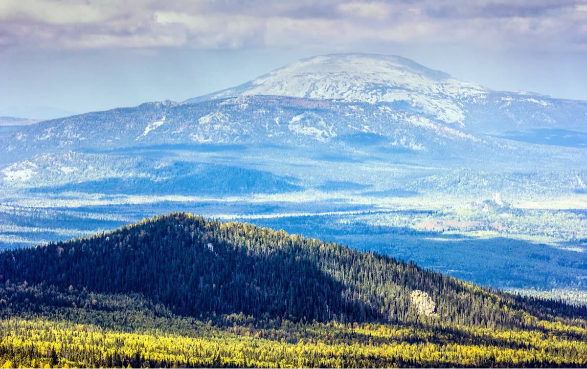
Yamantau has two peaks – Big Yamantau (1640.4 m) and Little Yamantau (1512.7 m). Both peaks of the mountain are plateaus with flat topography.
Yamantau is the highest point not only in the South Urals Nature Reserve, but also in the entire Southern Urals and the Republic of Bashkortostan. In translation from Bashkir language, Yamantau means "a bad mountain" ("yaman" – bad, evil and "tau" – mountain). There are many legends about the origin of the name. Most likely, the name was triggered by a number of unhappy factors. Firstly, there were many swamps and loose rock fields (kurumniks) on the slopes of the mountain, as a result of which in the olden times it was impossible to graze cattle there. Secondly, there are quite a lot of bears at the bottom of the mountains judging by their tracks and trampled glades. Thirdly, the local Bashkirs still believe in the bygone tales that horses were dying when they climbed this mountain. Besides, the weather is very changeable when you are approaching the top of the mountain. All this together made the indigenous peoples stay away from this mountain.
At an altitude of 1100m and above, the slopes of the mountains are composed of loose rocks with intermitted patches of grass, flowers, and moss. Below this mark the slopes are covered with mixed forest, in some places, there are alpine meadows, wind-broken trees that make some places unpassable, and sometimes you see rocky beats or weird rocky formations.
Yamantau mountain has a peculiar location, it is fenced with ridges from all sides. To the north of the mountain, there is the Mashak Range, to the west – the Nary Range, to the east – the Kumardak Range, the Inzer Range and the Belyatur and the Yusha Ranges. In addition, Yamantau fenced itself with the rivers Big Inzer and Little Inzer which originate on the eastern and western sides of the mountain respectively.
Two kilometres southeast of Yamantau, there is the second peak called Little Yamantau. Unlike its big brother, closed for visitors, Little Yamantau has a tourist route which can be taken only if you are accompanied by an employee of the reserve. The route begins at the Central Estate (Visitor’s Centre) of the South Urals Nature Reserve. The length of the route is 6 km, the elevation gain of the route is 600 m. At the top of the mountain, there is an observation platform with beautiful views of mountain ranges of the Southern Urals. On a trail, there are 4 stops for rest with benches. Not far from the top of Little Yamantau, near a spring, there is a forest hut intended for temporary rest.
In the late 1990s, there appeared the first rumours about mysterious buildings in the Southern Ural Mountains, the information was assumedly fed by the American press. At that time, the New York Times published that Russia had begun underground construction of a giant military complex. The purpose of the complex remained a mystery. Different versions were given, from a bunker or a repository of national treasures (Fort Knox a la Rus) to a humble warehouse for the mined ore. The complex was believed to be territorially located under Yamantau Mountain. 10 km to the west from the mountain is the closed town of Mezhgorie (the town with restricted public access, a common phenomenon in the USSR for settlements around military objects). Some rumours say that people living in Mezhgorie serviced the mysterious buildings and when there via a special railroad built inside the mountain from the town. The construction of this facility was allegedly completed in 2002. However, there was no official statement from the country's government regarding the purpose of the underground complex of Yamantau. There is a version that this data is classified, and a large number of military personnel really protect the object of state importance. Who knows, there might be another Area 51 or those rumours might be the sweet reminiscences of childhood tales about mountains.
At the top of the mountain, you can find the ruins of a heliport, abandoned and destroyed barracks, as well as other traces of the military base that had been operating on the mountain until the 1990s. In the centre of the plateau, there is a concrete obelisk in memory of the soldiers who died during the World War 2, which is usually called by the Russians the Great Patriotic War (1941-1945).
Visiting Yamantau nowadays is officially forbidden. The area is constantly patrolled by park rangers and the military to ensure the mountain remains sacrosanct and untouched by the ‘lowly humans’. Yet despite the ban, there are desperate tourists who are ready to conquer the mysterious mountain regardless the ensuing big fines and violation of the law.
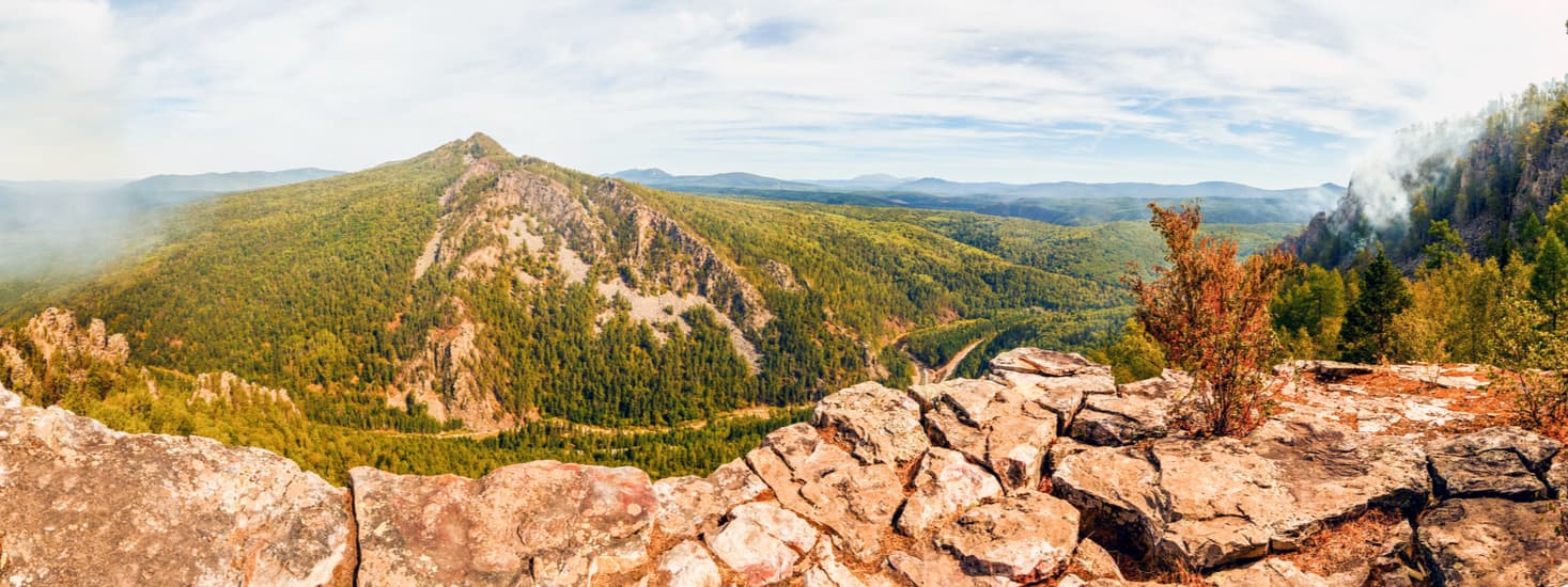
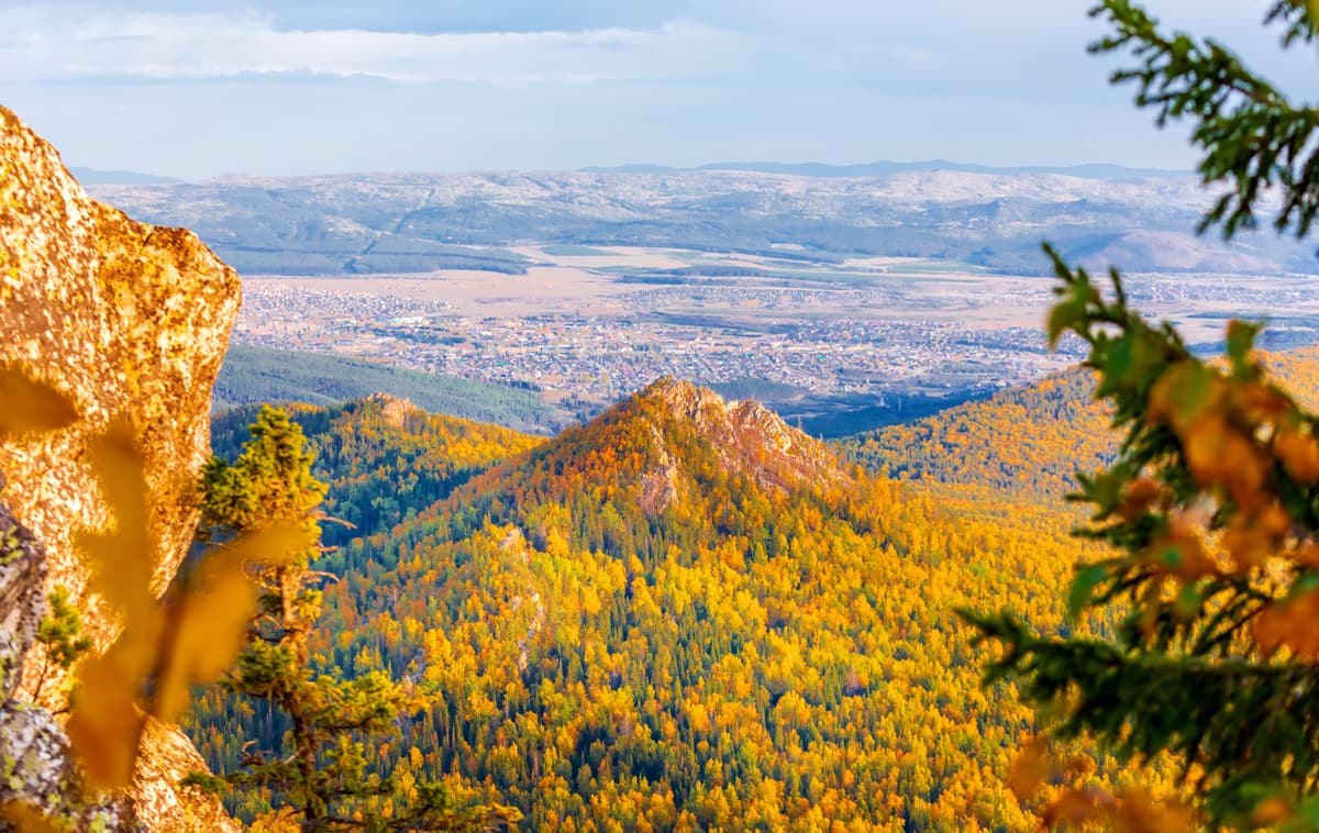
Big Shelom Mountain (1,427.1 m) is the fifth highest mountain in the Southern Urals and the highest point of the Zigalga Range. You can climb this mountain by following the trail called Big Shelom, it is the second tourist route developed by the Reserve authorities. The length of the trail is 3.5 km. The trail starts from the checkpoint Dvoinishi as it passes through the village of Dvoinishi and then the path winds through mixed woods and stony fields. At the beginning of the trail, near the checkpoint, there is a hut and a gazebo should you wish some rest.
The first half of the route passes along the Big Katav River. Once you go above 600 m a.s.l, you will see huge stone fields mainly maid of boulders or the so-called stone spots which gradually turn into stone rivers up to 3 km long and 100-150m wide. Separate rocky patches of cliffs up to 50 m high can be found at the height of 800 m and higher along the way.
In the area allowed for tourists, the Reserve offers the paths Little Yamantau and Big Shelom, and a package tour on the territory of the reserve. You can take these routes only if accompanied by an employee of the Reserve, or if you have ordered the tour as an individual or a group in advance.
It is important to note that it is strictly prohibited to visit Mount Little Yamantau individually without the guidance of an employee of the reserve. The peak of Mount Big Yamantau is officially closed for visiting, in case of violation there is a fine. The area near Yamantau and Mezhgorie town is quite densely patrolled by huntsmen and men in uniform. When caught in the restricted zone, travellers are asked to show their documents, they are fined and not allowed to enter the zone despite a long way to it. Thus, Yamantau remains out of reach for ordinary tourists, but you can visit the second highest peak in the Southern Urals - Big Iremel (1582.3m) in the Iremel Nature Park without any retributions for trespassing the sacred lands.
Still despite these obstacles, the most persistent travellers manage to climb Yamantau mountain through the villages of Kuzjelga and Tatly, which are in the direction of Beloretsk. This route does not go into the forbidden terrain, thus reducing the risk of encountering military patrols on the way. Another safe route to Yamantau is from its eastern side through the village of Nura. The southern part is marshy and inaccessible for humans. In spite of the inhibitions and mystical rumours associated with this place, Yamantau is a favourite destination for mountain conquerors and adventurers.
There are also some wonderful places with beautiful views of Yamantau, e.g. from the Karatash Range, also called Mesto Aigir by the name of the railway station near Inzer village in Beloretsky district. You can reach the ridge by the train going from Beloretsk to Ufa.
During your stay on the territory of the Reserve, you can visit the Museum of Nature and the Visitor’s Center of the Central Estate of the Reserve, rent motorboats, cars (including trucks and SUVs), buses and snowmobiles. You can also go horseback riding and visit the sauna.
In the rafting season for safety reasons, you can order a coastal escort from the State Inspector if you wish to experience the rapids of the rivers Big Inzer and Little Inzer.
The Reserve provides the following accommodation options: guest houses, forest huts, field stations, cordons, specially equipped tent parking lots where you can rent a tent as well.
To get to the South Urals Reserve, you need to drive to the village of Revet, Beloretskiy District of the Republic of Bashkortostan. That's where the Central Estate of the Reserve is located. The distance from this village to the city of Ufa is 200 km, and to the district centre of Beloretsk is just 90 km away.
You can reach the village of Revet by highway Ufa-Beloretsk or by railway Ufa-Inzer-Beloretsk. Not far from Revet village, there is a railway stop. And 8 km from the Central Estate there is a railway station Inzer.
A visit to the South Urals Reserve involves a small fee. The information about prices for the services of the Reserve, how to get there, about recreation centres and current routes can be found on the official website of the South Urals Reserve at http://www.south-ural-reserve.ru.
You can also get the visit permit and pay for entrance tickets in the village of Revet according to the information on the official website of the Reserve. Mind you, that the payment is usually done in cash, there might be no card servicing at such remote places.


The highest peak in South Ural State Nature Reserve is Mount Yamantau, at 1,640 m.
Notable peaks in South Ural State Nature Reserve include Mount Yamantau, Small Yamantau, Gora Bol’shoy Shelom, Uglovoi Mashak and Shirokii Mashak.


