
Scan the QR code and open PeakVisor on your phone
Located between Asheville and Charlotte in North Carolina, USA, South Mountains State Park lies just east of the Blue Ridge Mountains. These low mountains with their miles of trails and streams invite hikers, bikers, riders, and fishers to enjoy some of the state’s undeveloped forest. Icy Knob is the tallest and most prominent of the 21 mountains in the park, at 3,012 ft (918 m) tall and with a prominence of 1,785 ft (544 m).
South Mountains State Park was established in 1974 and currently covers more than 19,000 acres (7,690 hectares) between Charlotte and Asheville, North Carolina. It is the largest of North Carolina’s state parks and lies to the east of the Blue Ridge Mountains and southeast of Pisgah National Forest and Linville Gorge Wilderness. To its south, it borders South Mountains Game Lands. It is separated from its western mountain neighbors by the Catawba Valley.
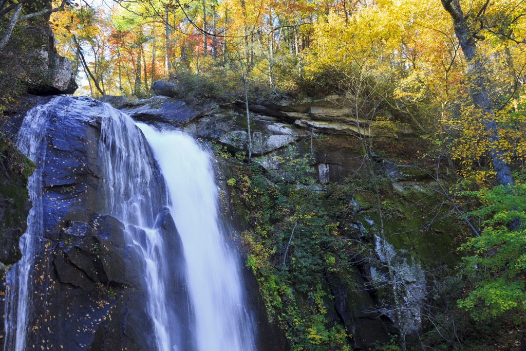
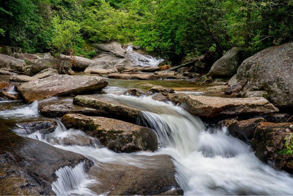
One of the park’s most iconic features is High Shoals Falls. Several trails around the waterfall lead to viewing platforms, swimming holes, campsites, and the upper reaches of the falls. Additionally, there are more than 40 mi (65 km) of trails for hiking, mountain biking, and horse riding, and seven locations with 24 backpacking campsites.
Facilities for equestrian recreation include 33 mi (53 km) designated trails, trailer parking, and a barn. Mountain bikers can enjoy a 17 mi (27 km) loop. There are campsites available near Jacob Fork River and Shinny Creek and miles of streams for trout fishing. The park’s visitor center houses comprehensive displays on the area’s cultural and natural history. The two main access points are at Jacob Fork and Clear Creek.
The tallest peaks are Icy Knob (3,012 ft/918 m), Hickory Knob (2,989 ft/911 m), Propst Mountain (2,982 ft/909 m), and Buzzard’s Roost (2,969 ft/905 m).
The South Mountains lie to the east of the Blue Ridge Mountains across the Catawba Valley. This old mountain range was carved out of the Blue Ridge region by erosion over millions of years.
It is composed primarily of gneiss (metamorphosed granite) and has peaks around 3,000 ft (915 m) or less. The rock composition in the mountain is foliated – layered metamorphic rock.
Of the stratified rocks, there are several layers. One is primarily biotite gneiss and mica schists made up of metamorphosed shale, siltstone, and sandstone. Another layer is made up of sillimanite schist with some areas containing pyrrhotite and graphite.
A final layer is biotite gneiss. There are some quartz monzonite intrusions present in the mountains.
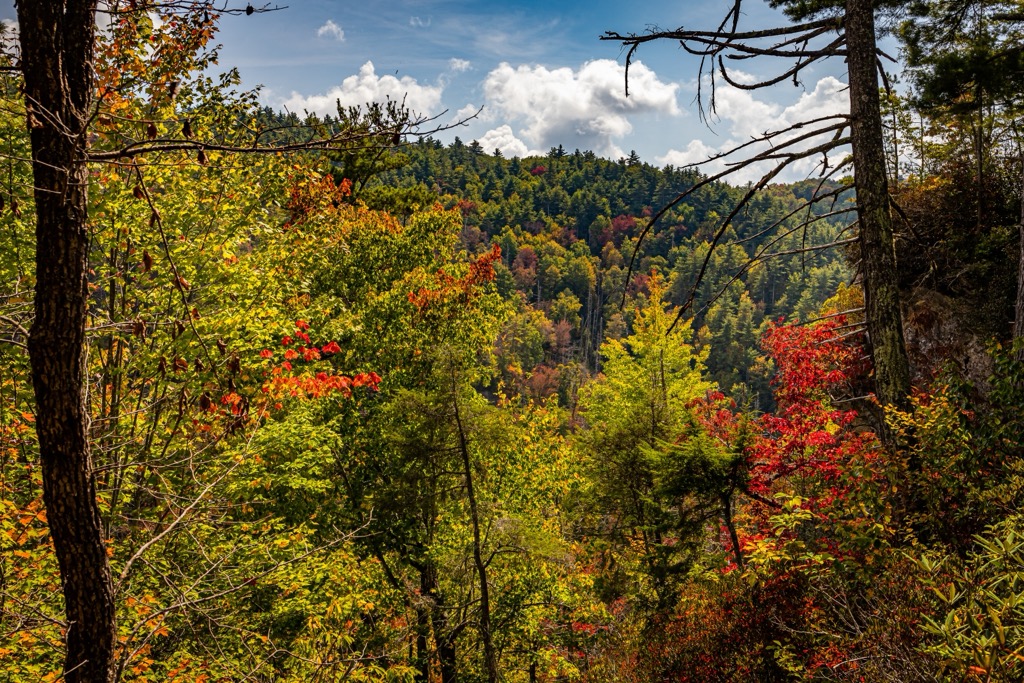
Forest types in the state park include pure conifer, mixed conifer, hardwood, and climax hardwood forests. The park falls within the state’s Piedmont region (taken from Italian and meaning foothills) between the coastal plains and Blue Ridge Mountains.
Oak, hickory, and a variety of pines are the predominant tree species. Wildflowers such as Jack-in-the-pulpit, lady slipper, and foam flowers bloom in the summer, and mountain laurel and rhododendron grow abundantly in the understory.
There is plenty of wildlife around, although not often seen in the more trafficked areas of the park. These include salamanders, frogs, and toads in moist areas, as well as eastern fence lizards, skinks, and small snakes. Although rarely encountered, venomous timber rattlesnakes and copperheads do live here so hikers should be aware.
More than 60 species of birds nest in the South Mountains. This includes many of the species that commonly live in the western Piedmont region, as well as the ruffed grouse, black-throated green warbler, and the rose-breasted grosbeak. Acadian flycatchers, common crows, Carolina chickadees, wood thrushes, red-eyed vireos, oven birds, hooded warblers, indigo buntings, Eastern towhees, and ravens also spend time in these forests.
A few common mammals within the park are white-tailed deer, black bears, woodchucks, chipmunks, gray squirrels, raccoons, Virginia opossums, shrews, and moles.
The Catawba Valley and gaps between the mountains to the west of South Mountains State Park were historically popular travel routes. The South Mountains served as a buffer zone between the territories of the Cherokee and Catawba Indians. The first European settlers in the region took up farming along the Catawba River.
Gold was discovered in Brindle Creek in 1828. This prompted a gold rush that drew immigrants, mining companies, and slave owners into the region and lasted into the early 1900s.
The first land development began in the 1930s when a Civilian Conservation Corps camp was set up at Enola. Employees built forest service roads, cleaned stream beds, and constructed a forest observation tower.
Proposals for the park first came in the 1940s. Funding came through in 1974 to purchase the first 5,779 acres (2,339 hectares) and establish the state park. Subsequent additions brought the total up to around 19,000 acres (7,690 hectares). A few historic graveyards lie scattered across the park, including some from the Civil War.
The state park is well maintained and makes it easy to access outdoor recreation of all kinds. There are miles of well marked and cleared trails for hiking, horse riding, and mountain biking.
All the streams are wild trout water except for 2 mi (3.2 km) of delayed harvest trout waters. Those hoping to fish will need to obtain a special license for trout fishing and should note that only single hook lures are allowed from October to the first Friday in June and all fish must be released.
There are 33 mi (53 km) of trails for horseback riders, trailer parking and a barn. Horse owners may be asked to show a Coggins test.
There are a handful of picnic sites at Jacob’s Fork and Shinny Creek. These picnic sites can be reserved in advance but parking here is on a first come, first serve basis.
Full list of hiking trails can be found on the state park website.
The trail to High Shoals water can be completed in a 2.5 mi (4 km) loop that climbs about 550 ft. Those wishing for a longer trail can add in a leg of the Headquarters trail. The High Shoals Falls trail passes by a few good swimming spots, several good views along the way, and viewing platforms for the falls.
From the parking lot, one can leave along either Hemlock or Headquarters trail heading upstream. After 0.5 mi (0.8 km), you’ll see a sign for High Shoals Falls and begin to climb stairs. One mile in, you’ll arrive at the viewing platforms. Keep climbing the stairs to reach the trail intersection with Upper Falls trail and access to campsites near the top of the falls.
It is considered a moderately strenuous hike with lots of stairs to climb to the falls. It is also quite popular so expect to have company on the trail, especially during the summer and on weekends.
Considered a strenuous hike, the trail to Chestnut Knob is slightly over 2 mi (3.2 km) one way and ascends approximately 1,000 ft (305 m). To begin this hike, leave the parking area following the Headquarters trail. After passing the amphitheater, look for Chestnut Knob Trail.
About half a mile in (0.8 km), you can stop at the Jacob Fork River Gorge Overlook. This first half mile is the most challenging part of the hike so it gets easier after this! Continue on from the outlook point, keeping left at the T-intersection to reach the Chestnut Knob Overlook. This steep trail is well-liked for its views of the waterfalls, Jacob Fork Gorge, and surrounding mountains.
Possum Trail is often combined with the Chestnut Knob trail to make a 7.7 mi (12.4 km) loop. This is one of the park’s most popular extended hikes. The Possum trail can be reached via the Shinny Trail, about 1.6 mi (2.6 km) from the Jacob Fork parking area.
It is considered a strenuous hike. Hikers can pick up trail maps before heading out and all trails are well marked and color coded for easy navigation.
This trail along the top of the falls divides the park’s north and south. It crosses above High Shoals Falls and passes through the Upper Falls Backcountry Campsite before a steep ascent to a lookout point. From there, the trail continues west to the Jacob Branch Backcountry campsite and finishes on the Lower CCC trail.
The trail can be used by hikers, bikers, and horses. The can be accessed 1.1 mi (1.8 km) in from the Jacob Fork parking area and from there the trail is 3.7 mi (6 km) one way and considered moderate.
South Mountains State Park lies northwest of Charlotte and east of Asheville. There are many campsites within and around the state park, as well as smaller towns such as Morgantown that offer all basic amenities and accommodation.
With a population of 875,000, Charlotte has lots to offer by way of culture, food and outdoor recreation. The city has museums and historic mansions to tour, farmers markets and numerous food halls such as 7th Street Public Market and Optimist Hall, spas, boutiques, and art galleries.

It is home to the U.S. National Whitewater Center, the largest man-made whitewater river in the world. You can take a stroll around the botanical gardens, or cool off in the water at Catawba River, Lake Norman, or Lake Wylie. Head over to Crowders Mountain State Park if you’re hoping to do some hiking near the city.
When dining out, you can find hearty foods like BBQ and classic southern fried chicken, international cuisines like Ethiopian and Peruvian, and plenty of breweries, bakeries, and coffee shops. You’ll find a choice of hotels, B&Bs, and rental properties to stay in in the city, and peaceful campsites and RV parks nearby.
Asheville in western North Carolina is surrounded by the Blue Ridge Mountains, the perfect spot for those looking to get out and hike, mountain bike, go for scenic drives, visit waterfalls, fish in the streams, or go kayaking on the French Broad River – the list could go on! The city of 92,000 people is also located close to Mount Mitchell, the highest point east of the Mississippi River.

Check out the Biltmore Estate. The 250 room mansion and 8,000 acre (3,240 hectare) estate originally belonged to a member of the Vanderbilt family. Today you can tour the estate, complete with trails, gardens, a winery, shopping, dining, and luxury accommodation.
In the city, explore art museums, galleries, live music, performing arts shows, and farmers markets. From fancy to home-style cooking, the dining scene here is diverse. Many restaurants use locally sourced products, everything from produce to local meat and mountain trout. Accomodation options in the city include hotels, resorts, cabins, inns, hostels, and campgrounds.


