
Scan the QR code and open PeakVisor on your phone
Sanabria Lake Natural Park has 45 named peaks. The highest is Pena Trevinca at 2,127 m. Other notable peaks include Pena Negra, Alto Ladeira da Medias and Peña Vidulante.
Located in northwestern Spain, lies Sanabria Lake Natural Park (Parque Natural del Lago de Sanabria); a stunning outdoor recreation destination located centered around Sanabria Lake. The park contains 42 named mountains. The tallest and most prominent peak is Pena Trevinca standing at 2,127 m (6,978 ft) with 884 m (2,900 ft) of prominence.
Sanabria Lake Natural Park is situated in the northern region of Spain in the northwestern region of the Zamora province. The park spans 22,365 ha (55,265 acres) across northern Spain.
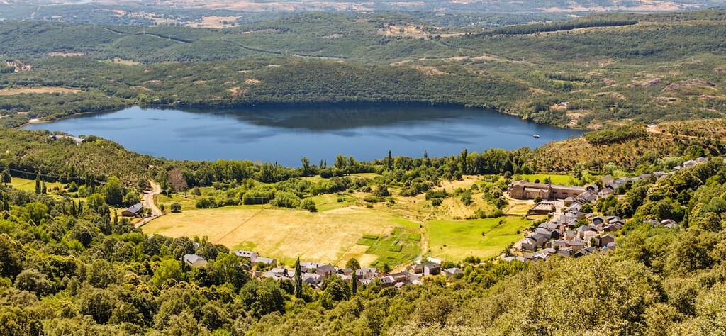
The park encompasses the land around Sanabria Lake and extends out to the west. Here lie the mountains of the park including Pena Trevinca. The lake is known for being the largest lake in Spain that is of glacial origin, covering 368 hectares (899 acres). The maximum depth of the lake reaches 53 meters (173 ft).
The rest of the park consists of the mountains surrounding the lake which includes canyons and smaller lakes. The main flow of the lake is fed by the river Tera. The lake itself is a large widening with the river.
The park is part of the Sierra de la Culebra mountain range which extends from northeastern Portugal across northwestern Spain. The range is characterized by their rolling formation and wooded slopes.
Additionally, Sanabria Lake Natural Park is surrounded by other popular outdoor recreation areas. Directly west lies the ZEPA Pena Trevinca with Fuentes del Narcea, Degaña and Ibias Natural Park and Ancares Leoneses y Alto Sil Nature Space (Espacio Natural de los ancares Leoneses y Alto Sil) to the north.
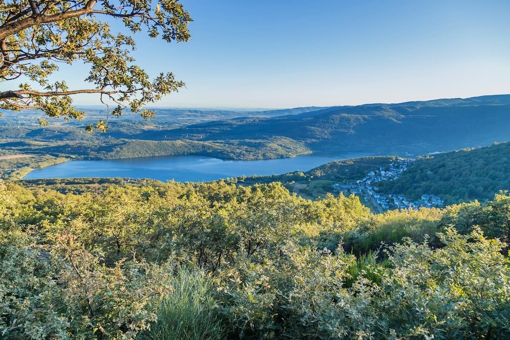
The lake, along with the surrounding peaks of the park create a vast glacial landscape. The cirques, valleys, and moraines showcase the historic formation of the region. The summit of many of the peaks in the region, and the Sierra de la Culebra mountain range, consists primarily of quartzite.
The Quaternary glaciers formed an ice sheet that covered the entire region. As the ice receded, a large U formation left behind the Tera valley. As the ice melted and carved out the Sierra de la Culebra, numerous glacial lakes and rivers were left behind. Now the smooth slopes left behind surround the largest glacier fed lake in the country.
Major peaks within the park include Pena Trevinca, Pena Negra, and Alto Ladeira de Medias.
The fertile soil of the region allows for flora to thrive. Despite the smaller size of the park, it is still home to over 1,500 species of. Oak trees dominate much of the landscape, from the lake shores up to the rolling hills.
Other regions in the park are populated by chestnut, ash, willow, and holly trees. At the highest elevations in the park are scrubland and heath, typical of the surrounding region.
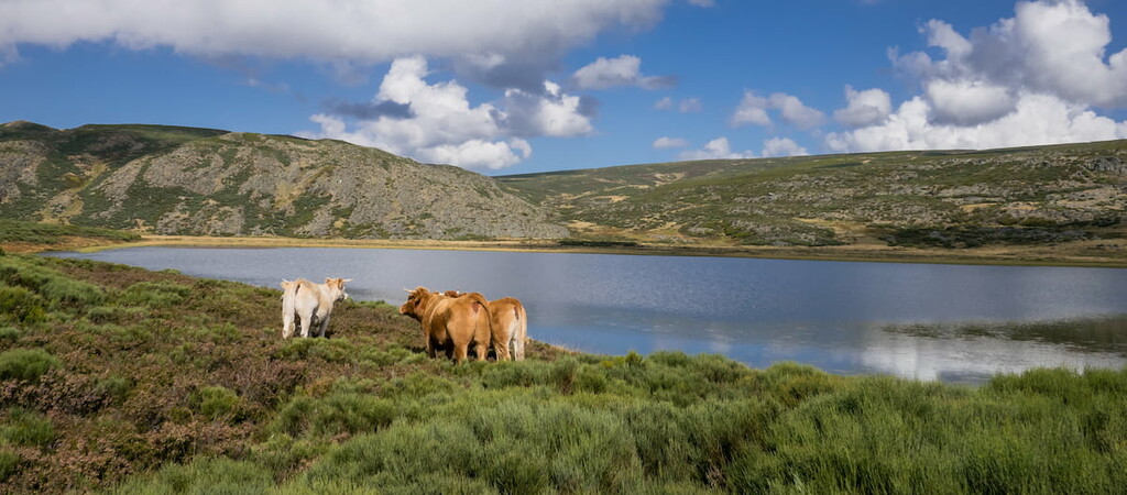
Perhaps the most notable species of the park is the wolf. Iberian wolves are found in the park in the surrounding region along with roe deer, wild boar, and otter. The sky of the park is home to eagle, peregrine falcon, buzzard, and various other birds of prey. Sanabria Lake is home to numerous species of trout.
HIstory in the region can be traced back to Puebla de Sanabria, a small town located 12 km (7.5 miles) from the park. The small city is thought to be one of the oldest establishments in the Zamora region, dating back to the year 509 AD.
The region has a rich history of various cultures mixing, due to its close proximity to Portugal. Much of the history of the region and its people centers from Puebla de Sanabria. Though now it acts as an established town, much of the tales of previous colonies refers to the region as a whole.
The park, including the lake, have been protected since the 1940s to help mitigate logging in the region. However, the park itself wasn’t established until 1978. Today a more indepth look at the geological and human history of the park can be found at the park’s interpretation center.
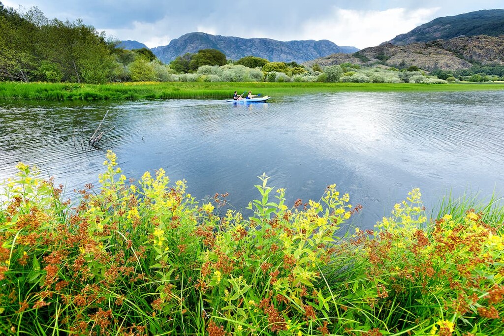
Sanabria Lake Natural Park is home to numerous trails. There are many short walking trails and beaches located along the shore of the lake, making them easily accessible to visitors. Here are some of the top hiking areas to visit in the park:
This 11.3 km (7 miles) loop trail has 680 m (2,230 ft) elevation gain. The route starts at the Ribadelago car park before crossing the Tera River. The route climbs steadily up the rocky cliffs with continual views of Lake Sanabria down below. After climbing the nearby mountain, the trail then winds to Laguna del Payon, Garandones reservoir and the Cardena reservoir. After exploring the rocking landscape and pockets of freshwater, the trial descents back down towards the main lake.

This 88.7 km (52 miles) loop trail has 2,737 m (8,979 ft) elevation gain. The multi-day trek takes hikers through all of the Sanabria Lake Natural Park. Established in 2007, the park connects numerous existing trails with spectacular views throughout. While the route can be completed all at once, many of the major hikes in the park follow along the same path.
The six stages of the full route include House of the Park - Refugio de las Yeguas, Las Yeguas Refuge - Ríopedro Refuge, Ríopedro Refuge - Porto de Sanabria, Porto de Sanabria - Laiol Refuge, Laiol Refuge - Sierra de Sotillo Refuge, and Sierra de Sotillo Refuge - Park House.
Looking for a place to stay nearSanabria Lake Natural Park? Here are some of the best cities and villages to check out in the region:
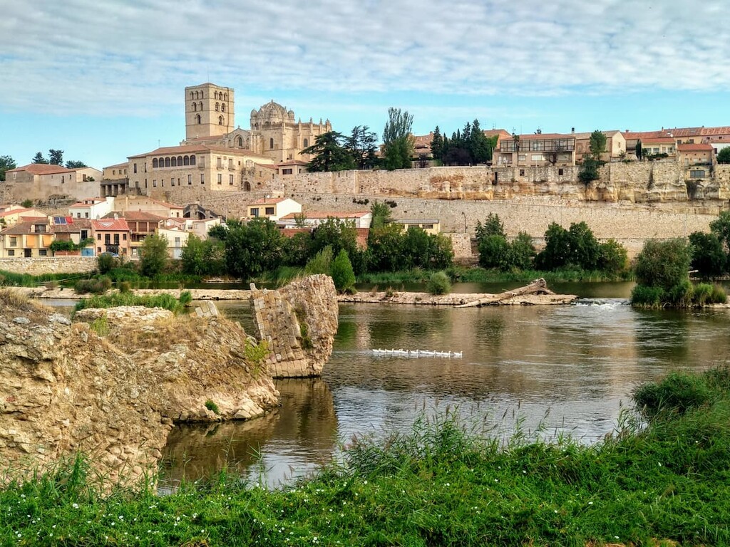
Located southeast of the park lies the city of Zamora, which is the capital of the province of Zamora. The city is situated along the Duero river and is known for its Holy Week celebrations.
Zamora has a population of around 65,000 with a cold semi-arid climate. The Castle of Zamora is a large fortress in the city showcasing Romanesque architecture. Other notable sites in the city include the Puente de Piedra bridge which helps connect Zamora to other cities across the river. Specialty foods of the city include their local cheeses, Toro wines, and aceitadas.
Located along the west coast of Spain, just north of Portugal, lies the city of Vigo. Located in the province of Ponteverda, the city has a population of around 296,000. The city grew rapidly in the 20th century becoming an industrial hub for the region.
Being located right on the coast, allows the city to have a summer Mediterranean climate with a dry trend during the warmer months. The high rainfall during the winter months often leads to it being compared to the Pacific Northwest in North America. It’s close proximity to the ocean allows for an abundance of seafood restaurants and cafes.


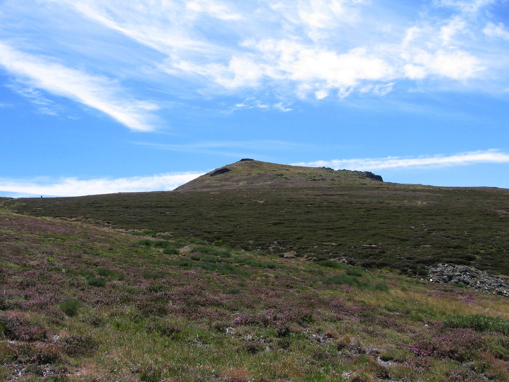
The highest peak in Sanabria Lake Natural Park is Pena Trevinca, at 2,127 m.
Notable peaks in Sanabria Lake Natural Park include Pena Trevinca, Pena Negra, Alto Ladeira da Medias, Peña Vidulante and Alto de la Surbia.


