Get PeakVisor App
Sign In
Search by GPS coordinates
- Latitude
- ° ' ''
- Longitude
- ° ' ''
- Units of Length

Yes
Cancel
❤ Wishlist ×
Choose
Delete
Spanning nearly 5,000 square kilometers (1,930 sq. mi) across southeastern Mexico, the Reserva de la Biosfera Tehuacán-Cuicatlán is a diverse natural protected area between the Mexican states of Puebla and Oaxaca. Over 315 named summits exist in Reserva de la Biosfera Tehuacán-Cuicatlán, the highest and most prominent among them Cerro Volcan Prieto (3,200 m/10,499 ft).
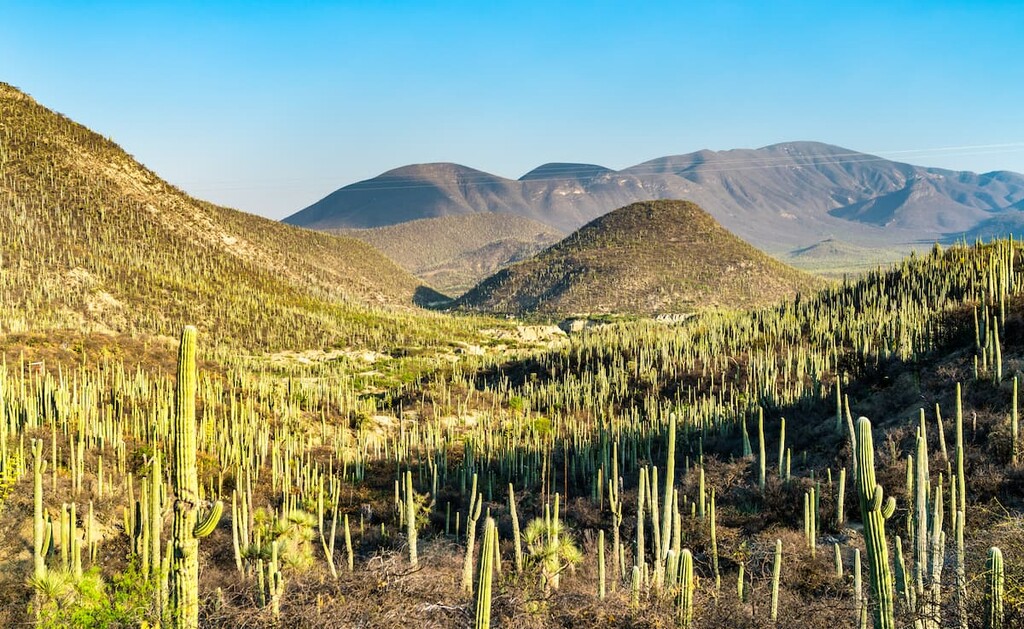
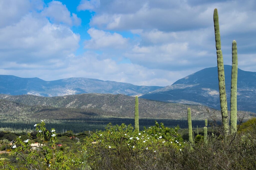
Reserva de la Biosfera Tehuacán-Cuicatlán (Tehuacán-Cuicatlán Biosphere Reserve) is a rugged, arid area that boasts hundreds of peaks of around 3,000 meters (9,840 ft) in elevation.
It is a scant 100 kilometers (60 mi) south of the dormant stratovolcano Pico de Orizaba (5,636 m/18,491 ft) Mexico’s highest summit and the third highest mountain in North America. The reserve is also nestled between southeastern Puebla and northern Oaxaca.
Reserva de la Biosfera Tehuacán-Cuicatlán is most easily reached from the major metropolitan area of Puebla, which is a little over two hours drive by car to the north. Buses also run between Puebla and the town of Tehuacán, the closest major city to the reserve.
The Reserva de la Biosfera Tehuacán-Cuicatlán is a part of the Sierra Madre del Sur, one of Mexico’s largest mountain ranges. The range stretches for approximately 1,200 kilometers from Michoacán to eastern Oaxaca and the Isthmus of Tehuantepec. It was named a UNESCO World Heritage Site in 2018.
The region has a relatively warm, arid climate that ranges to the semi-tropical in the Cuicateca region of the reserve. Rain is moderate to scarce in the summer months, but the reserve is known for receiving higher rainfall than many similar desert regions, which is one factor behind its incredible biodiversity.
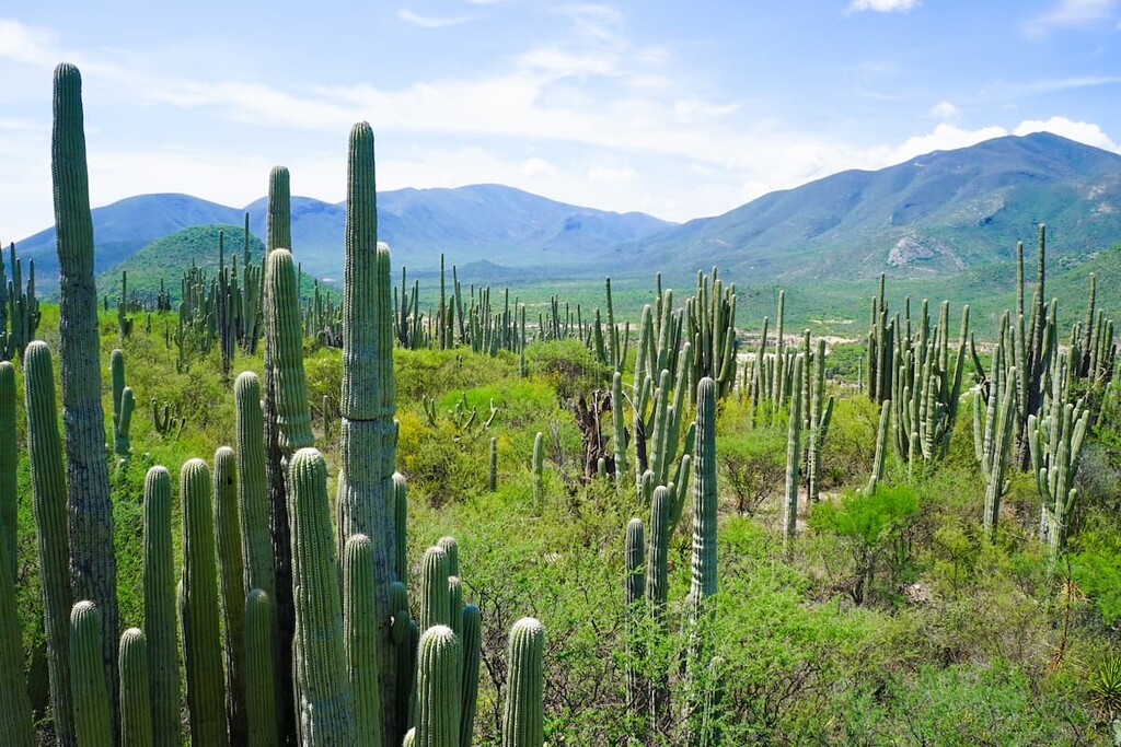
At higher elevations, mountains are often ringed with mist. Almost all of the Reserva de la Biosfera Tehuacán-Cuicatlán is part of the upper basin of the Papaloapan River, one of Mexico’s largest rivers, and as a result, many river valleys cut through the mountains, though larger flowing streams are rare.
As a portion of the Sierra Madre del Sur, the Reserva de la Biosfera Tehuacán-Cuicatlán is also surrounded by other major mountain ranges. The Sierra Mixteca borders it to the west, and to the east, it’s bordered by the Sierra Zongólica, Sierra Mazatec, and Sierra Juárez, which ring the reserve from north to south, respectively.
The rock found here is generally sedimentary rock hailing from the early Tertiary period, and it is often overlaid with volcanic deposits. Metamorphic rock outcroppings from the Paleozoic era can also be found in the region, particularly in the northeast near the Sierra Zongólica range. At lower elevations, Quaternary sandstones and conglomerates can be found along with Tertiary sedimentary rock.
Major peaks within the reserve include Cerro Volcan Prieto, Tepoxtla, Cerro Alto, Cerro Verde, Cerro Majada El Muerto, and Yucucuishi.
Reserva de la Biosfera Tehuacán-Cuicatlán hosts a vast range of flora and fauna, and it was designated as a world biodiversity hotspot by the International Union for Conservation of Nature (IUCN). Both the valley's geography and the abrupt changes in seasonal climate combine to foster ideal conditions for diversity and endemic flora.
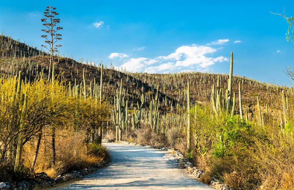
The reserve is notable as a home of the columnar cactus, which stretches up to 10 meters (33 ft) in height and makes up more than 10 percent of all agave species in Mexico. Reserva de la Biosfera Tehuacán-Cuicatlán has one of the highest concentrations of columnar cacti anywhere in the world.
There are nine plant communities mostly endemic to the region. Xeric shrubbery, low elevation tropical deciduous forest, pine-oak forest, and cloud forest are all common throughout the park. Of note, the park contains one of the few regions of mountain mesophilic forest in the country.
Within the reserve, there are over 102 different mammal species, including puma, white-tailed deer, collared peccary, lynx, and raccoon. There are many bats in the park including free-tailed bats, moustached bats, and vampire bats.
The reserve is also home to over 85 reptile species, including one of the world’s only venomous lizards, the Mexican beaded lizard. It also contains approximately 338 bird species. Birds of note include the green macaw, an endangered species of parrot, as well as the harpy eagle, northern aplomado, and peregrine falcons.
There are approximately 27 species of amphibians and 18 species of fish in Reserva de la Biosfera Tehuacán-Cuicatlán, an extremely high level of diversity for these types of animals in a desert region.
The Reserva de la Biosfera Tehuacán-Cuicatlán was one of the first regions in Mesoamerica that saw the development of agriculture, and the cultural proliferation that came with it. Researchers estimate that humans have occupied this region continuously as far back as 12,000 years, and fossilized maize remains that date back to 5,000 BCE have been discovered by archeologists in the reserve.
Approximately eight Indigenous groups have historically called the region home: the Mixtecos, Cuicatecos, Ixcatecos, Nahuas, Chocholtecos, Popolocas, Chinantecs, and Mazatecs.
The reserve valley has seen irrigation techniques implemented for approximately 2,000 years, via technology that included a large system of canals for surface water retention in addition to aquifers accessed from an extensive network of tunnels and caves.
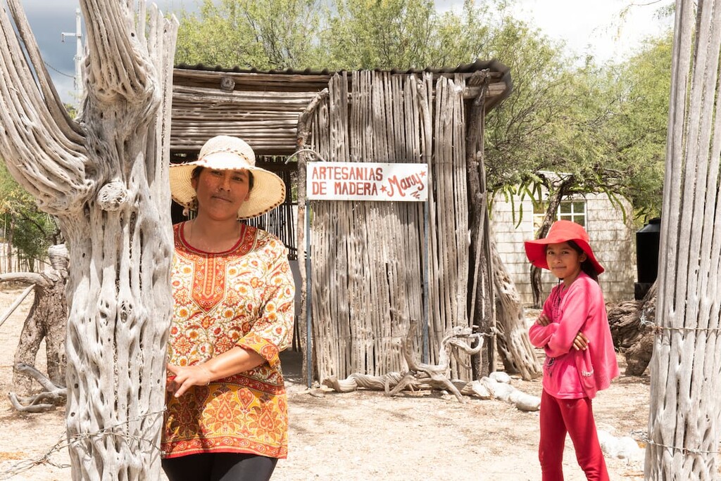
Mexican president Ernesto Zedillo Ponce de León formally declared the region a Biosphere Reserve in 1998. The reserve was also designated as a UNESCO World Heritage Site in 2018 as it contains both a substantial amount of cultural significance as well as a diversity of endemic flora and fauna.
Much of the hiking and trekking within the reserve is off-trail as there are few established trails. That being said, there are a couple of spots (mostly centered around small communities) that serve as excellent starting points for hikes. Many of these smaller communities also offer guided tours and other resources for visitors..
Located in the municipality of Zapotitlán Salinas, the Helia Bravos Hollis Botanical Garden is named for Dr. Helia Bravo Hollis, one of Mexico’s first graduate biologists, who earned her degree in 1931.
The expansive garden, which is famous for its large population of columnar cacti, is in situ, so the plants are exhibited in their natural habitat with little to no intervention. Here visitors can hike through striking cacti forests reaching far overhead, among a number of other endemic species of flora. It also houses a camping area.
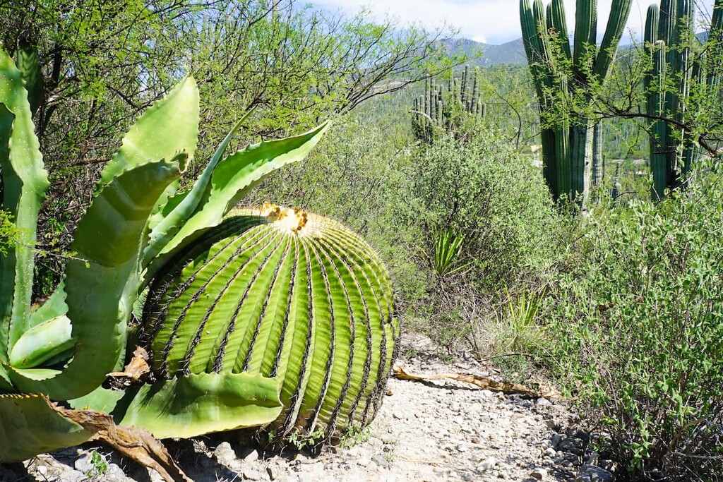
San Juan Raya is actually a small settlement (pop. 2,000), but the locals are expert guides and offer a number of tours of the surrounding region on horseback, foot, and by bicycle. Here you can stroll through cacti forests, search for endangered pineapple-shaped biznagas, and gaze upon an Elephant’s Foot (also known as a ponytail palm) that’s estimated to be over 1,000 years old.
Of particular note are the numerous fossils in the area dating to the Paleozoic era, including trilobites, as well as the footprints of pterosaur and Tyrannosaurus rex.
Here are some of the closest cities to the Reserva de la Biosfera Tehuacán-Cuicatlán, all of which offer a wealth of lodging opportunities as well as plenty of cultural and historical attractions for visitors to check out:
Puebla, which supports a metro population of about 3.2 million people, is the best jumping-off point to reach the reserve for international travelers, as it is the only city in the region with an airport serving direct international flights. The city is situated approximately 150 kilometers (93 mi) away to the north, a little over two hours by car.
Puebla is the fourth largest city in Mexico and possesses a rich colonial history dating back to the early 1500s, with a number of museums, galleries, cathedrals, and churches. Puebla is also notable as it is the one of the few major Mexican cities to formally celebrate Cinco de Mayo, which marks the defeat of invading French forces in the state of Pubela in 1862.
Around 170 kilometers (105 mi) to the south, Oaxaca (pop. 300,000) is another cultural hotspot, though a fraction of the size of Puebla.
From the Ethnobotanical Garden to the observatory to the plethora of museums, cafes, markets, and bars, there is plenty to do and see in Oaxaca. A visit to the world-famous hot springs at Hierve el Agua, an hour and a half outside of town by taxi, is also well worth the trip.

Tehuacán (pop. 248,000) is the closest major settlement, located approximately 30 minutes from the Reserva de la Biosfera Tehuacán-Cuicatlán. Well known for its mineral springs, Tehuacán offers the best option for travelers looking to stay near the park, with a number of hotels, hostels, and Airbnb opportunities available.
Aside from the reserve, the ex-Convent of San Francisco, a monastic complex dating to the 1500s that’s known for its historic art and architecture, offers an excellent side trip. Another great place to check out is the Museum of Mineralogy, which houses a large collection of art and scientific pieces, including many geologic specimens such as moonstones, fossil minerals, and meteorites.

There are a number of rustic cabins available for rental in the park, accessible by inquiring with the Mexican Natural Areas Protection Service (ANP) at tehuacan@conanp.gob.mx.
Primitive camping is also available via reservation. Both Helia Bravo Hollis and San Juan Raya have camping sites and cabins available for rent, administered by the local populace. A handful of the variety of small settlements within the reserve also host via Airbnb.
Explore Reserva de la biosfera Tehuacán-Cuicatlán with the PeakVisor 3D Map and identify its summits.


