
Scan the QR code and open PeakVisor on your phone
Xuhai-Guanyinbi Nature Reserve has 2 named peaks. The highest is Guanyin Shan at 349 m. Other notable peaks include Guanyinbi.
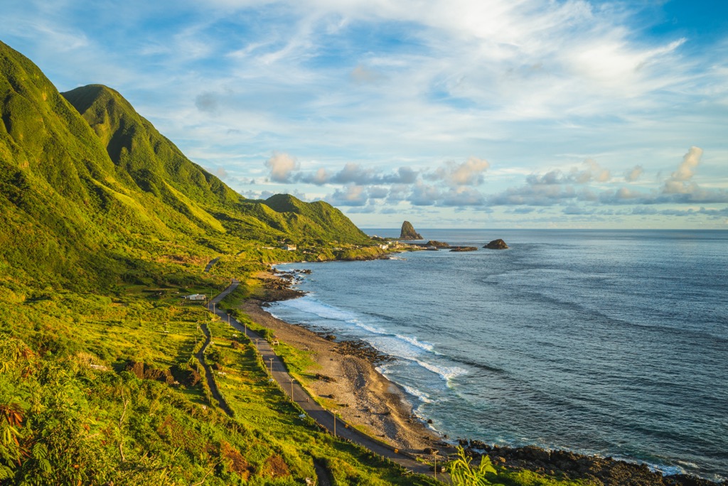
An untouched oasis on eastern Taiwan’s coastline, the Xuhai-Guanyinbi Nature Reserve (旭海-觀音鼻自然保留區) is a well-preserved coastal forest that holds 2 named mountains. Guanyin Shan (觀音山) is the highest hill, measuring 349 meters (1,145 ft).
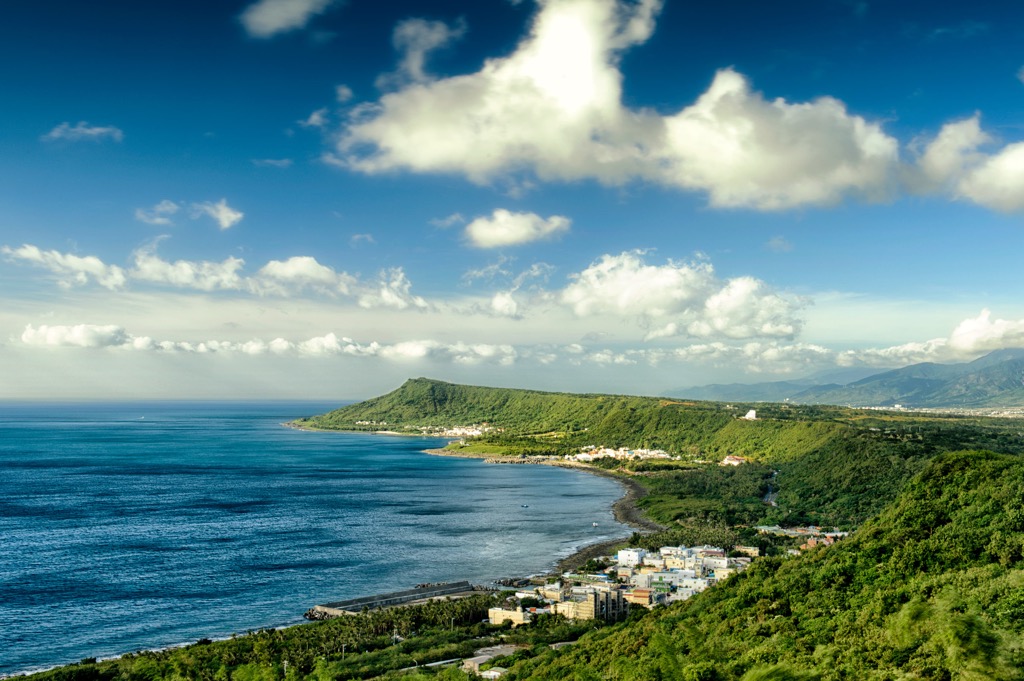
Xuhai-Guanyinbi Nature Reserve falls along Pingtung County’s (屏東縣) coastal Mudan Township (牡丹鄉). Situated just south of Taitung County’s (臺東縣) borders, the low-elevation nature reserve comprises a primitive coastal forest and shore area that covers 841 ha (2,078 ac).
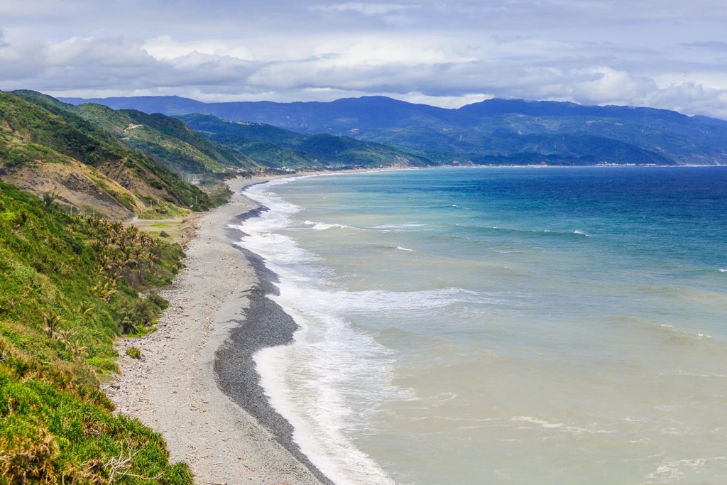
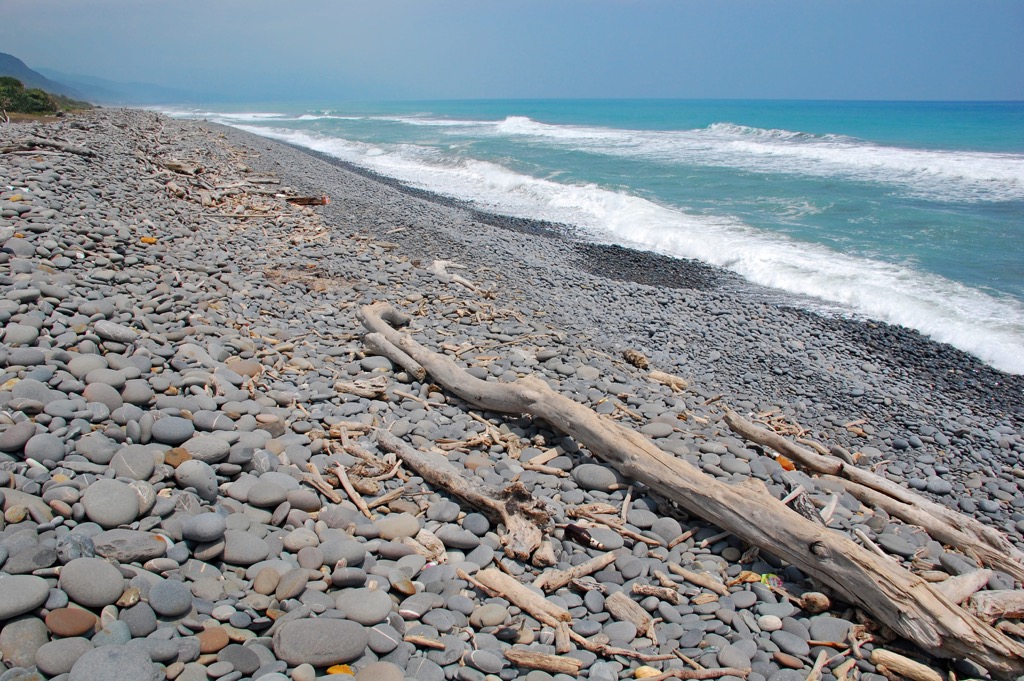
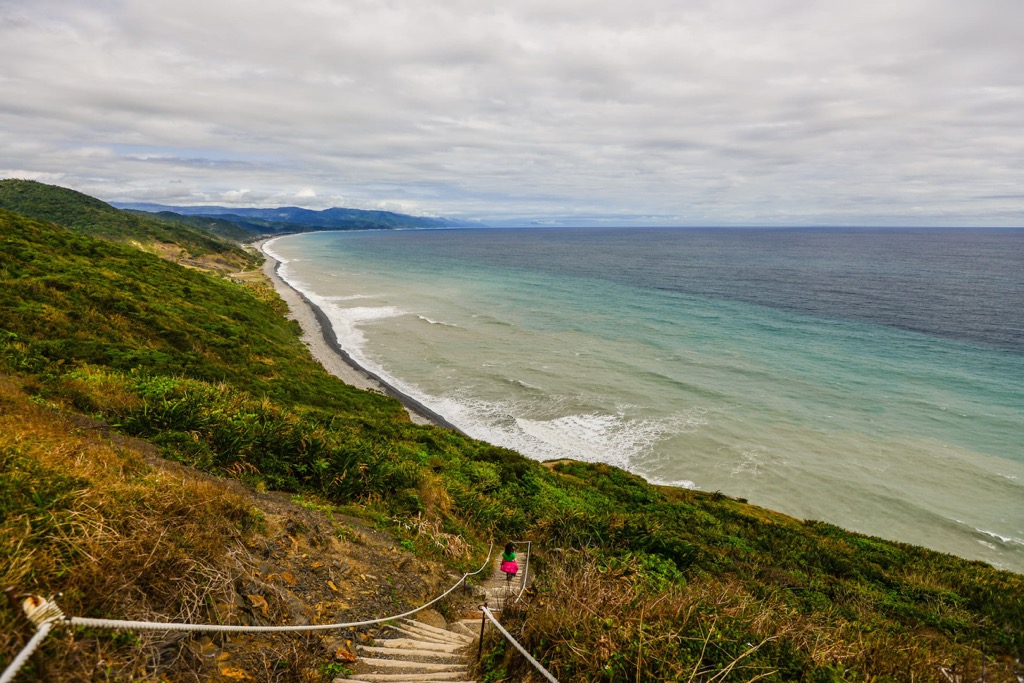
This region of southeast Taiwan is remote and receives few visitors; thus, human interference is low. However, one nature walk passes through this area, the Alangyi Ancient Road (阿郎壹古道). Trekking along here allows you to admire the pristine landscape of eroded seacliffs, pebble bays, and a gentle terrain that looks onto the subtropical rainforest of inner Pingtung County.
You can climb the two coastal hills of Guanyin Shan and Guanyinbi (觀音鼻), and then bathe in the Xuhai Hot Springs (旭海溫泉). During seasons of high rainfall, you’ll see streams flowing down the rolling terrain towards the Pacific Ocean. This is mainly during the summer months when typhoon season threatens its drastic downpour on Taiwan’s land.
As the Xuhai-Guanyinbi Nature Reserve lies on the coast, the region has a tropical monsoon climate and a yearly rainfall of 2,034 mm (80 in). One of the warmest areas in Taiwan, the region enjoys a pleasant annual average of 77°F (25°C). January dips to 69°F (20.3°C), while July has a high of 83°F (28.6°C).
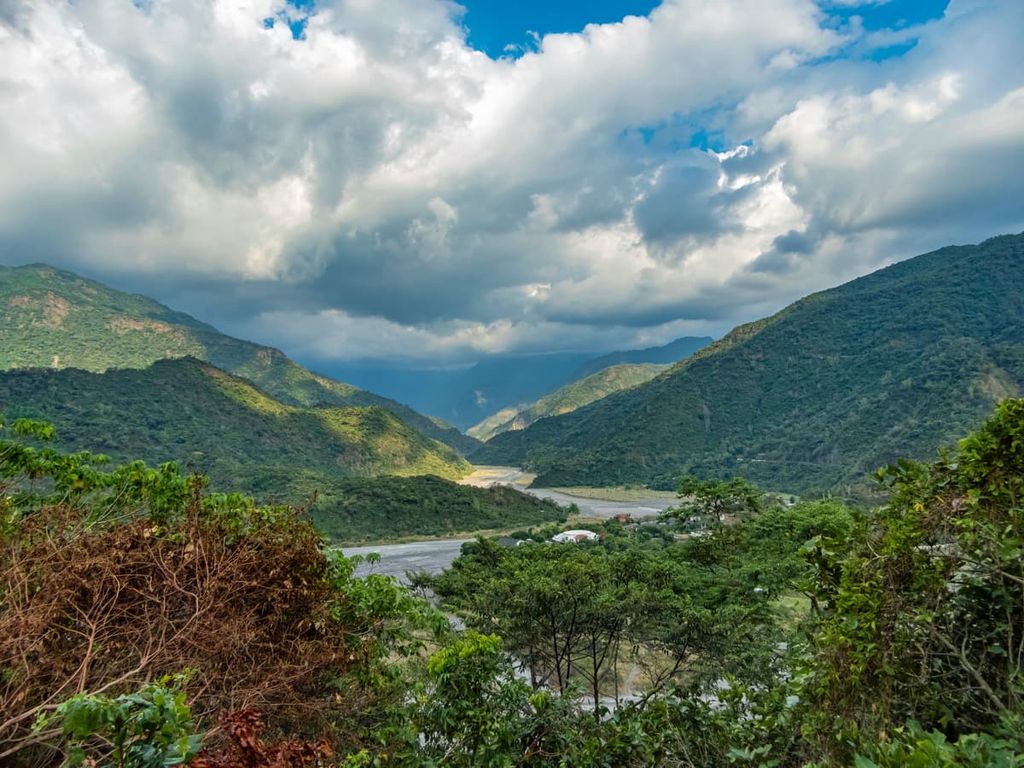
While the nature reserve lies away from Taiwan’s populated areas, there are well-known parks, forests, and other nature reserves nearby. Shuangliu National Forest (雙流國家森林遊樂區) is to the west, and Nanren Mountain Ecological Reserve (南仁山生態保護區) lies to the south. To the east is the Pacific Ocean, while to the north is the Dawu Mountain Nature Reserve (大武山自然保留區).
Guanyin Shan and Guanyinbi are uplifted land that now forms coastal hills. The rock strata are a mix of quartzite, hard sandstone, and metamorphic rocks. Two formations stretch across the Xuhai-Guanyinbi Nature Reserve, the northern Chaozhou and southern Mudan formations.
Due to sea erosion, there are many sea caves, cliffs, weathered rocks, and potholes on the rock. On the beaches, Nantian stone covers the shore. These stones have a smooth texture from the seawater weathering down these rocks.
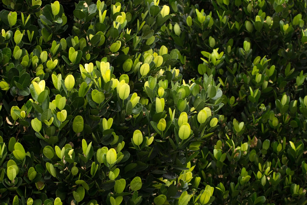
Xuhai-Guanyinbi Nature Reserve has a coastal forest of Fagaceae laurels featuring beech, oak, and flowering plants of Hengchun fumu (Garcinia multiflora Champ) and Eluanbi wild lily.
Along the bay, rare wildlife species such as green turtles and the coconut crab inhabit the land. There are also sightings of birds, such as the rare eight-colored bird. The nature reserve is also home to mammals, such as minks, civet cats, and Taiwan mongoose. Other not-too-common animals that you may see are ferret badgers and crab-eating mongooses.

The Alangyi Ancient Road that passes through Xuhai-Guanyinbi Nature Reserve has historical significance. Since the north-south crossing path opened in 1874, Taiwan’s southern tribes of the Paiwan, Pingpu and Amis people have walked the road to trade goods.
However, once the Mudan Incident occurred in 1874 in Pingtung, the Qing government set up controls along the Alangyi Ancient Road. The Mudan Incident involved Paiwan people murdering stranded Okinawan sailors after a shipwreck along Pingtung’s southern coast.
To retaliate, the Japanese avenged the Paiwan, slaughtering a Paiwan village. Thus, the Mudan Incident caused tension between the Qing government, who controlled Taiwan, and the Japanese. After the Sino-French War, Qing officials abandoned their posts, and thus Taiwan’s southern indigenous tribes could freely pass through the Alangyi Ancient Road again.
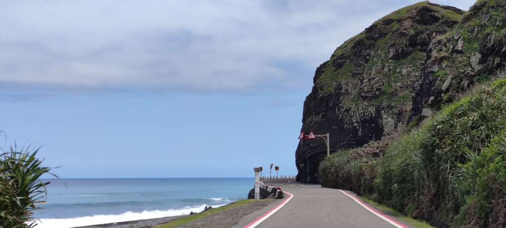
Another bit of history of the Xuhai-Guanyinbi Nature Reserve is that during the Second World War, the Japanese military bombed parts of the rock cliffs. Therefore, some areas around Guanyinbi are not accessible during high tide, as you have to walk up the coastal hill to continue your walk along the nature reserve.
The major hiking trails and areas in and around Xuhai-Guanyinbi Nature Reserve are:
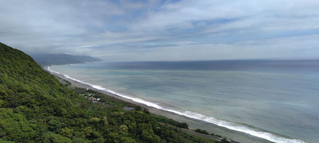
Discover Taiwan’s wild coastal road that stretches 12 km (7.4 mi) between Nantian Village (南田村) of Taitung County to Pingtung County’s Xuhai Village (旭海村). The deep blue ocean views are constant throughout the trek as you cross pebble beaches and climb gentle terrain when high tide spills onto the shore.
On the highest points of the journey, such as climbing Guanyin Shan, you can gaze onto the Xuhai-Guanyinbi Nature Reserve’s inland subtropical rainforest. On top of Guanyin Shan, you’ll also notice the nearby hills of Nantian Shan (南田山), Qigu Balin Shan Dongfeng (耆古巴林山東峰), and Taihe Shan (太和山).
Try to spot green turtles swimming in the intertidal zone and pay close attention to coconut crabs on the stony bays. Also, you’ll notice many wonderful and whimsical rock formations weathered by the fierce ocean.
Simplistic and functional, Xuhai Hot Springs’ bathing pools are the ideal answer after a day spent hiking and wandering. Indulge in a relaxing and soothing warm soak in the carbonated water at 113°F (45°C). Feel the bubbles rejuvenate and smoothen your skin, and you’ll leave looking radiant from the water’s healing contents.
After your indulgent bath, you can explore Xuhai’s Paiwan village, filled with local delicacies and surrounded by verdant nature. Or you can head to the nearby Mudan Bay to splash about in the waves on the fine gravel beach.
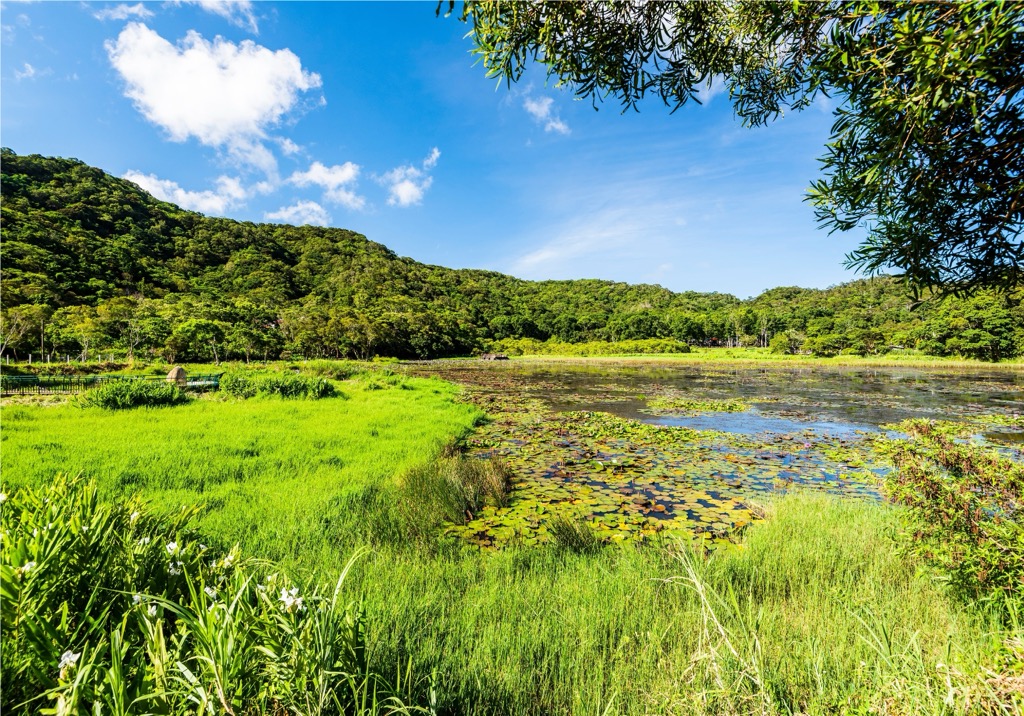
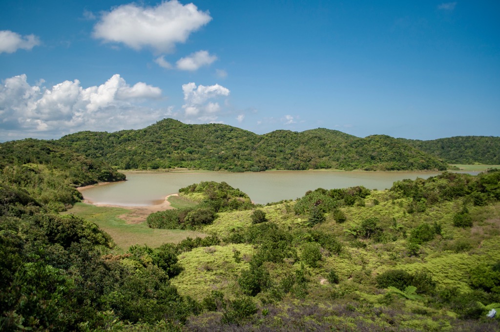
Explore the lush mahogany woodlands and wetland ecology of Dongyuan Forest Recreation Area (東源森林遊樂區). For a scenic walk, visit Dongyuan Lake, covered in lotus flowers and with willow trees encircling the pool.
As you head to the lake, you’ll pass a flowering trail of wild ginger that blooms milk blossoms during the summer months. Pay close attention to swallowtail butterflies crossing your path in the wild mahogany forest as you progress towards Dongyuan Lake.
Visit the lakeside viewing platform for an elevated perspective of the pond and to admire the hilly terrain undulating in the background. From here, you can also spot the nearby hills of Taihe Shan, Mudanbi Shan (牡丹鼻山), and Shangmudandong Shan (上牡丹東山).
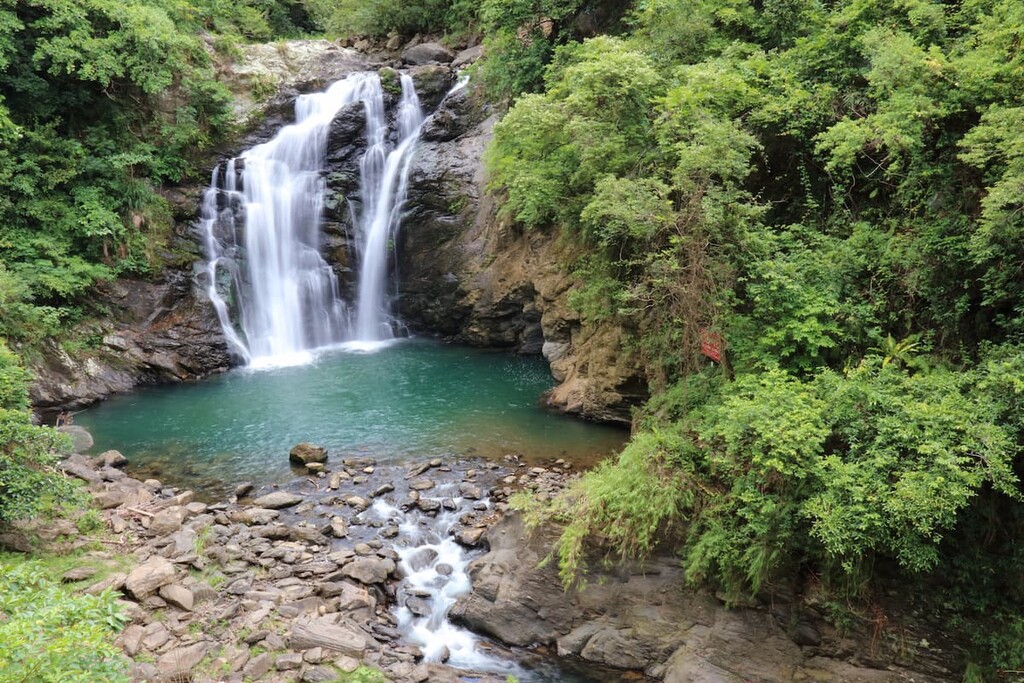
West of Xuhai-Guanyinbi Nature Reserve is Shuangliu National Forest, southern Taiwan’s garden of subtropical paradise. One of Shuangliu Forest’s beloved attractions is its show-stopping 25-meter (82 ft) waterfall, once voted Taiwan’s second most beautiful waterfall.
You’ll take the 3.2 km (2 mi) trail to Shuangliu Waterfall, wading through the ankle-deep Fenggang River and crossing a thriving Formosan ash forest. You’ll hear the Shuangliu Waterfall’s gushing roar before you witness the majestic sight. Streams of frothy rapids fall down the jagged cliff between leafy shrubbery.
Inhale the healing properties of Shuangliu Waterfall’s 9,350 negative ions, known for enhancing focus, clarity, and blood circulation. Once you’ve taken in the waterfall spectacle, continue the path to the white banyan forest with its embracing collection of aerial roots.
Limited to only 400 people per day to preserve the area’s primitive ecology, you’ll have to plan your trip beforehand. Home to over 1,200 vascular plants, the Nanren Shan Ecological Trial is a jungle of wild plants and raw beauty.
As you walk the 4 km (2.4 mi) path through a monsoon tropical rainforest, you’ll encounter precious wildlife in the fertile region. Tread carefully as frogs hop across the trail and listen out for the chirping cicadas and shrilling tweets of birdsong. Look above during winter to see grey-faced vultures migrating to southern Taiwan’s land.
You’ll reach Nanren Lake, a 28 ha (69 ac) freshwater pond, where you’ll spot the yellow-grey crab tilling soil on the lake’s edge. Wander around the primitive broadleaf forest that envelopes the lake for a peaceful stroll.
Below Xuhai-Guanyingbi Nature Reserve is Jiupenbitou’s (九棚鼻頭) open meadow. You’ll follow the Jiupenbitou River’s passage that leads to the Pacific Ocean, crossing the coastal grassland.
The easy 2.4 km (1.5 mi) path shows you undisturbed nature and wildlife along Taiwan’s east coast. You’ll obverse Taiwan sika deer grazing in the fields and water buffaloes at the river’s edge. As you look out onto the ocean, try and distinguish between the azure sky and the deep blue sea.
Bordering the grassy plains are lush forests of she-oak, lintou, and hawthorn trees for a shady respite from the unsheltered meadows of Himalayan fairy grass. Jiupengbitou is a beautiful spot to watch daybreak and dust as the sun glows over the endless Pacific Ocean.
Daren Township (達仁鄉) is the one of the nearby places to stay when visiting Xuhai-Guanyinbi Nature Reserve, while Taitung City (臺東市) is the closest urban center.
Considered as the primary region of southern Taiwan’s Paiwan people, Daren Township is a region full of cultural significance amidst a verdant wonderland.
One place that embodies Daren Township’s idyllic charm is Nantian Coastal Park (南田海岸親水公園). Remove your shoes and walk on the fine gravel beach, feeling the crunch underneath your feet. As you look out onto the turquoise expanse of the ocean, you can admire the wicker huts dotted along the seashore, adding interesting frames and shapes. Look out for the smooth and gray spotted Nantian stone around the beach area, for which this place is well-known.
Then, venture inland to the Dawu Keteleeria Nature Preservation Area (大武臺灣油杉保護區), where groves of 1,000 year old trees populate the emerald environment. A relic of the last glacial maximum, the Paiwan people bestow divine status onto these age old trees. As you trace the hilly terrain of the region, you’ll gain incredible views of Taiwan’s untouched land.
Another place to head out into nature is the Tjuwabal Paiwan Culture and Art Community (台東縣達仁鄉土坂村集會所). A Paiwan stronghold, engage with the cultural practises of Taiwan’s indigenous people, from their cuisine to their art and architecture. Examine the Paiwan’s incredible stonework, carvings, and paintings, and then sit down for a wholesome meal of the land’s vegetables. You can also visit Tuban Hot Springs and wander the fertile hiking trails of this scenic wilderndess.
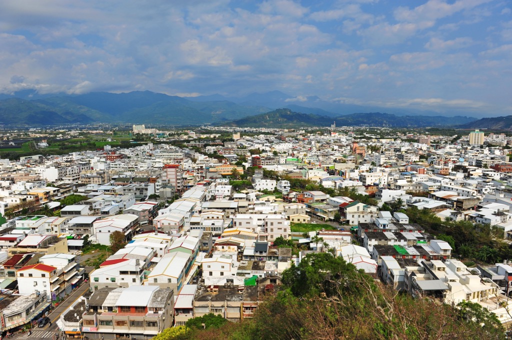
Southeasern Taiwan’s only city, Taitung City is both a major city and a lush jungle. As its one of Taiwan’s least connected cities, fewer tourists visit this enchanting oasis, which is how it retains its small-town, laid-back atmosphere.
Just north of Taitung City is the palm tree paradise of Dulan Forest (都蘭林場). Journey through the sheltered grove that opens up to display beautiful prospects over the ocean and coastal mountains. On your journey, you’ll stumble upon the Dulan site, a megalithic ruin of rock coffins and stone walls dating 3,000 years ago.
One of the best places to survey Taitung City’s green lungs is from Liyu Shan (鯉魚山). While only 76 meters (249 ft) tall, it’s a short climb for the most picturesque view. You’ll look out onto the Pacific Ocean washing onto the aquamarine shore and the verdant coastal hills undulating into Taiwan’s remote inland.
Finally, for the ultimate adventure, board the ferry in Taitung City to journey to the coral reef outcrops of Green (綠島) and Orchid islands (蘭嶼). Perfect for lazy beach days, snorkeling, fishing, and hiking around the leafy, tropical island, Green and Orchid islands are an ideal escape when you want to explore off the beaten track.
To get to Xuhai-Guanyinbi Nature Reserve, you first board the local express train (TRA) to Fangliao Station in Pingtung County. Then, you’ll take the 9189 Xiaowan bus from Fangliao to Checheng Farmer’s Association. Here, you’ll change to the 302 bus headed for the Xuhai Police Station. The Xuhai-Guanyinbi Nature Reserve is a 20 minute walk once you alight at the police station.

Alternatively, you can hire a car or scooter to make your own way there. It is a 69 km (43 mi) drive from Taitung City, and a 93 km (58 mi) journey from Pingtung City.


The highest peak in Xuhai-Guanyinbi Nature Reserve is Guanyin Shan, at 349 m.
Notable peaks in Xuhai-Guanyinbi Nature Reserve include Guanyin Shan and Guanyinbi.


