
Scan the QR code and open PeakVisor on your phone
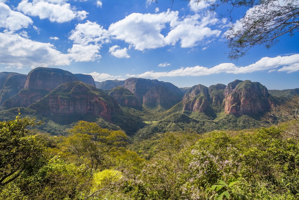
Parque Nacional Amboró (Amboró National Park) is a 4,425 sq km (1,709 sq mi) national park in central Bolivia, bordering the slightly larger Carrasco National Park to the west. It is one of 13 national parks in Bolivia. The park is incredibly biodiverse due to its location at the confluence of three distinct ecological regions: the Andes mountains, the Amazon basin, and the Gran Chaco lowlands. Amboró National Park is home to 18 named mountains. The highest is Cerro Calizonudo (2,726 m / 8,944 ft), while the most prominent is Cerro Agua Blanca (2,588 m / 8,491 ft), which boasts 513 meters (1,683 ft) of prominence.
Amboró National Park is located in the far west of Santa Cruz department and is home to several distinct ecological regions, including the plains of Dry Chaco, the southwest Amazon moist forest, the Bolivian montane dry forest, the Chiquitano dry forest, and the tropical Yungas forest belt and cloud forests at higher elevations.
Amboró is in the sub-Andean belt of Bolivia’s Eastern Cordillera, in a region known as the Bolivian Orocline or “Elbow of the Andes,” where the north-south range angles west towards Peru and Ecuador before continuing north.
Though there are only 18 named summits, the park is extremely mountainous. Elevations range from 300 meters (984 ft) to 2,726 meters (8,944 ft) at the summit of Cerro Calizonudo in the west. However, most of the park’s land area lies between 1,000 (3,280 ft) and 2,000 meters (6,561 ft).
Amboró National Park is rich in water resources, with numerous rivers and streams crisscrossing the landscape. Major rivers like the Yapacaní, Mamorecillo, and Guapay originate and flow through the park, forming a variety of sub-basins that support a wide range of aquatic and terrestrial life and play a critical role in the ecosystem.
The climate in Amboró National Park varies significantly due to its broad range in elevation. The Yungas belt, cloud forests, and other sub-Andean areas experience an extremely humid climate, with heavy rainfall (up to 4000 mm / 157 in annually). In contrast, the southern lowlands are extremely arid, with only around 600 millimeters (24 in) annually. There are also temperate regions with pronounced seasonal variations in the middling elevations.
The primary geological process that shaped Amboró National Park was the Andean orogeny, the mountain-building event that formed the Andes range. An orogeny is a tectonic process in which part of the earth's crust is folded and deformed by lateral compression, creating a mountain range; orogenies are responsible for the creation of most of the world’s major mountain ranges. The Andean orogeny started in the Jurassic period (~150 million years ago) and intensified during the Cenozoic era. It saw first the Nazca Plate and then the Antarctic Plate subducting beneath the South American Plate, pushing it upwards. This tectonic activity has not only uplifted the Andes Range but also caused significant volcanic activity and the formation of complex fault systems.
As mentioned above, Amboró is part of the Bolivian Orocline, where the north-south Andes range begins to curve west. The orocline’s formation is believed to have occurred during the Cenozoic era, particularly from the Eocene to the Miocene epochs. The specific mechanics are still a subject of research. Still, they involved a combination of factors, including changes in the angle or rate of subduction and the resistance of the South American continental crust to the compressive forces exerted by the subducting Nazca Plate.
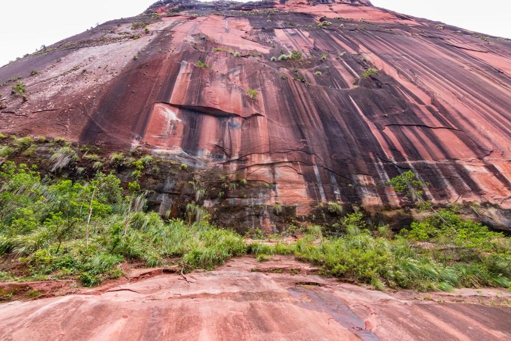
The varied topography of Amboró National Park has influenced the deposition of different sediments. In the lower areas, particularly in the Amazon Basin proximal regions, sedimentary deposits from fluvial and lacustrine environments are prevalent. These sediments include clays, sands, and organic-rich soils that support the lush vegetation of the rainforests. Older metamorphic and igneous rocks typical of the Andean core, such as gneisses and granites, are found in higher regions. These rocks have been exposed to intense pressure and temperature changes, leading to their metamorphosis over millions of years.
Volcanic activity has also played a significant role in shaping the landscape of Amboró National Park. The park's proximity to the Andean volcanic belt means that volcanic deposits are found in certain areas, contributing to the mineral-rich soils that support diverse plant life. Erosion, too, has sculpted the landscape over time. Water, wind, and gravitational forces have eroded rocks and soils, creating the park's numerous valleys, gorges, and steep slopes. The erosive power of the rivers, especially during the rainy season, has been particularly influential, carving out deep channels and transporting sediment.
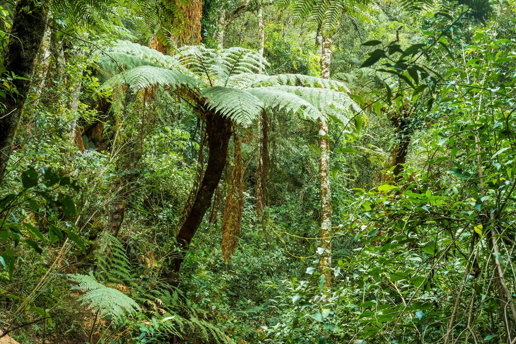
Amboró’s varied topography and climatic diversity support a wide variety of plant and animal species, making the park a hotspot for biodiversity. It is arguably one of the most diverse national parks in the entire world, with over 3,000 documented plant species, though most experts agree the actual number lies between 4,000 and 5,000. For perspective, that is about the same number of plant species as the whole of France, a country about 125 times larger than Amboró.
Notable species of flora include “mara” or Bolivian mahogany (Swietenia macrophylla), q'illu q'illu (Berberis bumaelifolia), mountain pine (Podocarpus spp.), Bolivian walnut (Juglans boliviana) and palms like pachiuva (Socratea exorrhiza) and açaí (Euterpe precatoria), as well as the endangered palma bendita (Ceroxylon sp. C.parvum).
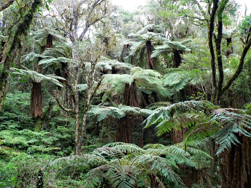
The lowlands also support numerous orchid species (~500), giant tree ferns, and endemic cacti. One notable example is the mighty Cereus (Cereus lamprospermus subs. colosseus), which can reach maturity at over 15 meters (50 ft).
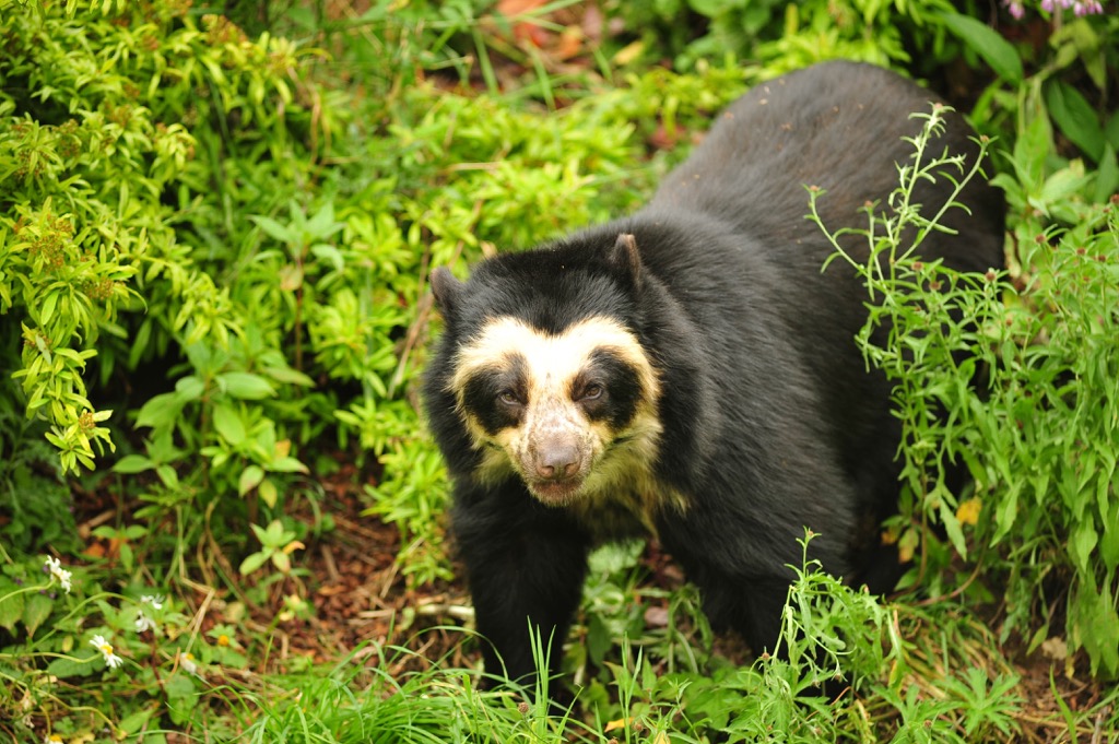
Notable species of flora include the “jucumari” or spectacled bears (Tremarctos ornatus), which are the only bear species native to South America, along with jaguars (Panthera onca), giant anteaters (Myrmecophaga tridactyla), military macaws (Ara militaris), harpy eagles (Harpia harpyja) toco toucans (Ramphastos toco), and horned curassow (Pauxi unicornis). Over 800 known bird species live in the park, the highest concentration of avian life anywhere in the world.
Initially, the area around Amboró National Park was inhabited by indigenous groups, including the Guarani, Chane, and Yuracare peoples. These groups lived in harmony with the dense forests and abundant wildlife, utilizing the region’s resources for sustenance and medicinal purposes. Their connection with the land is evident through various archaeological sites throughout the park, featuring rock paintings and ancient ceremonial sites.
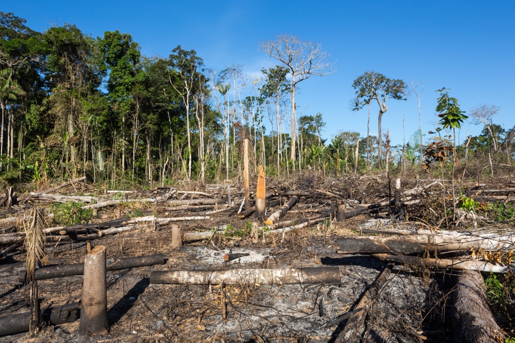
With the arrival of the Spanish in the 16th century, the region's dynamics began to change significantly. Spain’s conquest introduced new economic activities, such as agriculture and logging, altering the landscape. Over the centuries, as Bolivia underwent various political and economic transformations, the exploitation of Amboró's natural resources intensified. By the 19th century, as Bolivia's political landscape stabilized after its independence (1825), the exploitation of natural resources increased nationwide.
The decision to establish Amboró—first as a protected area in 1973 (Reserva de Vida Silvestre German Bush) and then a national park in 1984—was part of a broader national and international movement towards environmental conservation. The designation as a national park curtailed logging and other destructive activities by promoting conservation, responsible tourism, and sustainable use practices.
Amboró is one of the oldest national parks in Bolivia, along with Sajama (1939), Isiboro Sécure (1965), Tunari (1978), and Noel Kempff Mercado (1979). Initially only 1,800 sq km (695 sq mi), it expanded to over 6,300 sq km (2,432 sq mi) in 1991 but was reduced back to its current land area of 4,425 sq km (1,709 sq mi) in 1995.
Since its establishment, Amboró National Park has increasingly been managed not only with a focus on preserving its natural ecosystems but also accommodating the needs and rights of the local communities living on its borders.
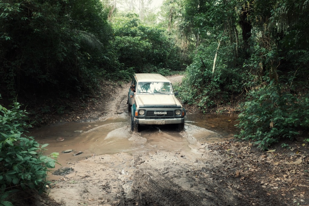
Even in the 21st century, Amboró National Park remains rugged and remote. Like all Bolivian national parks, it’s also technically illegal for foreigners to enter without a guide. Visiting during the dry season (May to September) is best to avoid washouts and muddy trails.
Visitors can access Amboró from the north (highlands and jungle) or south (arid lowlands). If coming from the south, most enter from the town of Samaipata (a three to four-hour drive from Santa Cruz de la Sierra). In the north, access is typically from Buena Vista (a two-hour drive from Santa Cruz). Park passes for foreigners are available for 100 Bolivianos ($15). Below are a few popular trails you can ask your guide about.
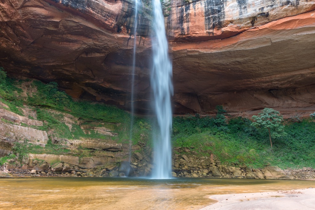
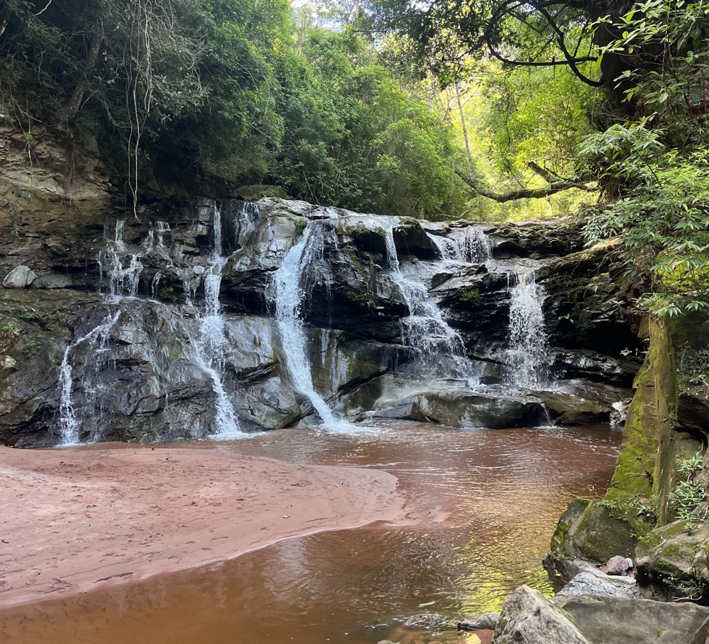
This short trail passes scores of brightly colored bromeliads and orchids, as well as multiple waterfalls. It takes most hikers around an hour and is best visited from June to November to see the orchids in full bloom.
This three-hour hike involves a lot of elevation gain but is very popular among birdwatchers and leads to a spectacular viewpoint.
This four-hour hike links up two popular trails, the Parque and Condor routes, and rewards hikers with a striking view of Refugio Los Volcanes and the surrounding picturesque landscapes. It crosses the Elvira River multiple times, passing giant ferns, massive bibosi (Ficus insipida) trees, and scores of orchids.
There are a number of villages ringing Amboró National Park, but most visitors enter through the charming town of Samaipata (pop. 5,000) to the south. Rife with cobblestone streets and colonial buildings, the town has a rich wine culture, with three large established wineries. It is known for its relaxed, bohemian vibe, with a variety of cafes, small shops, and guesthouses that cater to an international crowd. The local market and eateries offer a taste of the region's agricultural produce, with fresh fruits, vegetables, and regional dishes.
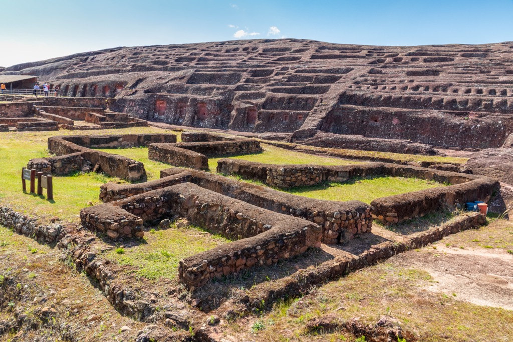
In addition to serving as the most popular gateway to Amboró, Samaipata is known for the nearby El Fuerte de Samaipata archaeological site. Dating to 300 CE, El Fuerte served military, religious, ceremonial, and residential functions for several indigenous peoples, including the Chané, Inca, and Guarani, as well as Spanish colonizers.
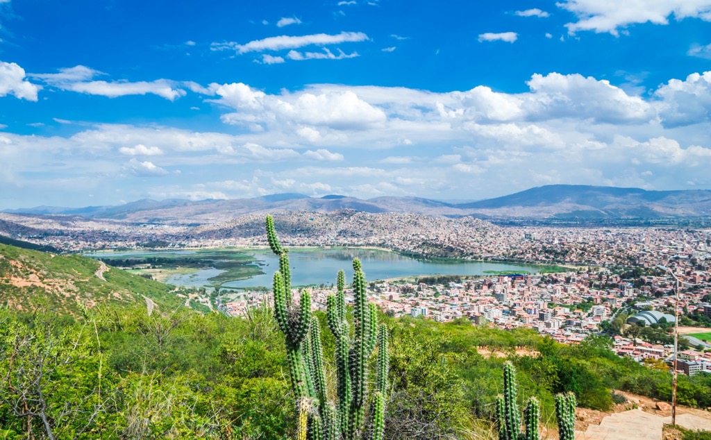
Santa Cruz de la Sierra (pop. 1,500,000), due east of Amboró, is the closest major city to the national park and the largest city in Bolivia. As the nation’s economic powerhouse, Santa Cruz has an outsized contribution to national GDP, primarily due to the heavy production of oil and gas, as well as agricultural products. The city produces 35% of the nation’s GDP and is the target of 40% of all direct foreign investment.
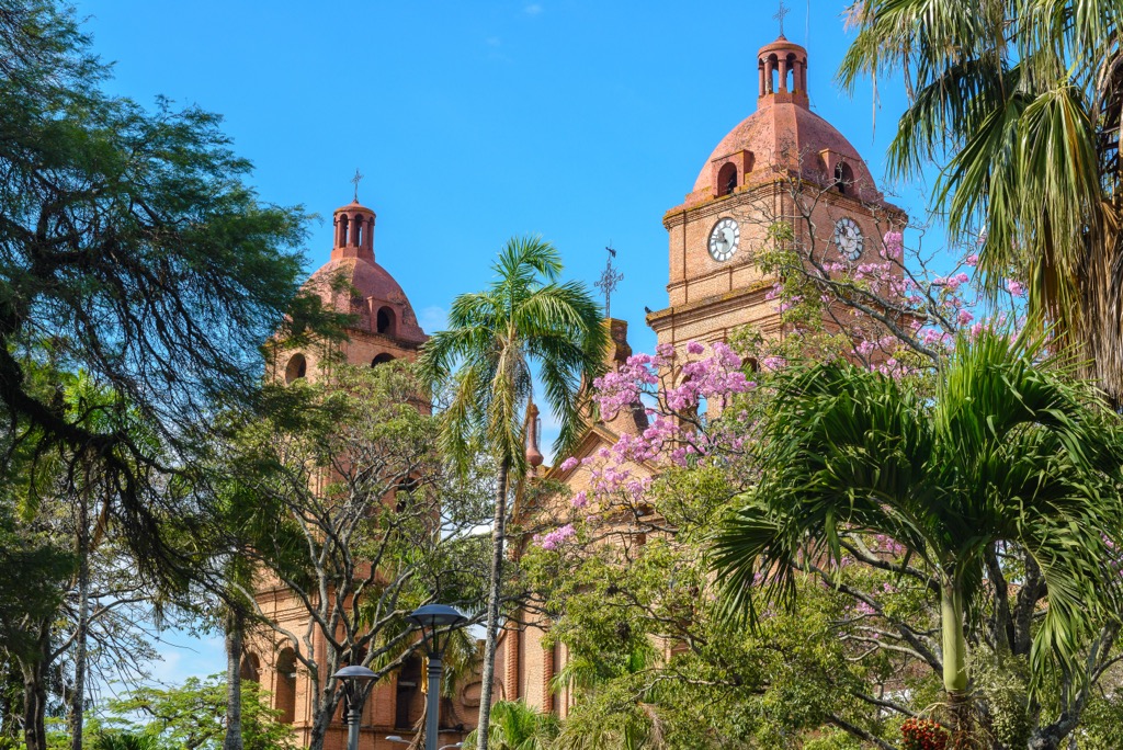
Santa Cruz is characterized by its rapid growth and modernity, contrasting with the more historical capitals in Bolivia, like Cochabamba (below). Like many South American cities, Santa Cruz is a melting pot of cultures, with a dynamic mix of indigenous, European, and other international influences, reflected in its vibrant culinary scene and nightlife. One notable attraction is the Cathedral Basilica of St. Lawrence. Located in Santa Cruz’s central square, this cathedral was built in the late 16th century. Another spot to check out is the Biocentro Güembé, an ecological park featuring a butterfly dome, orchid greenhouse, and several swimming pools. The park is home to many species of birds, fish, and other wildlife.
From Santa Cruz, the eastern border of Amboró is less than a half-hour drive, but reaching popular southern entrances like Samaipata will take several hours. To the north, Buena Vista is a bit closer, at 90 minutes to two hours.
Cochabamba (pop. 630,000), often referred to as the “City of Eternal Spring” due to its mild climate, is 260 kilometers (162 mi) west of Amboró National Park and the fourth largest city in Bolivia. Cochabamba is renowned for its rich cultural heritage, blending indigenous Quechua and Aymara with colonial influences.
A hub of political and social activism, Cochabamba was also the site of the “Bolivian Water War” in 2000, which saw heavy protests and violence in response to the privatization of the city's municipal water supply. The riots were pivotal in national policy changes regarding resource management.
Cochabamba is an important agricultural center. Thanks to its fertile soil, it produces a variety of crops, including potatoes, corn, and fruit. It also hosts one of the largest open-air markets in South America, La Cancha, where locals and tourists can find anything from fresh produce to traditional textiles.
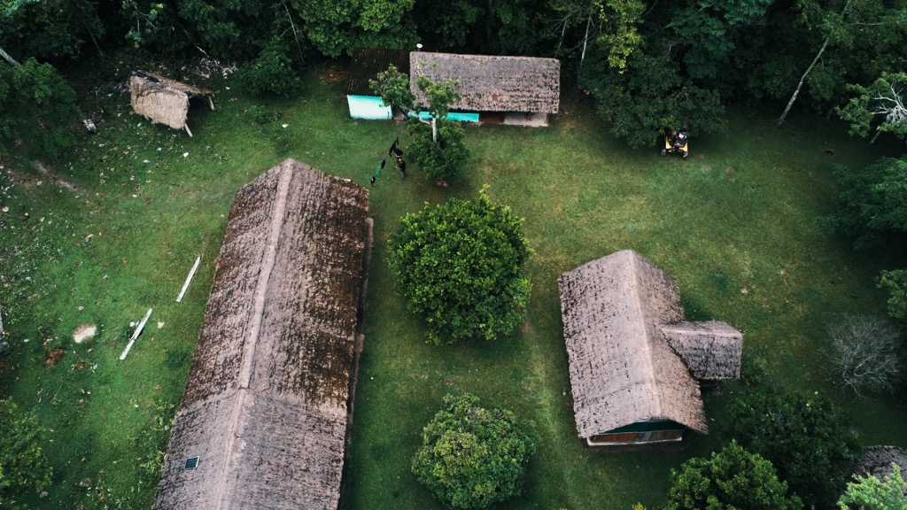
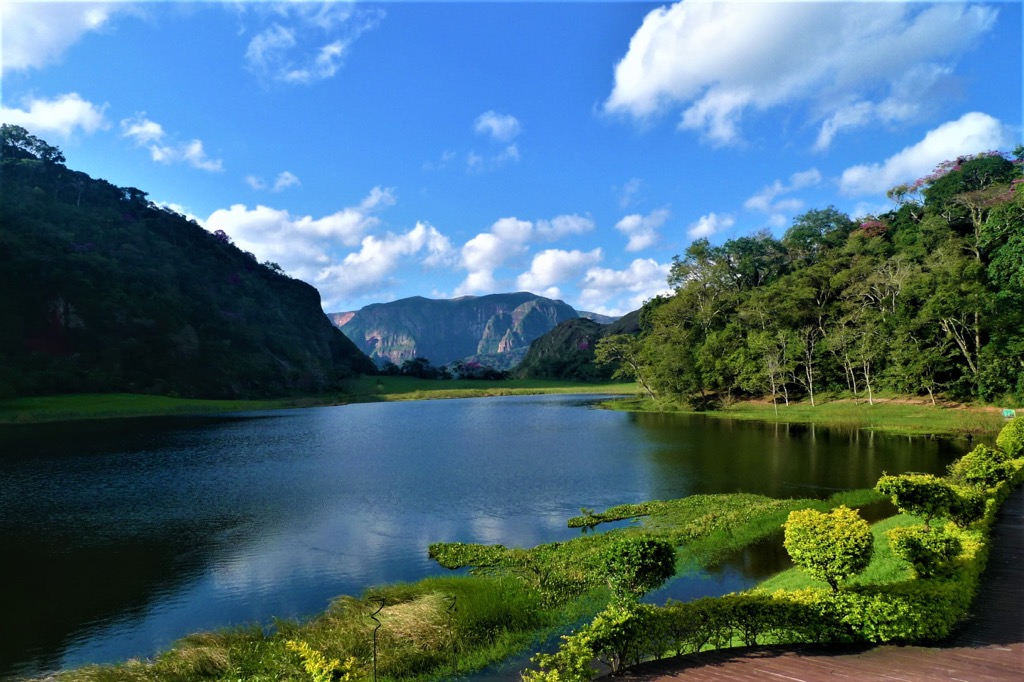
There are various accommodation options in and around the national park, including luxury lodges and rustic homestays. Check out Mataracú Tent Camp, La Chonta Lodge, and Villa Amboró on the north side and Refugio Los Volcanes or La Yunga Eco Lodge on the south side.


