Scan the QR code and open PeakVisor on your phone
Located on the southern central border of Costa Rica lies the Parque Internacional La Amistad. The park is the largest National Park in all of Central America as it spans throughout both Costa Rica and Panama protecting biodiversity within the Mesoamerican Biological Corridor. Between the two countries the Parque Internacional La Amistad spans 1,544 square miles. The park is split roughly between the two countries with slightly more being located within Panama.There are 35 named mountains in Parque Internacional La Amistad (Costa Rica). The highest and the most prominent mountain is Kamuk at 11,627 feet with 4,393 feet of prominence.
The biodiversity within the park is important to both the country’s ecosystems but also the planet as a whole. Designated as a UNESCO World Heritage Site, the park is surrounded by a 9 mile buffer zone. The buffer zone is more accessible with parts of it being used to farm coffee, catte, and indigenous practices. A vast majority of the park is relatively unexplored except for research purposes. Major explorations took place in 2006 and led to the discovery of over 12 new plant species, 15 amphibians, three reptiles, and one new dung better species.
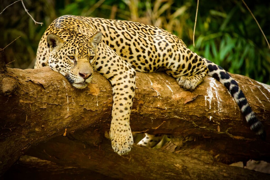
The vast park is home to a variety of other wildlife including five large cats. Pumas, jaguars, ocelots, margays, and jaguarundis roam throughout the Parque Internacional La Amistad, often going much of their life without encountering humans. Besides big cats, the park is home to monkeys, sloths, anteaters and over 600 species of birds. While there are no main roads throughout the park, the region is home to three indigenous tribes, Bribri, Ngobe-Bugle, and the Naso.
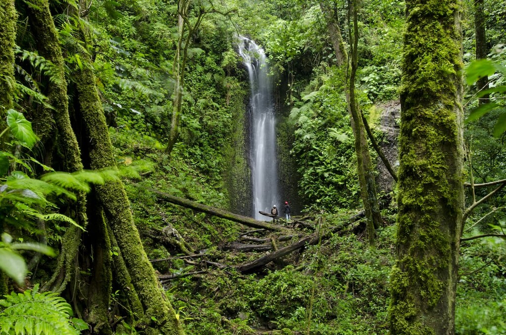
Researchers estimate that over two thirds of the plant and animal species in Costa Rica can be found within the biodiverse park. The park is home to one of the largest remaining sections of forest within Central America and within the Talamanca Mountains. The geography of the park ranges from lush forests up to the rugged mountain summits. Various forests thrive within the park including tropical lowland rainforest, montane forest, oak forest, and cloud forest. Much of the biodiversity of the region is due to Central America acting as a land bridge over millions of years between North and South America. The Talamanca Mountains are home to over 14,000 species of plants including over 1,000 different fern species.
Because the park is so important to biodiversity, there are few, if any, maintained trails throughout. Access to the park is limited and hikes are not regularly marked. Guided hikes are available for hire as well. Besides guided hikes, the few trails can be found starting at the Altamira Ranger Station. The park headquarters are located on the soutwestern park boundary.
Cerro Kamuk: Located at the core of the park, Cerro Kamuk is not explored very often. The trail to access the summit is 32 miles roundtrip and begins in Tres Colinas, a small mountain community located outside of Portero Grande. There are three campsites throughout the trail and all groups are required to have a local guide. The trail follows the main ridgeline through the mountains before reaching the summit.
Sendero Gigantes del Bosque: Leaving from the Altamira Ranger Station this short trail is just 3 miles long. The trail gets its name from the massive trees that tower over 100 feet above. Along the route lie two lookout towers, one for wildlife viewing while the other looks out over the surrounding landscape of the park.
Sendero Valle del Silencio: For a long trail, the Sendero Valle del Silencio totals 8.5 miles through the lush forest before climbing to the base of Cerro Kamuk. At the base of the mountain lies a campground though the hike can also be completed as a day trip. Due to the remote nature of the trail, a local guide is required.

Located an hour and a half from the park headquarters lies the city of Buenos Aires. The city has a population of around 22,000 and lies along the Pan-American Highway 2. The town sits near the Chirripo National Park, Hitoy-Cerere Biological Reserve and the La Amistad International Park. The semi-remote town is popular amongst tourists who want to w=see the nature that the country has to offer. Twelve miles outside of the city lies the largest tribal reservation in the nation for the Boruca, which spans60 square miles.
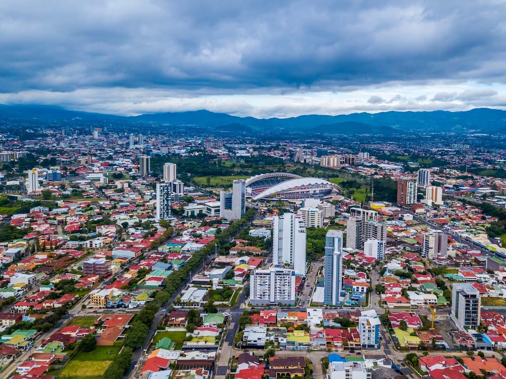
The largest city in the country is San Jose, which also happens to be the capitol. The metro population of the area is estimated to be 2.1 million people. The central location of the city allows for travelers to have easy access to all regions of the country. San Jose is known for being one of the safest major cities in Latin America and its focus on sustainability. Typical food throughout Costa Rica, and within San Jose, consists of gallo pinto, a mixture of beans and rice. From the capitol city, tourists have access to all of the major regions and National Parks that Costa Rica has to offer.