
Scan the QR code and open PeakVisor on your phone
The Monti Picentini, with its sublime mountains and vistas, is one of Italy's hidden hiking gems. There are 146 named mountains in Monti Picentini Regional Park. The highest and most prominent mountain is Monte Cervialto (1,809 m/5,935 ft).
Monti Picentini Regional Park (Parco Regionale dei Monti Picentini) is an area of protected countryside located in southwestern Italy. Monti Picentini Regional Park encompasses an area of approximately 622 sq km (240 sq mi) within the region of Campania.
The park's centers around the Monti Picentini, a mountain range located between the provinces of Avellino and Salerno. The Monti Picentini form a part of the Campanian Apennines within the 1,400 km (870 mi) long Apennines.
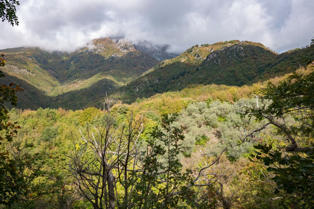
Monti Picentini is heavily forested, with several significant rivers originating from high in the mountains. Visitors are attracted to Monti Picentini not just due to the mountains but its waterfalls and caves.
The only significant lake in Monti Picentini Regional Park is Laceno Lake (Lago di Laceno), near the ski resort of Laceno. Notable rivers which spring from within the park include the Sele and the Picentino.
Monti Picentini Regional Park is located approximately 100 km (62 mi) to the east of Naples. Notable towns within Monti Picentini Regional Park include Acerno, Giffoni Valle Piana, Montella, and Volturara Irpina.
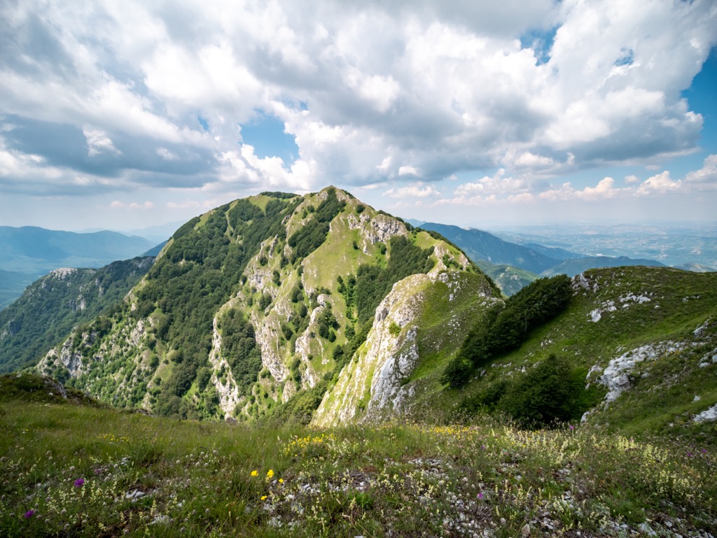
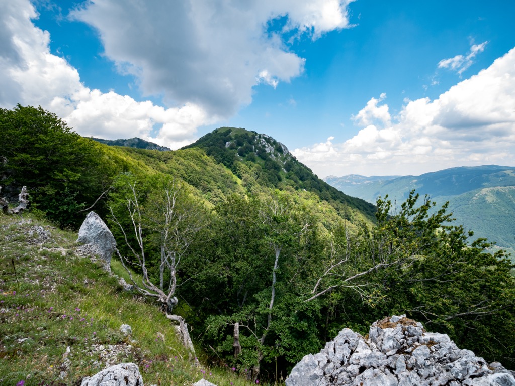
The Monti Picentini are composed primarily of dolomites and limestone. A central depression in the range where the Calore Irpino River meets the Tusciano River separates the Monti Picentini into two geologically different areas.
To the west of this central depression are mountains made up of dolomites. These mountains to the west have a harsher shape with rugged summits. To the east are mountains made up of limestone, which tend to be rounded. Both sides contain peaks exceeding 1,500 m (4,921 ft) in elevation.
Limestone is more common than dolomite across the range, with the mountains subjected to karst phenomenon. As a result, there are several caves across the range, such as Scalandrone Cave (Grotta dello Scalandrone).
The Campanian Apennines formed during the Apennine Orogeny, a mountain-building event that commenced approximately 65 million years ago during Cenozoic Era. The Apennine Orogeny came to a climax during the Miocene and Pliocene epochs between 2.6 and 23 million years ago.
The Apennine Orogeny was a fairly unusual orogeny caused by a fold and thrust-belt structure trending in three different directions: towards the Adriatic Sea, the Ionian Sea, and Africa.
The youth of this orogeny and the variety of rock types present are the main reasons the Apennines contain so many high and jagged mountains.
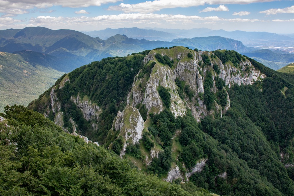
The highest summit in the Monti Picentini is Monte Cervialto (1,809 m/5,935 ft). Other notable mountains include Monte Terminio (1,806 m/5,925 ft), Monte Polveracchio (1,790 m/5,872 ft), and Monte Mai (1,607/5,272 ft).
The dense, lush forests of the Monti Picentini are home to a wide variety of flora and fauna. Read on to find out about Monti Picentini Regional Park's wildlife.
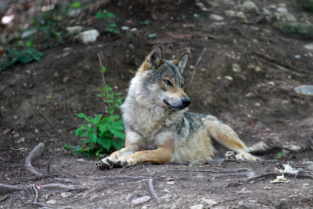
The Monti Picentini boasts important populations of several mammal species, including Apennine wolves and European wildcats. Other notable mammals in Monti Picentini National Park include badgers, foxes, pine martens, hazel dormice, and skunks.
The rocky cliffs and forests of the Monti Picentini support a large bird population with many fascinating species, including gold eagles, peregrine falcons, rock partridges, chough corals, hoopoes, and imperial ravens.
Several reptile species inhabit the Monti Picentini, with Italian three-toed skinks and common wall lizards widespread. There are also some rare and interesting amphibians in the park, like spectacled salamanders and yellow-bellied toads.
The forests and meadows of the Monti Picentini are home to hundreds of insect species. One of the rarest is the Alpine longhorn beetle, famed for its distinctive blue-gray markings.
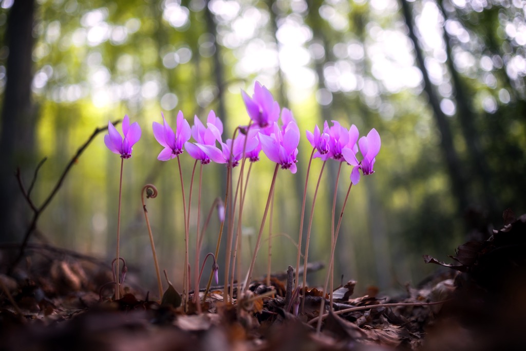
The flora of the Monti Picentini is especially rich, with approximately 1260 specimens, 8 percent of which are endemic to Italy. Monti Picentini Regional Park is home to a number of environments.
Beech and silver fir forests dominate the high mountain slopes. Mixed meso-Mediterranean forests are also common, containing maples, alders, downy oaks, hornbeams, sycamores, and manna ashes.
On the clifftop meadows of the Monti Picentini grow rare and endemic saxifrages, like Saxifraga ampullacea and Saxifraga porophylla.
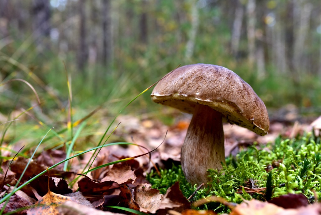
The Monti Picentini is excellent for foraging. Volturara Irpina, located at the foot of Monte Terminio, is famed for its truffles and porcini mushrooms.
Humans have been visiting and inhabiting the Monti Picentini since the Paleolithic period over 200,000 years ago. Evidence of humans from the Paleolithic period has been uncovered around the town of Montoro Superiore and Fisciano.
Human inhabitance of the Monti Picentini can be traced through prehistory, with traces of human existence around Eboli in the Neolithic period. Archeologists have also discovered remnants of the Gaudo culture and Oliveto Citra culture dating back to the Bronze and Iron Ages.
Seventeen archeological sites across Monti Picentini Regional Park show evidence of settlements built by the Hirpini, Picentes, and Etruscan civilizations.
Most of Monti Picentini's towns and villages were heavily affected by the Roman Empire. Giffoni Valle Piana, one of Monti Picentini's major settlements, was originally the ancient town of Picenza. Picenza was destroyed twice during the Roman conquest of southern Italy.
The name "picentini" derives from a term used by the Romans to describe the inhabitants of the mountains and the surrounding areas. It first appeared as a geographical name for the mountain range in the sixteenth century.
The Monti Picentini Regional Park was established in 1993 to protect the mountain range's fragile ecosystems and rich cultural heritage. The Monti Picentini's first paths were laid down in 1986.
With dramatic mountain climbs that afford panoramas of Campania, Monti Picentini Regional Park is one of southern Italy's most underrated hiking destinations.
Before hiking in Monti Picentini Regional Park, ensure you map out your route, bring appropriate clothing, and plenty of food and water. Check weather forecasts and inform others of your itinerary.
Read on to learn about some of the best hikes in Monti Picentini Regional Park.
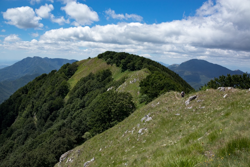
The highest mountain in the Monti Picentini, Monte Cervialto (1,809 m/5,935 ft), is located not far from the ski resort of Laceno, making it popular with hikers. The weather is highly changeable atop Monte Cervialto, so pay close attention to local weather forecasts when planning your excursion.
One of the best routes to the summit of Monte Cervialto is from Colle del Leone (1,234 m/4,048 ft). Slightly along the road from the Colle del Leone is a wooden sign and a clear path up Monte Cervialto.
The initial path is wide and gravelly, making it difficult to get lost. The final 300 m (984 ft) ascent to the summit of Monte Cervialto is signposted with red and white Club Alpino Italiano (CAI) markers. This final stretch is a short steep hike up a rocky grassy slope.
From atop Monte Cervialto, you'll be able to glimpse Lake Laceno in the distance. This trail is approximately 6.8 km (4.2 mi) in length.
Monte Terminio (1,806 m/5,925 ft) is the second-highest mountain in Monti Picentini Regional Park. Located in the northwest of the park, Monte Terminio towers over the nearby towns of Solofra and Volturara Irpina. Monte Terminio is popular with tourists thanks to its foraging opportunities.
Several routes lead to the summit of Monte Terminio, and one of the quickest is from the mountain's south. You can pick up this trail from the Bucaneve Restaurant near the Il Piccolo Ranch equestrian center.
You'll need to follow a mule track in the direction of the Rifugio Montano Acqua degli Uccelli (1,421 m/4,662 ft) crossing the plateau of Campolaspierto. When the track ends, you'll follow the red and white CAI markers toward Monte Terminio.
The final leg of this walk exits the forests for the rocky peak of Monte Terminio. An old radio repeater marks the summit. The views to the east towards Solofra are especially beautiful. This trail is approximately 2.3 km (1.4 mi) in length.
Monte Polveracchio (1,790 m/5,872 ft) is popular due to the WWF-managed Polveracchio Oasis (Oasi Polveracchio). The oasis protects 2 sq km (0.8 sq mi) of beech forests. It’s nicknamed "wolf's oasis" as it's one of the last few places Apennine wolves can be found in southern Italy.
Monte Polveracchio is one of the best places to visit for nature watchers in Monti Picentini Regional Park. You can observe many rare species in the Polveracchio Oasis, including green woodpeckers, wild cats, and fire salamanders.
Several CAI paths lead up to Monte Polveracchio's summit, including CAI 107, CAI 108, and CAI 167. The CAI 108 is a longer route but is considered less arduous than shorter alternatives like CAI 107.
The trail starts at Casone del Gaudo (1,100 m/3,610 ft), heading southeast towards the Senerchia Forestry Barracks, which is located between Monte Polveracchio and Monte Boschetiello (1,578 m/5,177 ft).
Follow the mule track onto the northeast ridge, which leads to the summit of Monte Polveracchio. You can use the short CAI 107 for a quicker descent. This trail is approximately 6.5 km (4 mi) in length.
From the summit, you'll be able to see Vesuvius (Vesuvio) (1,281 m/4,203 ft) to the west, Monte Raiamagra (1,667 m/5,469 ft) and Monte Cervialto (1,809 m/5,935 ft) to the north, and Monte Accellica (1,660 m/ 5,446 ft) to the northwest.
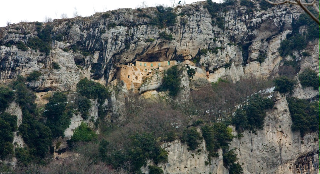
Pizzo San Michele (1,567 m/5,141 ft) is one of the most famous peaks in the Monti Picentini as it's topped with the highest sanctuary in Italy, the Sanctuary of Pizzo San Michele (Santuario di Pizzo San Michele). As the mountain is so popular with pilgrims and tourists that there's a short, well-beaten track leading to the summit.
From the Carpegna parking lot (Parcheggio di Carpegna), follow the Alta Via dei Picentini Occidentale, marked as CAI 115 and 116. The trail is wide, leading steadily uphill, passing the Statue of San Michele (Statua di San Michele) about halfway to the summit.
The terrace atop Pizzo San Michele affords 360-degree views, with the Lattari Mountains and the Gulf of Salerno visible. This trail is approximately 2 km (1.2 mi) in length.
It's possible to extend your walk along the Alta via Monti Picentini Occidentale to Monte Mai (1,607/5,272 ft). From Pizzo San Michele's summit, head west across Serra del Torrione (1,409 m/4,622 ft) to the Teglia Pass (Varco della Teglia) (1,460 m/4,790 ft) following CAI 116 A.
From the Teglia Pass, you'll walk southeast to the summit of Monte Mai. The Alta via Monti Picentini Occidentale is approximately 5 km (3.1 mi) in length.
Situated at the heart of the Monti Picentini, Monte Accellica (1,660 m/ 5,446 ft) provides some of the finest panoramic views in the entire range. The mountain is significant as its the source of several rivers, including the Picentino, the Tusciano, and the Calore Irpino, the latter of which is a tributary of the Volturno.
Hikes up this mountain are steep and unrelenting. The most popular trails are rated EE for experienced hikers, so don't attempt Monte Accellica unless you're well-prepared with appropriate hiking equipment and a GPS.
One of the most popular routes to the summit of Monte Accellica is following the 190 Cresta Nord Monte Accellica. From the Cara Rocchi on the Sentiero Italia, this trail skirts along the Sabato River to its source before climbing uphill through thick forests to the Colle Finestra (1,060 m/3,477 ft).
From the Colle Finestra, follow CAI 104 along the mountain ridge over Ninno dell'Accellica (1,538 m/5,046 ft) to the peak of Monte Accellica. From the summit, you'll be treated to views of the Ninno and Accellica Sud (1,606 m/5,269 ft), as well as the town of Bagnoli Irpino. This trail is approximately 5 km (3 mi) in length.
Quaint towns tucked away in valleys and sun-drenched seaside resorts await hikers visiting Monti Picentini Regional Park. Read on to learn about some of Monti Picentini Regional Park's main towns and cities.
Perched on the Amalfi Coast is the seaside city of Salerno. Salerno is located less than 50 km (31 mi) from the Monti Picentini Regional Park's center, making it the closest major city to the park.
Often overlooked in favor of Naples further up the coast, Salerno is surprisingly vibrant, with a historic city center, bustling trattorias, and one of the finest seafront promenades in Italy. It's also much more affordable than many surrounding towns and cities, which is ideal if you're hiking on a budget.
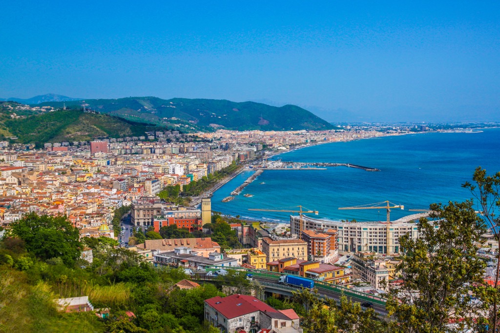
One of Salerno's must-see attractions is the eleventh-century Salerno Cathedral (Salerno Cattedrale), which features a crypt with relics of Saint Matthew.
Popular hotels in Salerno include Hotel Montestella, Grand Hotel Salerno, and Lloyd's Baia Hotel.
Giffoni Valle Piana is a small town resting on the southern boundary of Monti Picentini Regional Park. Despite its size, Giffoni hosts several unique annual events, like the world's largest children's film festival, the Giffoni Film Festival.
The most unusual event in Giffoni is the Tiro al Caciocavallo, where locals pay to shoot balls of caciocavallo cheese on a range. The best shooter wins a wheel of prosciutto. Giffoni is also an ancient settlement with some interesting historical sights, like the Castello di Terravecchia, which originated nearly 2,000 years ago.
Popular hotels in Giffoni Valle Piana include B&B Le Sorelle and B&B Ospiti a Corte.
Laceno is a small ski resort located in the northeast of Monti Picentini Regional Park. Laceno attracts skiers across Italy with its 13 pistes and 600 m (1968 ft) of vertical descents.
If you're looking for something to do in Laceno other than skiing, Lacenolandia amusement park is great for keeping kids entertained. Hiking opportunities near Laceno are among the best in Monti Picentini, with Lake Laceno and Monte Cervialto (1,809 m/5,935 ft) right on your doorstep.
Popular hotels in Laceno include Grand Hotel Grisone and Hotel Ristorante La Lucciola.
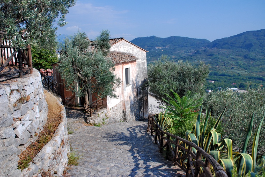
If you're planning an excursion west of the Monti Picentini, consider visiting Solofra. Solofra is a great base from which to hike up several mountains, including Monte Pergola (852 m/2,795 ft) and Monte Terminio (1,806 m/5,925 ft).
Solofra's main attraction is the Collegiate Church of San Michele Arcangelo (Collegiata di San Michele Arcangelo), a sixteenth-century church lavishly decorated in Baroque style. Solofra Castle (Castello di Solofra) is worth visiting if you enjoy hiking off the beaten path.
Popular hotels in Solofra include Solofra Palace Hotel & Resort and the Serena Rooms.


