Scan the QR code and open PeakVisor on your phone
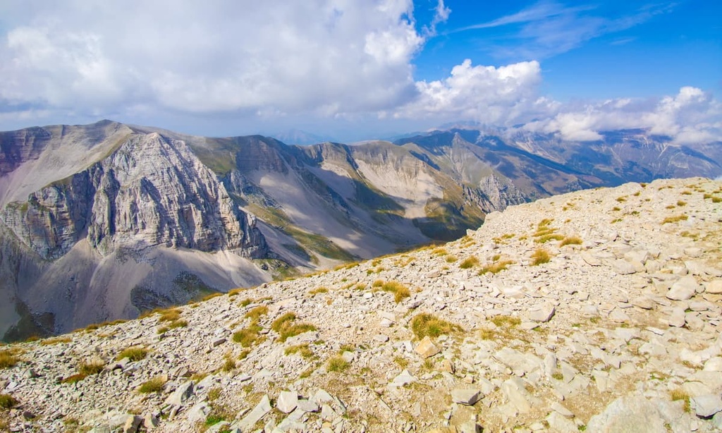
Escape civilization and climb the highest mountains in the remote Umbria-Marche Apennines when you visit Italy’s Monti Sibillini National Park. There are 192 named mountains in Monti Sibillini National Park. The highest and the most prominent mountain in the park is Monte Vettore (2,476 m/8,123 ft).
Located in Central Italy, Monti Sibillini National Park (Parco Nazionale dei Monti Sibillini) covers an area of approximately 714 sq. km (276 sq. mi) across the regions of Marche and Umbria.
The park's landscape is dominated by the Sibillini Mountains (Monti Sibillini) of the Umbria-Marche Apennines (Umbro-Marchigiano Apennines). The Sibillini Mountains are a part of the Apennines, which is an extensive mountain range that stretches for 1,200 km (750 mi) along the spine of Italy.
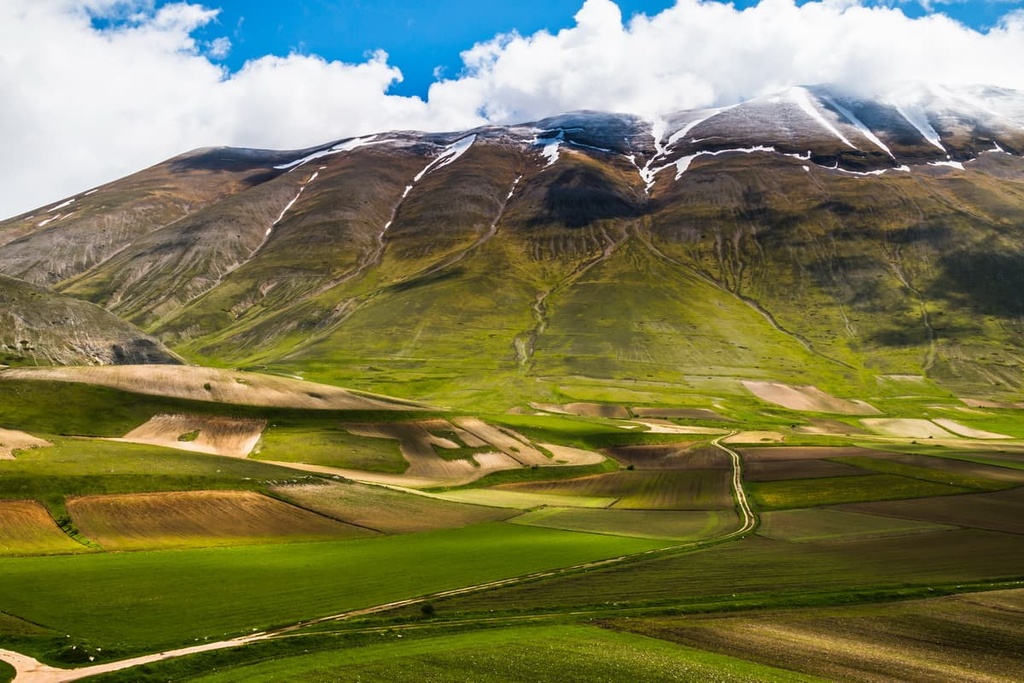
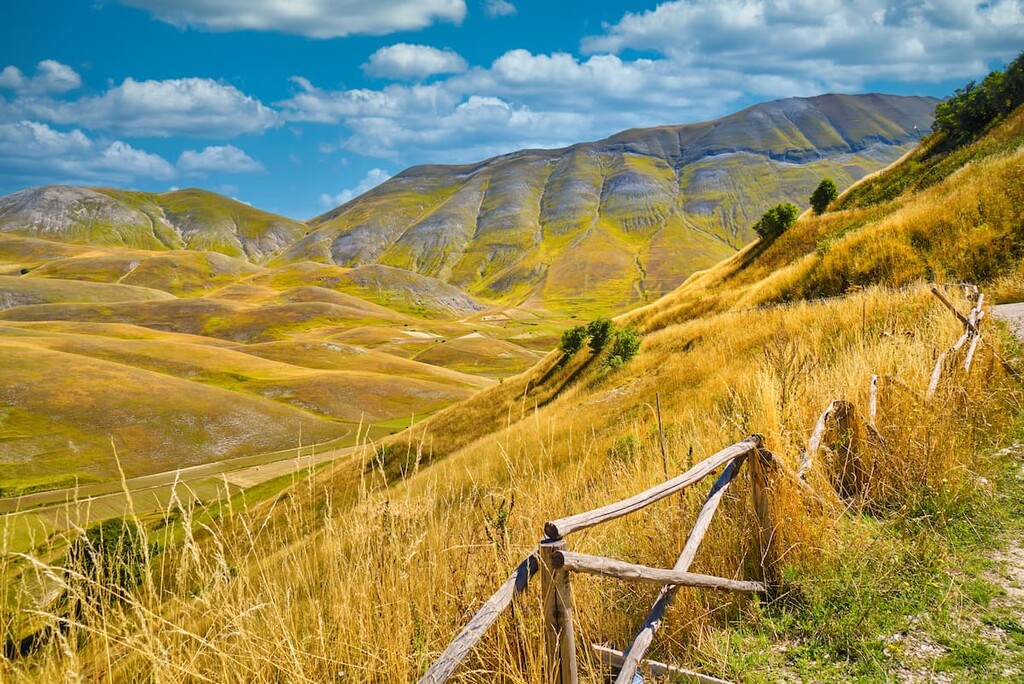
The Monti Sibillini are verdant and high in elevation, with mountains interspersed by lush U-shaped valleys and river gorges. Over two dozen peaks with the Umbria-Marche Apennines exceed 2,000 m (6,561 ft) in elevation. The range contains Monte Vettore (2,476 m/8,123 ft), one of the top ten tallest mountains in the Apennines.
Several significant rivers flow through Monti Sibillini National Park, the most notable of which is the 116-km (72-mi) long Nera, the major tributary to the Tiber. The 70 km (43 mi) Tenna River is also notable for having carved out the popular Gola dell'Infernaccio (Hell’s Gorge). The largest and only lake within Monti Sibillini National Park is the Lago di Fiastra reservoir, which is fed by the Fiastrone River.
Monti Sibillini National Park is located near several other parks and borders, such as Gran Sasso and Monti della Laga National Park (Parco Nazionale del Gran Sasso e Monti della Laga) to the south. Other nearby parks include the Natural Regional Park of Gola della Rossa and Frasassi and Monte Cucco Park.
Due to the park's rugged landscape, most settlements in the region are small hilltop villages and towns. Many of the park’s settlements are now abandoned due to the 2016 earthquakes that rocked the region.
Notable settlements in the park that are still inhabited include Castelluccio, Norcia, and Montemonaco. The nearest major city is Perugia, the capital of Umbria, which is located approximately 90 km (56 mi) to the northwest of the park.
The Monti Sibillini formed approximately 200 million years ago during the Mesozoic Era. The landscape consists of a succession of sedimentary rocks.
The park's west side consists of marl and limestone, while the east side consists of marl and sandstone. These rocks formed when the area lay underneath an ancient and warm shallow sea. During this time, sediment from dead marine animals settled onto the bottom of the sea, accumulating over millions of years to form the limestone and sandstone that we see today.
The area's marl formed about 50 million years later due to deposits of calcareous sediment and tectonic movement. During this period, the Monti Sibillini were affected by deep sea carbonate sedimentation, which saw the mixing of limestone and clay into marl.
Later, the Monti Sibillini were uplifted by the Apennine orogeny, a mountain-building event that happened in several stages starting approximately 65 million years ago during the Cenozoic Era. It came to a climax in the Miocene and Pliocene epochs between 25 and 2 million years ago.
Due to the presence of a large number of faults along the western edge of Apennines, seismic activity is common along the whole of the Apennine range. In fact, over 40,000 seismic incidences have been recorded since 1,000 CE.
Seismic activity is especially common around Monti Sibillini National Park. Many towns, including Visso and Arquata del Tronto, were extensively damaged during Italy's 2016 earthquakes.
Today, Monti Sibillini National Park features some of the highest summits in Central Italy, many of which are included in the CAI's (Club Alpino Italiano) Apennine 2000, a list of over 240 “collectible” peaks across the Apennine range.
Popular summits to climb within Monti Sibillini National Park include Monte Sibilla (2,173 m/7,129 ft), Cima del Redentore (2,448 m/8,031 ft), and Monte Bove (2,112 m/6,929 ft).
The unspoiled landscape of the Monti Sibillini is a nature lover's paradise, home to a wide range of intriguing flora and fauna. Habitats across the landscape range from subalpine grasslands to beech forests to glacial lakes.
Among the 50 mammal species present in Monti Sibillini National Park are chamois and Apennine deer. After disappearing for decades, both species have been successfully reintroduced to the area. Apennine deer were missing from the park for approximately 200 years.
Monti Sibillini National Park has served as a refuge for Apennine wolves for decades after nearly going extinct in the wild during the 1970s. Conservation projects have led to a growth in their population and range. There are now an estimated 400 to 500 Apennine wolves in Italy.
Another elusive and fascinating predator native to the Monti Sibillini is the European wildcat. Other fascinating mammals in the Monti Sibillini include crested porcupines, snow voles, and roe deer.
The Monti Sibillini are popular with bird watchers as over 150 species inhabit the area. One of the most popular sights is the golden eagle, which has begun nesting in long-abandoned areas of the park since its establishment. Other notable birds of prey in the park include goshawks, peregrine falcons, and Eurasian eagle owls.
Dozens of other smaller bird species make nests on the cliff tops and in the beech forests of the park. Commonly spotted species include southern rock partridges, Alpine choughs, and wallcreepers.
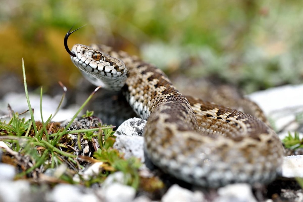
The Orsini viper, the smallest viper in Europe, is extremely rare in the region. It is considered to be vulnerable by conservationists, but it can be found in the Monti Sibillini. Its range spans from France, Germany, and Italy into Central Europe, but is quickly shrinking.
One of the most interesting endemic species within Monti Sibillini National Park is Chirocephalus marchesonii. Chirocephalus marchesonii is a species of fairy shrimp found only in Lago di Pilato, a glacial lake in a U-shaped valley between Monte Vettore (2,476 m/8,123 ft) and Cima del Redentore (2,448 m/8,031 ft).
The ecological systems across Monti Sibillini National Park change with elevation. Below 1,000 m (3,280 ft) in elevation, the landscape is dominated by forests of ash, downy oak, and black hornbeam. Higher up the mountainsides, beech forests take over. Above 1,700 m (5,577 ft), pastures and alpine grasslands replace the woodlands.
There are approximately 1,800 plant species found within Monti Sibillini National Park. The park's alpine pastures feature swathes of vibrant wildflowers, including edelweiss, martagon lilies, pasque flowers, and orchids.
Several plant species can be found growing out of the scree on the mountainsides, including Drypis spinosa, Isatis allionii, and alpine toadflax. Ephedra nebrodensis and Carex disticha are two plant species rarely found anywhere else in Italy other than Monti Sibillini National Park.
Monti Sibillini National Park has a fascinating history that’s rooted in religion and mythology. The mountain group takes its name from Sibilla or Sibyl, an ancient prophetess named the “queen of the fairies” who is said to have lived in a cave on the side of Monte Sibilla (2,173 m/7,129 ft).
The legend has medieval origins in local cults though the first notable written account of Sibilla was from Antoine de La Sale in the fifteenth century.
Many knights and cultists visited the Cave of Sibilla throughout the Middle Ages and Renaissance, hoping to uncover the secrets of the prophetess. Explorers documented the cave in the eighteenth century before it collapsed entirely in the 1960s.
Lago di Pilato, which is home to the endemic Chirocephalus marchesonii, holds an important place in history and folklore. Known in English as Lake Pilate, Lago di Pilato is said to be where Pontius Pilate was killed and buried for his role in the Passion of Christ.
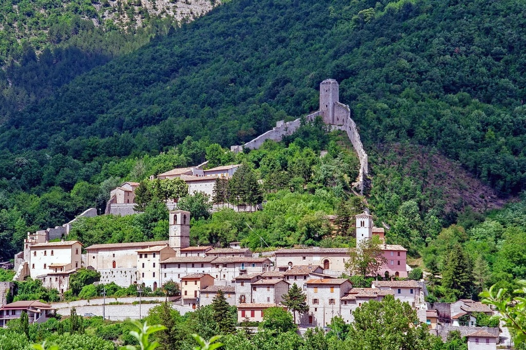
Many of the towns across Monti Sibillini National Park date back to prehistory. Visso, once the seat of Monti Sibillini National Park but now in ruins due to the 2016 earthquakes, dates back to the thirteenth century BCE.
The Romans conquered Visso in the third century BCE and named it Vicus Elacensis. It's now one of the prettiest ghost towns in Italy, with its medieval town plan and Renaissance mansions.
Monti Sibillini was designated a national park in 1993 to protect the park's cultural heritage and unique and unspoiled habitats. The Ente Parco Nazionale dei Monti Sibillini manages the park.
Due to the area's high elevation and seismic activity, Monti Sibillini is an exciting yet potentially risky place to plan a hiking adventure.
There are paths that lead up the tallest mountains in the park, though many of these peaks are covered in snow and are prone to avalanches. In addition, the 2016 earthquakes have made some hillsides unstable, and landslides sometimes occur.
Before setting out on a hike, check with local authorities to ensure each route on your itinerary is open. Many of the most popular trails are listed on the park's website, with a smiley face system denoting which routes are currently open. A local guide is highly recommended to hikers with limited knowledge of the area.
The park's paths follow the CAI's trail rating scale, which is explained here. Read on to learn about some of the main hiking areas and trails within Monti Sibillini National Park.
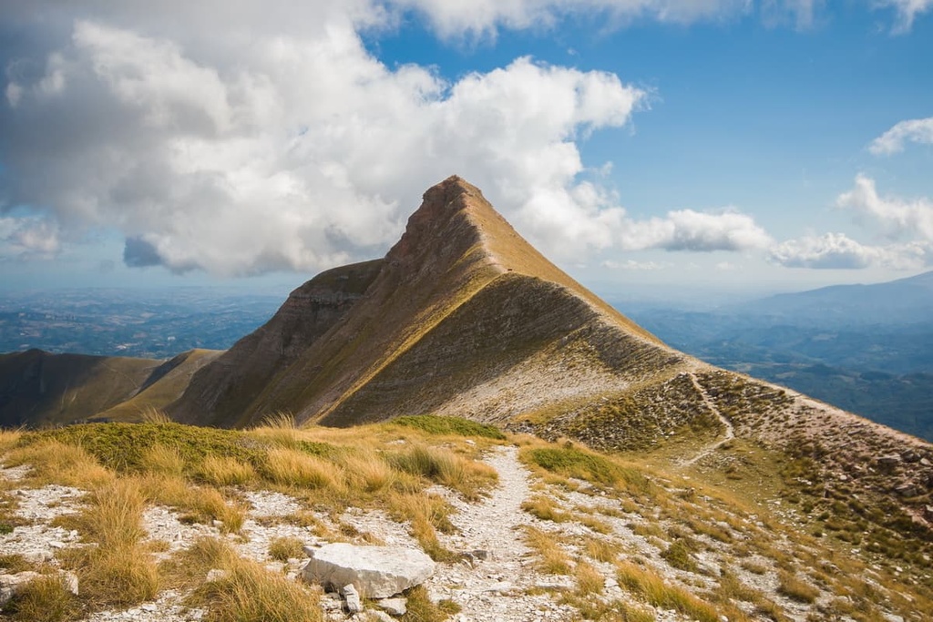
Monte Vettore (2,476 m/8,123 ft) is the highest mountain in the Monti Sibillini and the ninth-highest peak in the Apennines. Monte Vettore is also of great historical importance due to the presence of Lago di Pilato between Monte Vettore and Cima del Redentore (2,448 m/8,031 ft).
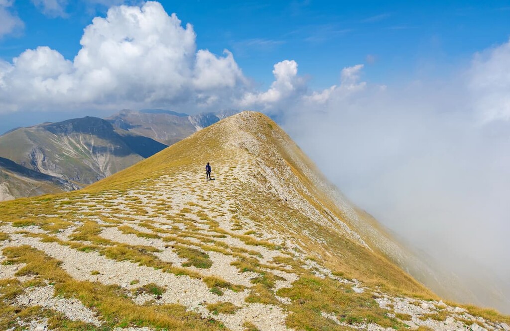
As a result, Monte Vettore is very popular with expert hikers who are looking to scale the most significant summits in the Apennines. Following damage done by the 2016 earthquakes, the best way to scale Monte Vettore is on the trail from Arquata del Tronto on the park's shared southern boundary with Gran Sasso e Monti della Laga National Park.
The trail leads through chestnut groves to Forca di Presta. From Forca di Presta, hikers can reach the summit of Monte Vettore. A detour is required between Camartina and Vena dei Corvi due to earthquake damage. This walk takes about 5 hours one way and is rated EE for experienced hikers by the CAI.
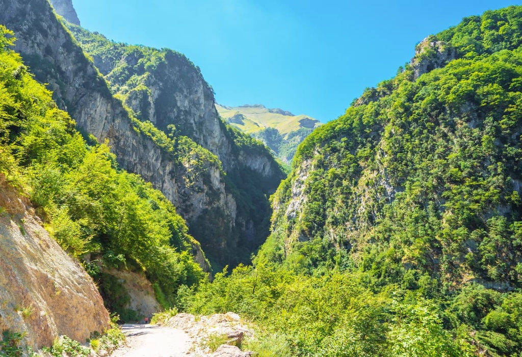
The Gola dell'Infernaccio (Hell's Gorge) is one of the most popular and beautiful gorges in the Umbria-Marche Apennines.
Carved by the Tenna River, the Gola dell'Infernaccio is easily accessible and offers sweeping views of the Tenna Valley. At the center of the Gola dell'Infernaccio is the Hermitage of San Leonardo al Volubrio, an ancient monastery and pilgrimage site.
One of the best ways to experience the gorge is on the trail from the Parcheggio Valleria, Infernaccio car park. This trail leads through the entire gorge towards the Passo Cattivo. This linear walk takes about 4 hours to complete one way and is rated EE for experienced hikers by the CAI.
Shrouded in mystery and folklore, Monte Sibilla (2,173 m/7,129 ft) is the ideal hiking destination for anyone looking to uncover the "Versante della Magia" or “magical side” of Monti Sibillini National Park.
Monte Sibilla was the site of the Cave of Sibilla, the supposed refuge of the prophetess, Sibyl. Standing at over 2,000 m (6,561 ft) in elevation, Monte Sibilla offers some of the best views in the southeastern part of the park, with Monte Priora (2,333 m/7,654 ft) to the north and Monte Porche (2,233 m/7,326 ft) to the southwest.
The best way to scale Monte Sibilla is from the rifugio Sibilla (1,540 m/5,052 ft). Note that this trail is partially damaged between Monte Sibilla and Cima Vallelunga (2,221 m/7,286 ft), so check with the park authority before attempting this hike. The walk takes 4 hours in total and is rated EE for experienced hikers by the CAI.
Monte Bove (2,169 m/7,116 ft) is one of the most striking mountains in the Monti Sibillini, with its sheer dolomitic cliff faces. It's very popular with visitors as it was where Apennine chamois were reintroduced to the park and is still one of the best places to see this iconic species.
The best way to scale Monte Bove is from the nearby village of Ussita. The trail leads to both of Monte Bove's summits, Monte Bove Sud (2,169 m/7,116 ft) and Monte Bove Nord (2,112 m/6,929 ft).
Note that a section of the trail around Val di Bove is closed due to damage by the 2016 earthquake. That said, the section from Monte Cornaccione (1,770 m/5,807 ft) to Monte Bove is still open. This walk takes approximately 5 hours to complete and is rated EE for experienced hikers by the CAI.
Located in the south of the park near Norcia, Monte delle Rose (1,861 m/6,106 ft) is highly recommended by local guides. The trail takes hikers through various environments, from beech forests to alpine pastures. The summit of the mountain also provides sweeping views across the entirety of Monti Sibillini.
There's a trail that leads from the picnic area at Forca di Ancarano. The trail passes through the Grotta di Patino on the way to the summit of Monte delle Rose.
Due to seismic activity, part of this trail has been closed, so check the conditions before visiting. The walk takes around 6 hours to complete and is rated EE for experienced hikers by the CAI. If this route is closed, Monte delle Rose is reachable along the Grande Anello dei Monti Sibillini (Great Ring of the Sibillini).
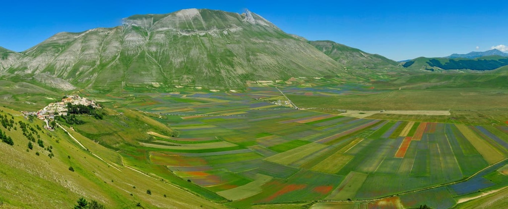
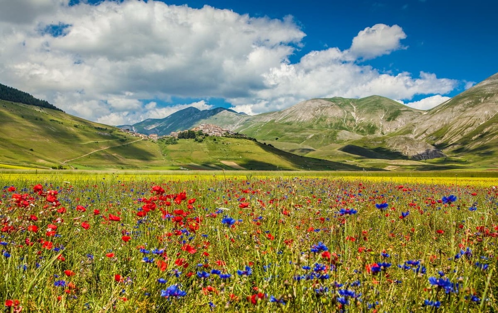
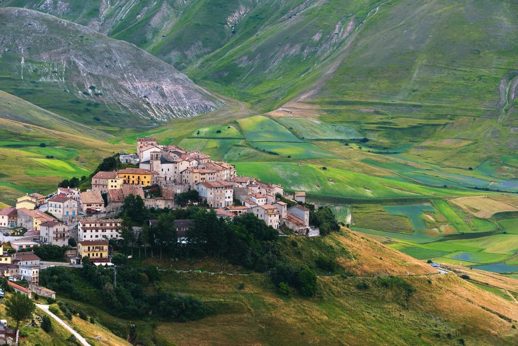
The Piano Grande is one of the most spectacular areas of Monti Sibillini National Park. This 16 sq. km (6 sq. mi) plateau sits at over 1,219 m (4,000 ft) in elevation and is encircled by many of the highest mountains in the Monti Sibillini, including Monte Vettore (2,476 m/8,123 ft).
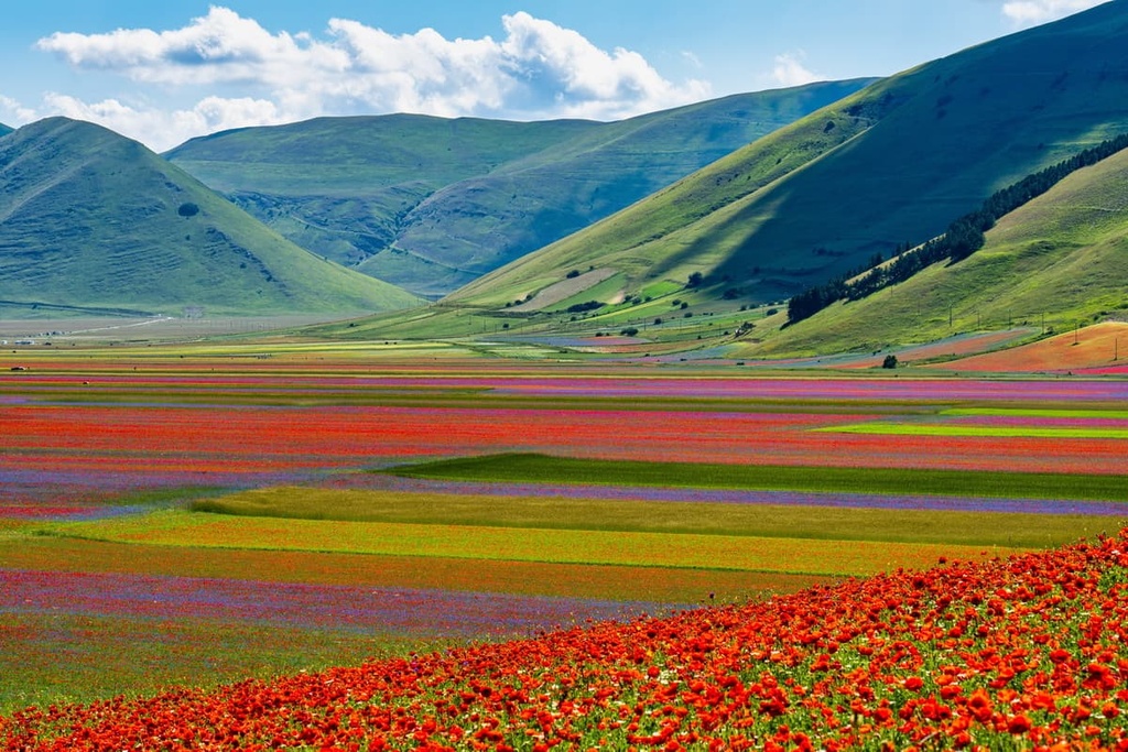
On top of a hill in the middle of the plateau is the picturesque village of Castelluccio, which was badly damaged by the 2016 earthquakes but is still inhabited. The Piano Grande is popular with hikers during summer and spring when the plateau transforms into a vibrant tapestry of wildflowers.
The best way to explore the Piano Grande is from Castelluccio. The trail takes hikers up Monte Ventòsola (1,718 m/5,636 ft) before descending into the Piano Grande. This walk takes approximately 6 hours in total and is rated E for hiking by the CAI.
Hikers searching for a long-distance trek across Monti Sibillini National Park won't want to miss the Grande Anello dei Monti Sibillini. The Great Ring of the Sibillini takes hikers on a 124 km (77 mi) tour of the park's circumference, visiting many of the Monti Sibillini's best villages, valleys, and viewpoints along the way.

The Grande Anello dei Monti Sibillini is a grueling hike that’s only suitable for highly experienced hikers. The walk is split into nine sections, with each part taking between 3 and 6 hours to complete. The start and end of the Grande Anello dei Monti Sibillini is the center of Visso, which is home to the park's former headquarters.
Walking clockwise from Visso to Cupi, the first section takes hikers across the slopes of Monte Careschio (1,367 m/4,485 ft) before passing by the towering face of Monte Bove Sud (2,169 m/7,116 ft). The second section leads from Cupi to the picturesque Lago di Fiastra, passing over Monte Val di Fibbia (1,577 m/5,174 ft) in the process.
The third section is from Fiastra to Monastero. The walk leads along a ridge with sweeping views of the Valle del Fiastrone. There are several ancient monasteries worth exploring in the valley, including the thirteenth-century Col di Pietra. The fourth section from Monastero to Garulla passes through the scenic fields of Prati di Ragnolo.
Next, the trail heads south to Rubbiano, with the fifth section traversing the eastern bases of Monte Castel Manardo (1,917 m/6,289 ft) and Monte Priora (2,333 m/7,654 ft) before diving into the valleys of Ambro and Tenna.
The sixth section leads to Colle di Montegallo, passing through near Monte Sibilla (2,173 m/7,129 ft) along a ridge that leads from Monte Banditello (1,873 m/6,145 ft) and Monte Torrone (2,117 m/6,946 ft) to Monte Vettore (2,476 m/8,123 ft).
The seventh section from Colle di Montegallo to Colle le Cese heads down Monte Vettore to Forca di Presta and onto the ridge of Monte Macchialta (1,751 m/5,745 ft) along what's known as the "Sentiero dei Mietitori" or "Path of the Reapers."
The penultimate leg of the Grande Anello dei Monti Sibillini involves a leisurely walk across the Valle del Campiano to Campo Vecchio. Here, hikers pass through the sublime Piano Grande, which is home to the hilltop village of Castelluccio. Finally, you’ll return to your starting point by crossing the Colli dell'Acquaro and crossing the Valle Visso between Monte Moricone (1,429 m/4,688 ft) and Monte Cavolese (1,493 m/4,898 ft).
There are many charming villages and towns dotted across Monti Sibillini National Park. Unfortunately, many settlements were severely damaged or destroyed by 2016's magnitude 6 earthquakes, including the park's headquarters, Visso.
Read on to learn about Monti Sibillini National Park's main towns and villages.
Situated approximately 60 km (37 mi) to the northwest of Monti Sibillini National Park is the city of Perugia. The capital of Umbria, Perugia is the largest settlement near the Monti Sibillini, and it is the perfect place to stay if you're looking to soak up some local culture. The city is famous for its numerous festivals and its association with the Renaissance painter Perugino.
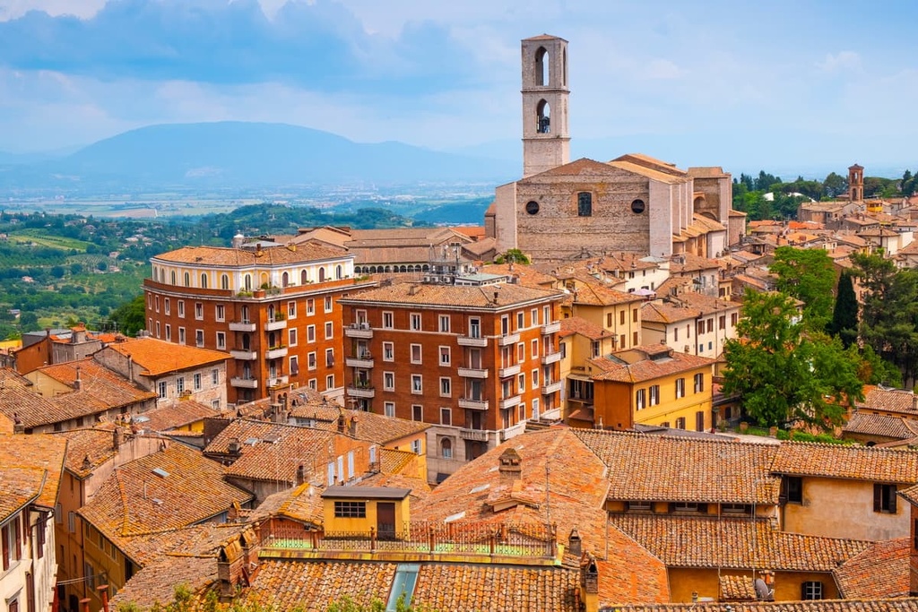
During your visit to Perugia, ensure you peruse the collection at the National Gallery and stroll around the medieval Piazza IV Novembre. Popular hotels in Perugia include the Sangallo Palace Hotel and the Chocohotel.
Norcia is the largest town within Monti Sibillini National Park. Located in the park's southwestern corner, Norcia is a historic settlement that dates back to the fifth century.
The town is home to some fascinating landmarks like the sixteenth-century Cathedral of Santa Maria Argentea and the ruins of the Basilica St. Benedict, the latter of which was destroyed during the 2016 earthquakes. If you're planning to spend a night in Norcia, book a room at the Relais & Chateaux Palazzo Seneca or the Albergo Benito.
Perched on the park's eastern boundary is the town of Montemonaco. Montemonaco is one of the prettiest in Monti Sibillini due to its location on a plateau in the Aso Valley facing Monte Zampa (1,791 m/5,876 ft) and Monte Sibilla (2,173 m/7,129 ft).
During your stay in Montemonaco, spend a relaxing day at Lago di Gerosa and tour the Museo della Sibilla. Popular accommodation options in Montemonaco include the rifugio Altino and Monti Azzurri.
The crowning jewel of Monti Sibillini National Park is the village of Castelluccio. Castelluccio is located on a hilltop at 1,452 m (4,764 ft) in elevation, making it the highest settlement in the park. It sits overlooking the Piano Grande di Castelluccio di Norcia, one of the most beautiful features of the Monti Sibillini.
While Castelluccio is a small community with few major attractions, it's close to some of the park's best hiking areas, including its highest mountain, Monte Vettore (2,476 m/8,123 ft). Castelluccio is also famous for its produce, including lentils and salami. Popular hotels in Castelluccio include Taverna Castelluccio and Agriturismo la Valle delle Aquile.