
Scan the QR code and open PeakVisor on your phone
Nanren Mountain Ecological Reserve has 12 named peaks. The highest is Wanlideshan at 527 m. Other notable peaks include Nanren Shan, Zhulaoshushan and Yulanlanshan.
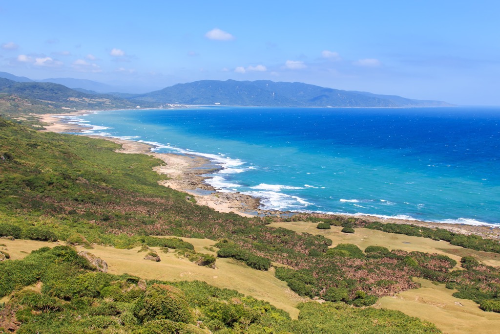
In the southern Taiwan tropical rainforest lies the Nanren Mountain Ecological Reserve (南仁山生態保護區). Narrow ravines shaded by luscious broadleaf trees dominate the coastal environment. Wanlideshan (萬里得山) is the tallest and most prominent of 12 named hills, at 27 meters (1,729 ft).
Nanren Mountain Ecological Reserve is situated in the Manzhou Township (滿洲鄉) of Pingtung County (屏東縣). Uninhabitable and offroad, the forested region of 5,800 ha (14,322 ac) is frequently visited.
The fewer visitors is helpful, as the well-preserved woods is Taiwan’s only low-elevation virgin forest. Nanren’s fertile zone is kept in good hands, falling under Kenting National Park’s (墾丁國家公園) governance.
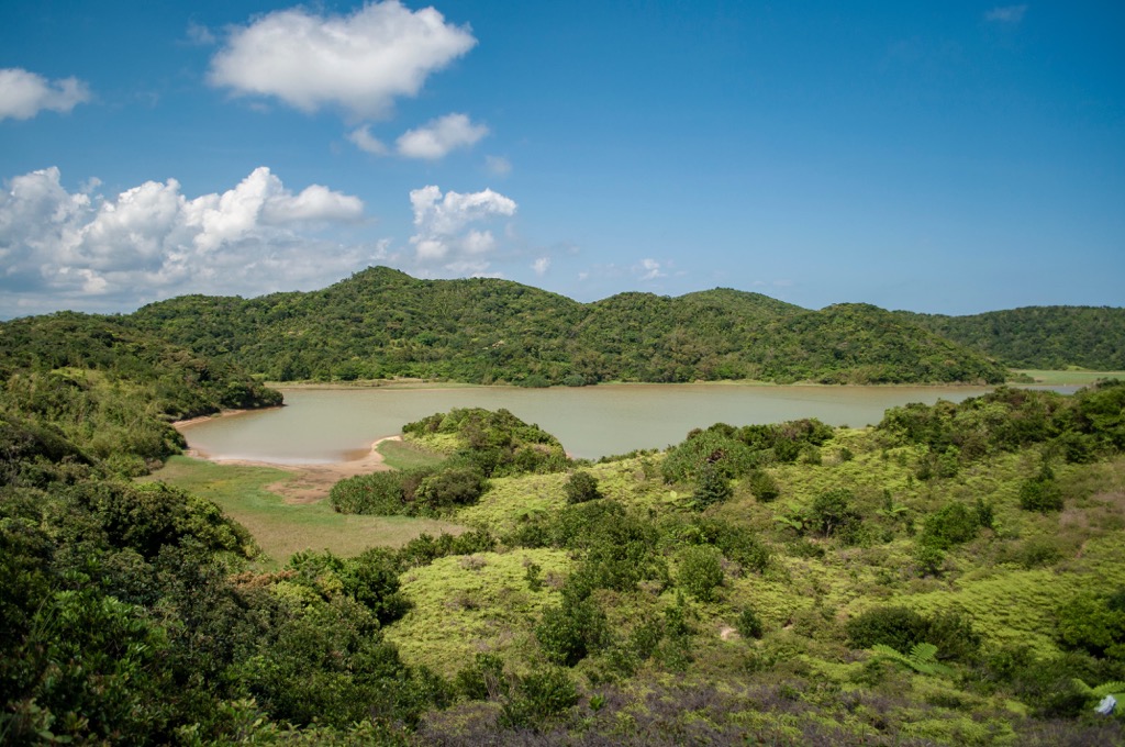
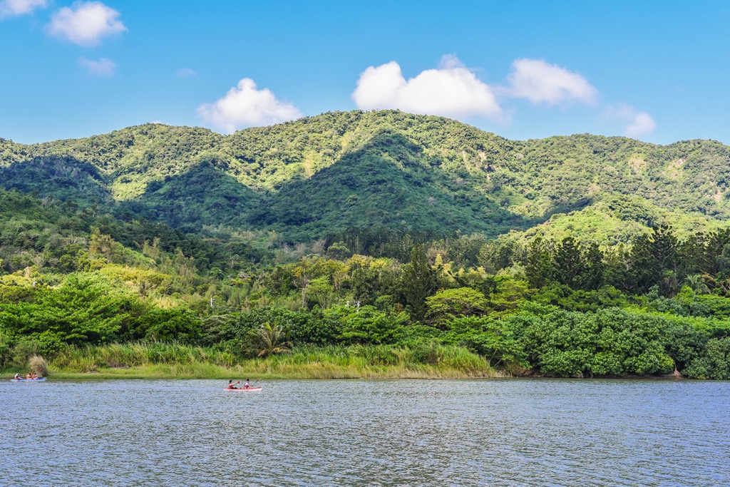
The flourishing ecological reserve contains a freshwater alpine pond, Nanren Lake (南仁湖). Comprising 28 ha (69 ac), the hillside pool grows various aquatic plant species. Its setting is spectacular as lush, leafy woodlands surround the bottle-green lake.
An undulating network of low-lying peaks ripples across the forested terrain. Other notable hills are Nanren Shan (南仁山), Zhulaoshu Shan (豬朥束山), and Chufeng Shan (出風山).
The topography of small hills, deep forests, and a long coastline affects the weather in this region. High rainfall dampens the land in the monsoon season. Typhoons also bring their share of torrents and forceful winds. Southern Taiwan’s signature warmth of an annual 79°F (26°C) combined with the wet soil creates a humid environment.
Sitting far south in Taiwan, Nanren Mountain Ecological Reserve still has a few notable areas of interest nearby. Kenting National Forest Recreation Area (墾丁國家森林遊樂區) lies to the south, while to the east is the Pacific Ocean. In the west is Jianshan Coastal Reserve (尖山沿海保護區) and the Xuhai-Guanyinbi Nature Reserve (旭海-觀音鼻自然保留區) is to the north.
Nanren’s gentle mountains comprise the southernmost strip of the mighty Central Mountain Range (中央山脈). The longest massif in Taiwan, the tallest peaks lie in Taiwan’s centre. The ridges taper in height and sheerness as it extends northwards and southwards. Compared to Xiuguluan Shan’s (秀姑巒山) highest peak, measuring 3,860 meters (12,664 ft), Wanlideshan’s elevation of 527 meters (1,729 ft) pales.
The hills of Nanren Mountain Ecological Reserve date between the mid to late Miocene epoch. Shale and sandstone are the main geological components of these hills.
A tropical monsoon rainforest characterizes Nanren Mountain Ecological Reserve’s plant life. In the valleys and lower regions is a thriving growth of Moraceae and evergreen laurels. Banyan, mulberry, and camphor trees are some of the various plants that flourish in the forest.
As the elevation rises, Fagaceae plants of oak and beech trees flourish on the windy east-facing hillside. In Taiwan, these broadleaf trees usually feature above 1,000 meters (3,281 ft). However, in the humid Nanren Mountain Ecological Reserve, they grow at 500 meters (1,640 ft).
Birdlife echoes in Nanren’s rainforest, featuring over 80 species. Wildlife is varied, with 11 species of mammals, five groups of turtles, and 12 kinds of fish. In addition, 65 species of butterflies roam the leafy reserve, together with 235 groups of insects and 13 lizard species.
Southern Taiwan’s land of Pingtung County is a Paiwan stronghold. The indigenous Paiwan people are the earliest inhabitants of this region. Living in the fertile land, the Paiwan tribe possesses excellent rainforest knowledge and lead ecotours through this lush area.
One incident occurred in southern Taiwan’s territory that would go down in history. In 1887, the stormy seas and stony coral reefs damaged an Okinawan boat, causing a shipwreck. At the time, present-day Japan’s Okinawa was under the Qing dynasty’s control.
The 66 stranded sailors sought refuge inland. Upon finding the foreign fleet, Paiwan locals killed 54 Okinawans. The 12 remaining crew fled, returning to Okinawa and recalled their horrors to the Japanese government.
The Qing dynasty ignored Japan’s request to interrogate the matter further. As revenge, Japan planned an attack on Paiwan villages in 1874, where a bloody massacre happened.
The Mudan Incident thus created tension between Japan and the Qing dynasty. Feeling under pressure, the Qing dynasty reviewed its links to Taiwan. They then initiated the immigration of Han settlers into Taiwan to boost the Chinese population.
Nanren Mountain Ecological Reserve’s most favorable hiking trails and areas are:
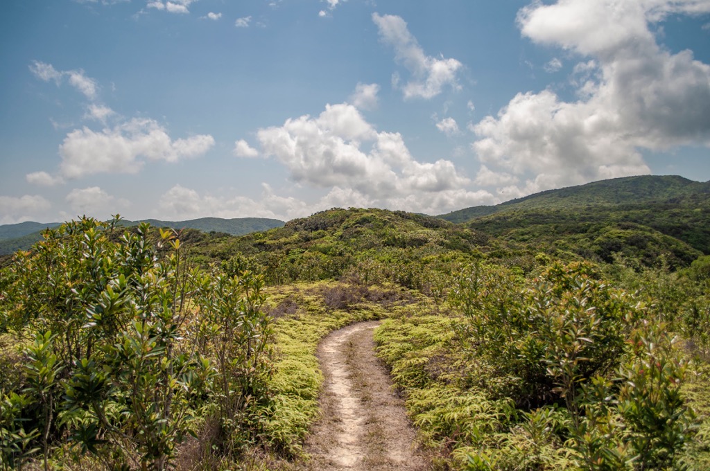
Climbing Nanren’s highest mountain involves passing through the shaded and lush rainforest. Wild and overgrown foliage extends in all directions through the luxurious emerald grove. The extensive plant growth narrows the pathway, allowing you to brush against leaves and shrubbery.
Bursts of birdsong reverberate through the damp, dark woods. Keep your eyes peeled for sightings of butterflies that streak across the path’s greenery. A short 3 km (1.8 mi) hike leads you to Wanlideshan’s open summit.
Enjoy the panoramic view of coastal hills and turquoise shores. You can locate the southern hills of Dashanmushan (大山母山) and Dajianshishan (大尖石山), leading towards the Bashi Channel (巴士海峡). To the east is Piyishan (埤亦山), which extends towards the Pacific Ocean. Laofoshan (老佛山) lies west, and the Taiwan Strait’s waters are lapping offshore.
Spanning Nanren Lake’s edge, this 4 km (2.4 mi) trail advances through a magical region rich in biodiversity. Countless plant species and wildlife coexist in this fertile kingdom. Discover the hidden nature of this remote tropical monsoon rainforest.
Journey through the jungle, where over 1,200 vascular plant species flourish. Spot grey-faced vultures fly overhead to Taiwan’s southern parts for migration season in October. Look out for the varied wildlife of frogs hopping on the path and the endemic yellow-grey freshwater crab circling the lake’s shore.
In addition to birdsong, a chorus of chirping cicadas adds to nature’s orchestra. To retain the primitive ecology, entry to Nanren Mountain Ecological Trail is limited to only 400 visitors per day.
Southern Taiwan's botanical garden boasts a splendid array of plant life. Kenting's coves claim over 1,000 plant species belonging to specific varieties, such as medicinal plants, rubber trees, and tropical fruits.
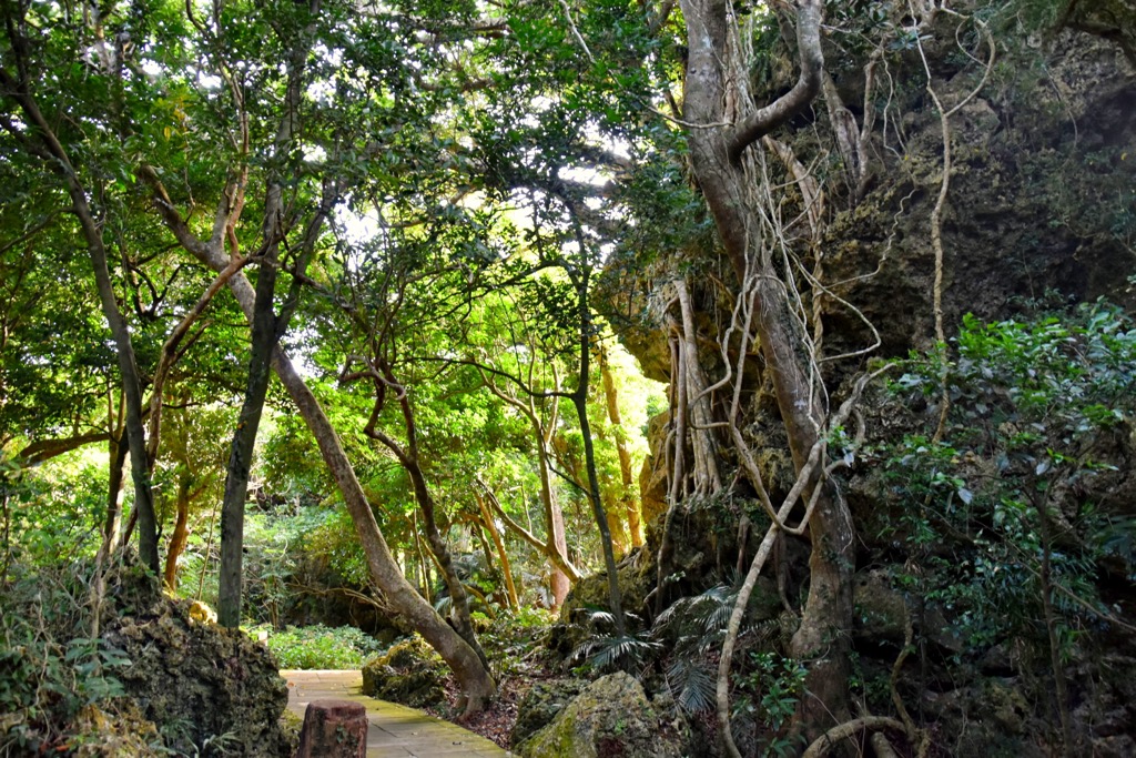
One striking feature of Kenting Forest is the coral Fairy Caves. Once an underwater formation, the sharp and jagged insides of the cave feature dripping stalactites, and rounded stalagmite mounds adorn the uneven floor.
A crevice in a particular grotto is the popular One Line Sky, where a strip of blue illuminates the dim, cream-walled cave. One Line Sky's fissure is an aftereffect of Taiwan's notorious earthquakes. Thus, One Line Sky proves how strong mineral walls succumb to earthshattering natural disasters.
For the best view of Kenting's leafy paradise, head up to the 27 meter (89 ft) observation tower. You can also look at Kenting's white sandy beaches, the crystalline Bashi Channel, and Taiwan Strait.
Another peak to climb in Nanren Mountain Ecological Reserve is Zhulaoshu Shan. Situated next to the coast, Zhulaoshu Shan’s ascent is met with afternoon mist and strong winds. Lesser frequented than Wanlideshan, Zhuloashu Shan’s path is a wild overgrowth of greenery.
For a small mountain of 410 meters (1,345 ft), the hike to Zhulaoshu Shan’s peak is challenging. The dense jungle obscures the path, while cliffs demand physical exertion to scale. The beauty of lush leafiness both dims and enchances the fear of getting lost at every turn. Keep your phone on you to track the GPS coordinates.
Once you’ve reached the summit, feel the forceful coastal wind blow your hair. Wanlideshan and Nanrenshan’s peaks rest in the north, while you can view Laofoshan and Santaishan (三台山) in the west. To the east, you can watch the ebb and flow of the cerulean sea.
Chufengbi’s primitive sea platform features various stone outcrops and an eroded sandstone reef. Like the rest of Nanren’s attractions, Chufengbi (出風鼻) is remote and inaccessible. A two-hour hike from Jiupeng Village leads you to the rocky headland.
Various rock formations line the craggy shore, featuring crumbling honeycomb and linear mushroom rocks. Coastal plants like the lintou tree and vines add greenery along the pebbled shore. You may even uncover rusted parts of shipwrecks on the beach, a common feature of Chufengbi’s rocky coral coastline.
The northeastern-most point of Nanren Ecological is the flat, verdant meadows of Jiupengbitou (九棚鼻頭). This 2.4 km (1.5 mi) hike traces the Jiupeng River's path to the Pacific Ocean.
En route, you can observe Taiwan sika deer grazing on the grassy lawn and water buffaloes bathing in the creek. Admire the altering blue shades where the sky meets the sea, an endless cobalt vision.
Various plant life thrive on this coastal route. An emerald wonderland of the lintou, she-oak, and hawthorn trees border the flatlands, while Himalayan fairy grass flourishes in the coastal meadow. This open field is a prime spot to watch the warm glow of sunrise's dramatic arrival each morning.
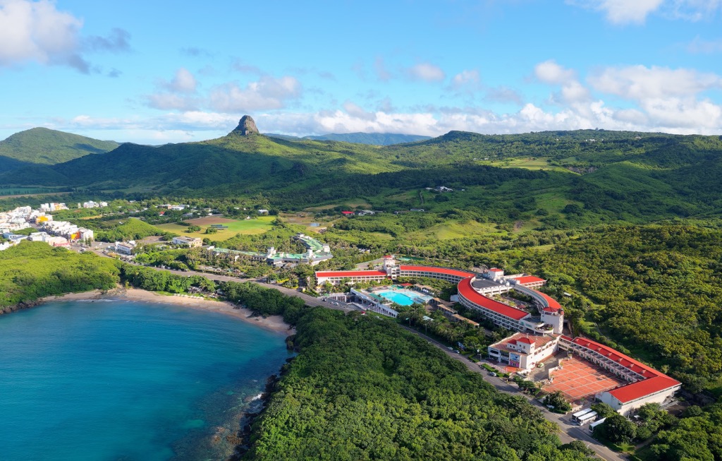
Wondering where to stay near Nanren Mountain Ecological Reserve? Kenting (墾丁) and Hengchun Township (恆春鄉) are your two best options which will not disappoint.
Tropical Kenting is synonymous with beaches, festivities, and summer. Host of the annual Spring Scream carnival every April, Kenting buzzes with excitement year-round. It's a prime vacation spot in summer and the best place to experience Taiwan's warmest winter. You can lie on the beach in December and dip into the sea for a refreshing cooldown.
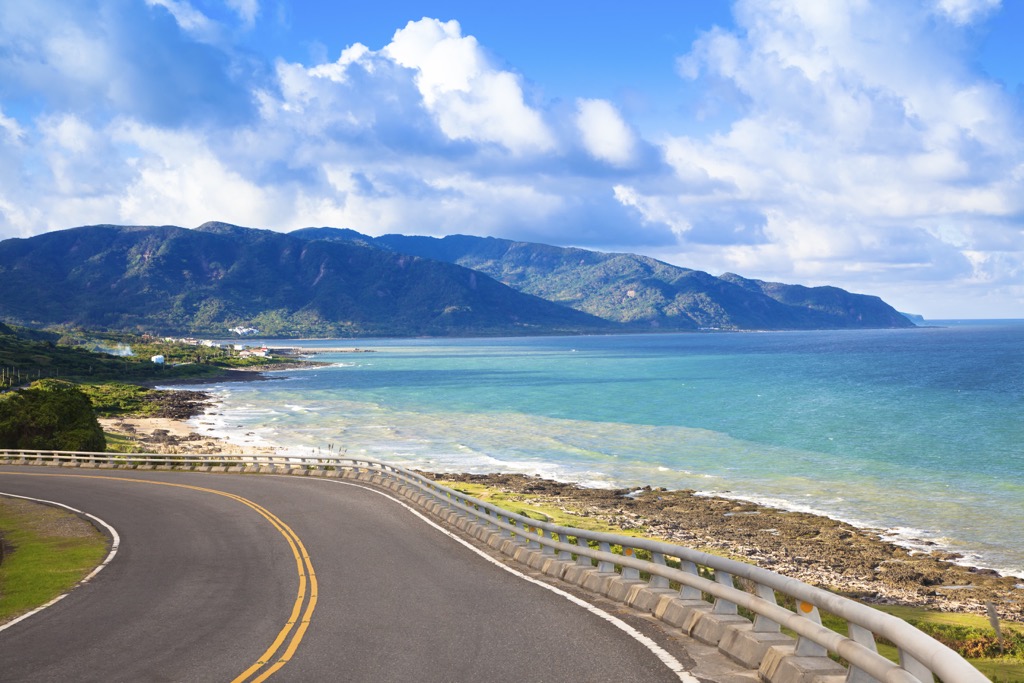
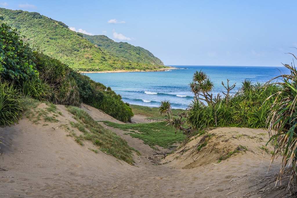
One such beach to visit is Baisha Bay. The white sand beach and turquoise sea radiate under the glowing sun. Coral reefs line the bay that spans 400 meters (1,312 ft), adding a fascinating display of rock pools and marine life. The salty sea air and crashing waves distil a tranquil environment.
When evening arrives, Kenting Street comes alive. Local vendors set up shop on the road, cajoling passers-by to sample their delicacies. Above them, Kenting's fluorescent signs and installations pulsate. You won't go starving in Kenting. A row of restaurants backs the bustling night market, offering various worldwide cuisines. Some interesting finds at the night market are fried Oreos and fried milk balls.
Finally, visit the Eluanbi Lighthouse stationed on the southernmost tip of Taiwan. The stark white building is a celebrated landmark on the southern peninsula and reportedly is Asia's brightest watchtower. The captivating coastal scenery shows craggy coral reefs, green rolling hills, and an azure ocean.
Taiwan’s southernmost township, Hengchun, is a sleepy settlement with well-preserved history. Hengchun’s relaxed lifestyle is alluring, as locals prioritize community and leisure activities. This stress-free approach is evident in the friendly faces you encounter in Hengchun.
The Qing dynasty constructed Hengchun’s old city in 1873, including the city gates and walls that secured Hengchun’s residents from outside interference. Hengchun’s city gates still stand today. Due to their short distance, you can journey on foot to admire the grand pagoda entrances into Hengchun.

Part of the city wall is still intact from the West Gate. To gain a better perspective of Hengchun’s old town, climb the city barrier and admire Hengchun from above. The wall connects to the Mazu Temple, the South Gate and East Gate, giving you a near panoramic outlook of this charming, ancient town.
Finally, once back on solid ground, head to the Old Town. A treasure trove of traditional herbal concoctions, ghost money, and incense, to name a few, Hengchun’s Old Town is fascinating as the crumbling red-brick buildings. Modern tea shops and cafes appear sporadically in the historic centre, a welcome contrast to the ancient facade.
To get to Nanren Mountain Ecological Reserve, first take the Taiwan High-Speed Rail (HSR) to Zouying Station in Kaohsuing. Then, transfer to the Kenting Express Bus that departs outside of Zouying HSR Station.
Alternatively, the 9117 and 9118 bus also head to Kenting, but these depart from Zhongshan Bus Station, outside of Kaohsuing Main Station. You can travel by MRT from Zouying HSR Station to Kaohsuing Main Station.
The Kenting Express Buss, 9117, and 9118 all make stops in Hengchun and Kenting. Once in Kenting, it is best to organise your own transport to Nanren Mountain Ecological Reserve. The 200 County Road from Kenting is the gateway to Nanren, from where you turn off to your desired location in Nanren’s rainforest.


The highest peak in Nanren Mountain Ecological Reserve is Wanlideshan, at 527 m.
Notable peaks in Nanren Mountain Ecological Reserve include Wanlideshan, Nanren Shan, Zhulaoshushan, Yulanlanshan and Chufeng Shan.


