Scan the QR code and open PeakVisor on your phone
Namaqua National Park is a natural wonderland located in the Northern Cape province of South Africa, near the border with Namibia. There are 22 named peaks in the park; Osseberg (816 m / 2,677 ft) is the highest point, while the most prominent mountain is Tafelberg, at 636 meters (2,087 ft) of prominence.
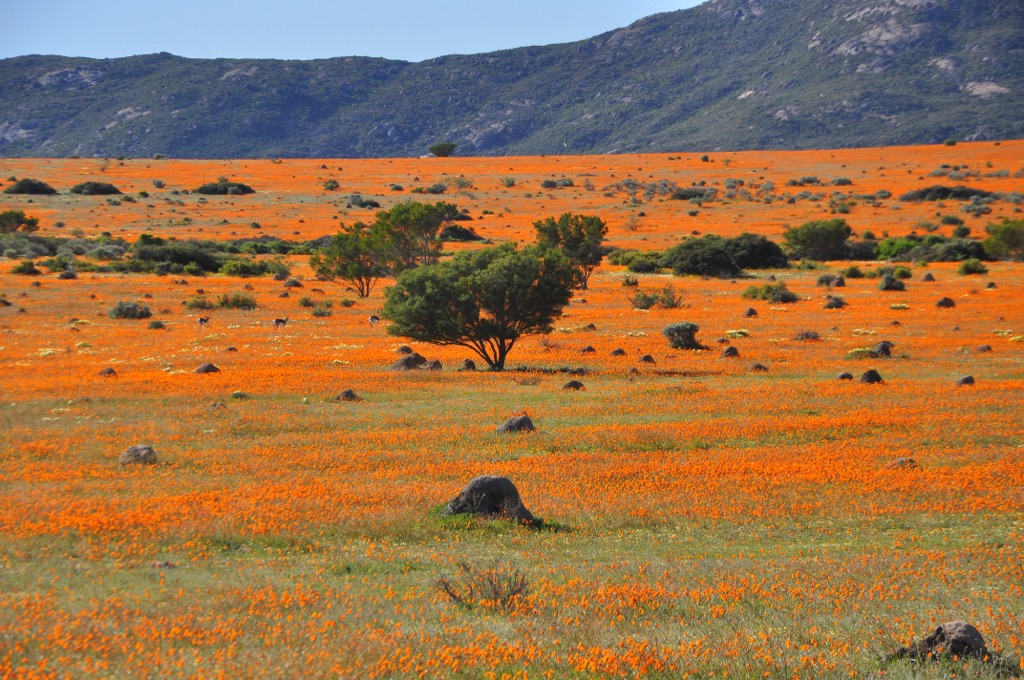
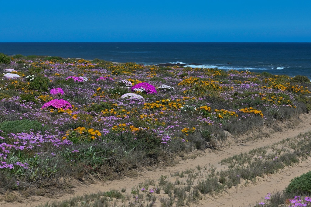
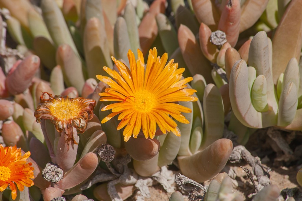
The Namaqua National Park showcases the unique and diverse flora and fauna of the Succulent Karoo biome. The park covers an area of 136,800 ha (338,040 ac) and consists of two sections: the Skilpad section near Kamieskroon and the coastal section between the Groen and Spoeg rivers. The park is famous for its spectacular display of Skilwildflowers that bloom in the spring, attracting thousands of visitors every year.
The geography of Namaqua National Park is characterized by semi-arid landscapes, with hot and dry summers averaging above 30°C (86°F) and cold winters with 5°C (41°F) highs. As one of the driest regions in South Africa, it receives most of its rainfall between May and August, with an average annual rainfall of 340 mm (13 in) at the Skilpad section. The park’s terrain encompasses quartz-strewn plains, undulating hills, granite outcrops, and rugged mountains.
In 2001, the government established Namaqua National Park to conserve the rich diversity of succulent plants that are endemic to the region. The semi-desert Succulent Karoo biome is one of the world's most biodiverse and arid regions, with over 5000 plant species, of which about 40% are endemic and 18% are threatened.
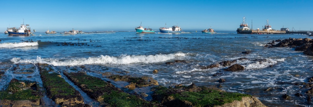
Several years later, in 2008, the coastal section along the Groen and Spoeg rivers was added, featuring sandy beaches, rocky shores, and salt marshes. This extension provides a habitat for diverse marine and bird species influenced by the cold Benguela Current, which brings fog, mist, and moisture to the plant and animal life along the coastline.
The Namaqua National Park is situated within the Bushmanland Terrane of the Namaqua-Natal Metamorphic Province, characterized by granites and gneisses originating from the mid-Proterozoic era. The park contains metamorphic granulite facies rocks, which exhibit high-temperature and moderate-pressure metamorphism.
These rocks underwent formation through two or more thermotectonic cycles, with the most recent and intense cycle occurring approximately 1150 million years ago and featuring gneissic granite and charnockite intrusions.
One of the park's most striking features is its diverse plant life, adapted to survive in arid conditions. Namaqua National Park is a biodiversity hotspot with the world’s highest concentration and diversity of succulent plants in an arid region. The park alone has more than 3,5000 plant species, of which 1,000 are endemic, including the iconic halfmens (Pachypodium namaquanum) and various aloe species. During spring, the park becomes a riot of color as wildflowers bloom across the landscape.
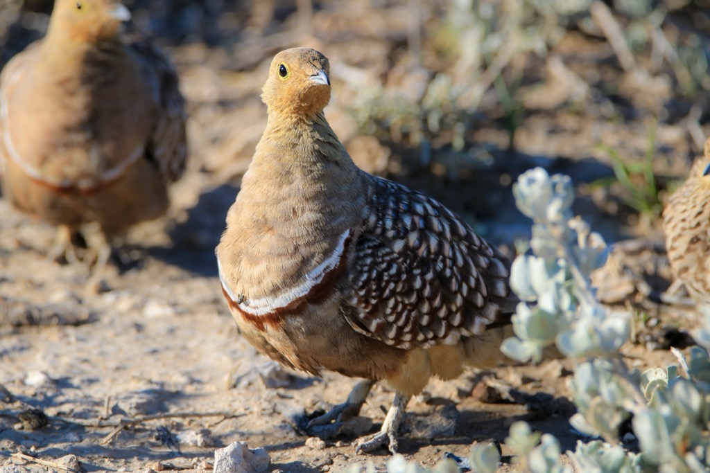
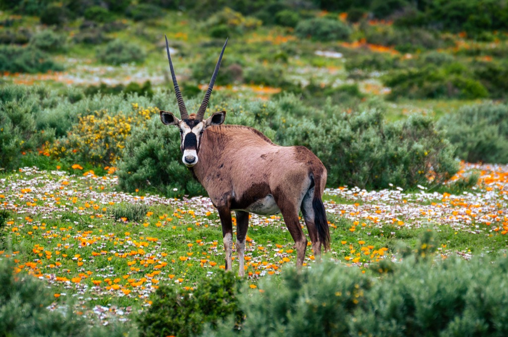
While the park's arid environment may seem inhospitable, it supports a surprising variety of wildlife. The park also has a rich fauna, with more than 50 mammal species, 200 bird species, 60 reptile species, and 40 amphibian species. Some of the mammals that can be seen in the park include Cape Mountain zebra, springbok, aardvark, and leopards.
Despite its arid nature, Namaqua National Park is not devoid of water. The park encompasses ephemeral rivers and wetlands that are crucial in supporting life. These water sources attract a range of aquatic and semi-aquatic species, contributing to the overall ecological balance of the area.
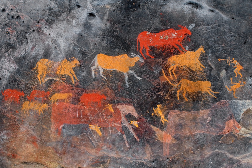
The earliest evidence of humans in the Namaqualand dates back hundreds of thousands of years, when Homo erectus made hand axes that have been found in the park. Later, the hunter-gatherer San people inhabited the region for thousands of years. They left traces of their culture and lifestyle in rock paintings, engravings, stone tools, and ostrich eggshell beads.
The San were later joined by the Khoikhoi, who were pastoralists and brought domesticated animals such as sheep and cattle to the region. The Khoikhoi and the San interacted and intermarried, forming the Nama people, the ancestors of the current inhabitants of Namaqualand. The Nama people adapted to the harsh environment, developing a unique culture and language incorporating San and Khoikhoi elements.
The arrival of European settlers in the 17th century brought significant changes to the Namaqualand region. The Europeans established farms and trading posts and competed with the Nama for land and resources. The Europeans also introduced new technologies, such as copper and diamond mining, which had a lasting impact on the area's landscape and economy. The Nama people resisted colonial encroachment and fought several wars against the British and the Boers in the 19th and 20th centuries.
The Namaqua National Park was established in 2001 to conserve the rich biodiversity of the Succulent Karoo biome, home to the world's largest concentration of succulent plants. The park also seeks to protect the cultural heritage and the livelihoods of the Nama people, who still practice traditional pastoralism and harvesting of wild plants.
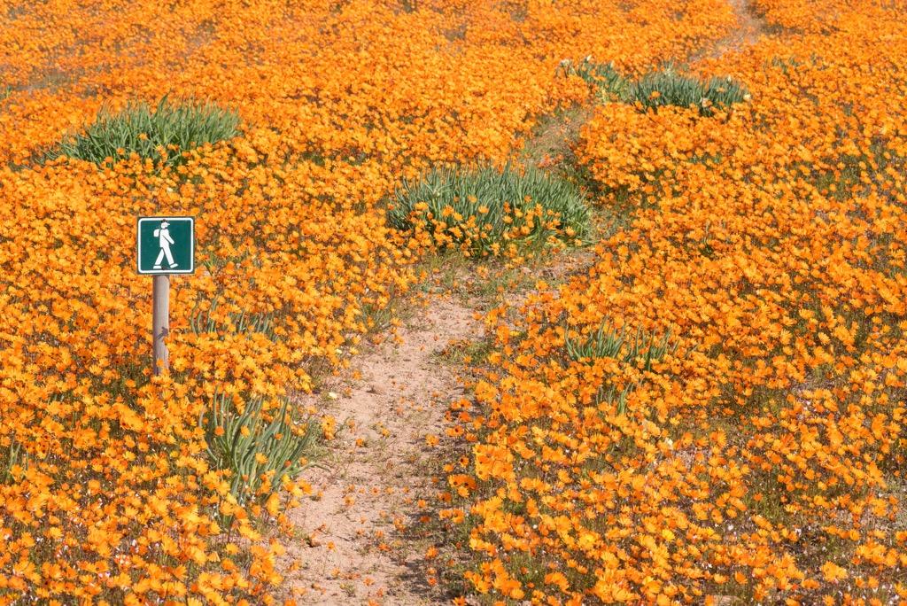
The Skilpad Walking Trail is a 5 km (3 mi) circular route through the spectacular scenery of one of the most biodiverse regions in the world. The trail is located in the Skilpad section of Namaqua National Park, accessible by car from the village of Kamieskroon.
The trail is especially popular during the spring flower season when a carpet of colorful blooms transforms the landscape. The trail offers views of the Osseberg, Tafelberg, and Brandberg, and the Roof of Namaqualand outcrops, as well as the chance to spot some of the park’s wildlife, such as gemsbok, springbok, klipspringer, and various birds.
The Korhaan Walking Trail is a short and easy hike that showcases the diverse flora and fauna of the Namaqua National Park. The trail is about 3 km (1.8 mi) long and starts at the Skilpad office, offering a great view of the valley below. Hikers pass through bushy areas, seeing a variety of flowers, especially in spring when the park is famous for its wildflowers. Spotting wildlife, such as dassies, tortoises, and korhaans, is common.
The Heaviside Hiking Trail is a scenic trail that follows the coastline of the Namaqua National Park. The 6.5 km (4 mi) long trail is named after the Heaviside dolphin, a rare and endemic species seen in the waters along the trail. The trail starts from the Abjoel viewing deck, about 15 km (9 mi) north of the Groenrivier office in the coastal section of the park.
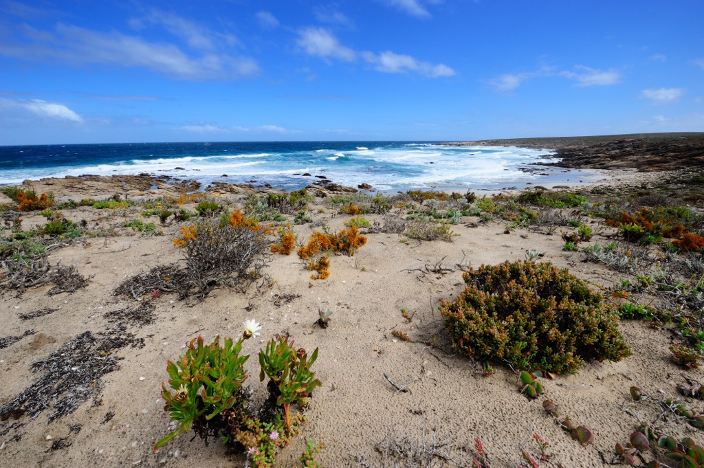
Hikers can observe fields of wildflowers in spring, giant rock formations, star-filled night skies, and the Atlantic Ocean. Furthermore, hikers can also walk along stretches of white sandy beach, explore the tidal rock pools, and spot birds like black oystercatchers on the Namaqualand coast.
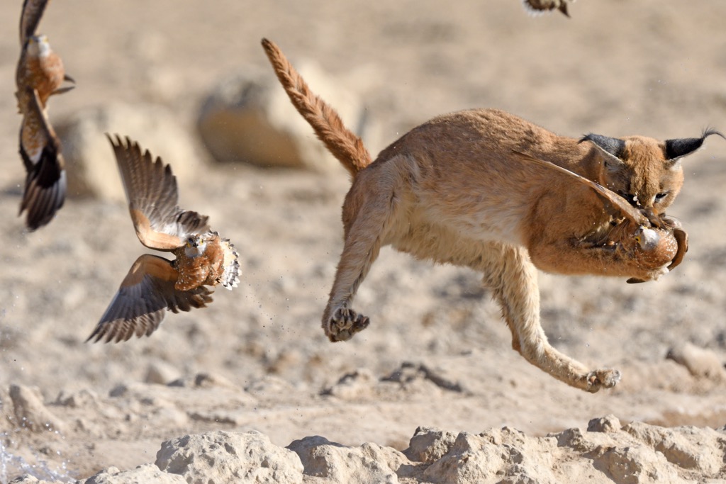
The Caracal Eco-Trail is a 188 km (117 mi) 4x4 route through the diverse landscapes of Namaqua National Park. The trail is named after the caracal, a medium-sized wild cat inhabiting the park's arid mountainous terrain.
The trail starts at the Skilpad Wildflower Reserve, descending the Soebatsfontein pass, a steep and winding road that offers views of the Kamiesberg mountains. Passing through the mineral-rich Namaqua flatlands with fynbos on sand dunes, the trail crosses the Hondeklip Bay road, leading to a 50 km (31 mi) coastal stretch along the west coast. The trail concludes at the Groen River mouth, home to seabirds like gulls, terns, and cormorants.
Kamieskroon is a small town in the Northern Cape province, situated in the foothills of the Kamiesberg range.
One of the main attractions of Kamieskroon is the annual wildflower display that takes place during the late winter and early spring months, usually from August to September. The arid landscape comes alive with a vibrant array of flowers, attracting visitors worldwide. Additionally, the Northern Cape is renowned for its clear skies, making it an ideal location for stargazing.
The Namaqualand MTB Trail is a mountain biking network spanning the Kamiesberg. The trails vary in difficulty and length, ranging from 15 km (9 mi) to 60 km (37 mi). The trails offer views of the mountains, valleys, and flowers, as well as challenging terrain.
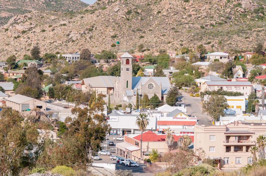
Springbok is a town in the Northern Cape province in the Namaqualand region. It’s the largest town in the region and a popular tourist destination, especially during the spring flower season.
Springbok is an old copper mining town; the Namaqualand Museum showcases the city’s culture and history. The museum exhibits various aspects of the town’s past, such as the copper mining industry, the Anglo-Boer War, the Jewish community, and the Nama people’s traditions and customs.
Meanwhile, Beskus Tours offers adventurers a range of activities within the park, such as canyoning, rappelling, hiking, and mountain biking.
Port Nolloth Beach is a coastal town about 140 km (87 mi) west of Springbok. It is a fishing and mining town and a popular holiday destination for its sandy beaches and fresh seafood. Visitors can swim, sunbathe, surf, or kayak at the beach or visit attractions such as the /Ai-/Ais Richtersveld Transfrontier Park (ARTP), McDougall’s Bay, and the Port Nolloth Museum.