Scan the QR code and open PeakVisor on your phone
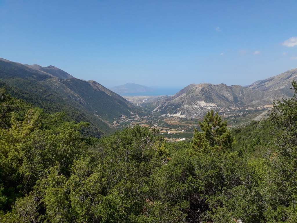
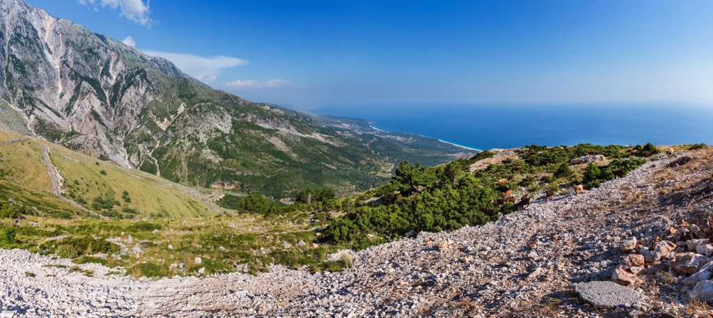
Llogara is a national park in southwestern Albania encompassing the Ceraunian Mountains along the Albanian Riviera. Llogara is one of Albania's smallest national parks at only ten sq. km of territory (3.9 sq. mi). The highest peak is Maja Qores (2,018 m / 6,621 ft). The contrast between the Ionian Sea and the mountains solidifies the natural beauty of this park.
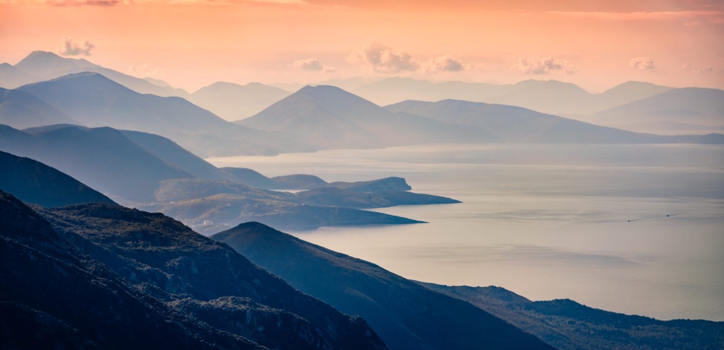
Llogara National Park is located in the region of the Ceraunian Mountains, near the town of Orikum in southwestern Albania. The park is part of Vlorë County and offers a beautiful sea view. The area also marks the general convergence of the Ionian and the Adriatic seas.
Llogara Pass is a geobotanical dividing line between Europe's typical Mediterranean vegetation and the mountains' mixed forest. Besides the rich biodiversity, southern Albania's high peaks and stunning landscapes are notable in this region.
The parks' elevation varies between 200 m (656 ft) and 2,018 m (6,621 ft). Llogara is open almost all year round, thanks to an enjoyable Mediterranean climate and limited rainy days per season.
The national park is close to Butrint National Park, providing an excellent opportunity to visit historical monuments. Llogara National Park is also a tourist destination and a transit bridge for the Ionian coast.
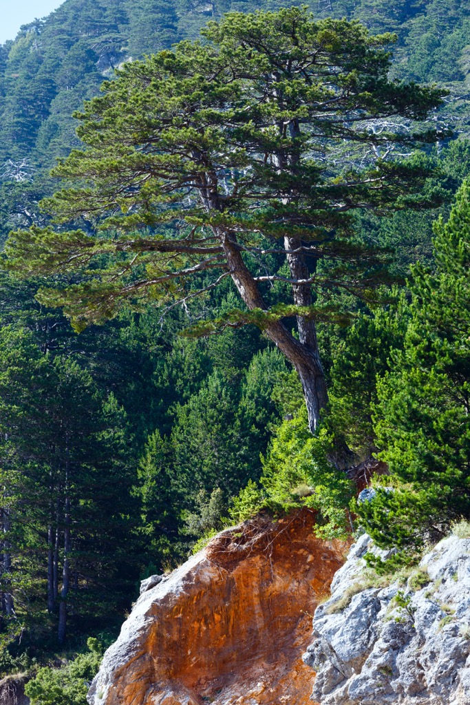
Llogara National Park is a small national park with an area of 10 sq. km (3.9 sq mi). Rich forests carpet most of the park’s landscape. In addition to mountain forests, the park consists of jagged peaks and alpine meadows, which create beautiful views.
The park gained popularity due to its diversity, including majestic mountains and a beautiful coastline. Much of the flora is endemic due to the combination of the Mediterranean climate, mountainous terrain, and other geographical features that make this region unique.
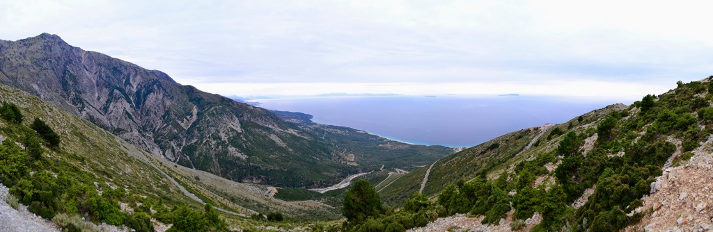
The Vlorë district, in the southwestern part of Albania, contains the Ceraunian Mountains. These mountains rise above the shores of the Ionian Sea and stretch approximately 100 km (62 mi) in a southeast-northwest direction following the Albanian Riviera. Llogara Pass at 1,027 m (3,369 feet) divides the mountains into the Western and Akroceraunian Mountains within the Karaburun Peninsula.
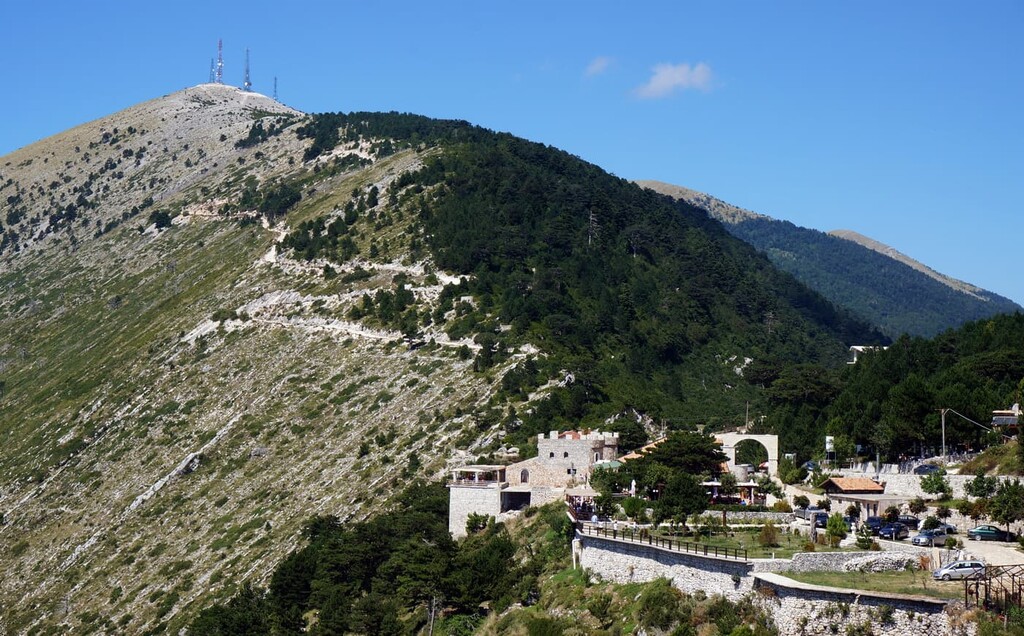
A significant portion of Llogara National Park is the Albanian Riviera. This beautiful Mediterranean coastline stretches from Sarande and Vlore's districts, attracting many tourists during the summer. This stretch of Riviera, known as Bregu, is home to many ancient cultural relics. Historic churches, monasteries, old castles, and quaint Mediterranean villages are sprinkled throughout the coastline.
Llogara National Park belongs to the Sazani tectonic zone. Carbonate rocks of flysch and chert compose this region on the southwestern part of the Balkan peninsula. As a reminder of this geologically active zone, mountains dominate the park’s landscape.
This area has three important geological features: the Rrëza e Kanalit mountain range, Llogara Pass, and the Karaburun peninsula. The Llogara Pass is particularly well-studied because of its geological, biological, and geomorphological importance.
Due to its extreme steepness, the southeast slope of the Llogara Pass has hardly any vegetation, unlike the northwestern side. The 24 km (15 mi) long mountain range Rrëza e Kanalit also has steep slopes and relatively little vegetation.
The Rrëza e Kanalit, with its 1,499 m (4,917 ft) summit, creates a sharp contrast with the Bay of Vlora and the coastline. Due to its active morphological evolution, the Rrëza e Kanalit is defined by long, steep slopes that stand vertically to the sea and the dense stream network that has formed small beaches.
Rrëza e Kanalit is significant for the caves Dukë Gjoni and Daci, and Karstic forms such as tunnels, cliffs, underground karstic holes, and wells. The coastline is peppered with bluffs, pits, and caves, resulting from tectonic activity and sea erosion.

The highest and most prominent peaks in Llogara National Park are:
Forest covered a large part of Llogara National Park. The park was established in 1966 to protect its ecosystems and rich biodiversity. According to the IUCN, Llogara National Park belongs to Category Two protection status. The region contains many species and is a critical habitat for birds and plants.
The park belongs to the ecoregion of Illyrian deciduous terrestrial forests of the Palearctic Mediterranean and scrub biomes. Additionally, the park's flora is full of endemic species due to variations in the high altitude and the characteristics of the southern part of Albania.
Llogara National Park’s forests are diverse, consisting of various deciduous and coniferous species, including Black pine, Bulgarian fir, Bosnian pine, Kermes oak, ash, and other species. Strong winds that are frequent in this area shape the park's slopes and vegetation.
The most famous crooked tree is the Flag Pine, declared a Natural Monument and easily recognizable. It is located at 910 m (2,985 ft) and is over 100 years old. Flag Pine carries unique values as an artistic creation of the relentless southerly winds. Flag Pine is an example of the species Pinus nigera and is 20 m (65 ft) long.
The park is also home to a diverse set of protected fauna. Specially protected species include the bald eagle, stone partridge, griffon vulture, fallow deer, roe deer, European wild cat, chamois, wolf, fox, squirrel, and otter.
Llogara-Dukat, Orikum-Karaburun, is between Llogara National Park and the Karaburun Managed Nature Reserve. This area serves as a bridge between two natural ecosystems, with rich biodiversity throughout the Mediterranean, alpine meadows, and pine forests. Llogara-Dukat features vegetation typical of sea cliffs, wetlands, and remnants of alluvial forests.
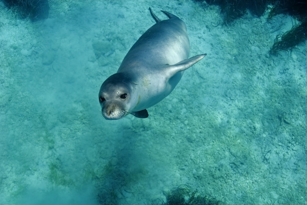
Llogara-Dukat has vibrant marine life as well. Dolphins are common. Other rare species include the Mediterranean monk seal, one of these waters' most threatened animals.
Llogara was designated a national park in 1966. Its proximity to the sea and strategic location have prompted many wars for the land around Llogara. Nevertheless, this mountainous region has never sustained a substantial population, so few buildings or historical remains exist.
As a strategic position during the Himara revolt, Greek military units were stationed near Llogara. The Greeks defended the Himara region against Ottoman and Albanian attacks from Vlorë.
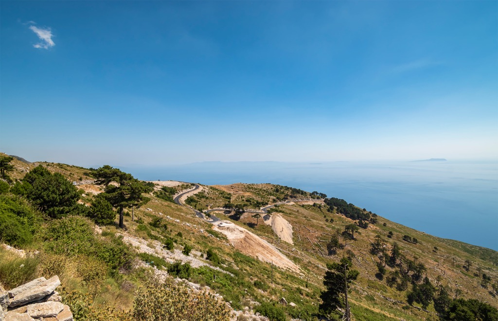
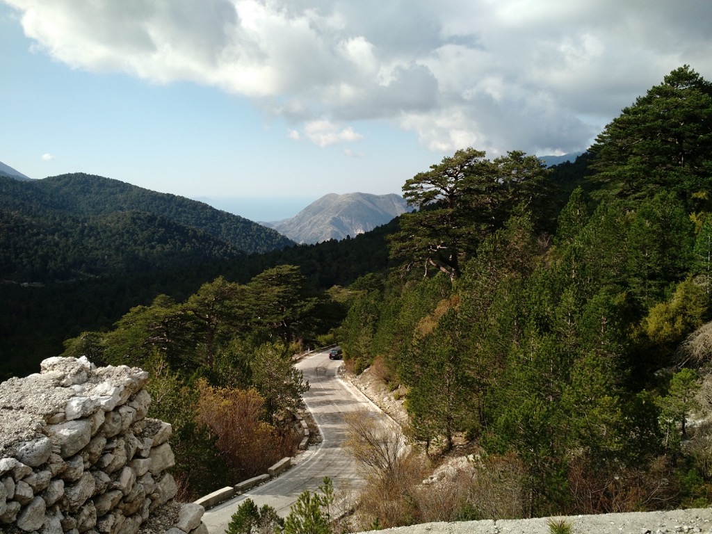
During the First World War, while the area was under Italian occupation, Austro-Hungarian prisoners reinforced the cobblestone road from Orikum to Dhermi. In 1970 this historic road was asphalted. In 2000, after the fall of the communist government, the road was restored. This beautiful road passes through the Llogara Pass and has a beautiful view of the Albanian Riviera.
Dervish Ali's towers are located near the village of Dukat I Vjetër, 4 km (2,5 mi) from the Vlorë-Saranda national road, and were built at the beginning of the nineteenth century. This complex bears the name of Dervish Ali, known as the organizer of peasant revolts against the reforms of the Tanzimat in Albania during 1847-1848.
The towers were originally built in 1828 by Janina specialists to ensure the protection of the village and to serve as a shelter in difficult times of attacks and wars. Dervish Ali's three towers have about 40 turrets with a capacity of over 200 warriors. In December 1977, the Dervish Ali Towers complex was declared a museum and was taken under the care of the Institute of Cultural Monuments.
Taking advantage of the region’s clean mountain air, the communist government created a sanatorium for lung diseases in the 1970s. Despite attempts to maintain them, these cultural monuments have fallen into disrepair.
Like any mountainous nature park, Llogara is host to many great hikes.
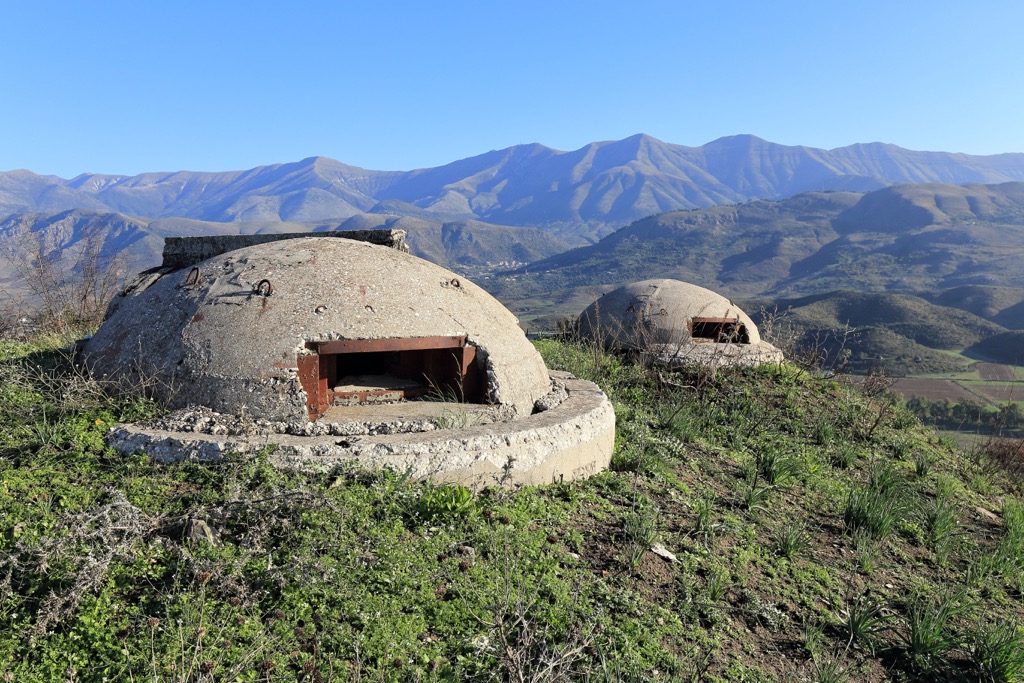
Maja Qores 2,018 m (6,621 ft) is the park’s highest peak, and there are many ways to reach the summit. The most beautiful trail starts at the main road near the bunker ruins.
The track is moderately difficult and is around 7 km (4.5 mi) long. Following the marked trail through the forest, you'll have a spectacular panoramic view of the sea and mountains. In winter, the peaks are buried in snow, and you must be prepared for freezing temperatures and a snow-covered trail surface.
The Maja Thanasit trail also starts at the main road near the bunker ruins. Afterward, follow the gravel road on the east side. This straightforward route is 4 km (3 mi) long and great for families.
Llogara’s climate suits butterflies and you will see countless specimens flitting about. These beautiful, friendly insects add to the pleasure of sea and mountains around you. The views of Maja Thanasit (1,352 m / 4,436 ft) are spectacular.
From Llogara National Park, the city of Vlora is 40 km (29 mi), Sarande is 89 km (55 mi), and Durres is 166 km (103 mi).
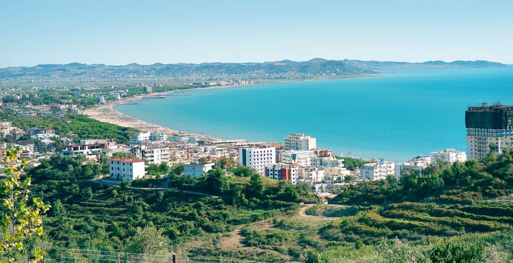
Vlore, the pearl of the two seas, is the third largest city in Albania, with a population of around 130,000. Vlore is ideally located in the bay of Vlora. With 150 km (93 mi) of coastline where the Adriatic and Ionian Seas meet, you can visit the azure sea, white sand beaches, green forests, olive and lemon plantations, and a rich cultural and historical heritage.
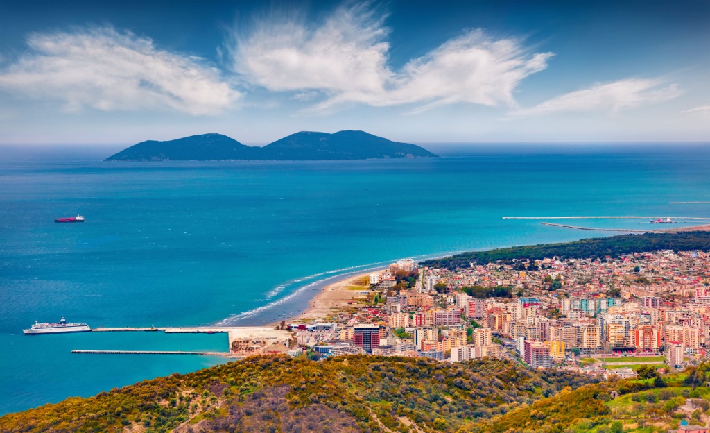
With significant infrastructure investments, Vlora is rapidly building its image as a leading tourist destination in Albania. Therefore, finding accommodation in the city is likely to be easy.
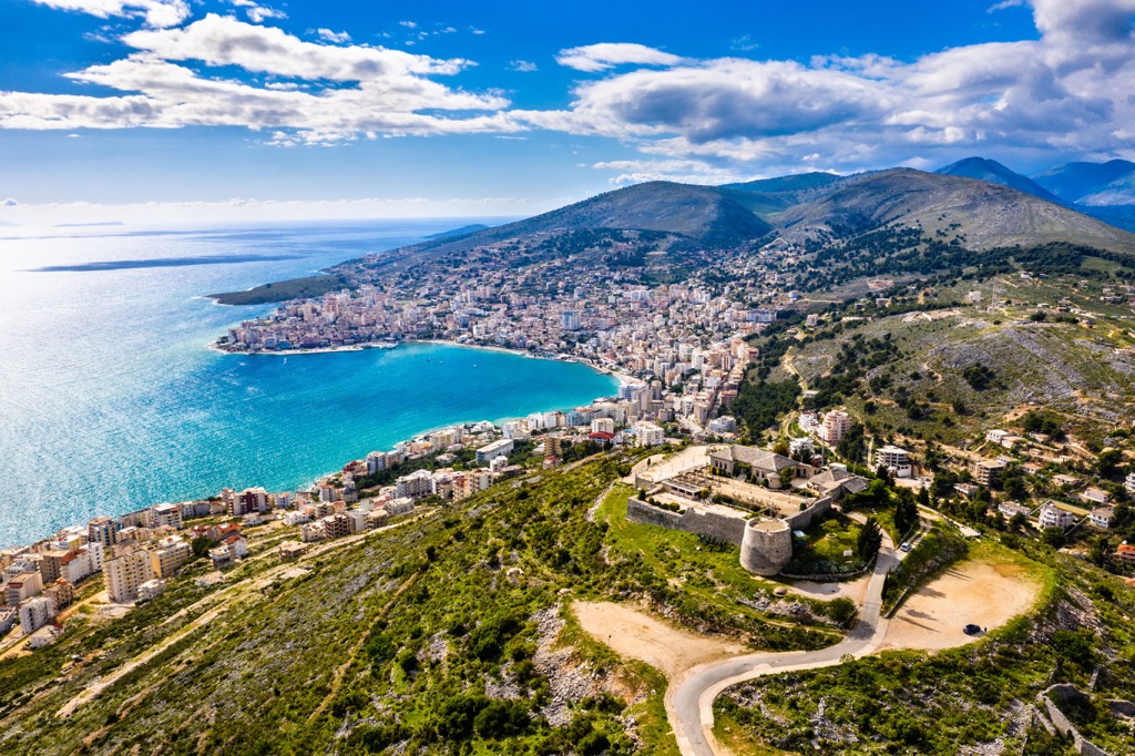
The city of Sarande is located in southern Albania, occupying a beautiful landscape surrounded by the sea and mountains. Sarande has a pronounced Mediterranean climate and warm sea water with 300 sunny days annually.
Sarande is undoubtedly one of the most desirable cities for summer holidays. Here, you can visit several attractions, including the remains of the fifth-century Synagogue, various museums, and the old fortress above the city. Naturally, you are also at the doorstep of Llogara National Park, as well as Butrint National Park, which is located near Sarande.
Durres is a city and a port located on the Adriatic coast, only 33 km (20 mi) from Tirana. Like other cities along the Albanian coast, Durres is subject to a desirable Mediterranean climate. Today, Durrës is a modern city with a population of 120,000. It is a tourist center with many new buildings, hotels, and apartments.