Scan the QR code and open PeakVisor on your phone
Butrint National Park lies in southern Albania. It is a park of significant historical and archeological importance. Access to the turquoise color of the Ionian Sea, the remains of buildings dating from prehistoric times to the present day, and various important species of birds and plants make this national park worth a visit. There are 23 mountains in Butrint National Park. The most prominent and highest of which is Maja e Milesë (823 m/ 2,700 ft).
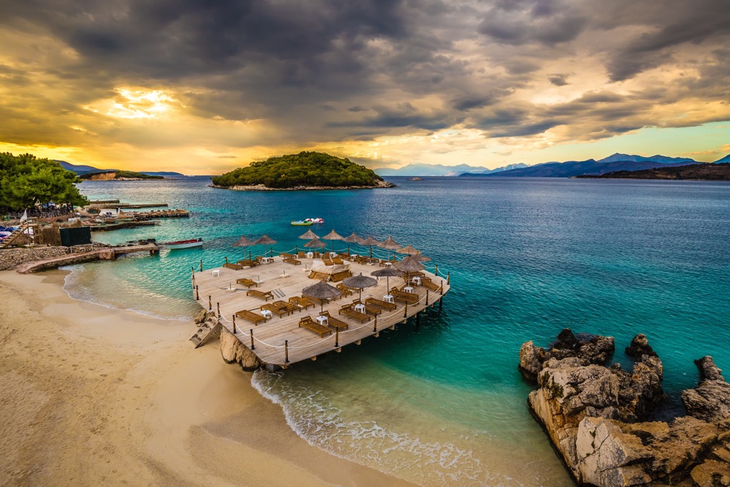
Butrint National Park is based on ancient city ruins and has an area of 94.2 sq. km (36.37 sq. mi). It is part of Vlorë County, surrounded by the Ceraunian Mountains. It is located in the Southeast part of Albania in the Strait of Corfu, close to the border with Greece. This national park has access to the Ionian Sea. The city of Surandë is 18 km (11 mi) from Butrint National Park.
The area around the ancient city of Butrint in southern Albania is not only home to many globally endangered species but also an area of rich cultural history, which is the reason why this national park is on the UNESCO world heritage list.
The national park includes very diverse natural, semi-natural and artificial habitats. For example, freshwater marshes, reed beds, orchards and arable fields, Mediterranean forests, maquis, and coastal waters with sandy and rocky shores and others are included. The area of Butrint is one of the most critical areas of biodiversity in Albania. Also, it is one of the most important archaeological points of Albania.
The park enjoys a beautiful Mediterrane climate which explains why this site has been significant from prehistoric times. Butrint National Park is diverse, especially its hydrographic network. The park contains a few lakes, a lagoon, and rivers.
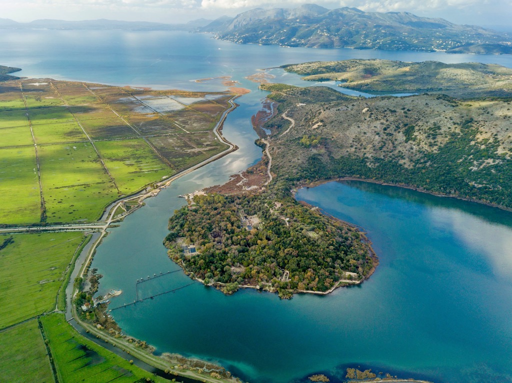
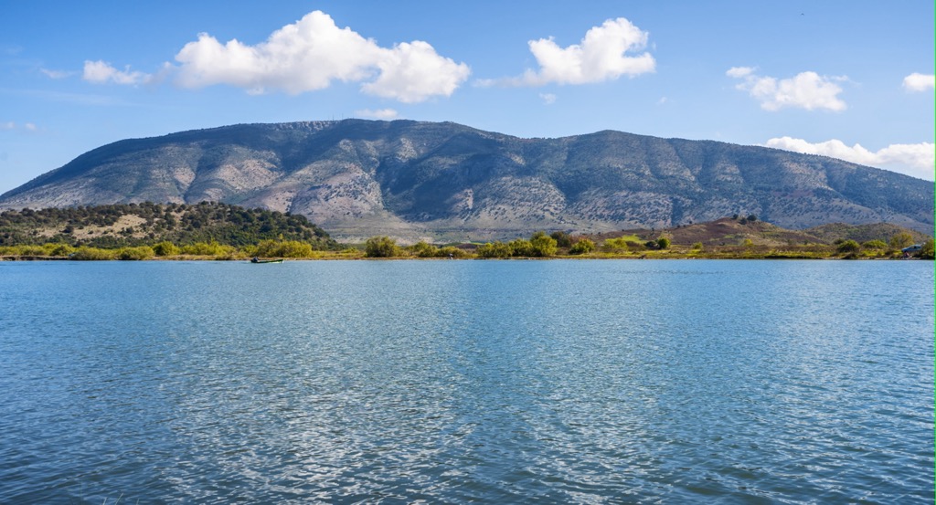
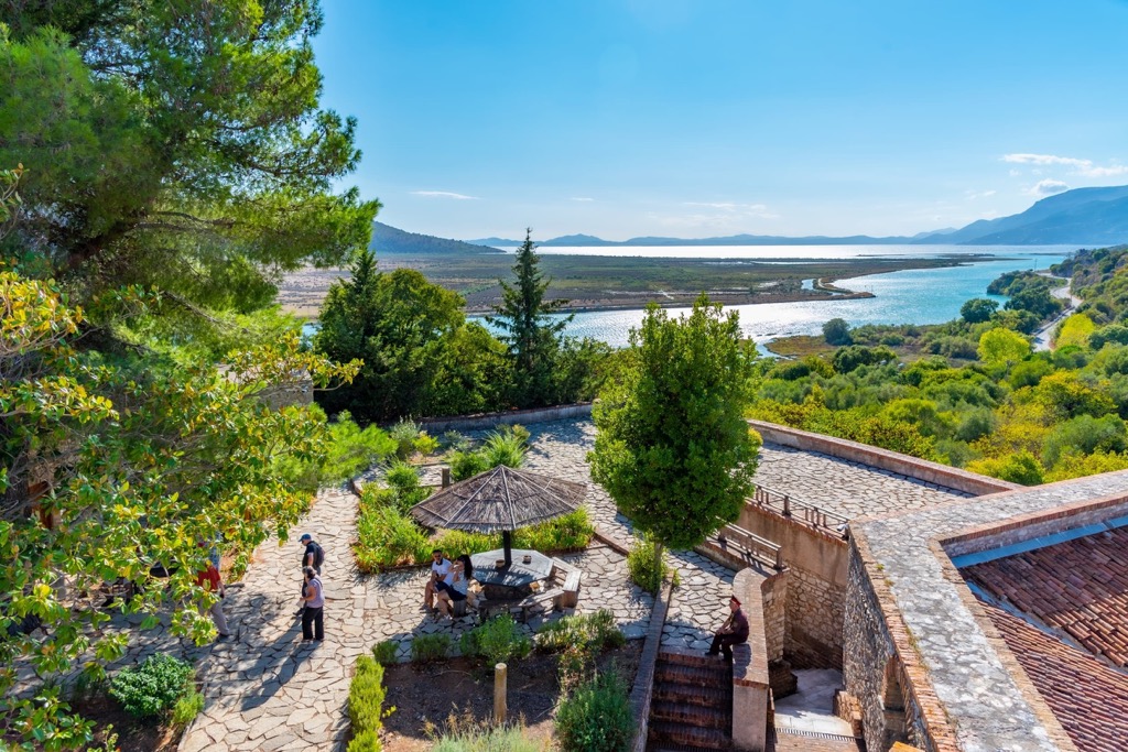
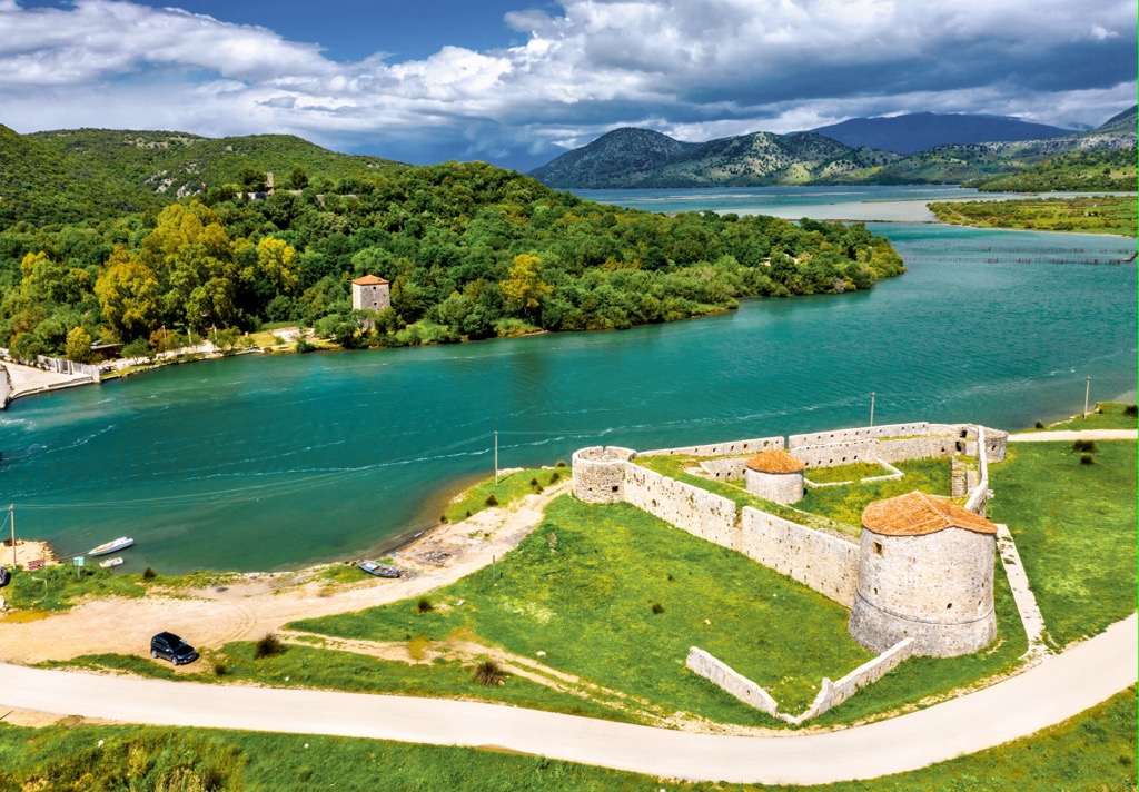
There are two lakes in this national park, the biggest of which is Lake Butrint, with a surface of 16 km (10 mi). The lake is located in the northwest part of the park and is linked with the Ionian Sea through the 100 m (330 ft) wide Vivari Channel.
The second lake is Lake Buffi which has a 2 m (6,5 ft) elevation above the Adriatic Sea, with a surface of 83 ha (210 ar). The lake is located southeast of Lake Butrint. In case the lake overflows, the excess water flows into Lake Butrint.
The rivers of the national park are steep and short, and they have a massive water flow. Two rivers are important for this area, River Bistrica, which is located on the north, and River Pavlo in the south of the national park.
The borders of this park extend to the exit of the surrounding villages, such as Ksamili, Vrina, Shëndëllia, and Xarra. The creation of the national park became a necessity, according to specialists, for the preservation of the unique location and atmosphere of Butrint.
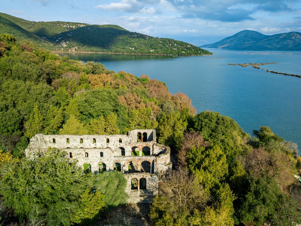
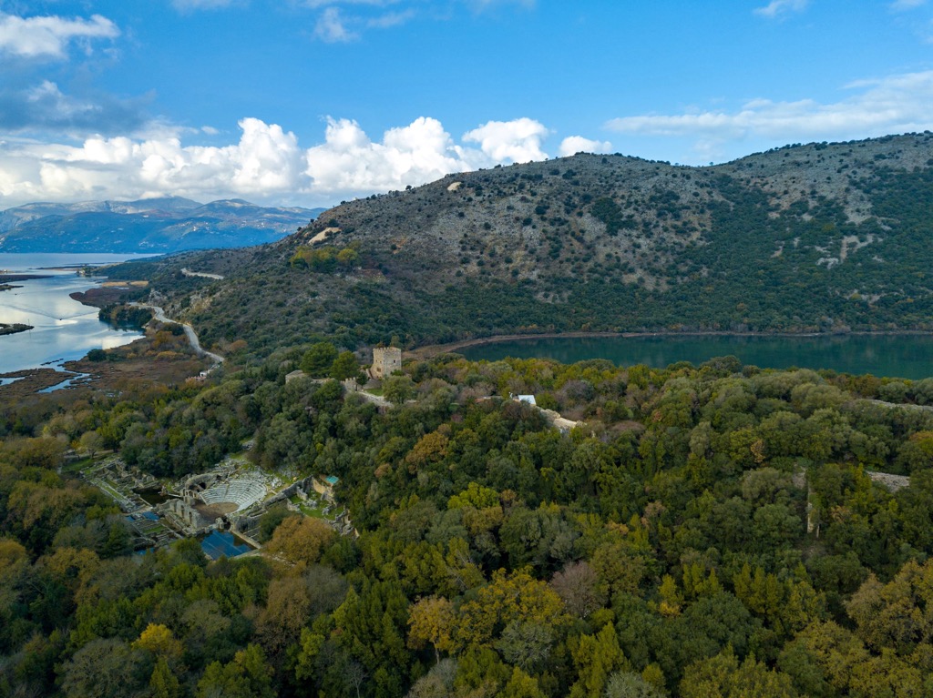
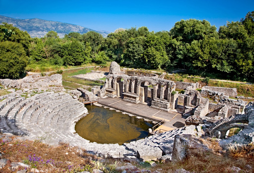
Within Butrint, there are ten great archaeological sites related to the history of Butrint. Some of them are the area inside the walls of Butrint and the ones outside the walls. Butrint National Park is an extraordinary treasure for Albanian tourism.
A significant part of Butrint Lagoon is almost absent of sand. There is more sand content in regions where the lagoon connects with the shore of Virna and Vurgu plains. Sand is the dominant sediment fraction in Vivari Channel.
In Butrint Bay, the sediments of the shore in front of Vrina Plain consist mainly of sand.
In front of the Pavllo River estuary, the sand percentage progressively reduces to open sea. The mineralogical composition of Butrint is of great diversity.
The most abundant minerals are quartz, calcite, plagioclase, illite and micas, and halite. Other minerals such as chlorites, kaolinite, anhydrite, aragonite, and magnesian calcite occur in smaller amounts.
Iron sulfide minerals, such as pyrite and probably marcasite, are also identified in the deep anoxic part of the lagoon. The clay fraction mineralogical analysis revealed the occurrence of quartz, calcite, plagioclase, illite and micas, chlorites, kaolinite, K-feldspars, and aragonite.
Butrint Lagoon floor is very smooth and almost structureless in its central part, while in the shallower sectors of the lagoon, deposits and phytobenthos assemblages occur. Moreover, in Vivari Channel, various types of sediment ripples and sand barriers were detected.
There is evidence of human activities on lagoon beds, such as fixed concrete rafts for mussel cultivation and trawl scars, abandoned nets and ropes, and wrecks of small modern boats and concrete blocks.
Architectural remains of archaeological interest were found in the eastern part of the Vivari Channel. Also, Butrint National Park is full of karst and rock formations. The highest peaks in Butrint National Park are:
Butrint National Park is essential for this part of Europe due to the preservation of biodiversity. The park's location adds to the great variety of animals and plants. It is an area with 16 endangered species of flora and 14 globally endangered species of fauna.
This national park is home to globally threatened species, two of which are critically endangered species. For example, Horseshoe Bats (Rhinolophus) and Mouse Eared Bat (Myotis). 17% of all species living in Albania live in Butrint National Park. The park is awe-inspiring for its reptiles, birds, amphibians, and mammals, including the wolf.
This is the only place in all of Albania where the Epirus tortoise, the sand boa, and the Balkan wall lizard live. Butrint bay and Varina marsh are important feeding and nesting grounds for birds. In winter, waders visit the shallows, including the common snipe, red-legged plover, goldfinch, and shrike.
National Park includes 246 species of birds, 39 species of mammals, and plenty of coastal species as well. Some mammals include beech marten, red fox, golden jackal, otter, and, grey wolf.
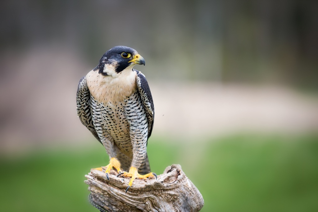
Butrint National Park is home to over 246 species of birds that live in different areas of the park. Some of these birds pass the Adriatic flyway, and for some, this is their permanent habitat. The fascinating birds in this national park are the golden oriole, golden eagle, and peregrine falcon. Ionian Sea Coast is an important wintering destination for many birds. At the same time, the Marshes of the park are feeding sites for different species of birds.
This Park is very diverse in its reptile species. 25 species of reptiles have been documented. They are represented by slowworm, Balkan green lizard, and aesculapian snake. Sea is full of life as well and has around 105 species that inhabit the seawater around the Park.
According to the phytogeographical division, Butrint National Park belongs to the following:
The Illyrian Deciduous forests are an ecoregion within the Mediterranean biome that stretches along the northern and eastern coasts of the Adriatic and Ionian seas. From northern Italy to the north of Greece. The primary vegetation of this region consists of forest ecosystems consisting of deciduous species, mainly oak and chestnut.
The Palearctic is the largest biogeographic region on Earth. It extends throughout Eurasia, north of the Himalayas, and northern Africa.
The empire consists of several bioregions, the Euro-Siberian region, the Mediterranean basin, Sahara, and the Arabian Desert. Western, Central, and Eastern Asia
The availability of water in the form of lakes, reservoirs, and rivers, under the additional influence of the terrain, dramatically influences the biological diversity of this area. The flora of Butrint National Park consists of more than 800 to 900 species, which is 27% of the total number of species in Albania.
Shallow coastal lagoons have mussel beds with large rock formations. The water is much deeper than in other areas. They are covered with thick grasses. The seabed is mainly covered with underwater meadows of spiral ditch grass (ruppia cirrhosa) and dwarf eelgrass (zostera noltei).
Inside Butrint National Park and on the nearby eastern and southern slopes of Sotira, dominate evergreen forests. They can be divided into three different vegetation zones:
Dolphins frequently visit the waters around the national park. The rocks and caverns of the park are one of the last nesting places for the endangered Mediterranean monk seal. Sea turtles are common in the coastal waters of Butrint National Park. Two species of sea turtles are endangered in Albania: the leatherback sea turtle and the loggerhead sea turtle.
Many legends describe how Butrint was found. Homer and Virgil describe the most popular one. Some believe that Trojan exiles found Butrint after the fall of Troy in the thirteenth century BC. Butrint has its roots in the name Buthrotos.
According to the legend, on arrival, Priam's son, Helen, made a sacrifice. The sacrifice was a cattle he fought with on the shore, which he wounded and killed. This was considered a good sign, and the place was named Buthrotum, which means "wounded cattle."
It's known that Butrint was inhabited in the twelfth century BC, but the settlement would flourish only after the eighth century BC. From the excavations made in the Acropolis, it was discovered that first, people traded with other cultures connected through the Mediterranean world. They made their own ceramics but also imported Corinthian ceramics.
In written sources, Butrinti is mentioned for the first time in history in the sixth century BC. In writing "Europa" by the Greek geographer Hecataeus of Miletus. At the time of imperators Julius Caesar and Augustus, Butrint became a Roman colony.
In the earliest periods, the city became one of the main points of a local tribe called Chaonians. The establishment of a Corinthian colony in Corfu stimulated commercial exchanges, which added to the economic and social development of Butrint. This is also shown by the Corinthian pottery found in the city's Acropolis.
Later, during the Hellenistic period, when Butrint and Kaonia became part of Epirus, the city became a self-governing state "Koinon" called Prasaib. Butrint became the main center of the territory. The inscriptions are a rich source of information about how the city was governed and Butrints inhabitants' ethnicity.
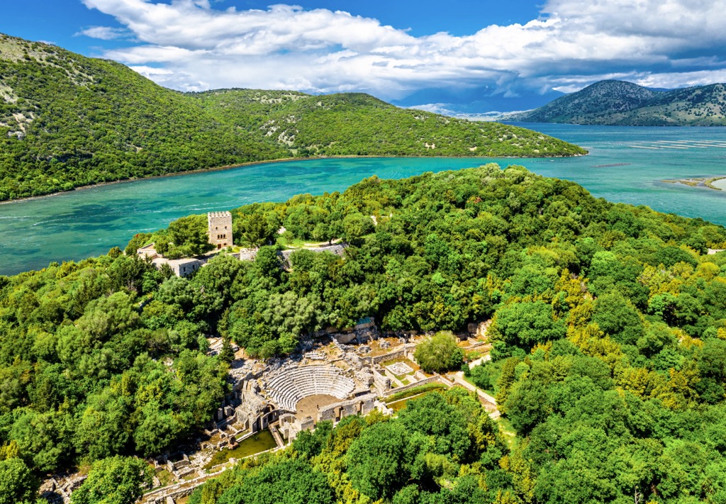
Butrint also had several civil institutions. The archaeological evidence for this phase of the city's life clearly shows its strengthening. The temple and the theater testify to the growth of the city's cultural needs. The southern defensive wall also dates to this period.
During most of its ancient history, Butrint functioned as a cult center dedicated to Asclepius, the god of health. Important in the history of Butrint is the third Roman-Macedonian war. When Philip V of Macedonia suffered the final defeat, after this, Rome established control over the eastern coast of Epirus, destroying the allied cities of Macedonia.
After that, Butrint's history was increasingly entangled with Roman politics. Epirus became a favorite place for many Romans. What attracted the Roman Empire most was the favorable position as a trading center that both sea and land could reach.
Julius Caesar tried to establish a colony in Butrint. This step was significant in Caesar's strategy to control Eastern Greece and the route from the Adriatic to the Aegean. Ceasar didn't live to see this, but Augustus carried out his vision. This was a prosperous period for Butrint and its inhabitants.
The third century was fatal for Butrints glory. A large earthquake destroyed most of the city and marked the beginning of the city's decline. At the beginning of the sixth century, Butrint became an episcopal seat. A large baptistery, one of the largest early Christian buildings of its kind, and a basilica were also built.
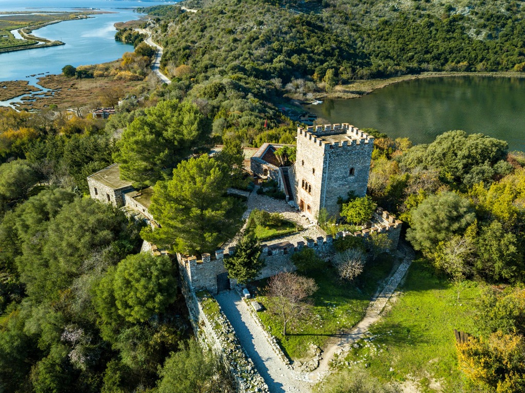
Byzantine rule over Butrint lasted until the thirteenth century, after which the area was ruled by many powers, considering that the city was strategically important on the navigation route between the Adriatic and Ionian seas. Venice and the Ottoman Empire, in particular, fought for Butrint.
Later it entered the possessions of Venice, from which Ali Pasha separated it. With the fall of the Pashall of Ioannina, Butrint came under Ottoman rule until the independence of Albania in 1912.
In 1435, the Italian humanist Qiriaco d'Ancona stayed in Butrint and was the first to document several monuments found in Butrint. Also, he saw that Butrint would be one of the critical archeological centers.
Italian archaeologist Ugolini made sensational discoveries in 1928, such as the Roman Baths, the Baptistery, and the Theater, where he also found the sculpture with the head of Dea of Butrint. The Italian archeological mission continued its work until 1943. After the Second World War, archaeological research in Butrint would continue under Albanian institutions' control and, after 1989, cooperate with foreign Institutions.
Here are the best hikes in Butrint you should take to get the most experience out of this place.
This one-way trail is great for visitors that stay in the nearby city of Ksamil. It is only 6,5 km (4 mi) long with minimal elevation gain. If you are an average walker, you will need about 3 hours to finish the trail. The trail starts from the city center of Ksamil and, following the main road, leads to Butrint National Park entrance.
After which, you will follow the archeological trail through Butrint National Park. The trail is full of beautiful panoramic views and beautiful forests. During the trail, you will see most of the archeological sites and old ruins, such as the Fountain of Nymphs, the Basilica, the Baptistery, Venetian Castle, etc.

This is the trail you will take if you are in a hurry or the weather could be better. The trail starts at Butrint National Park entrance and leads you through the most important sights in Butrint National Park.
These are Venetian Castle, Basilica, Baptistery, Roman House, and Venetian Tower. The trail is around 2,4 km (1,5 mi) and takes about 1,5 hours. Great for family and people that don't have much time.
Archeological sites are a must to visit when you are in the Park. There is no better way than to follow the trail through the whole National Park. This is an easy 3 km (2 mi) trail that takes about 2,5 hours of sightseeing.
The trail starts at the entrance and is well-marked. Following all the ruins and historical buildings, you will see The theater from the third century, the Gymnasium, the Baptistery, the Basilica, the Acropolis, the Fountain of the Nymphs, and every other historical sight in the park.
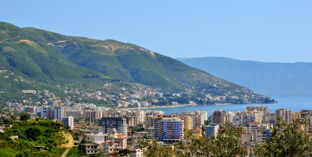
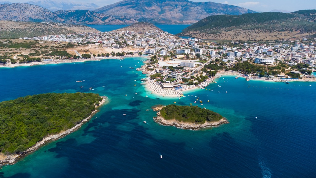
Cities that surround Butrint National Park are Sarandë, Vlora, and Ksamil in Albania and Corfu in Greece. Butrint National Park is around 18 km (11 mi) away from Sarandë, 140 km (87 mi) away from Vlora, 5 km (3 mi) away from Ksamil, and 64 km (39 mi) away from Corfu.
Sarande is a city located in the southern part of Albania, close to the border with Greece. This city is one of the most popular resorts in Albania. Sarande has a population of around 35,000 people. There are a lot of different apartments and hotels in this city which makes it the perfect option.
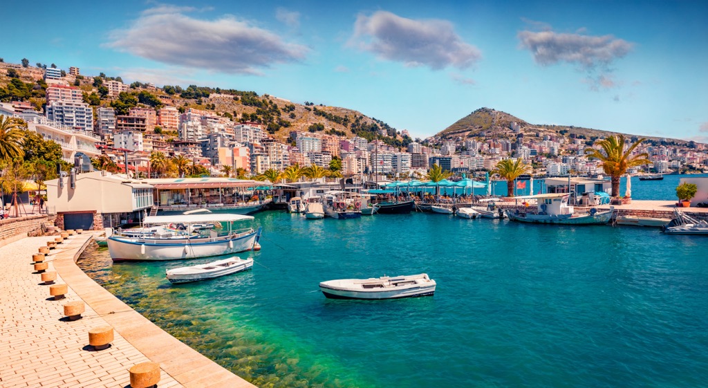
It is located in an amazing location, surrounded by the sea and mountains. It is an excellent destination for all categories of tourists, families, young people, and older tourists.
Sarande has a Mediterranean climate, very warm seawater, and more than 300 sunny days a year.
Vlora is a port and former capital of Albania located in the southern part of the country. This is the place where the country's independence from the Ottoman Empire was declared at the beginning of the twentieth century.
It is one of the oldest Albanian cities, and it has preserved its rich history and culture, so it is a beautiful location for tourists. It is popular because of its unique ancient monuments. The offer of accommodation in Vlora is large, and the prices are affordable.
Ksamil is located in the very south of Albania, near the border of Albania with Greece and just a few kilometers from the Greek island of Corfu. Ksamil is a small town on the coast of the Ionian Sea, with a population of 3,000 people.
But during the summer season, this place is visited by a large number of tourists.
Ksamil is specific for its crystal clear water and the turquoise color of the sea. Regarding accommodation in Ksamil, hotels, apartments, and villas are available. Given that you are in Albania, the prices are not high.
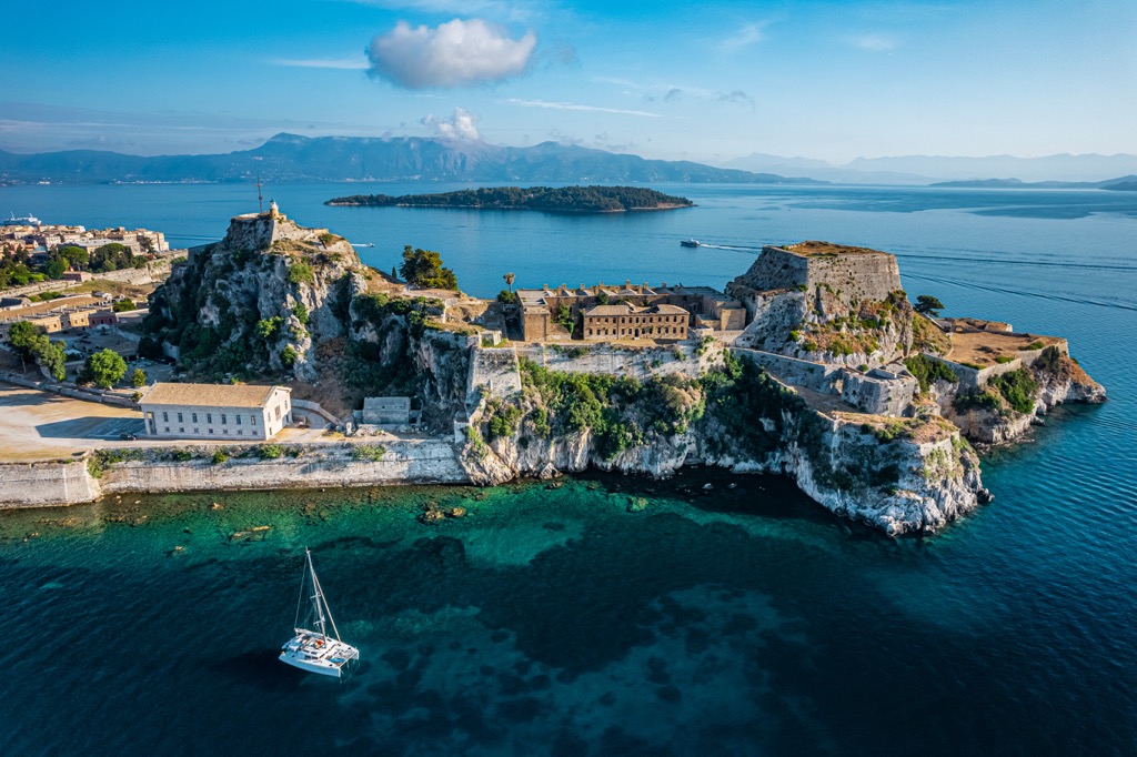
Corfu is a Greek island located on the Ionian Sea. There is an international airport in Corfu. It's one of the wealthiest regions in Greece. It has a population of about 40,000 people. It is a well-known tourist destination, given that this city is full of sights worth visiting.
This city offers a variety of accommodations, from luxurious to affordable. Corfu is a bigger city and has a lot of content for entertainment.