
Scan the QR code and open PeakVisor on your phone
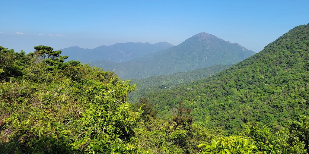
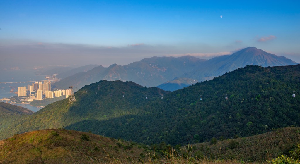
Lantau North Country Park is a verdant landscape of wooded hills on Lantau Island in the Hong Kong Special Administrative Region of China. There are 19 named mountains in the park. The highest and the most prominent mountain is Sunset Peak (869 m/ 2,851 ft).
Designated in 1978, Lantau North Country Park occupies an area of 2,200 hectares (5,436 acres) on Lantau, the largest island in Hong Kong. It borders the new town of Tung Chung to the north and Lantau South Country Park to the south.
Apart from the park proper, 2,360-hectares (5,832 acres) next to its eastern side were designated as Lantau North (Extension) Country Park in 2008. This article refers to both parks as “the park” even though they are managed as separate entities.
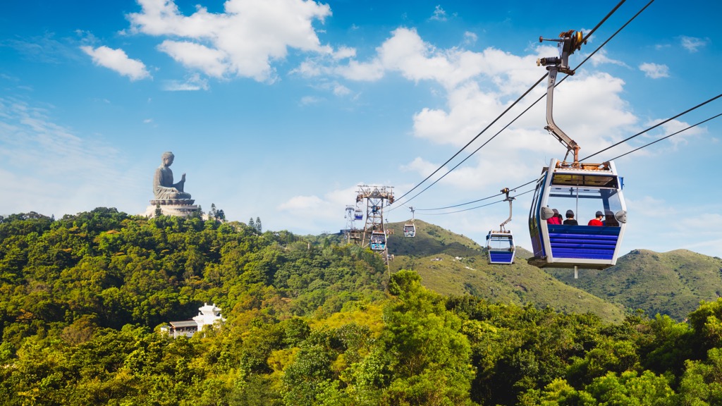
The park is on the more developed side of the island compared to Lantau South Country Park. The Hong Kong International Airport and Hong Kong Disneyland are just a few kilometers away to the north, while the Ngong Ping plateau to the south has some of the city’s top attractions such as Po Lin Monastery and the 34-meter (112-ft) Tian Tan Buddha bronze statue.
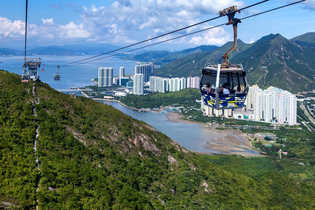
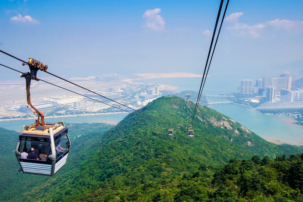
Ngong Ping 360, one of the two cable car rides in Hong Kong, zips above the park between downtown Tung Chung and Ngong Ping Village. Its rescue trail of wooden steps doubles as a popular hiking trail.
The rocks in the park are mostly formed of Mesozoic granites and volcanic rocks. The western side of the park tends to be more craggy with lots of lava and volcanic tufts. The eastern side has more rounded hills largely made up of granite.
The landscape in the area is deeply weathered. Much of it is covered with saprolite, a soft decomposed rock material formed in situ by chemical weathering.
A major volcanic episode happened on the island in the late Jurassic period between 146 to 148 million years ago. It resulted in the development and subsequent collapse of a caldera. The volcanic ash ejected was so hot in places that it welded together to become lava.
The eastern side features a collection of vertical sheets of rocks known as the Lantau dyke swarm, which was produced when lava and magma moved into cracks in existing granitic rocks.
A few rivers including Tung Chung River, which is the only large river in Hong Kong that has not been extensively channelized, flow through northern Lantau. Despite the proximity of its lower course to urban areas, Tung Ching River still has excellent water quality and remains largely free from man-made disruptions.
Five streams known as the “five dragons of Tung Chung” are tucked in the deep valleys north of Sunset Peak. They are the North Dragon (北龍), Crouching Dragon (臥龍), Yellow Dragon (黃龍), Hidden Dragon (藏龍) and East Dragon (東龍).
The park boasts a variety of terrestrial habitats such as secondary woodlands, montane forests, grasslands and shrublands as well as freshwater streams.
On top of common plant species such as azaleas and rhododendrons, there is a diversity of protected plants like the Chinese New Year flower (Enkianthus quinqueflorus), Hong Kong magnolia (Magnolia championii) and the carnivorous pitcher plant (Nepenthes mirabilis).
Many kinds of orchid thrive in the area, including the Hong Kong lady’s slipper orchid (Paphiopedilum purpuratum), bamboo orchid (Arundina chinensis) and purple bulb orchid (Ania hongkongensis).
The critically endangered Hong Kong asarum (Asarum hongkongense), a perennial herb with leathery leaves, was first discovered in the area in the 1980s. Not only is it endemic to Hong Kong, it is found nowhere else in the world other than Lantau Island.
Some of the mammals residing in the area are the red muntjac and Chinese ferret badger. The Chinese white dolphin, whose population in Hong Kong is down to fewer than 40 individuals, can be found off the coast of north Lantau.
Tung Chung River has a total of 23 recorded freshwater species, the second highest among the city’s rivers. Rare and endangered species include the Beijiang thick-lipped barb, Philippine neon goby and seaweed pipefish.
The streams are ideal breeding grounds for the native amphibians like Hong Kong newt, South China cascade frog and short-legged toad. The large rocks commonly found at the steep upper course are microhabitats that shelter various creatures like shrimps, crabs and dragonflies.
North Lantau was inhabited since at least the Neolithic Age, as evidenced by the remains of a 3,500-year-old village found at Pa Tau Kwu (扒頭鼓), close to the present-day Hong Kong Disneyland.
During the Song Dynasty (960-1279 AD), Lantau was a major salt production base as well as a way stop on the Maritime Silk Route that linked China with other parts of Asia and the Middle East.
In the Ming Dynasty (1368 –1644 AD), Portuguese merchants established a trading post in north Lantau in the 1510s, but were driven out a few years later after they were defeated by Chinese forces in a naval battle.
In order to curb pirate activities and opium trading, the Tung Chung Fort and the Tung Chung Battery were built in the early 18th century and the early 19th century respectively. Lantau’s strategic position lasted till Hong Kong was colonized by the British in the 1840s.
Following the colonization, Lantau was relegated to the periphery of the administration. While Hong Kong developed into a busy city, the island lapsed into an outlying backwater of fishing villages and Buddhist sanctuaries, the most famous of which is Po Lin Monastery founded in 1906.
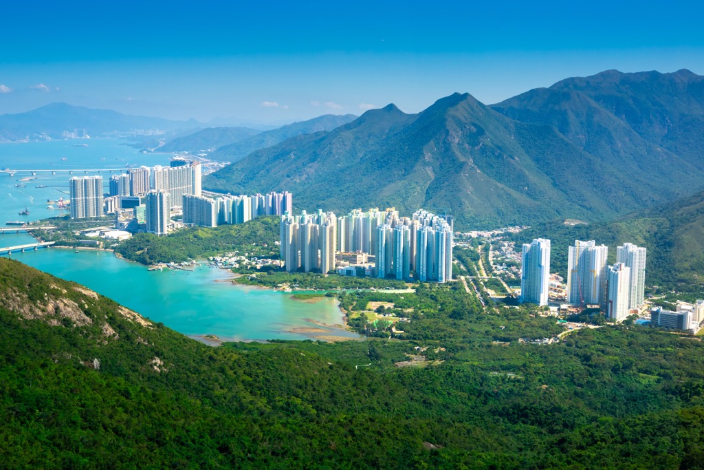
After Hong Kong’s handover back to China in 1997, the Hong Kong International Airport was relocated to north Lantau. It coincided with the development of the supporting community of Tung Chung New Town, completed with housing complexes and mass transit links.
Other mega development projects have followed, like the Hong Kong Disneyland that opened in 2005 and the Hong Kong–Zhuhai–Macao Bridge, completed in 2018, which is the longest sea-crossing bridge in the world.
The many dips and rises in the park offer excellent opportunities for peak scaling and stream hiking. Here are the best trails and attractions to explore.
This side centers around the uplands of Ngong Ping, which has a campsite and a YHA hostel, though the tourist facilities are in a “country park enclave” which is excluded from any country park.
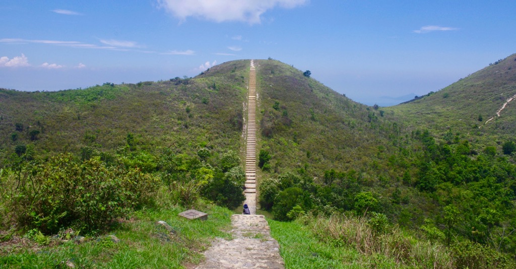
Ngong Ping Trail, which connects downtown Tung Chung with Ngong Ping Village, used to be a crude trail until its makeover in 2004 to serve as the rescue and maintenance trail of the Ngong Ping 360 cable car.
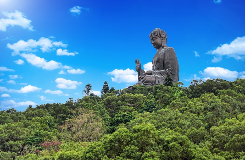
Much of the 5.7-km (3.5-mi) trail is paved with neat wooden steps though it is physically demanding to go up, especially in the section known as “stairway to heaven”. The trail offers views of Tung Chung Bay, the airport and the giant Tian Tan Buddha, while a constant stream of cable cars glide overhead.
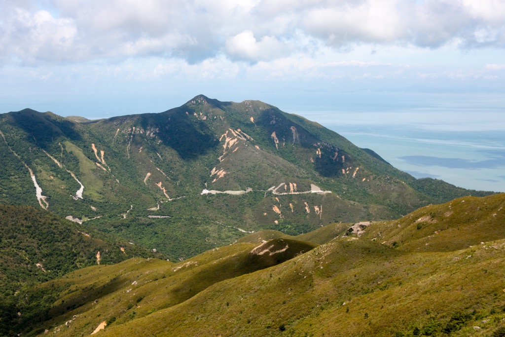
From Ngong Ping Village, Nei Lak Shan Country Trail is a moderate 5-km (3.1-mi) loop with views of downtown Tung Chung as well as the imposing Lantau Peak (934 m/ 3,064 ft) and Sunset Peak (869 m/ 2,851 ft). While the trail circles Nei Lak Shan (751 m / 2,464 ft), an unofficial footpath off the trail leads to the summit.
There is a cluster of peaks on this side, including Ap Kuk Lek (721 m/ 2,365 ft), Pok To Yan (529 m/ 1,736 ft), Por Kai Shan (482 m/ 1,581 ft) and Lin Fa Shan (766 m/ 2,513 ft).
Ap Kuk Lek offers panoramic views that extend across the sea to New Territories. Pok To Yan and Por Kai Shan are two connecting peaks whose montane shrub forests harbor more than two hundred species of native plants.
Lin Fa Shan is connected to Sunset Peak (869 m/ 2,851 ft) and Yi Tong Shan (749 m/ 2,457 ft), both of which are partly in Lantau South Country Park. All three peaks are on the list of the ten highest peaks in Hong Kong. They are known for silvergrass that grows all over the slopes.
The pristine mountain streams in the valleys are popular for stream hikes. Wong Lung Stream (or Yellow Dragon Stream) is the most accessible one, while Pak Lung Stream (or North Dragon Stream) has the clearest waters that end at the Heavenly Book Wall, which is a pair of cliffs set at right angles.
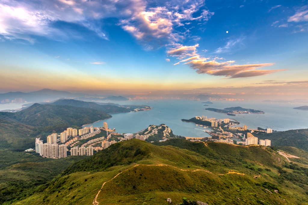
The gateway neighborhood to the park is Tung Chung, which has been drastically transformed in the last three decades. A sleepy rural fishing community till the 1990s, Tung Chung is now a dynamic new town with the fastest growing population in Hong Kong.
Among new highrises and the biggest outlet mall in the city, pieces of nature and history persist. The mangroves of Tung Chung Bay, the fishing village of Ma Wan Chung and the historic Tung Chung Fort are within a few minutes’ walk of one another.


