Scan the QR code and open PeakVisor on your phone
The Kgalagadi Transfrontier Park is a conservation area in the Kalahari Desert, straddling the border between South Africa and Botswana. There are 53 named mountains in Kgalagadi Transfrontier Park. Groot Kolk is the highest point at 1,056 meters (3,465 ft). The most prominent mountain is Ellis Kolk, measuring 1,010 meters (3,314 ft).
The Kgalagadi Transfrontier Park is located in South Africa’s Northern Cape province and Botswana’s Kgalagadi District and covers approximately 380,000 ha (939,000 ac). It was created by merging South Africa's Kalahari Gemsbok National Park and Botswana's Gemsbok National Park, one of Africa's largest protected areas.
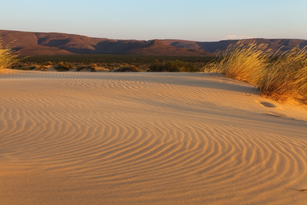
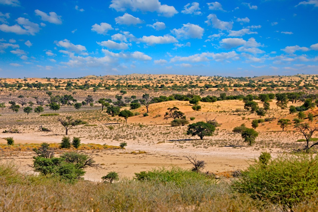
The park is located in the southern Kalahari Desert, a semi-arid sandy savanna with red sand dunes, grassy plains, and dry riverbeds. The Nossob and Auob rivers flow only after rare heavy rains.
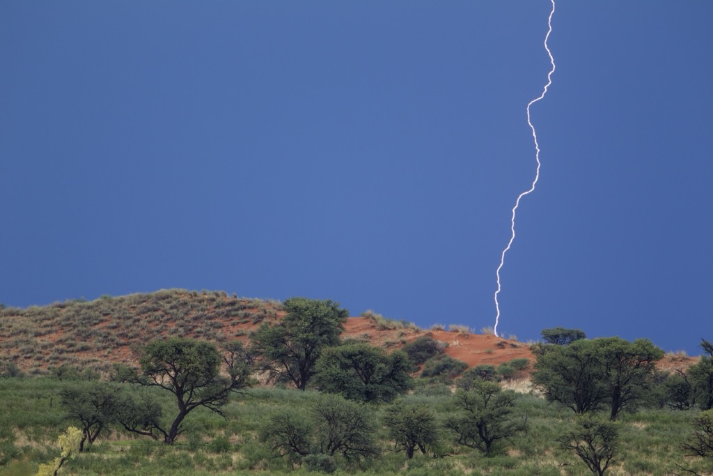
Kgalagadi has a desert climate with hot summers up to 40°C (104°F) and cold winters, where night temperatures can drop below freezing. Rainfall is scarce, averaging 200 mm (8 in) annually, mainly from short, isolated storms.
The park's vegetation includes drought-resistant grasses, shrubs, and trees, such as the camelthorn acacia and shepherd’s tree, which sustain wildlife in the harsh environment.
Kgalagadi has no permanent water sources. Wildlife depends on scattered waterholes and moisture from vegetation. The sandy soil allows quick drainage and prevents surface water retention.
The park lies on the border of South Africa and Botswana and shares international conservation efforts. There are no fences between the two countries, allowing wildlife to move freely. Though regulations and facilities vary, visitors can access the park from both countries.
The park lies on Precambrian igneous and metamorphic rocks of the Kaapvaal and Zimbabwe Cratons, some of the Earth's oldest continental crust, over 2.5 billion years old. These are overlain by sedimentary deposits from the Late Paleozoic to Mesozoic eras, including sandstones and shales of the Karoo Supergroup.
The surface is dominated by the Kalahari Sands, which have been formed over the past two million years. These wind-deposited sands create dune systems stabilized by sparse vegetation. The sands are reddish due to iron oxides and form part of the larger Kalahari Basin, which extends beyond the park.
Ancient river systems, including the Nossob and Auob Rivers, have left gravel terraces, clay pans, and dry channels. These rivers occupy former channels from wetter climatic periods, with fossilized evidence of past lakes and wetlands.
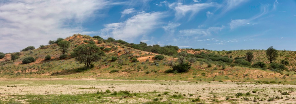
Kgalagadi Transfrontier Park experiences an arid to semi-arid climate. The landscape consists of red sand dunes, dry riverbeds, and open grasslands with sparse vegetation shaped by limited water availability and nutrient-poor soils.
The park's vegetation is dominated by drought-resistant plants, such as grasses like Stipagrostis, camelthorn, and shepherd’s tree. These plants have deep roots or water-conserving leaves. After rainfall, the landscape briefly blooms, providing forage for herbivores.
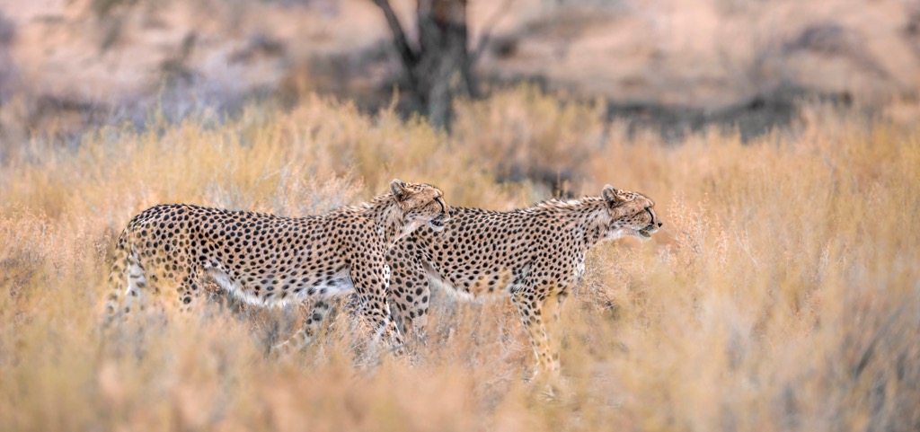
The park supports diverse wildlife, including predators like black-maned lions, leopards, cheetahs, and hyenas. Herbivores such as springbok, gemsbok, and wildebeest migrate seasonally for grazing. Over 200 bird species, including martial eagles and sociable weavers, thrive alongside reptiles like cobras and insects like beetles, which play key ecological roles.
The Kgalagadi Transfrontier Park's arid environment has shaped its rich human history. The San people were among the region's earliest inhabitants, living as hunter-gatherers for thousands of years. They relied on deep knowledge of the land for survival.
Around 2,000 years ago, Khoikhoi pastoralists introduced livestock, coexisting with the San and altering land use in the region. European colonization in the 17th and 18th centuries brought firearms, fences, and commercial hunting, leading to the displacement of indigenous communities and disruption of traditional ways of life.
Conservation efforts began in the 20th century with the establishment of South Africa's Gemsbok National Park in 1931 and Botswana's Mabuasehube Game Reserve in 1971. These initiatives often excluded Indigenous peoples from their ancestral lands.
The creation of the Kgalagadi Transfrontier Park in 2000 merged these areas, promoting cross-border conservation and tourism. Recent efforts aim to involve local communities, particularly the San, in management and decision-making.
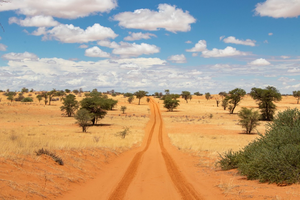
There isn’t much in the way of hiking in Kgalagadi; the environment is simply too harsh, and the wildlife too dangerous. The best way to explore the park’s unique landscape and ecosystem is via off-road vehicles.
The Nossob 4x4 Eco-Trail is a 214 km (133 mi) adventure that takes visitors through the Kgalagadi's dune fields. Over the course of four days and three nights, visitors will traverse the remote terrain between Twee Rivieren and Nossob camps. The journey offers a chance to experience the park's raw beauty and encounter its wildlife, including the black-maned Kalahari lions, and locate some of the park’s high hills, like Ellis Kolk and Seven Pans.
The Leeudril 4x4 Loop offers a shorter off-road experience. The 13 km (8 mi) trail starts north of the Leeuwdril Waterhole and ends at a lookout point north of the Houmoed Waterhole. The trail provides a more accessible option for visitors who may not have the time or resources for a longer expedition. Along the way, visitors can enjoy the park's diverse landscapes and spot some of its resident wildlife.
The Bitterpan Trail is a 120 km (74.5 mi) 4x4 route accessible only to 4x4 vehicles. The trail connects the Nossob and Mata-Mata camps, passing through the remote and scenic Bitterpan Wilderness Camp. This elevated, stilted camp overlooks a waterhole, providing excellent wildlife viewing opportunities right from the accommodation and has views of Bitterpan. The trail itself winds through the Kalahari dunes, offering sweeping views and the chance to see a variety of wildlife, including lions, cheetahs, and numerous bird species.
The Mabuasehube Wilderness Trail is a 155 km (96 mi), two-day 4x4 adventure that runs from the Mabuasehube section of the park in Botswana to the Nossob camp in South Africa. This trail is known for its remoteness and offers a unique perspective on the park's diverse landscapes, from vast open pans to rolling dunes. The trail includes an obligatory overnight stop at the Mosomane campsite, which has no facilities, so visitors must be fully self-sufficient.
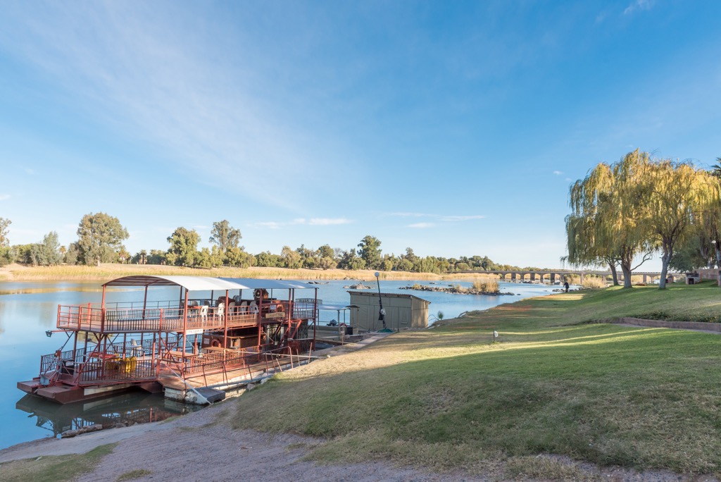
Upington is a town in the Northern Cape province on the banks of the Orange River. It is a hub for warm-climate agriculture, particularly grape farming and wine production. The town is also a gateway to the Kalahari Desert and its surrounding regions.
The Orange River is the region's lifeline. Visitors can enjoy various recreational activities like river cruises, kayaking, and fishing.
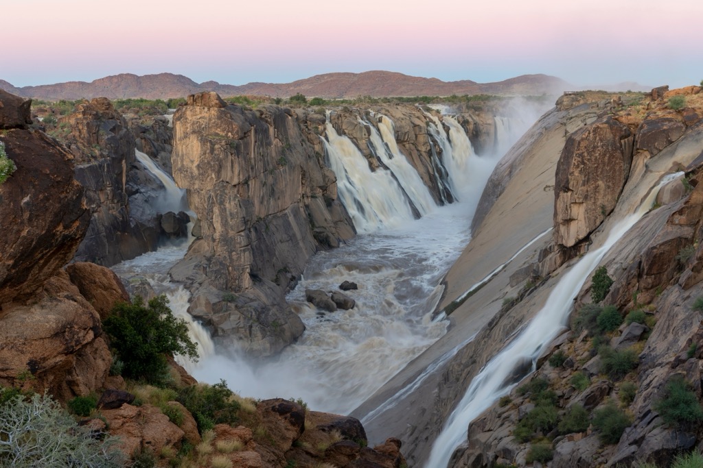
Just over 100 km (60 mi) from Upington, this national park is home to Augrabies Falls, where the Orange River plunges 56 meters (184 ft) into a dramatic gorge. The park offers hiking trails, wildlife viewing opportunities, and vistas of the rugged landscape.
Upington is part of the Northern Cape's wine-producing region, and Bezalel Estate offers wine and brandy tastings in a serene vineyard setting. Visitors can enjoy guided tours and learn about the art of winemaking in this arid region.
Hotazel is a small mining town in the Kalahari Desert in South Africa's Northern Cape province. It is known for its manganese reserves, some of the world’s largest. While not all mines are open to the public, the region’s mining history is significant and offers insight into the process.
The surrounding Kalahari Desert landscape provides opportunities for solitude, unique desert wildlife, and exceptional stargazing. Located nearby, the Witsand Nature Reserve features striking white sand dunes and the rare roaring sands phenomenon. It’s a destination for hiking, birdwatching, sandboarding, and wildlife spotting.