Scan the QR code and open PeakVisor on your phone
Augrabies Falls National Park is a nature reserve located in the Northern Cape province of South Africa. The park is known for its picturesque landscapes, impressive canyons, and the prominent Augrabies Falls, which is its primary attraction. There are 3 named mountains in Augrabies Falls National Park; the highest and the most prominent is Spieëlkop, measuring 904 meters (2,966 ft).
Augrabies Falls National Park covers approximately 82,000 ha (202,626 ac) along the Orange River. Its proximity to Upington, the largest town in the area with an airport, just 120 km (74 mi) to the east, makes it accessible for visitors.
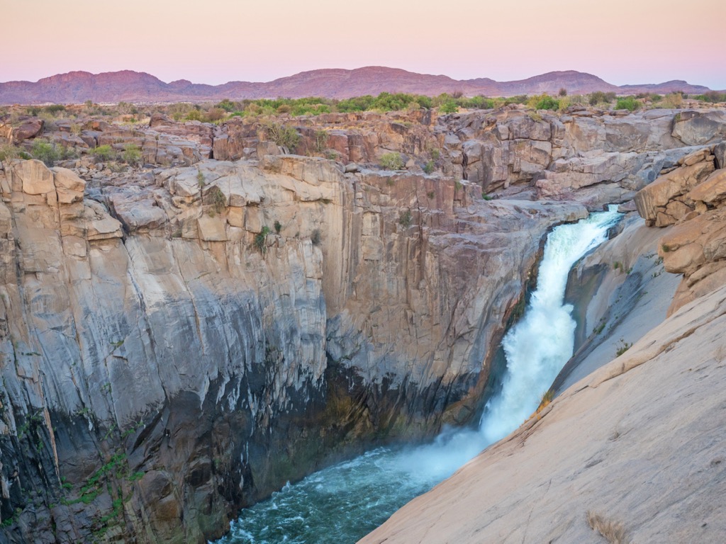
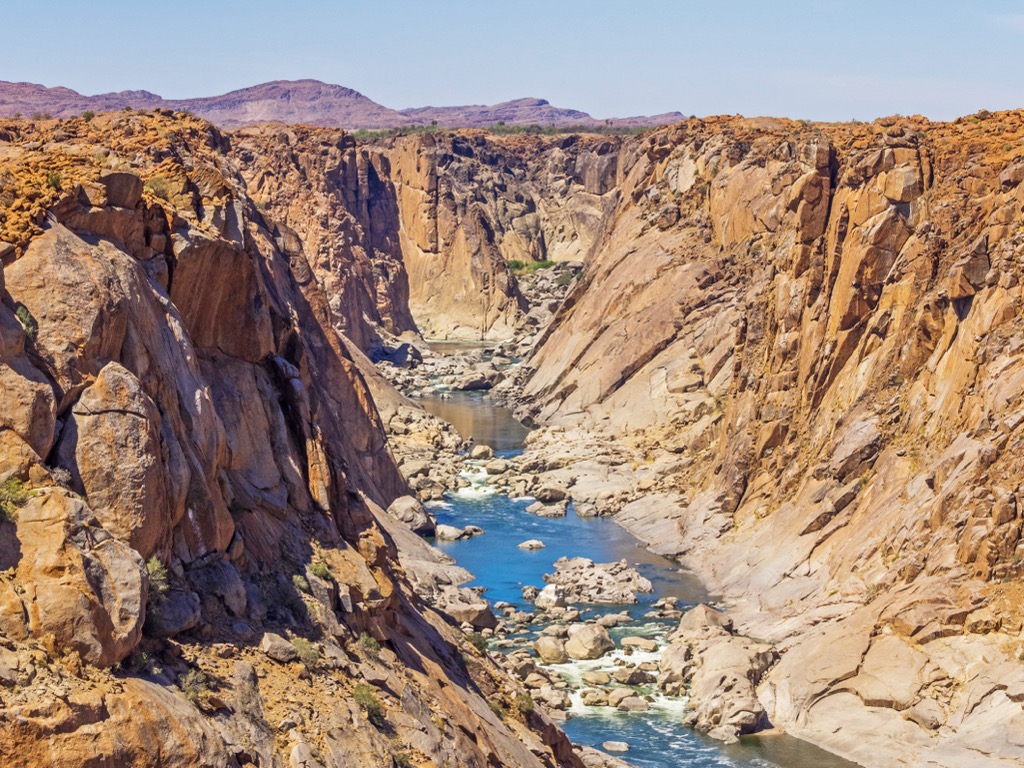
The park’s main feature is the Augrabies Falls, one of the largest waterfalls in Africa, formed by the Orange River cascading approximately 56 meters (183 feet) down a granite gorge. The name Augrabies originates from the Khoi-San language, meaning a place of great noise, aptly describing the falls' thunderous sound.
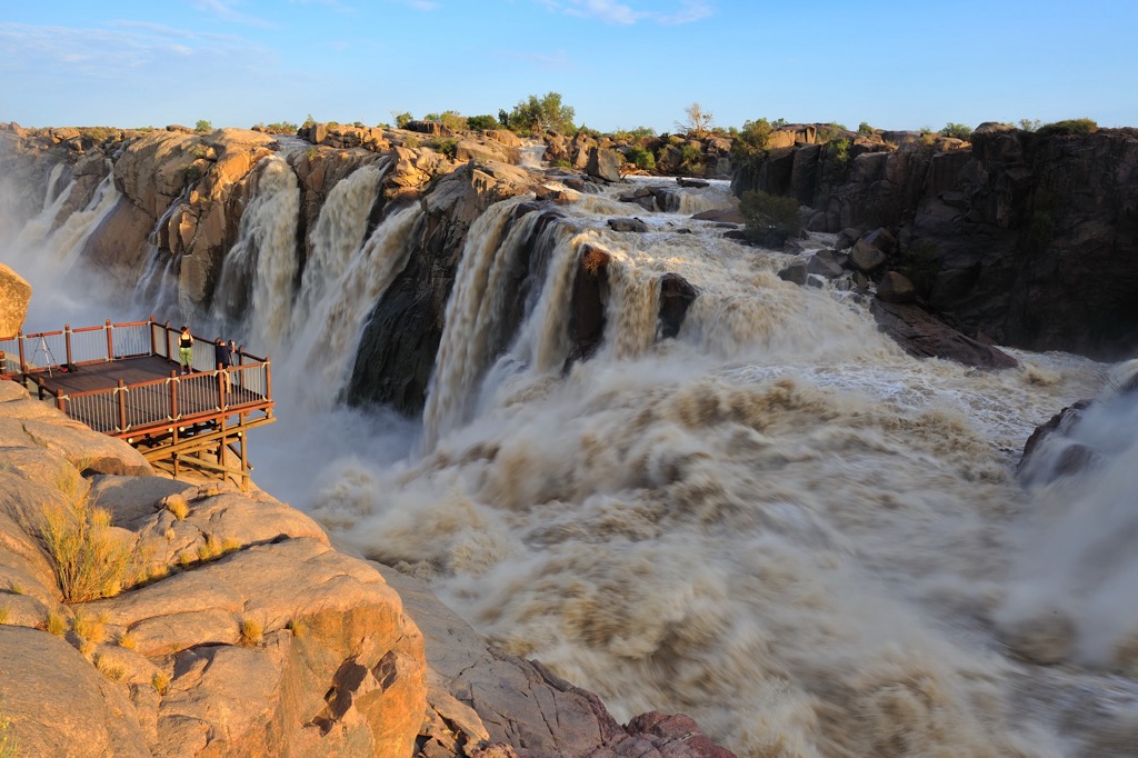
The Orange River shapes the park's landscape, creating deep gorges and notable rock formations. The granite rocks, subjected to erosion over an extended period, contribute to the park's geological distinctiveness. Moon Rock, a rounded granite hill within the park, provides panoramic views of the surroundings and the Orange River.
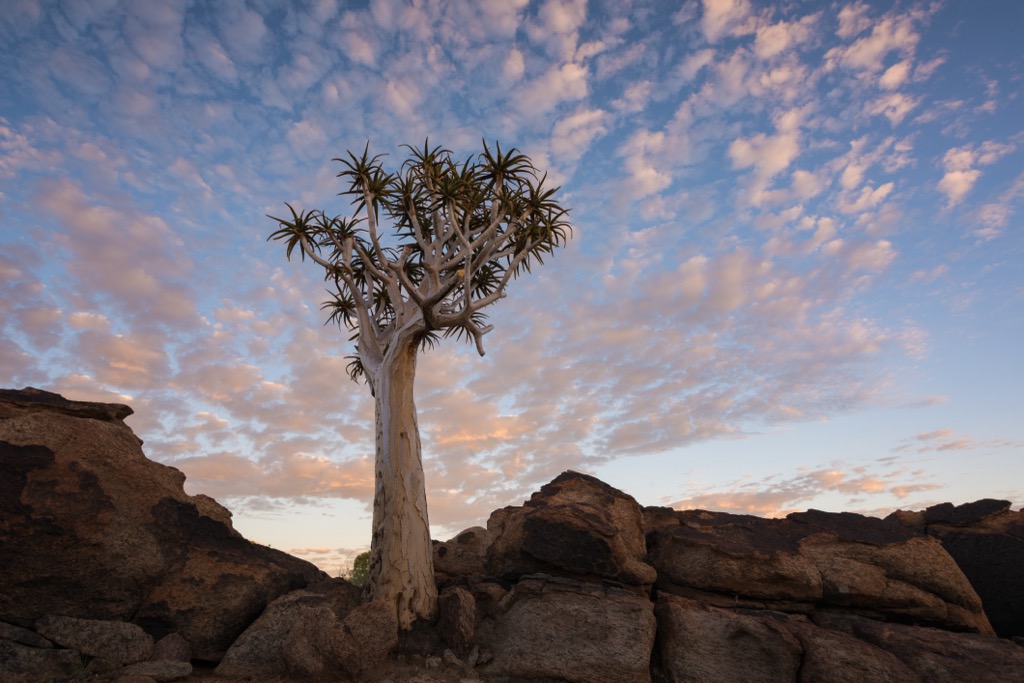
The arid conditions prevalent in Augrabies Falls National Park have created unique ecosystems. The park's flora is adapted to its arid environment, featuring plant species such as the Quiver tree and various succulents. Wildlife includes mammals like klipspringer, dassies (rock hyrax), and baboons.
Hiking trails are available for exploration to view the falls, gorges, and diverse landscapes. The park blends natural features, wildlife, and geological formations, providing visitors with an enriching experience in South Africa's arid beauty.
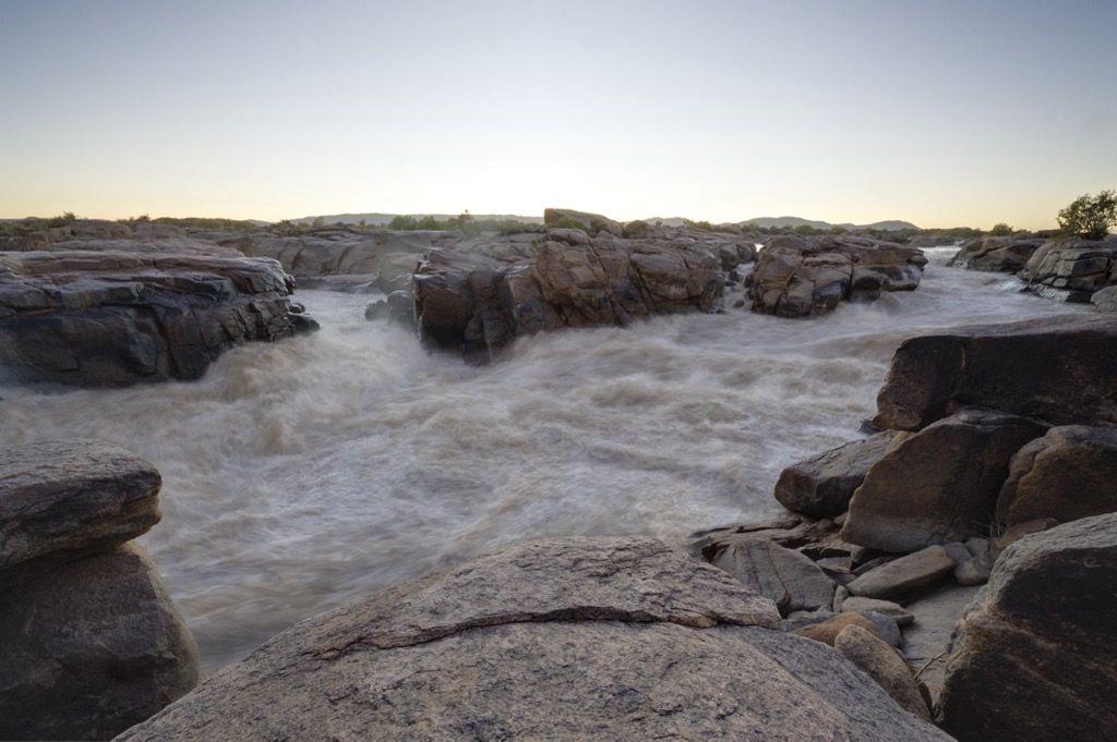
The foundation of Augrabies Falls National Park is predominantly granite, a type of intrusive igneous rock. This granitic rock forms the solid base for the Augrabies Gorge and contributes to the impressive cliffs surrounding the falls. The granite in the park has weathered over time, creating interesting rock formations and boulders. In addition to granite, the park features rocks such as gneiss and schist, which have metamorphic origins.
Augrabies Falls National Park is a semi-arid region characterized by low rainfall and harsh environmental conditions. The park showcases a range of vegetation types, including arid savannah, Nama Karoo, and succulent Karoo. Plant life in the park has adapted to survive in these arid conditions, and visitors can observe unique species, such as various succulents, shrubs, and hardy grasses.
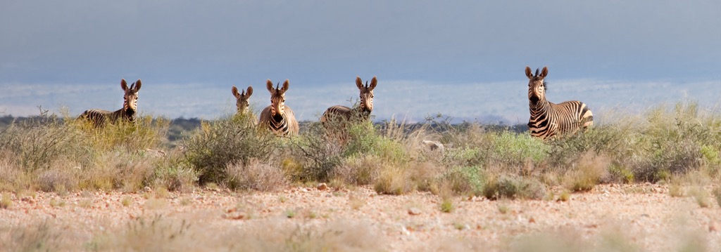
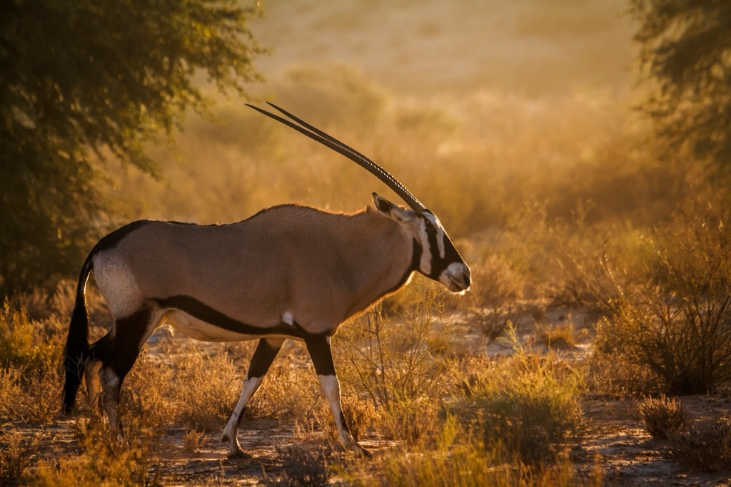
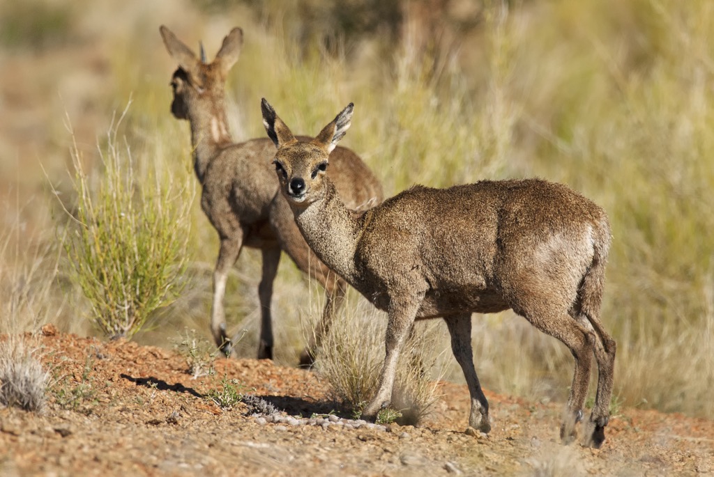
Despite the arid environment, Augrabies Falls National Park supports diverse wildlife. Mammals in the park include gemsbok, springbok, klipspringer, and Hartmann's mountain zebra. Predators like leopards and brown hyenas also inhabit the area. The park is a birdwatcher's paradise, with over 200 bird species recorded, including raptors, waterbirds, and various species adapted to arid environments.
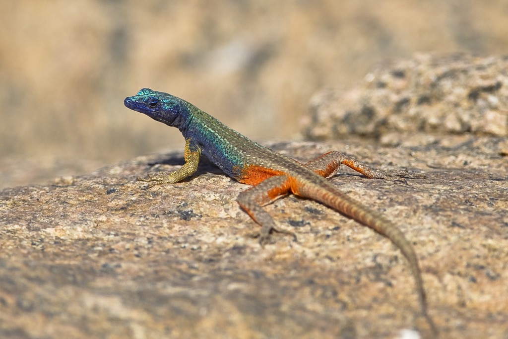
The park is home to a variety of reptiles and amphibians adapted to the semi-arid conditions. Lizards, snakes, and tortoises are common, and the park provides a habitat for several species of frogs that thrive near water sources.
Augrabies Falls National Park has a diverse human history. Indigenous San and Khoi communities lived there for thousands of years, leaving behind rock engravings. These Peoples, often called Bushmen, were hunter-gatherers with a deep connection to the land.
Dutch and British settlers' exploration and colonization in the 17th and 18th centuries impacted the region. The interactions between European settlers and indigenous communities profoundly impacted the traditional way of life.
The 19th century saw increased missionary influence and the establishment of missions. Christianity had cultural and social consequences for the indigenous people, as their traditional beliefs and practices were often supplanted by European religious influences.
The colonial era brought changes in land use and environmental degradation. More recently, efforts to preserve the unique natural features have gained momentum. The national park was officially established in 1966, focusing on protecting Augrabies Falls and the surrounding biodiversity. Today, the park showcases natural and cultural heritage, allowing visitors to explore the area's rich history in addition to the scenery.
The Klipspringer Trail, spanning 36 km (22 mi) over three days, offers breathtaking views of Augrabies Falls, unique rock formations, and the Orange River Gorge. Day one covers 14.4 km (9 mi), from the park’s reception to Twin Falls and following the Orange River Gorge to Visaend Hut. Day two, with a challenging 10 km (6 mi), descends into the Orange River Gorge for 3.7 km (2.3 mi) before climbing towards Berghut. The final day involves an 11.5 km (7 mi) trek back to the start via Swartrante’s dark rock hills.
The trail is ideal for spotting klipspringer antelope, known for rock-hopping. Wildlife encounters include baboons, monkeys, and steenbok antelope. Birdwatchers can enjoy sightings of kingfishers and fish eagles along the Orange River. The trail also showcases diverse indigenous flora, including quiver trees, contributing to the overall scenic appeal.
The Dassie Trail spans a distance of 5.5 km (3.4 mi) and is characterized by moderate difficulty due to slippery rocks along the path. This circular route offers scenic views, river crossings, and distinctive geological formations. Key attractions include intriguing potholes created by water erosion and the impressive dark, layered rocks of the Swartrante. The path crosses Moon Rock, an exfoliation dome composed of gneiss, notable for its resemblance to the moon’s surface.
Hartman’s Loop is a self-drive trail that traverses challenging terrain and showcases intriguing rock formations, diverse plant life, and scenic views. The loop spans approximately 67 km (42 mi) and is easily navigable with a 4x4 vehicle. Wildlife enthusiasts may spot various animals along the way, including klipspringer, Hartmann’s mountain zebra, giraffe, and springbok. En route, visitors will spot the granite hills of Bleskop, Spelonkop, and the Swartrante against the arid landscape.
The Twin Falls Trail spans around 2 km (1.2 mi) and is a moderately challenging out-and-back trail. The trail’s main attraction, Twin Falls, is 2 km (1.2 mi) from Augrabies Falls. The gorge beneath the falls maintains an average depth of about 240 meters (787 feet) and extends for 18 km (11 miles).
Augrabies is a town in the Northern Cape province of South Africa, along the south bank of the Orange River. The town is known for its outdoor activities and the impressive Augrabies Falls.
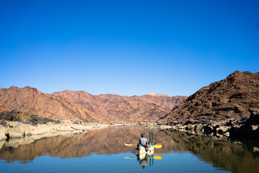
The Orange River, which runs through Augrabies, provides river rafting and canoeing opportunities. Visitors can take guided tours to navigate the river's rapids.
Located a short drive from Augrabies, Riemvasmaak Hot Springs is a unique natural hot spring with warm mineral-rich waters surrounded by the dramatic landscapes of the Northern Cape. A bit further from Augrabies, the Kokerboom Forest near Keimoes features a collection of quiver trees, which are unique succulent plants native to the region.
Upington is another town in the Northern Cape, 120 km (74 mi) east of Augrabies. Upington is known for its warm climate, desert topography, and the Orange River.
Upington is part of the famous Orange River Wine Route, one of South Africa's most scenic wine regions. Visitors can explore numerous wine estates and cellars, tasting the region's renowned wines. The warm climate and fertile soil contribute to the production of high-quality grapes.
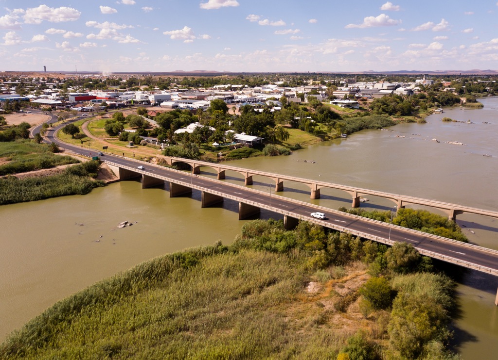
The Orange River is a focal point of life in Upington, and visitors can enjoy leisurely river cruises that provide a unique perspective of the surrounding scenery. Sunset cruises are particularly popular, with charming views as the sun dips below the horizon.
Kgalagadi Transfrontier Park spans the border between South Africa and Botswana, offering incredible wildlife viewing and photography opportunities. The park is renowned for its populations of lions, cheetahs, and other iconic African species, as well as its stunning desert landscapes.