
Scan the QR code and open PeakVisor on your phone
Dry Creek Buttes Wilderness Study Area has 10 named peaks. The highest is Red Butte at 1,397 m. Other notable peaks include North Table Mountain, South Table Mountain and Dry Creek Buttes.
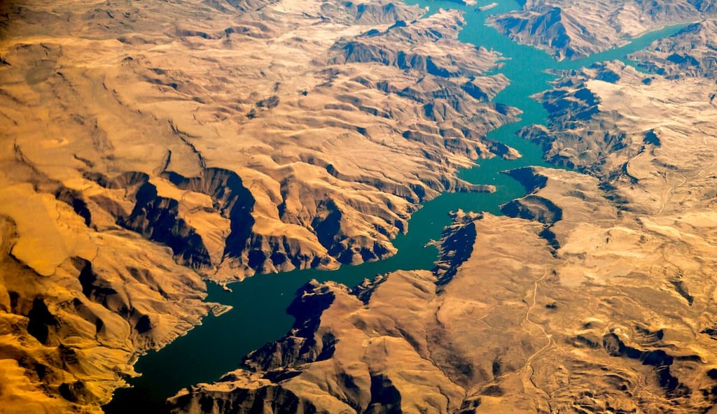
The Dry Creek Buttes Wilderness Study Area is located in Malheur County in the state of Oregon. This protected area of land covers 49,880 acres and runs for 20 miles across the state, parallel to the Owyhee Reservoir. There are 10 named mountains in Dry Creek Buttes Wilderness Study Area. The highest and the most prominent mountain is Red Butte at 4,583 feet.
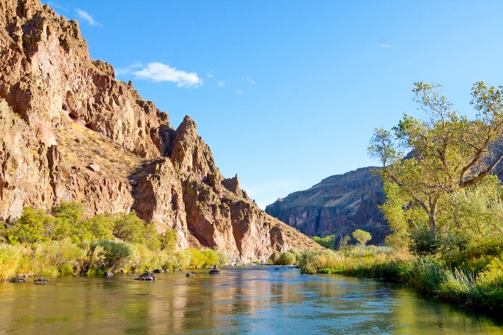
The landscape of the Dry Creek Buttes Wilderness Study Area is quite rugged. The land is characterized by gulches and deep ravines across, all of which drain into the Owyhee Reservoir. These gulches are separated by both rolling and steep hills. The southern region of the Wilderness is more rugged than the north. In the south are numerous rock outcroppings surrounded by sagebrush and wheatgrass. Major features within the Dry Creek Buttes Wilderness Study Area include Red Butte, as the tallest point, along with Dry Creek Buttes, Sand Hills, North Table Mountain, and South Table Mountain. On the east side of the Owyhee Reservoir, lies the Honeycombs Wilderness Study Area.
While there aren’t any trails within the Dry Creek Buttes Wilderness Study Area, the nearby Honeycombs Wilderness Study Area, Upper Leslie Gulch Wilderness Study Area, and Slocum Creek Wilderness Study Area is home to numerous hikes. Popular ones include Juniper Gulch Trail, Dago Gulch, Timber Gulch.
Two and a half hours east of the Dry Creek Buttes Wilderness lies the city of Boise, Idaho. The city is the capital of the state of Idaho and the most populous city in the state. Situated on the Boise River, the city is 41 miles east of the Oregon border and 110 miles north of the Nevada border. The Boise metropolitan area contains the state’s three most populous cities; Boise, Nampa, and Meridian with a total population of 710,000. The city is known as “The City of Trees” and the downtown area is full of shops and local dining options. The town is home to numerous recreational opportunities which include hiking and biking. Boise is also home to the Boise River Greenbelt which is an extensive urban trail system along the Boise River.


The highest peak in Dry Creek Buttes Wilderness Study Area is Red Butte, at 1,397 m.
Notable peaks in Dry Creek Buttes Wilderness Study Area include Red Butte, North Table Mountain, South Table Mountain, Dry Creek Buttes and Burnt Mountain.


